Henderson Flat
Total Miles
13.2
Technical Rating
Best Time
Spring, Fall, Summer
Trail Type
Full-Width Road
Accessible By
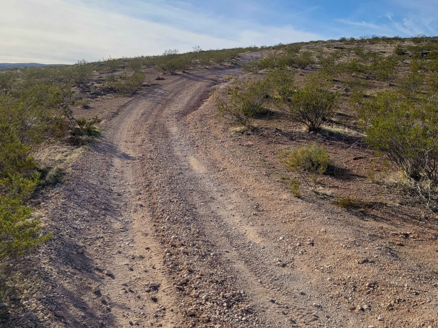
Trail Overview
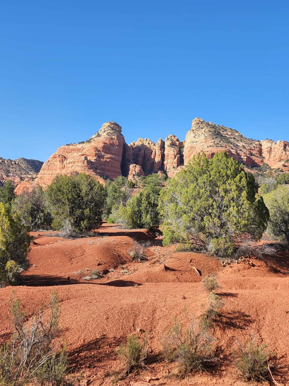
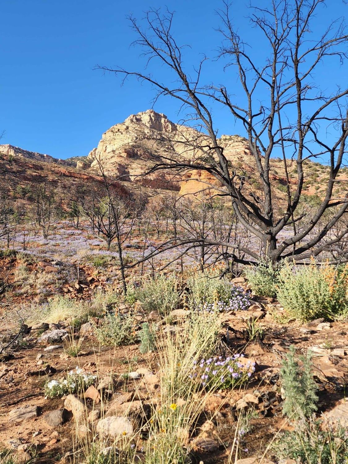
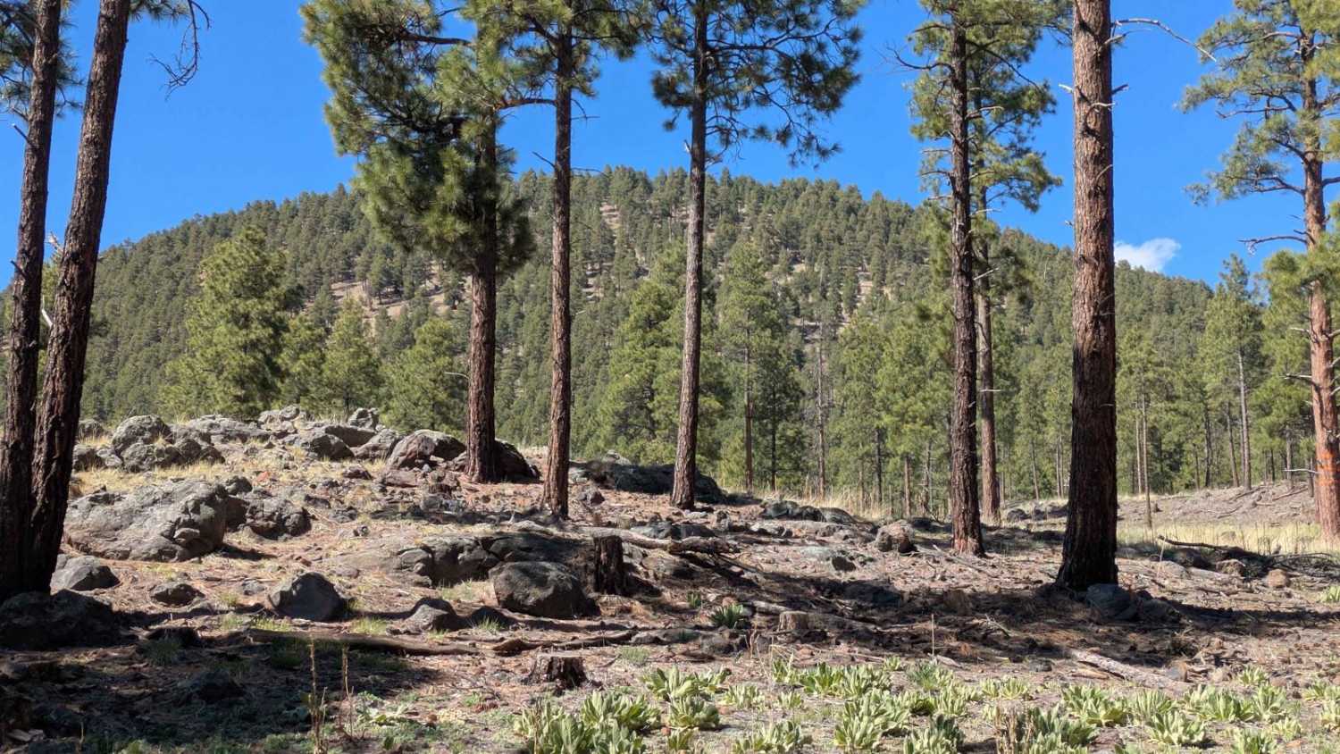
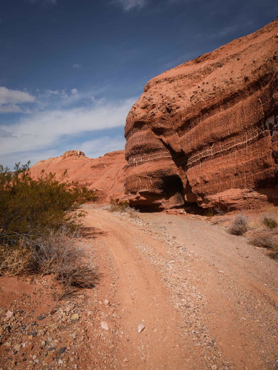
This trail is a one-way in (13 miles) and one-way out through pinyon-juniper woodlands. Drive along this two-track road (FR 181) and see wildlife; wildflowers (spring) in the Rafael Fire scar (2021); small canyons; red-rock escarpments; a historic ranch cabin; and good views. The road ends at the Sycamore Canyon Wilderness boundary with great views of Woodchute Mountain (Arizona's Black Hills) to the south; "Arizona's other Red Rocks" at the mouth of Sycamore Canyon to the north; and opportunities for dispersed camping. This is a good launching point for hikers and backpackers into the wilderness. With a little effort on foot from the end of the road, you might discover historic cliff dwellings and more spectacular views of the wilderness.
Photos of Henderson Flat
Difficulty
Most of this trail is easy and can be done with a stock 4WD vehicle. However, there are several streambed crossings that have eroded in summer rains following the Rafael Fire in 2021. These crossings have exposed some deep ruts, large rocks, and small rock shelves. The intermediate 5 rating is due to potential changes in road conditions and/or inexperienced off-road drivers negotiating the streambed crossings, short/few sections of steep grades, and a short section of the trail along a canyon ledge. The potential exists for further erosion and difficulty as road conditions may deteriorate in wet weather. Deep and swift running water is possible during and immediately following summer monsoon storms in the area or uphill from the area, even if it's not raining on the trail. This country has the potential for flash flooding in heavy rains. Check weather forecasts and be prepared to wait it out on high ground; there is ample opportunity along the trail to stay out of streambeds.
Status Reports
Henderson Flat can be accessed by the following ride types:
- High-Clearance 4x4
- SUV
- SxS (60")
- ATV (50")
- Dirt Bike
Henderson Flat Map
Popular Trails
FS 9011K Cutoff

Black Rock Trail
The onX Offroad Difference
onX Offroad combines trail photos, descriptions, difficulty ratings, width restrictions, seasonality, and more in a user-friendly interface. Available on all devices, with offline access and full compatibility with CarPlay and Android Auto. Discover what you’re missing today!