
Off-Road Trails in Baja California Sur
Discover off-road trails in Baja California Sur
Off-Road Trails in Baja California Sur
Discover the best off-road trails in Baja California Sur. Browse trail maps, check difficulty ratings, and find your next adventure — whether you're looking for a quick ride or an all-day expedition.
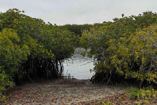
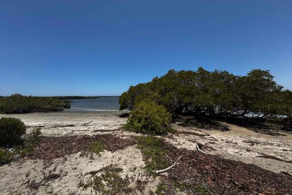
Las Vacas
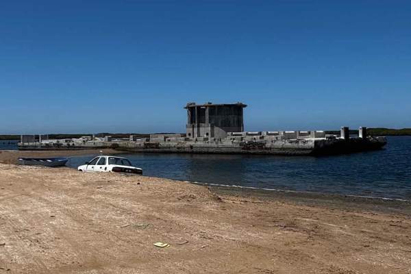
Beginning at sea level where the San Vicente Trail drops into the mangroves, this off-road route winds through a dynamic landscape that alternates between dual tracks flanked by dense wetlands and sandy paths lined with desert flora. As you progress, the trail forks--straight ahead leads deeper into...
Learn more about Las Vacas
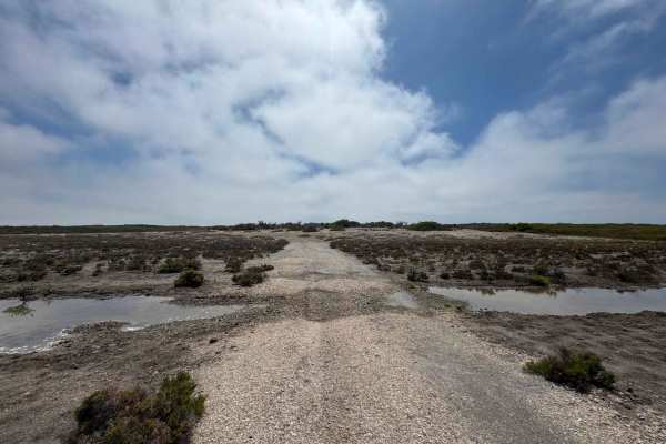
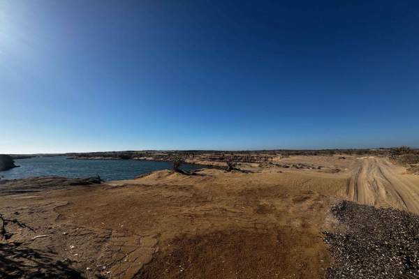
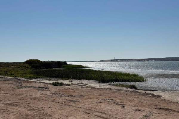
Estuary Peninsula
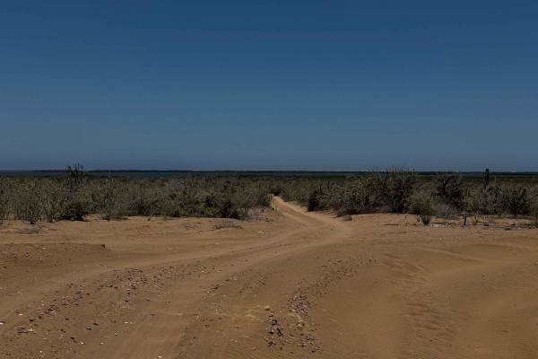
This off-road route begins at a four-way intersection just a few miles inland from the coast, heading north as the desert terrain quickly gives way to a more open, sparse landscape at the edge of the salt flats. Upon reaching the flats, the trail makes a sharp 90-degree turn west, skirting along the...
Learn more about Estuary Peninsula
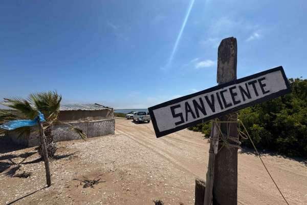
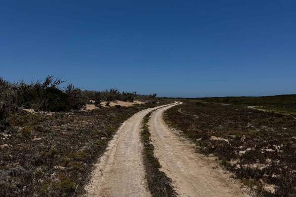
San Vicente
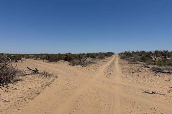
Running north to south, this scenic off-road route begins just across the arroyo from the lighthouse at its intersection with the Peninsula Route. The first few miles feature deep, well-worn sand--often three inches or more--traveled frequently during Baja race events. The road cuts through mid-heig...
Learn more about San Vicente
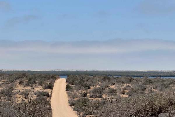
Campo Vicente Access
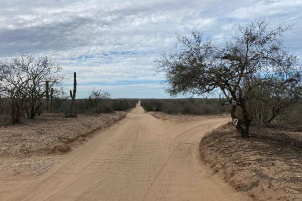
Approaching from the south, this trail follows a direct south-to-north path commonly used in Baja off-road races, characterized by a narrows single-vehicle track with 2 to 4 inches of sand and small whoops throughout. The route gently climbs and descends 20 to 30 meters several times, maintaining a ...
Learn more about Campo Vicente Access
Los Praditos
This scenic off-road trail begins just off a well-known Baja race route and meanders along the coastline before descending into the lush lowlands, where the road becomes more compacted and traces the edge of expansive mangroves. These low-lying areas can become waterlogged during high tides or after...
Learn more about Los Praditos
Maria Auxiliadora Coastal
Beginning in the town of Maria Auxiliadora, this route heads west toward the coastal lowlands, transitioning quickly from a firm, hard-packed surface to sections covered with large, wind-blown sand drifts--some reaching 2 to 3 feet high. While the underlying road appears well-maintained, likely due ...
Learn more about Maria Auxiliadora Coastal
Middle Road-Mangroves
This off-road trail begins off the lower mangrove road and runs mostly straight for the first four miles, with the initial two miles being narrow and relatively smooth, bordered by tall desert vegetation that may leave pinstripes on full-size vehicles. Unless you're seeking a side-by-side-style adve...
Learn more about Middle Road-Mangroves
El Faro Santa Domingo
This route begins off the Santa Domingo West Trail as a soft, sandy path that is narrow but navigable with care to avoid scratching your vehicle. This trail is more frequently traveled than others in the area, resulting in minor washboarding in spots, but it remains mostly smooth. Along the way, you...
Learn more about El Faro Santa Domingo
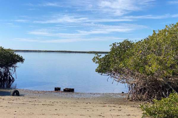
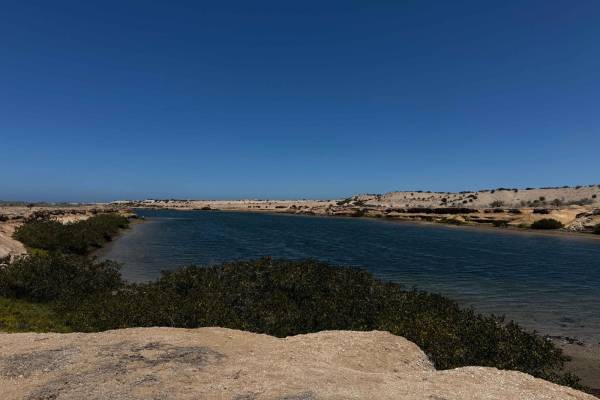
Mangroves Soledad
Entering from the north, this off-road trail begins by skirting the lush coastal mangroves near Soledad, with well-packed, slightly damp twin tracks winding through vibrant green growth. The route occasionally loops onto small peninsulas--ideal for fishing--with frequent glimpses of the sea shimmeri...
Learn more about Mangroves Soledad
Lagos Secos
This off-road trail branches northeast at a 45-degree angle from a well-known Baja race route, quickly straightening out after less than a mile. The stretch comprises 2 to 3 inches of light sand and remains relatively smooth due to minimal traffic. The trail heads north through open desert terrain, ...
Learn more about Lagos Secos
Canalito-Mangroves
This narrow two-track trail, just wide enough for a single vehicle, follows a popular section of the Baja racecourse and begins at a massive, deep canal known locally as "Canalito," a remnant of the region's historic phosphate mining era. Beyond the canal, the route stretches out in a mostly straigh...
Learn more about Canalito-Mangroves
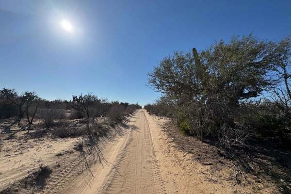
El Pailabote
This trail begins off the Los Hombres Solo route, winding through a narrow, sandy path flanked by mid-height desert vegetation. Full-size vehicles may experience some scratching as the vegetation occasionally encroaches on the trail. Airing down your tires is highly recommended due to the soft, 2-3 ...
Learn more about El Pailabote
Estero Loop
Approaching from the west, this narrow single vehicle trail gently winds into the lowlands near the estero, where the path shows deep ruts worn in by Baja race traffic. Roughly a mile in, you'll find peaceful campsites near the water, tucked into the natural bends of the terrain. From there, the rou...
Learn more about Estero Loop
Maria Auxiliadora Southwest
Starting near the town of Maria Auxiliadora, this off-road route heads southwest into the desert, quickly leaving town behind. The initial stretch passes through an area cluttered with trash--common near the outskirts--so it's best practice not to stop until you're clear of the landfill zones. The r...
Learn more about Maria Auxiliadora Southwest
Highway-Estuary Connection
This off-road route begins off the main highway leading to Adolfo Lopez Mateos and heads northwest in a relatively direct line toward the estuary region, though it ends about a mile inland. The trail starts out a bit rough, with scattered piles of clam and oyster shells--discarded by local fishermen...
Learn more about Highway-Estuary Connection
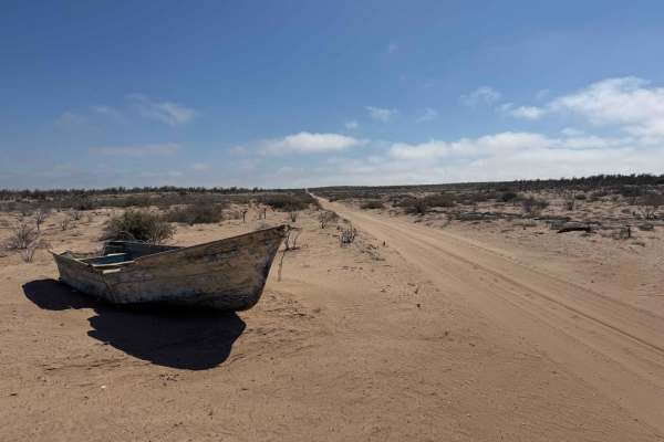
La Rodrigada
This off-road trail begins just off the highway to Puerto Adolfo Lopez Mateos, marked by a towering telephone pole that hosts a massive Caracara bird nest--one of many sightings of these striking raptors common in the region. The trail initially stretches out in a straight line for several miles, wi...
Learn more about La Rodrigada
Rofomex
This off-road route begins near the town of Puerto Adolfo Lopez Mateos, connecting directly with the main highway. Like many roads between small towns and fishing camps, the initial stretch is littered with roadside trash, but the landscape quickly opens up and becomes cleaner as you progress. The r...
Learn more about Rofomex
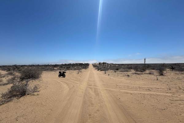
High Crossover
This trail begins at the highway to Puerto Adolfo Lopez Mateos and runs in a mostly straight line for roughly three-quarters of its length. The surface consists primarily of light sand, ranging from about an inch to four inches deep, with a few short climbs where evidence of 2WD vehicles struggling ...
Learn more about High Crossover
North-South Low Cross
Beginning from the south and heading north, this off-road trail is initially faint and easy to miss, marked by minimal use and soft, sandy terrain about 2-3 inches deep. Roughly 100 yards to the west, a more defined fork joins the same route, offering a slightly clearer entry point. As you progress,...
Learn more about North-South Low Cross
Santa Domingo West
This trail begins at the El Faro Trail, which originates in Santa Domingo and serves primarily as a utility road leading to a coastal area where clams, oysters, and conch shells are farmed. Along the route, you'll pass large piles of these shells, a hallmark of the region's aquaculture. The road is ...
Learn more about Santa Domingo West
ATV trails in Baja California Sur
Explore ATV-friendly trails in Baja California Sur. These trails are accessible for vehicles up to 50 inches wide, perfect for ATVs and smaller off-road machines.
Las Vacas
Beginning at sea level where the San Vicente Trail drops into the mangroves, this off-road route winds through a dynamic landscape that alternates between dual tracks flanked by dense wetlands and sandy paths lined with desert flora. As you progress, the trail forks--straight ahead leads deeper into...
Learn more about Las Vacas
Estuary Peninsula
This off-road route begins at a four-way intersection just a few miles inland from the coast, heading north as the desert terrain quickly gives way to a more open, sparse landscape at the edge of the salt flats. Upon reaching the flats, the trail makes a sharp 90-degree turn west, skirting along the...
Learn more about Estuary Peninsula
San Vicente
Running north to south, this scenic off-road route begins just across the arroyo from the lighthouse at its intersection with the Peninsula Route. The first few miles feature deep, well-worn sand--often three inches or more--traveled frequently during Baja race events. The road cuts through mid-heig...
Learn more about San Vicente
Campo Vicente Access
Approaching from the south, this trail follows a direct south-to-north path commonly used in Baja off-road races, characterized by a narrows single-vehicle track with 2 to 4 inches of sand and small whoops throughout. The route gently climbs and descends 20 to 30 meters several times, maintaining a ...
Learn more about Campo Vicente Access
UTV/side-by-side trails in Baja California Sur
Find UTV and side-by-side trails in Baja California Sur. These trails accommodate vehicles up to 60 inches wide, ideal for UTVs, side-by-sides, and wider off-road rigs.
Las Vacas
Beginning at sea level where the San Vicente Trail drops into the mangroves, this off-road route winds through a dynamic landscape that alternates between dual tracks flanked by dense wetlands and sandy paths lined with desert flora. As you progress, the trail forks--straight ahead leads deeper into...
Learn more about Las Vacas
Estuary Peninsula
This off-road route begins at a four-way intersection just a few miles inland from the coast, heading north as the desert terrain quickly gives way to a more open, sparse landscape at the edge of the salt flats. Upon reaching the flats, the trail makes a sharp 90-degree turn west, skirting along the...
Learn more about Estuary Peninsula
San Vicente
Running north to south, this scenic off-road route begins just across the arroyo from the lighthouse at its intersection with the Peninsula Route. The first few miles feature deep, well-worn sand--often three inches or more--traveled frequently during Baja race events. The road cuts through mid-heig...
Learn more about San Vicente
Campo Vicente Access
Approaching from the south, this trail follows a direct south-to-north path commonly used in Baja off-road races, characterized by a narrows single-vehicle track with 2 to 4 inches of sand and small whoops throughout. The route gently climbs and descends 20 to 30 meters several times, maintaining a ...
Learn more about Campo Vicente Access
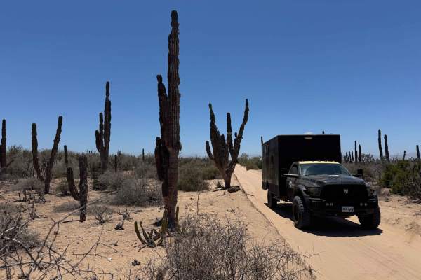
The onX Offroad Difference
onX Offroad combines trail photos, descriptions, difficulty ratings, width restrictions, seasonality, and more in a user-friendly interface. Available on all devices, with offline access and full compatibility with CarPlay and Android Auto. Discover what you're missing today!
Open Trail Map