
Dirt Bike Trails
Near Timnath, Colorado
Explore All Dirt Bike Trails Near Timnath, Colorado
Dirt Bike Trails Near Timnath, Colorado
Discover the best dirt bike trails near you. Browse trail maps, check difficulty ratings, and find your next adventure — whether you're looking for a quick ride or an all-day expedition.
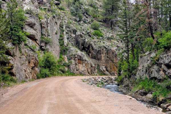
Buckhorn Road - 44H
Buckhorn Road (Larimer County Road 44H) is a highly scenic dirt route that serves as a major connector between the Stove Prairie area and Pingree Park Road. Heading east to west, the trail gently climbs through Buckhorn Canyon, following a creek through thick pine and aspen forests up to the 9,163-f...
Learn more about Buckhorn Road - 44H
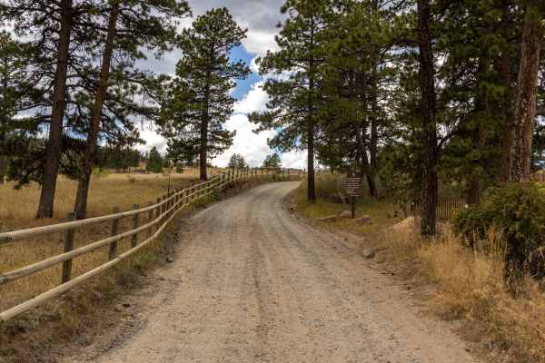
Old Flowers Road
Old Flowers Road is a challenging offroad trail featuring mud ruts, steep hills with loose rock, potholes, and erosion throughout. The trail is rough, with dips, bumps, and occasional water crossings that demand careful vehicle handling. Portions of the route traverse burn scars, adding to the rugge...
Learn more about Old Flowers Road
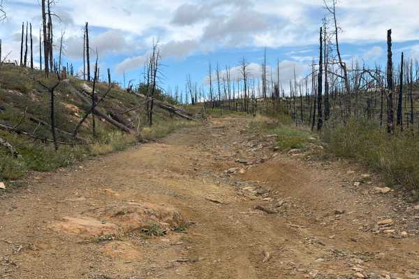
Green Pig Road
Green Pig Road (part of Forest Road 132) is meant to be a short, semi-challenging road leading down to a dispersed camping area, cutting through the burn scars of the forest with wonderful views. The trail is easily accessible as it connects to Forest Service Road 513 as a pull-off area to connect t...
Learn more about Green Pig Road
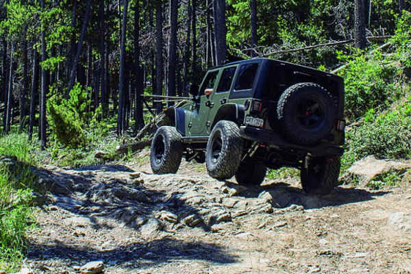
Storm Mountain, Bear Gulch
**Currently closed due to rock/mud slide from fire** Check out the side roads, and enjoy some fun terrain on this trail in the Roosevelt National Forest. There is a fun little loop off the east side. Watch for gates and signs during hunting season to avoid hefty penalties. There is some camping avai...
Learn more about Storm Mountain, Bear Gulch
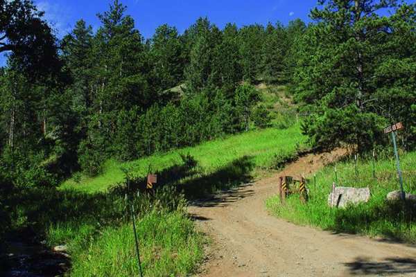
Moody Hill
Moody Hill is a 5.1-mile off-road trail near Masonville, Colorado located within the Roosevelt National Forest. The route climbs from 6,566 feet to 8,529 feet, starting with a steep, technical ascent and a tight, rocky turn. A high-clearance, short-wheelbase 4x4 vehicle with skid plates is recommend...
Learn more about Moody Hill
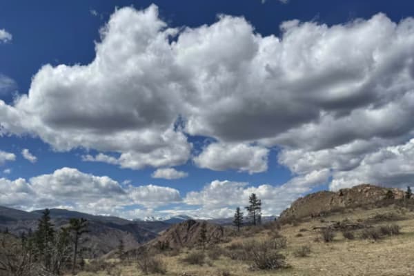
Swan Road
This out-and-back trail traverses several ridges with steep grades and 360-degree views of the surrounding mountains and valleys. The trail is mostly made up of a two-track forest road. Several of the descents/accents are eroded, creating the most challenging and technical sections of the trail. The...
Learn more about Swan Road
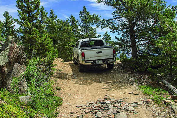
Greer Road
There are limited views on this trail due to the thick trees, but you'll have a great time exploring side roads. This is a really good area for ATVs and UTVs. Camp and unload on the east portion of the trail. This trail is open all year; however, there is a gate that may be closed for temporary clos...
Learn more about Greer Road
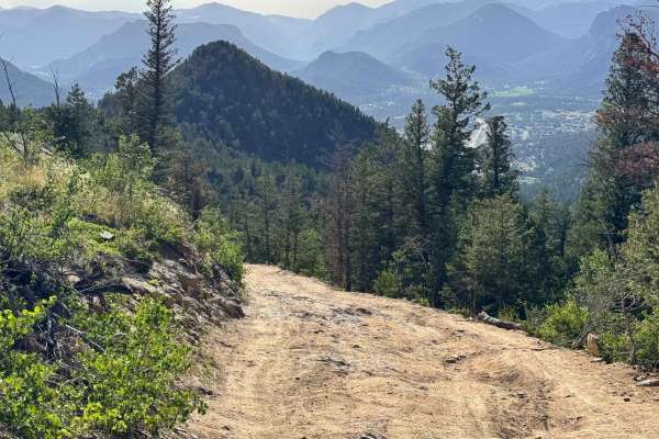
Pole Hill Road
This trail starts with a steep climb with two options: the left is dirt that has been washed out/dug out, and the right is rocky, but both can be navigated in a stock 4x4. The trail continues with several sections of exposed bedrock where tire placement is important, and skid plates would be benefic...
Learn more about Pole Hill Road
Hurley Road
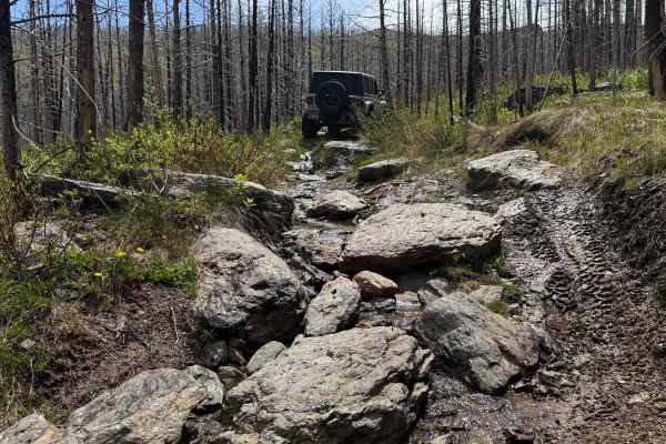
This trail starts with a few mud holes and a rocky climb that offers great views of the surrounding mountains. In the summer, snowmelt creates a steady flow of water that can make the toughest sections even more difficult. Campsites are limited, but there's a larger spot at the junction of a side tr...
Learn more about Hurley Road
Kelly Flats
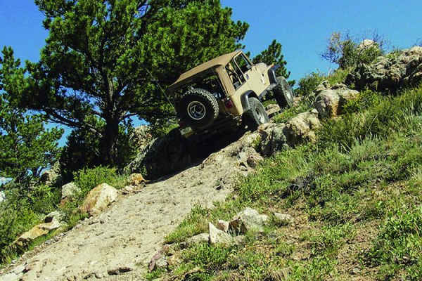
Head straight uphill from out of the Cache La Poudre River Valley and wind across a a ridge high above the Mummy Range. Two well-known obstacles, The Chutes and Heart Attack Hill. Both have bypasses, but they aren't easy. ATVs will have an especially hard time on this trail.
Learn more about Kelly Flats
Johnny Park Road
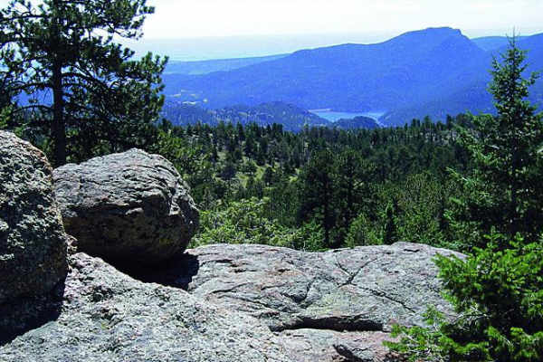
Most of this trail will follow a high ridge with amazing views. Start on the east end for the best camping and easy access to the trail. Unlicensed vehicles are permitted, and this is a popular spot for them as well. There are some good challenging spots to the north towards the end of the trail. If...
Learn more about Johnny Park Road
FS 234
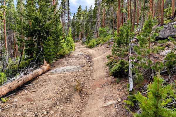
Tucked off Pingree Park Road, Forest Road 234 and its 234A (also known as Twin Lakes Spur Road) offshoot offer a fun, rugged little drive through dense pine forest. While short, it is a great track for flexing your suspension while hunting for secluded dispersed campsites. The trail winds tightly th...
Learn more about FS 234

Dadd Gulch
Branching directly off the popular Crown Point Road, Dadd Gulch is a highly rewarding intermediate trail tucked into the Roosevelt National Forest. It is a fantastic destination if you are hunting for top-tier dispersed camping, as the route features several large, scenic clearings equipped with est...
Learn more about Dadd Gulch
Pierson Park Road
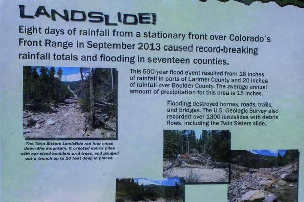
Both sides are open. The southern side is fun for ATVs and UTVs. It is somewhat flat, with camping available along the route. You'll be in the trees for the most part, but check out the views when you get to the high points. There are some fun side roads to explore, including those around Peirson Pa...
Learn more about Pierson Park Road
Sevenmile Creek
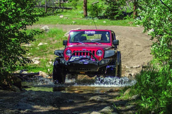
Start off through a valley, meandering along a beautiful rocky creek. Then climb out and head across some majestic forest land. The second portion offers a lot of different side roads to take, with a great deal camping for large RVs or motorhomes. Open June 14 to April 15.
Learn more about Sevenmile Creek
Headache Road
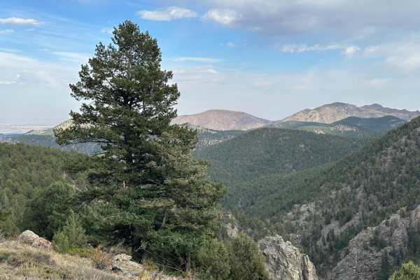
Headache Road is an out-and-back trail that runs off of the east side of Miller Rock Road trail. Contrary to the name it shouldn't cause too many headaches. The trail primarily consists of dirt and gravel with a few rocks to crawl over. It is mostly forested with some areas of tight trees that could...
Learn more about Headache Road
Miller Rock Road
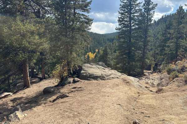
Miller Rock Road is an out-and-back trail that starts off of the south side of Riverside Driveuns along Middle Street Vrain Creek. The trail primarily consists of dirt and gravel with many rocks and boulders to crawl over. It is mostly forested, with some areas of tight trees that could be tricky fo...
Learn more about Miller Rock Road
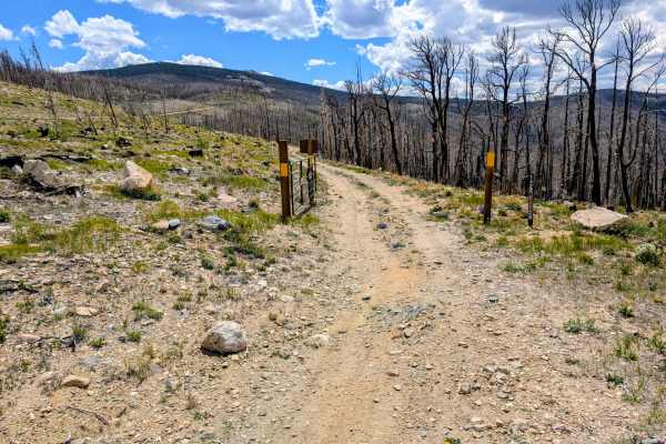
Black Hollow Road - FS 142
Black Hollow Road (Forest Road 142) is a moderately short but striking loop accessed directly off Crown Point Road in the Roosevelt National Forest. The defining characteristic of this trail is its path through the 2020 Cameron Peak Fire burn scar. The landscape is a stark, fascinating mix of charre...
Learn more about Black Hollow Road - FS 142
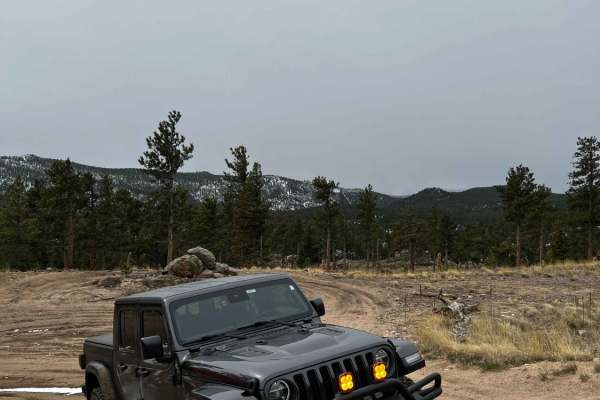
Cave Creek Road
Cave Creek Road (USFS Road 217) is a short but engaging 0.9-mile climb in the Roosevelt National Forest, perfect for moderately experienced offroaders seeking a quick challenge with scenic overlooks. Starting from the Peak to Peak Highway near Raymond, the route wastes no time, immediately throwing ...
Learn more about Cave Creek Road
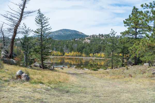
Chicken Park - FS 181
This scenic trail is the main route through the Chicken Park trail system. The trail passes through a mix of pine and aspen forest within open meadows and rock formations. Some rock formations are 100’s of feet tall. The trail passes by multiple dispersed campsites and spur trails. The trail ends at...
Learn more about Chicken Park - FS 181
ATV trails near Timnath, Colorado
Explore ATV-friendly trails near you. These trails are accessible for vehicles up to 50 inches wide, perfect for ATVs and smaller off-road machines.
Old Flowers Road
Old Flowers Road is a challenging offroad trail featuring mud ruts, steep hills with loose rock, potholes, and erosion throughout. The trail is rough, with dips, bumps, and occasional water crossings that demand careful vehicle handling. Portions of the route traverse burn scars, adding to the rugge...
Learn more about Old Flowers Road
Green Pig Road
Green Pig Road (part of Forest Road 132) is meant to be a short, semi-challenging road leading down to a dispersed camping area, cutting through the burn scars of the forest with wonderful views. The trail is easily accessible as it connects to Forest Service Road 513 as a pull-off area to connect t...
Learn more about Green Pig Road
Storm Mountain, Bear Gulch
**Currently closed due to rock/mud slide from fire** Check out the side roads, and enjoy some fun terrain on this trail in the Roosevelt National Forest. There is a fun little loop off the east side. Watch for gates and signs during hunting season to avoid hefty penalties. There is some camping avai...
Learn more about Storm Mountain, Bear Gulch
Moody Hill
Moody Hill is a 5.1-mile off-road trail near Masonville, Colorado located within the Roosevelt National Forest. The route climbs from 6,566 feet to 8,529 feet, starting with a steep, technical ascent and a tight, rocky turn. A high-clearance, short-wheelbase 4x4 vehicle with skid plates is recommend...
Learn more about Moody Hill
UTV/side-by-side trails near Timnath, Colorado
Find UTV and side-by-side trails near you. These trails accommodate vehicles up to 60 inches wide, ideal for UTVs, side-by-sides, and wider off-road rigs.
Old Flowers Road
Old Flowers Road is a challenging offroad trail featuring mud ruts, steep hills with loose rock, potholes, and erosion throughout. The trail is rough, with dips, bumps, and occasional water crossings that demand careful vehicle handling. Portions of the route traverse burn scars, adding to the rugge...
Learn more about Old Flowers Road
Green Pig Road
Green Pig Road (part of Forest Road 132) is meant to be a short, semi-challenging road leading down to a dispersed camping area, cutting through the burn scars of the forest with wonderful views. The trail is easily accessible as it connects to Forest Service Road 513 as a pull-off area to connect t...
Learn more about Green Pig Road
Storm Mountain, Bear Gulch
**Currently closed due to rock/mud slide from fire** Check out the side roads, and enjoy some fun terrain on this trail in the Roosevelt National Forest. There is a fun little loop off the east side. Watch for gates and signs during hunting season to avoid hefty penalties. There is some camping avai...
Learn more about Storm Mountain, Bear Gulch
Moody Hill
Moody Hill is a 5.1-mile off-road trail near Masonville, Colorado located within the Roosevelt National Forest. The route climbs from 6,566 feet to 8,529 feet, starting with a steep, technical ascent and a tight, rocky turn. A high-clearance, short-wheelbase 4x4 vehicle with skid plates is recommend...
Learn more about Moody Hill
The onX Offroad Difference
onX Offroad combines trail photos, descriptions, difficulty ratings, width restrictions, seasonality, and more in a user-friendly interface. Available on all devices, with offline access and full compatibility with CarPlay and Android Auto. Discover what you're missing today!
Open Trail Map