
Dirt Bike Trails
Near Tehama, California
Explore All Dirt Bike Trails Near Tehama, California
Dirt Bike Trails Near Tehama, California
Discover the best dirt bike trails near you. Browse trail maps, check difficulty ratings, and find your next adventure — whether you're looking for a quick ride or an all-day expedition.
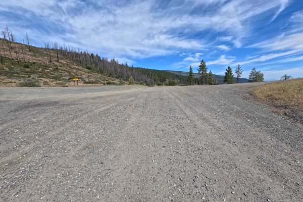
Eagle Rock - FS 24N36
Winding through a starkly beautiful forest recovering from wildfire with dense brush understory and standing burnt snags, Eagle Rock (FS 24N36) offers a scenic backcountry ridge spur within the Mendocino National Forest. Accessed directly off of the Paskenta-Eel River Road (Hwy M2) at a broad, open ...
Learn more about Eagle Rock - FS 24N36
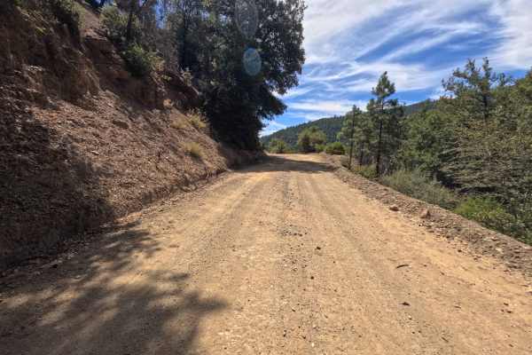
Elder Creek - FS 25N09
Winding through a mix of towering pine timber, oak groves, and actively managed forestlands within the Mendocino National Forest, Elder Creek (FS 25N09) offers a tranquil and broad mountain drive. Accessed directly off Paskenta-Eel River Road (Hwy M2) at the prominent four-way junction, this gently ...
Learn more about Elder Creek - FS 25N09
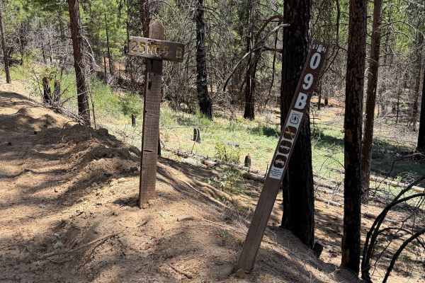
Section 17 - FS 25N09B
Set within a dry, mixed pine and oak woodland recovering from past fire impacts in the Mendocino National Forest, Section 17 (FS 25N09B) provides a peaceful side excursion. Accessed directly off of Elder Creek Road (FS 25N09) near the Paskenta-Eel River Road corridor, this route stems off to the rig...
Learn more about Section 17 - FS 25N09B
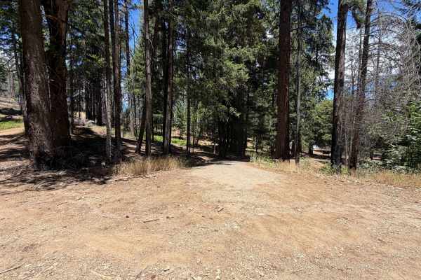
Whitlock - FS 24N19
Set within a partially burnt coniferous forest with emerging shrub understory in the Mendocino National Forest, Whitlock (FS 24N19) offers a rustic mountain slope climb. Accessed directly near Whitlock Campground, this dirt spur branches upward into quieter backcountry terrain. Outdoor enthusiasts p...
Learn more about Whitlock - FS 24N19
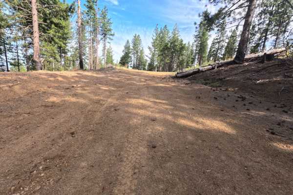
Ball Rock Ridge - FS 24N41
Set within an open, high-country pine forest with scattered snags and brush understory in the Mendocino National Forest, Ball Rock Ridge (FS 24N41) climbs gracefully toward Tatham Ridge. Accessed from a prominent three-way forest intersection, this double-wide route serves as a scenic connection bet...
Learn more about Ball Rock Ridge - FS 24N41
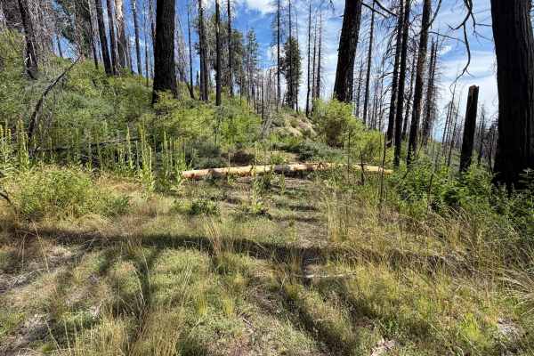
Bigelow - FS 24N41D
Branching off a busy multi-road junction, Bigelow - FS 24N41D is a scenic out-and-back mountain spur traversing the eastern slopes of the Mendocino National Forest. Navigating an ecosystem rebounding from the 2020 August Complex Wildfire, the route winds through a mixture of standing burned trees, d...
Learn more about Bigelow - FS 24N41D
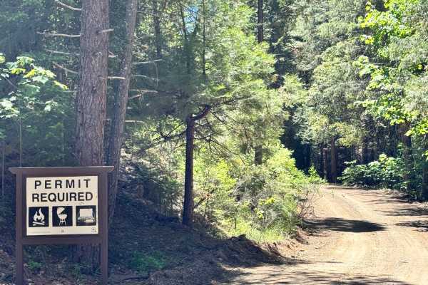
North Philbrook - 27N06
This trail is long but easy with plenty of camping options along the way, with many that will fit multiple vehicles. No obstacles along the trail. There are great views of Lassen Peak from multiple spots on the trail. Some camp spots have views of Lassen Peak from them as well.
Learn more about North Philbrook - 27N06
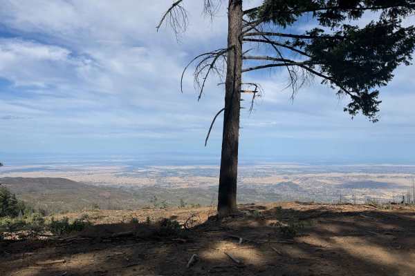
Lower Alltop - FS 24N56
Branching off from the main artery of Forest Road M2, Lower Alltop - FS 24N56 is a gentle out-and-back spur that dips down along the mountainside in the Mendocino National Forest. Navigating through an environment recovering from the massive 2020 August Complex Wildfire, the route features standing ...
Learn more about Lower Alltop - FS 24N56
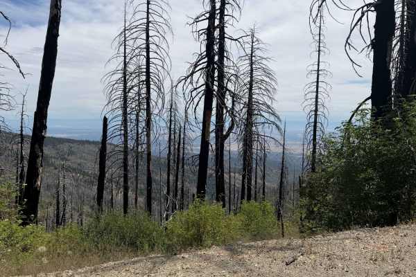
Postpile - FS 24N38
Accessed directly off Tatham Ridge, Postpile - FS 24N38 is an engaging 3.3-mile single-track bypass road traversing the eastern flank of the mountain. Situated within the Mendocino National Forest, the track passes through a localized burn scar from the 2020 August Complex Wildfire before breaking o...
Learn more about Postpile - FS 24N38
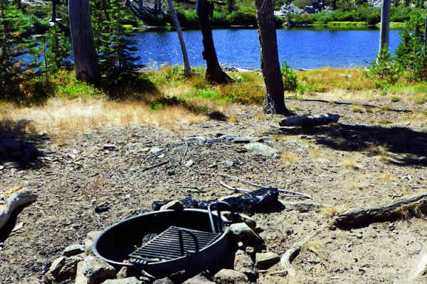
High Lakes
High Lakes is a premier destination for experienced offroaders seeking challenging rock crawling and scenic lakeside camping on a gorgeous high plateau. Located in the High Lakes OHV Area, this 17.5-mile trail features diverse and demanding terrain, with elevations ranging from 4,977 feet to 6,614 f...
Learn more about High Lakes
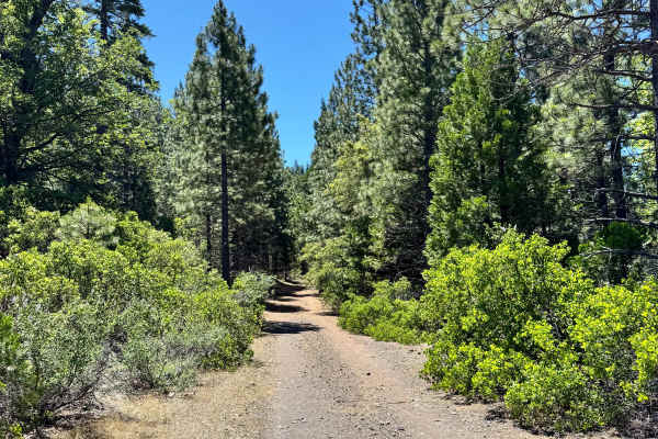
Calf Spur South - FS 27N12Y
This trail is a mix of gravel and dirt. This is a short 1-mile trail that does have some narrow spots and shelf sections. There was also a nice-sized camp spot on the trail that had a nice view of the mountains and valleys in the distance.
Learn more about Calf Spur South - FS 27N12Y
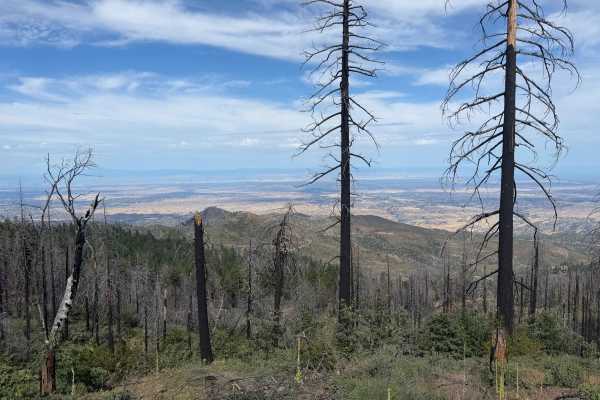
Tatham Ridge - FS 24N04
Connecting Forest Road M22 and Forest Road M2, Tatham Ridge - FS 24N04 is a thrilling 10-mile ridge run offering expansive valley vistas and cool pine-shaded stretches throughout the Mendocino National Forest. Traversing a high-altitude landscape recovering from the catastrophic 2020 August Complex ...
Learn more about Tatham Ridge - FS 24N04
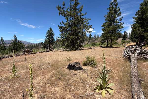
Ball Rock Summit - FS 25N66
Branching sharply off Forest Road M22, Ball Rock Summit (FS 25N66) serves as a steep, energetic climbing spur that delivers drivers straight up to the crest of Tatham Ridge. Nestled within the Mendocino National Forest, the trail traverses high-elevation terrain recovering from the massive 2020 Aug...
Learn more about Ball Rock Summit - FS 25N66
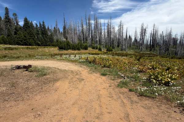
Rocky Cabin Spring - FS 24N40
Branching gently off Tatham Ridge, Rocky Cabin Spring - FS 24N40 offers an inviting 1.4-mile interconnected route that winds through the high-elevation Mendocino National Forest. Traversing a subalpine landscape recovering from the 2020 August Complex Wildfire, the area features standing charred tim...
Learn more about Rocky Cabin Spring - FS 24N40
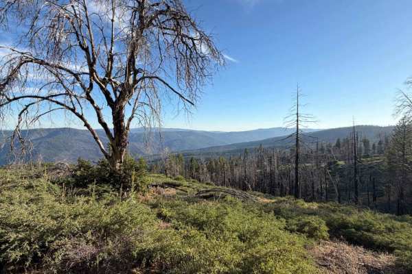
Trough Ridge Spur A - FS 24N05A
Set along a sun-drenched mountain ridge recovering from past wildfires with sparse standing timber and brushy understory in the Mendocino National Forest, Trough Ridge Spur A (FS 24N05A) provides an airy, scenic detour. Accessed directly off of Trough Ridge Road (FS 24N05), this gentle side track is...
Learn more about Trough Ridge Spur A - FS 24N05A
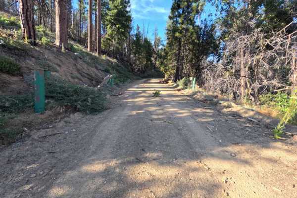
Trough Ridge - FS 24N05
Set within a high-country pine forest recovering from the massive 2020 August Complex Fire in the Mendocino National Forest, Trough Ridge (FS 24N05) provides a picturesque and accessible mountain ascent. Accessed directly off of the primary Paskenta-Eel River Road (Highway M2), this 2.6-mile connect...
Learn more about Trough Ridge - FS 24N05
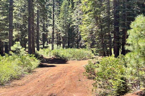
Colby Loop - FS 27N06B
This is a beautiful trail with dense green trees around it. The trail is dirt with a layer of dried pine needles. There aren't any ruts or washes along this trail at the time of mapping, but there are dead branches in and along the side of the trail. There is a nice, wide-open camp spot along the tr...
Learn more about Colby Loop - FS 27N06B
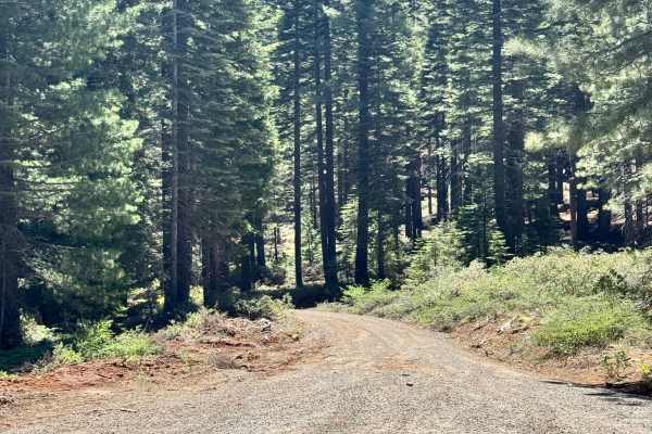
Colby Mountain Lookout - FS 27N36
This dirt trail leads up to the Colby Mountain Lookout. The trail itself is easy. Colby Mountain Lookout is at the end of the trail, and the lookout has been manned by Ken Jordan from 1985 to 2024, and will be opening back up in the 2026 season before retiring. There are obviously some great views a...
Learn more about Colby Mountain Lookout - FS 27N36
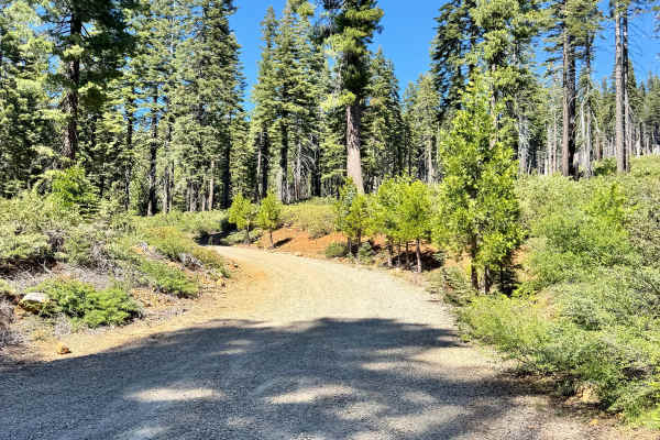
Rattlesnake - FS 27N12
This is a long trail that is a mix of dirt and gravel. There are some sections of the trail that have great views of Lassen Peak. There are a few washes along the trail and some shelf roads. There is also a small creek crossing. There are plenty of spots to pull off and camp as well. Some that can h...
Learn more about Rattlesnake - FS 27N12
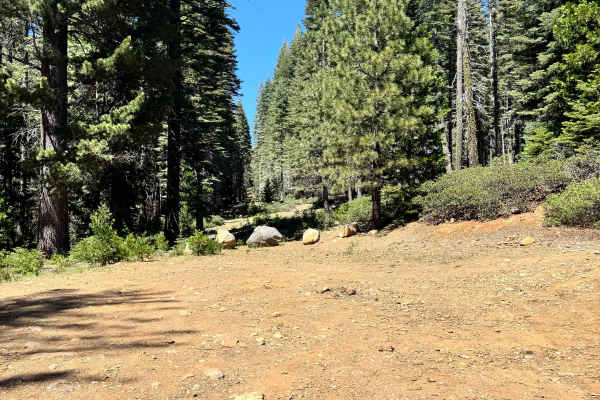
Willow Creek - FS 26N07
This is a short spur trail that has a large camp spot at the end of it that can fit multiple vehicles. This is an easy trail, no washes or ruts. There is a rust-resistant sugar pine with signs to protect it for reforestation efforts. This is a beautiful trail and a camp in dense forest.
Learn more about Willow Creek - FS 26N07
ATV trails near Tehama, California
Explore ATV-friendly trails near you. These trails are accessible for vehicles up to 50 inches wide, perfect for ATVs and smaller off-road machines.
Eagle Rock - FS 24N36
Winding through a starkly beautiful forest recovering from wildfire with dense brush understory and standing burnt snags, Eagle Rock (FS 24N36) offers a scenic backcountry ridge spur within the Mendocino National Forest. Accessed directly off of the Paskenta-Eel River Road (Hwy M2) at a broad, open ...
Learn more about Eagle Rock - FS 24N36
Elder Creek - FS 25N09
Winding through a mix of towering pine timber, oak groves, and actively managed forestlands within the Mendocino National Forest, Elder Creek (FS 25N09) offers a tranquil and broad mountain drive. Accessed directly off Paskenta-Eel River Road (Hwy M2) at the prominent four-way junction, this gently ...
Learn more about Elder Creek - FS 25N09
Section 17 - FS 25N09B
Set within a dry, mixed pine and oak woodland recovering from past fire impacts in the Mendocino National Forest, Section 17 (FS 25N09B) provides a peaceful side excursion. Accessed directly off of Elder Creek Road (FS 25N09) near the Paskenta-Eel River Road corridor, this route stems off to the rig...
Learn more about Section 17 - FS 25N09B
Whitlock - FS 24N19
Set within a partially burnt coniferous forest with emerging shrub understory in the Mendocino National Forest, Whitlock (FS 24N19) offers a rustic mountain slope climb. Accessed directly near Whitlock Campground, this dirt spur branches upward into quieter backcountry terrain. Outdoor enthusiasts p...
Learn more about Whitlock - FS 24N19
UTV/side-by-side trails near Tehama, California
Find UTV and side-by-side trails near you. These trails accommodate vehicles up to 60 inches wide, ideal for UTVs, side-by-sides, and wider off-road rigs.
Eagle Rock - FS 24N36
Winding through a starkly beautiful forest recovering from wildfire with dense brush understory and standing burnt snags, Eagle Rock (FS 24N36) offers a scenic backcountry ridge spur within the Mendocino National Forest. Accessed directly off of the Paskenta-Eel River Road (Hwy M2) at a broad, open ...
Learn more about Eagle Rock - FS 24N36
Elder Creek - FS 25N09
Winding through a mix of towering pine timber, oak groves, and actively managed forestlands within the Mendocino National Forest, Elder Creek (FS 25N09) offers a tranquil and broad mountain drive. Accessed directly off Paskenta-Eel River Road (Hwy M2) at the prominent four-way junction, this gently ...
Learn more about Elder Creek - FS 25N09
Section 17 - FS 25N09B
Set within a dry, mixed pine and oak woodland recovering from past fire impacts in the Mendocino National Forest, Section 17 (FS 25N09B) provides a peaceful side excursion. Accessed directly off of Elder Creek Road (FS 25N09) near the Paskenta-Eel River Road corridor, this route stems off to the rig...
Learn more about Section 17 - FS 25N09B
Whitlock - FS 24N19
Set within a partially burnt coniferous forest with emerging shrub understory in the Mendocino National Forest, Whitlock (FS 24N19) offers a rustic mountain slope climb. Accessed directly near Whitlock Campground, this dirt spur branches upward into quieter backcountry terrain. Outdoor enthusiasts p...
Learn more about Whitlock - FS 24N19
The onX Offroad Difference
onX Offroad combines trail photos, descriptions, difficulty ratings, width restrictions, seasonality, and more in a user-friendly interface. Available on all devices, with offline access and full compatibility with CarPlay and Android Auto. Discover what you're missing today!
Open Trail Map