
Dirt Bike Trails
Near Stearns, Kentucky
Explore All Dirt Bike Trails Near Stearns, Kentucky
Dirt Bike Trails Near Stearns, Kentucky
Discover the best dirt bike trails near you. Browse trail maps, check difficulty ratings, and find your next adventure — whether you're looking for a quick ride or an all-day expedition.
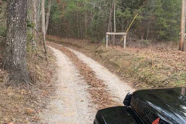
Bandy Creek Trek
This is a combination of dirt, gravel, and single-track in-the-woods roads. There really aren't a lot of difficult obstacles to make a note of other than a few areas that are washed out on Duncan Hollow Road. We had cell service off and on during this drive (Verizon). There weren't any great views a...
Learn more about Bandy Creek Trek
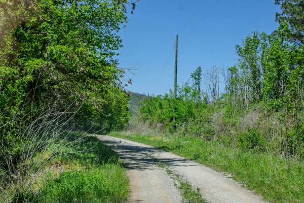
RBW 4
RBW 4 is a two-way gravel road that begins where RBW 7 ends and continues up the mountain toward a gated elk hunting area. This route is wide enough for vehicles to pass in most areas and has no major obstacles along the main road. The gravel surface is generally easy to travel, making this more of ...
Learn more about RBW 4
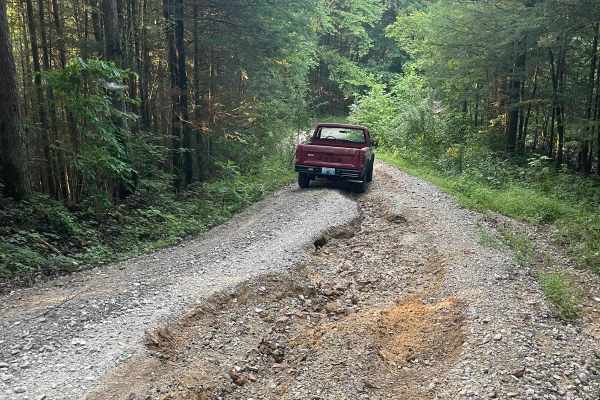
Bear Creek Falls (5138)
Access to a beautiful waterfall into the Rockcastle River. Characteristics of an old Forest Service Road. Large gravel, dirt, and shallow water crossings. Some washouts around one foot deep. Beautiful drive through a less-trafficked area of Daniel Boone National Forest. There is a possibility of dow...
Learn more about Bear Creek Falls (5138)
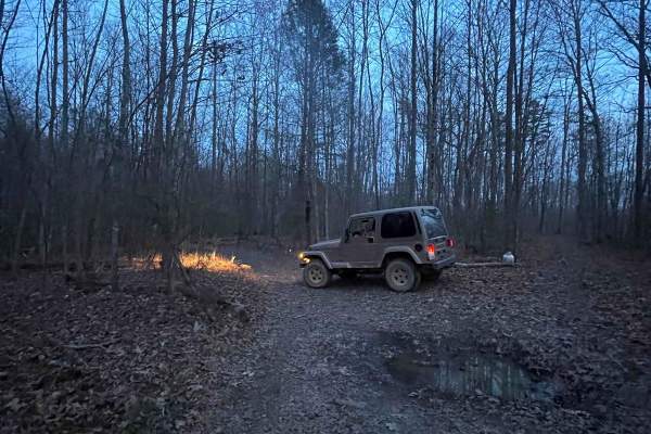
4005A
This trail is more like the old school Appalachian four wheeling trails than most Forest Service roads. There's no gravel, some tight cuts between trees, and a few mud holes. If you're trying to avoid scratches, then stay away--lots of low hanging limbs and branches. There are various offshoots that...
Learn more about 4005A
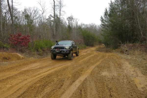
Trail 13 - Lee Asbury Road
This trail starts on the south end as a wide dirt road that can be traversed in most stock vehicles. It remains this way until you get to around Broyles Cemetary. Towards the north end, it becomes more difficult with some rutted mud holes and some rocky sections with up to 10-inch ledges. There are ...
Learn more about Trail 13 - Lee Asbury Road
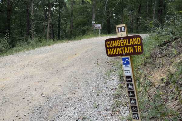
Cumberland Mountain Trail
Cumberland Mountain Trail is a more difficult OHV route suited for riders seeking a longer mountain-style ride along the southwestern edge of the Sundquist Unit in North Cumberland Wildlife Management Area. The trail follows rugged Appalachian terrain and connects with multiple interior routes befor...
Learn more about Cumberland Mountain Trail
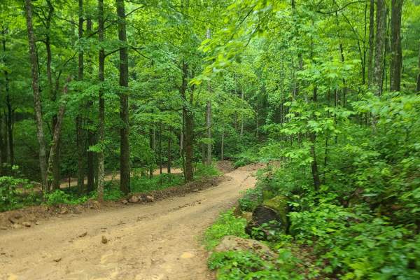
Ride Royal Blue Trail - Trail 27
This is a trail that connects the Ride Royal Blue Resort to the trails at Royal Blue. It starts off in the parking lot at Ride Royal Blue and goes up to Trail 19. The route is steep and winds its way up the ridges to the main trail system. It is slick and muddy with a few ledges and small obstacles.
Learn more about Ride Royal Blue Trail - Trail 27
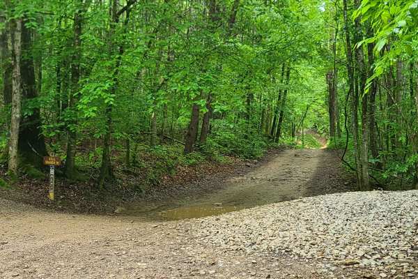
Stell Branch Trail - Trail 11
This trail connects Trail 13 and Trail 10 at the north end of the trail system. It is extremely rutted and run down--many of the trails have been blocked and replaced with bypasses. It can be difficult to figure out which branch to take, but it is a fun trail otherwise. The trail is open to ATVs and...
Learn more about Stell Branch Trail - Trail 11
RBW7
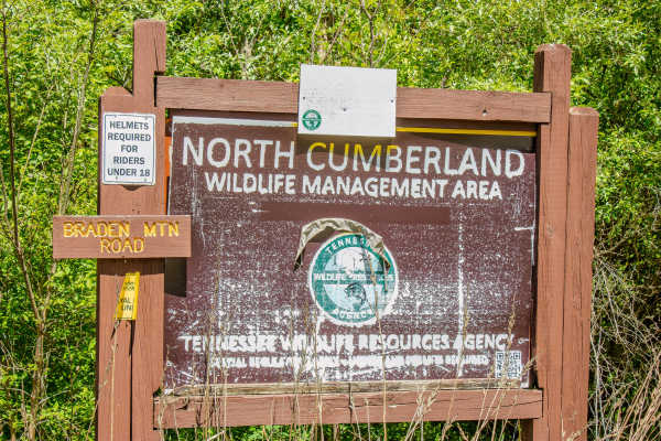
RBW 7 is a two-way gravel road that connects off Howard H. Baker Highway and climbs into the mountain area of the Royal Blue Riding Area and North Cumberland Wildlife Management Area.
The road is wide enough for two vehicles to pass in most areas and has several places to pull over, stop, and explo...
Learn more about RBW7
Top of the World Trail 30
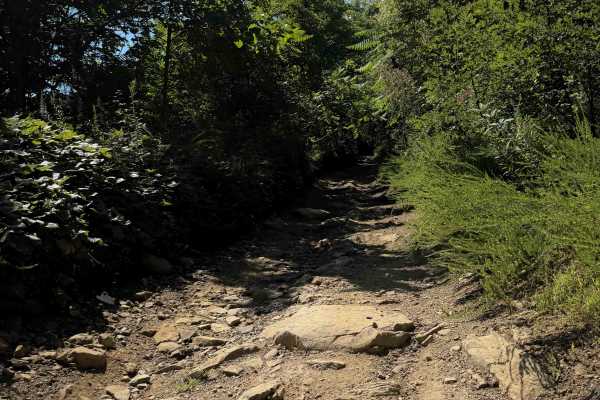
Top of the World is a steep off-highway vehicle trail within the Sundquist Unit of the North Cumberland OHV Riding Area, near LaFollette, Tennessee. There is often a deep rut to the side of the trail, off-camber sections, and shallow ruts filled in with loose rocks, making it an intermediate route. ...
Learn more about Top of the World Trail 30
Tram Branch Trail
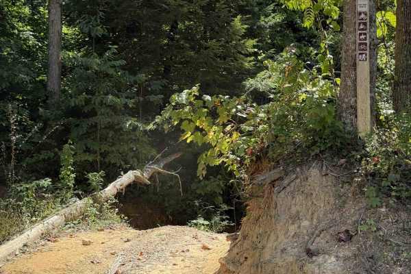
Tram Branch Trail is an easy OHV connector suited for riders looking for a quick route between interior trails and road access within the Sundquist Unit of North Cumberland Wildlife Management Area. This short cutoff spur links Jennings Creek Trail with Lee Asbury Road, allowing ATVs and side-by-sid...
Learn more about Tram Branch Trail
Trail 19 - Walnut Mountain Trail
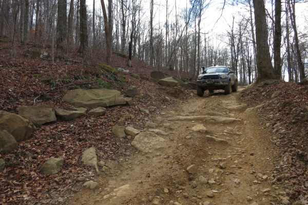
This is a long mountain road that is almost all single track along the side of the mountains with beautiful views throughout the trail. There are lots of humps and dips that make it a challenge if you have low approach or departure angles, deep rutted mud holes, and a few technical rocky sections. T...
Learn more about Trail 19 - Walnut Mountain Trail
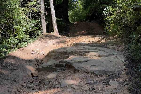
Muse Hollow Trail
Muse Hollow Trail is a moderately difficult OHV route suited for riders with some experience navigating uneven Appalachian terrain within the Sundquist Unit of North Cumberland Wildlife Management Area. This route travels through forested ridges and hollows near the Walnut Mountain trail network and...
Learn more about Muse Hollow Trail
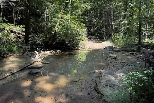
Pond Ridge
The Pond Ridge Trail within the Sundquist Unit of the North Cumberland Off- Highway Vehicle Riding Area is 4 miles long, with several fun intermediate rock and root features. The east entrance starts with a shallow water crossing through the Jim Branch Creek, over slippery rocks. After you exit the ...
Learn more about Pond Ridge
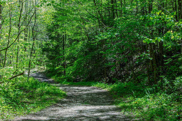
Jake's Branch Road
Jake’s Branch Road is a two-way gravel road that connects from RBS13 to Howard H. Baker Highway. The road is wide and has plenty of room for vehicles to pass, making it one of the easier connector routes in this area. The surface is mostly gravel with a few dips along the way, but there are no serio...
Learn more about Jake's Branch Road
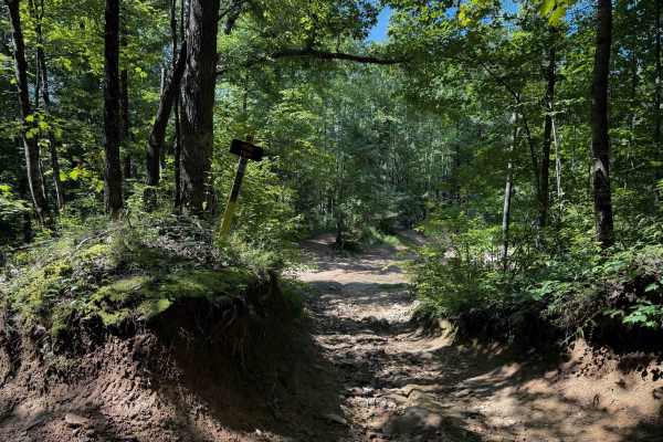
Pond Trail 29
Pond Trail, within the Sundquist Unit of the North Cumberland Off Highway Vehicle Riding Area, near LaFollette, Tennessee, is 2 miles long, meandering up and over small rolling hills on a muddy quad track. The east entrance to the trail is off of Fred’s Way Trail and has a narrow entrance between ta...
Learn more about Pond Trail 29
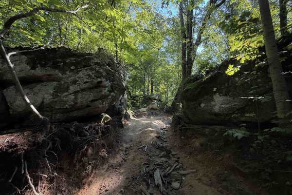
Long Haul Hollow Trail 31
Long Haul Hollow is a difficult Off- Highway Vehicle Trail within the Sundquist Unit of the North Cumberland Off- Highway Vehicle Riding Area, north of the town of LaFollette, Tennessee. It’s a rocky climb from north to south, gaining about 700 feet in elevation before it connects to Muse Hollow Tra...
Learn more about Long Haul Hollow Trail 31
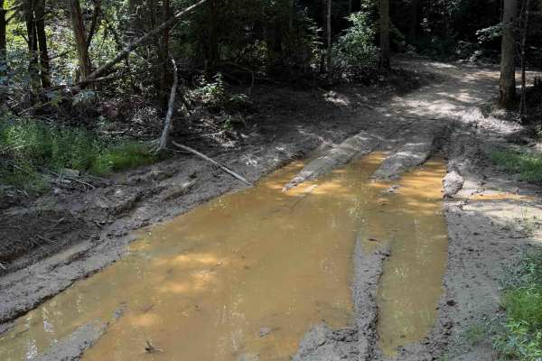
School House Trail 16
The School House Trail within the Sundquist Unit of the North Cumberland Off- Highway Vehicle Riding Area is open to high-clearance 4x4 vehicles and Off- Highway Vehicles. The short trail, at 1.2 miles long, is mostly wide and gradual, with minimal elevation change. It meanders on a hilltop in a lus...
Learn more about School House Trail 16
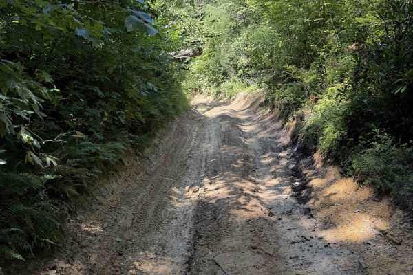
Jennings Creek Trail 8
Jennings Creek Trail is an easy 4x4 trail within the Sundquist Unit of the North Cumberland Off-Highway Vehicle Riding Area. It accesses several easy Off-Highway Vehicle trails, including Tram Branch and Meadow Branch. Jennings Trail meanders the rolling hillsides and forest floor, through a scenic ...
Learn more about Jennings Creek Trail 8
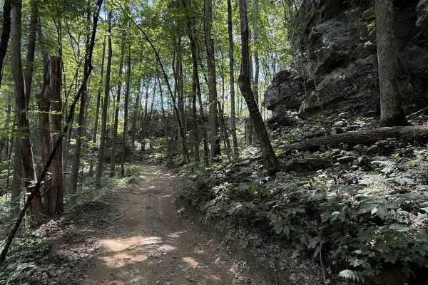
Lost Ridge Trail 14
Lost Ridge Trail within the Sundquist Unit of the North Cumberland OHV Riding Area, is a 1.7 mile long easy OHV trail. It’s mostly a narrow trail on a muddy clay-dirt surface, with a mix of loose rock, and a few bigger flat rocks in the trail that are easy to ride over, but can be slick when wet. Th...
Learn more about Lost Ridge Trail 14
ATV trails near Stearns, Kentucky
Explore ATV-friendly trails near you. These trails are accessible for vehicles up to 50 inches wide, perfect for ATVs and smaller off-road machines.
Bandy Creek Trek
This is a combination of dirt, gravel, and single-track in-the-woods roads. There really aren't a lot of difficult obstacles to make a note of other than a few areas that are washed out on Duncan Hollow Road. We had cell service off and on during this drive (Verizon). There weren't any great views a...
Learn more about Bandy Creek Trek
RBW 4
RBW 4 is a two-way gravel road that begins where RBW 7 ends and continues up the mountain toward a gated elk hunting area. This route is wide enough for vehicles to pass in most areas and has no major obstacles along the main road. The gravel surface is generally easy to travel, making this more of ...
Learn more about RBW 4
Bear Creek Falls (5138)
Access to a beautiful waterfall into the Rockcastle River. Characteristics of an old Forest Service Road. Large gravel, dirt, and shallow water crossings. Some washouts around one foot deep. Beautiful drive through a less-trafficked area of Daniel Boone National Forest. There is a possibility of dow...
Learn more about Bear Creek Falls (5138)
4005A
This trail is more like the old school Appalachian four wheeling trails than most Forest Service roads. There's no gravel, some tight cuts between trees, and a few mud holes. If you're trying to avoid scratches, then stay away--lots of low hanging limbs and branches. There are various offshoots that...
Learn more about 4005A
UTV/side-by-side trails near Stearns, Kentucky
Find UTV and side-by-side trails near you. These trails accommodate vehicles up to 60 inches wide, ideal for UTVs, side-by-sides, and wider off-road rigs.
Bandy Creek Trek
This is a combination of dirt, gravel, and single-track in-the-woods roads. There really aren't a lot of difficult obstacles to make a note of other than a few areas that are washed out on Duncan Hollow Road. We had cell service off and on during this drive (Verizon). There weren't any great views a...
Learn more about Bandy Creek Trek
RBW 4
RBW 4 is a two-way gravel road that begins where RBW 7 ends and continues up the mountain toward a gated elk hunting area. This route is wide enough for vehicles to pass in most areas and has no major obstacles along the main road. The gravel surface is generally easy to travel, making this more of ...
Learn more about RBW 4
Bear Creek Falls (5138)
Access to a beautiful waterfall into the Rockcastle River. Characteristics of an old Forest Service Road. Large gravel, dirt, and shallow water crossings. Some washouts around one foot deep. Beautiful drive through a less-trafficked area of Daniel Boone National Forest. There is a possibility of dow...
Learn more about Bear Creek Falls (5138)
4005A
This trail is more like the old school Appalachian four wheeling trails than most Forest Service roads. There's no gravel, some tight cuts between trees, and a few mud holes. If you're trying to avoid scratches, then stay away--lots of low hanging limbs and branches. There are various offshoots that...
Learn more about 4005A
The onX Offroad Difference
onX Offroad combines trail photos, descriptions, difficulty ratings, width restrictions, seasonality, and more in a user-friendly interface. Available on all devices, with offline access and full compatibility with CarPlay and Android Auto. Discover what you're missing today!
Open Trail Map