
Dirt Bike Trails
Near Silver Summit, Utah
Explore All Dirt Bike Trails Near Silver Summit, Utah
Dirt Bike Trails Near Silver Summit, Utah
Discover the best dirt bike trails near you. Browse trail maps, check difficulty ratings, and find your next adventure — whether you're looking for a quick ride or an all-day expedition.
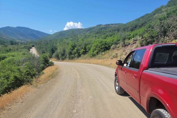
Jeremy Ranch Road
Best for those looking for a scenic route near Park City, this road provides a "back way" into the Jeremy Ranch area as well as backcountry access to Mormon Flats State Park and the Mormon Flats Campground. Most of the road is a broad, graded dirt track, with a very brief section with some very smal...
Learn more about Jeremy Ranch Road
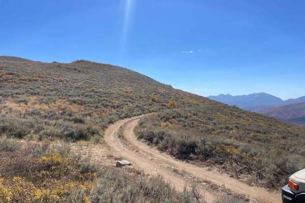
Polly Ridge
This trail takes you from the top of the Polly Springs trail all the way south to get a view over the Heber Valley. It is simple but can be tight in some sections. It has a few sections with trees on one side and a steep drop-off on the other, with little room to spare on either side. This trail end...
Learn more about Polly Ridge
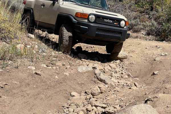
Polly Springs
Polly Springs Trail takes you from Pine Canyon Road to the Polly Ridge. Expect many trees surrounding the trail with more straight-forwardsimpler rocks at the beginning. As you progress, you will hit the first significant rock section. It consists of an intense rut on the left and an off-camber sect...
Learn more about Polly Springs
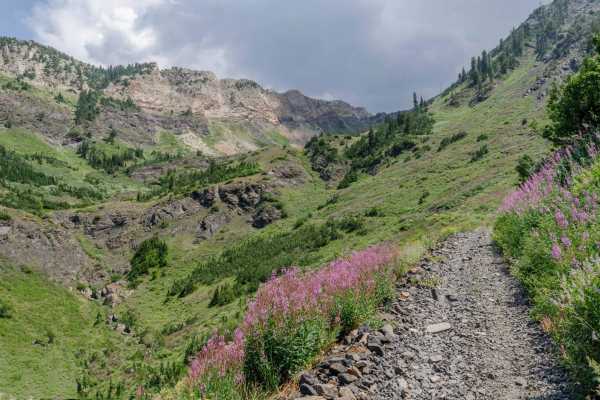
Mineral Fork
Mineral Fork gets the designation as the only off-road route open in the Cottonwoods above Salt Lake County. This trail is popular with dirt bikes, ATVs and hikers. Be sure to respect anyone that is using the trail. Your vehicle has to be under 50" to complete the trail. Please be courteous and obey...
Learn more about Mineral Fork
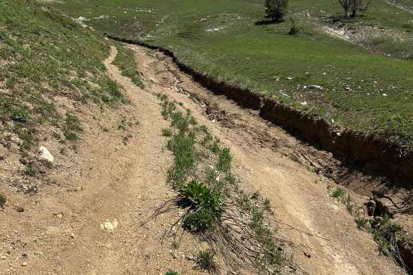
Mill Flat Gulch
Out and back, lots of chunks, but the trail is plenty wide to navigate. A few various tight turns that can be navigated as well. The trail gets progressively more chunky as you climb in elevation. Some larger rock gardens take skill to navigate. The top parts of the trail are washed out, rutted from...
Learn more about Mill Flat Gulch
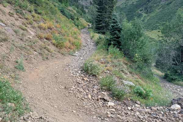
Mineral Fork Road
The .07 miles loop of Mineral Fork Road is a steady climb into Big Cottonwood Canyon's mining history that takes you to the historic Wasatch Mine. The trail surface consists of loose rock, ruts, narrow shelf sections, and a couple of shallow water crossings, making this specific route suitable only ...
Learn more about Mineral Fork Road
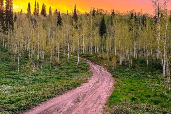
Rattlesnake Hill
Rattlesnake Hill, named after the origins behind the name of the Snake Creek area, is a steep rocky trail with spectacular views. The trail has many steep grades with areas approaching or even surpassing 30 degrees, creating an exciting adventure. Near the bottom of the trail, there are some switchb...
Learn more about Rattlesnake Hill
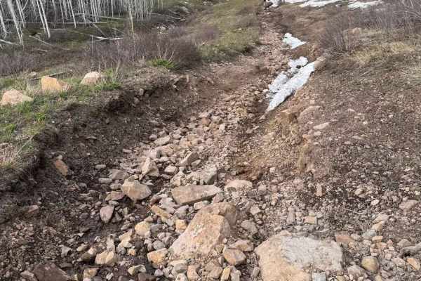
Big Flat
Big Flat is a fun trail up in the Snake Creek area. It is definitely a tighter trail, with a chance you might get a pin stripe or two, especially in a wider vehicle. This trail does have one spot that adds to most of the challenge, and is a steep, rocky climb that you will most likely want a spotter...
Learn more about Big Flat
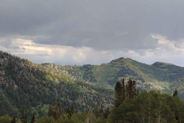
Miller Hill
This is a fun and somewhat technical out-and-back trail. It's a nice scenic trail through the pines and aspens with a few camping spots along the trail. Depending on when you go, there are a lot of wildflowers along the way. This trail also goes up to Tyngs Grave and also old mine areas. There are s...
Learn more about Miller Hill
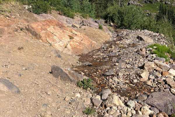
Mineral Basin Trail
Mineral Basin Trail is a beautiful, scenic route that will take you into the Mineral Basin at Snowbird Resort. There are many springs and other sights to see, including the famous "Iron Bog". The trail, however, is no easy task, littered with rock gardens, steep climbs, and rock slabs. The trail beg...
Learn more about Mineral Basin Trail
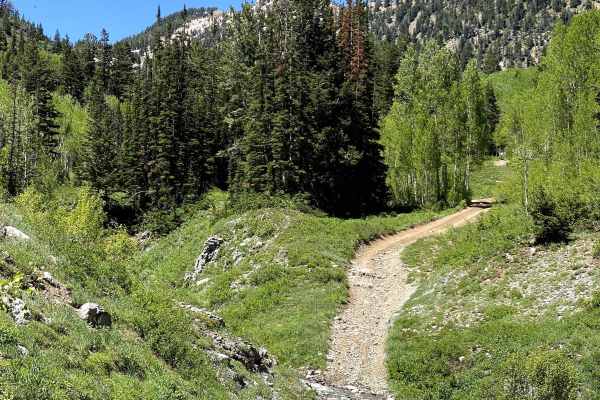
Alta Dry Fork (FR 70198)
One of the most beautiful trails in the area, Alta Dry Fork will challenge beginners and offer some fun for intermediates. Ford low water crossings and navigate your way through pines, aspens, and verdant alpine meadows. Wildflowers trace the trail that follows the Alta Dry Fork Creek, which, depend...
Learn more about Alta Dry Fork (FR 70198)
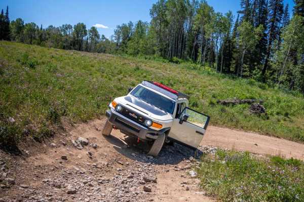
Hoyt Canyon
Hoyt Canyon winds up to where Wide Hollow connects, and continues up towards the Hoyt Peak saddle. Expect a dusty trail that continues through aspen and pine trees for the most part. The trail is pretty simple except for 2 small rock gardens that are a little more slow-going. The rocks are not very ...
Learn more about Hoyt Canyon
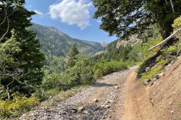
Mary Ellen Gulch
Mary Ellen Gulch is a scenic, introductory out-and-back trail in American Fork Canyon that offers stock high-clearance four-wheel-drive vehicles and SxSs an elevated climb alongside a year-round stream. Spanning approximately 3.5 miles one way, this route serves as an excellent warm-up for nearby Fo...
Learn more about Mary Ellen Gulch
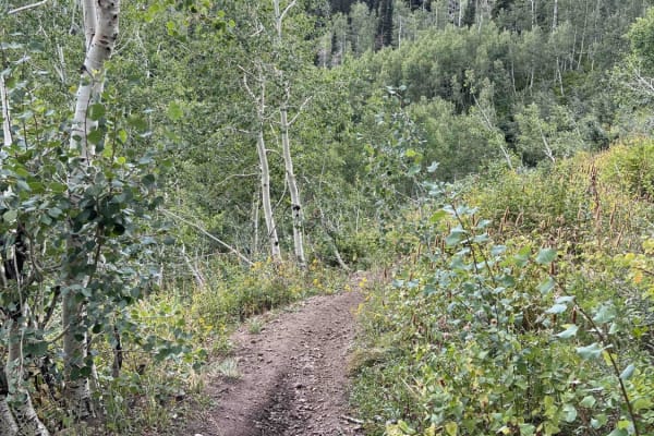
Pot Hollow (2037)
Pot Hollow trail runs east from East Ridge Trail and terminates at a forest road in Pot Hollow. After this intersection, it's all forest roads, so this is a dead-end for single track. Riding west to east, the trail descends steeply in the beginning and flattens out towards Pot Hollow. The trail is m...
Learn more about Pot Hollow (2037)
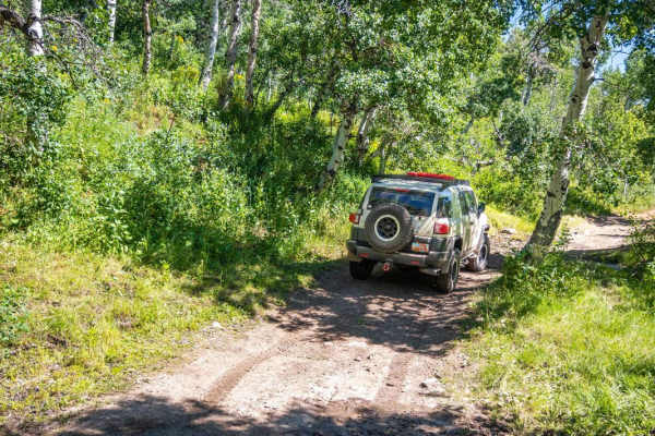
Wide Hollow
Wide Hollow makes its way up the valley into the Hoyt Peak trail system. Some sections are tight and are a little slow-going if you do not want pinstripes. The trail ends up in more of an aspen grove with a few small creeks and pond crossings. Watch out for the cattle when heading up this trail beca...
Learn more about Wide Hollow
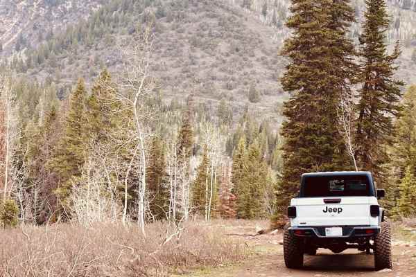
Forest Lake Trail
Forest Lake Trail is in the beautiful American Fork Canyon, Utah. This trail runs Southeast on the way up and is not a loop trail. It is recommended to have a higher clearance vehicle but can be navigated clean with the right spotter. Certain stock vehicles will be able to complete the trail if you ...
Learn more about Forest Lake Trail
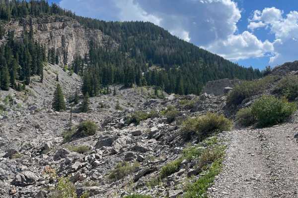
South Fork Weber - FR 031
The start of the trail is pretty open and flowy and isn't difficult at all. Eventually, you will encounter some rock gardens with some sections that require a decent approach, breakover, and departure angle. Take it slow and you will be okay. Next, you will reach a river that requires being driven u...
Learn more about South Fork Weber - FR 031
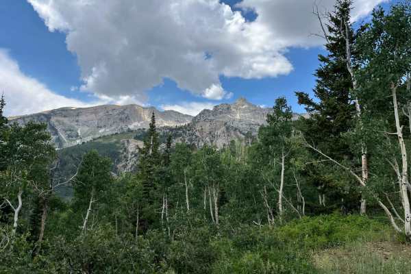
Major Evans
This is a narrow track through pleasant trees. The track switches up the mountainside and provides good views of the surrounding peaks. Since it ends at a locked gate, it needs an hour up, and an hour down. Passing can be difficult due to the track width. There are some pleasant meadows at the turno...
Learn more about Major Evans
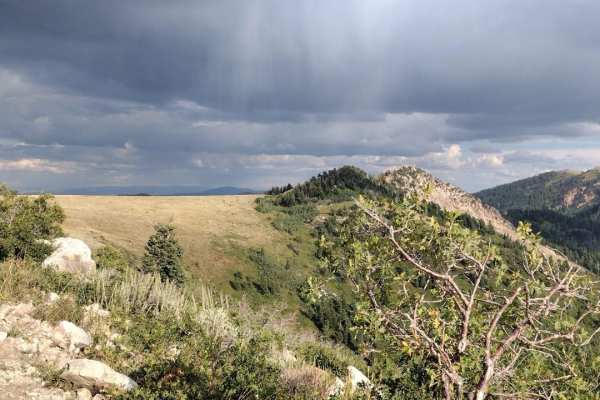
North Holbrook FS 1629
This is an out-and-back easy trail. It goes over to a small turnaround viewpoint. For larger vehicles, you will need to park here and walk the next 100 feet to the second viewpoint. ATVs and motorcycles can continue on the trail to the small turnaround and viewpoint. There is a small trail that take...
Learn more about North Holbrook FS 1629
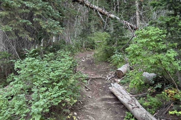
Forest Lake (2171)
Forest Lake Trail drops down from the Ridge Trail to Forest Lake. It's a shorter single-track trail that loses ~500 feet of elevation when riding towards Forest Lake. From the lake, you can take forest roads back to Tibble Fork Reservoir via Shaffer Fork and American Fork Snake Creek, or turn around...
Learn more about Forest Lake (2171)
ATV trails near Silver Summit, Utah
Explore ATV-friendly trails near you. These trails are accessible for vehicles up to 50 inches wide, perfect for ATVs and smaller off-road machines.
Jeremy Ranch Road
Best for those looking for a scenic route near Park City, this road provides a "back way" into the Jeremy Ranch area as well as backcountry access to Mormon Flats State Park and the Mormon Flats Campground. Most of the road is a broad, graded dirt track, with a very brief section with some very smal...
Learn more about Jeremy Ranch Road
Polly Ridge
This trail takes you from the top of the Polly Springs trail all the way south to get a view over the Heber Valley. It is simple but can be tight in some sections. It has a few sections with trees on one side and a steep drop-off on the other, with little room to spare on either side. This trail end...
Learn more about Polly Ridge
Polly Springs
Polly Springs Trail takes you from Pine Canyon Road to the Polly Ridge. Expect many trees surrounding the trail with more straight-forwardsimpler rocks at the beginning. As you progress, you will hit the first significant rock section. It consists of an intense rut on the left and an off-camber sect...
Learn more about Polly Springs
Mineral Fork
Mineral Fork gets the designation as the only off-road route open in the Cottonwoods above Salt Lake County. This trail is popular with dirt bikes, ATVs and hikers. Be sure to respect anyone that is using the trail. Your vehicle has to be under 50" to complete the trail. Please be courteous and obey...
Learn more about Mineral Fork
UTV/side-by-side trails near Silver Summit, Utah
Find UTV and side-by-side trails near you. These trails accommodate vehicles up to 60 inches wide, ideal for UTVs, side-by-sides, and wider off-road rigs.
Jeremy Ranch Road
Best for those looking for a scenic route near Park City, this road provides a "back way" into the Jeremy Ranch area as well as backcountry access to Mormon Flats State Park and the Mormon Flats Campground. Most of the road is a broad, graded dirt track, with a very brief section with some very smal...
Learn more about Jeremy Ranch Road
Polly Ridge
This trail takes you from the top of the Polly Springs trail all the way south to get a view over the Heber Valley. It is simple but can be tight in some sections. It has a few sections with trees on one side and a steep drop-off on the other, with little room to spare on either side. This trail end...
Learn more about Polly Ridge
Polly Springs
Polly Springs Trail takes you from Pine Canyon Road to the Polly Ridge. Expect many trees surrounding the trail with more straight-forwardsimpler rocks at the beginning. As you progress, you will hit the first significant rock section. It consists of an intense rut on the left and an off-camber sect...
Learn more about Polly Springs
Mill Flat Gulch
Out and back, lots of chunks, but the trail is plenty wide to navigate. A few various tight turns that can be navigated as well. The trail gets progressively more chunky as you climb in elevation. Some larger rock gardens take skill to navigate. The top parts of the trail are washed out, rutted from...
Learn more about Mill Flat Gulch
The onX Offroad Difference
onX Offroad combines trail photos, descriptions, difficulty ratings, width restrictions, seasonality, and more in a user-friendly interface. Available on all devices, with offline access and full compatibility with CarPlay and Android Auto. Discover what you're missing today!
Open Trail Map