
Dirt Bike Trails
Near Knoxville, Arkansas
Explore All Dirt Bike Trails Near Knoxville, Arkansas
Dirt Bike Trails Near Knoxville, Arkansas
Discover the best dirt bike trails near you. Browse trail maps, check difficulty ratings, and find your next adventure — whether you're looking for a quick ride or an all-day expedition.
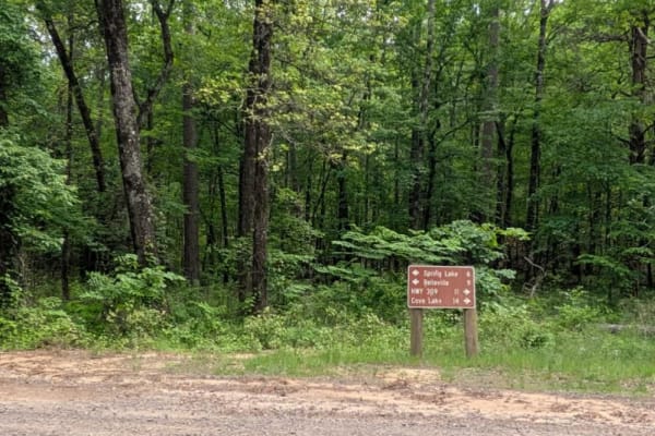
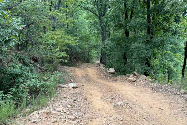
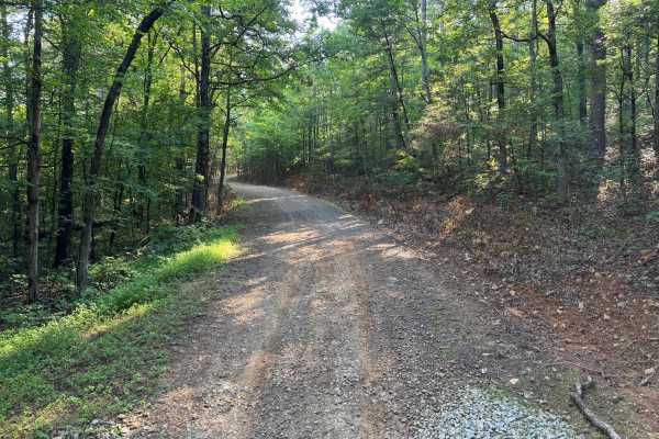
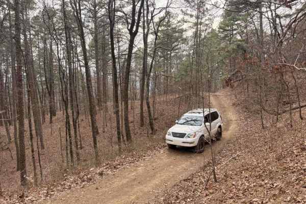
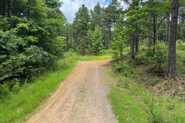
Spring Lake Northern Access Road
Spring Lake Northern Access Road is a wide, well-maintained route that winds through scenic farmland, offering a peaceful and open drive. However, the trail surface is severely corrugated, particularly on the ascents and descents, making cautious driving essential to avoid vehicle damage. While the ...
Learn more about Spring Lake Northern Access Road
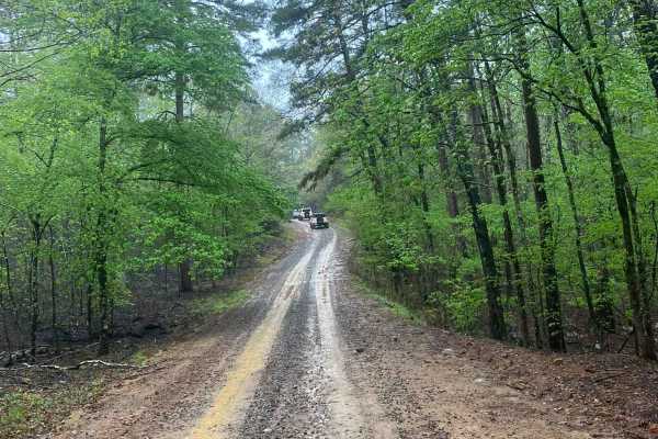
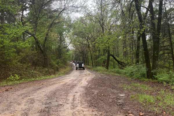
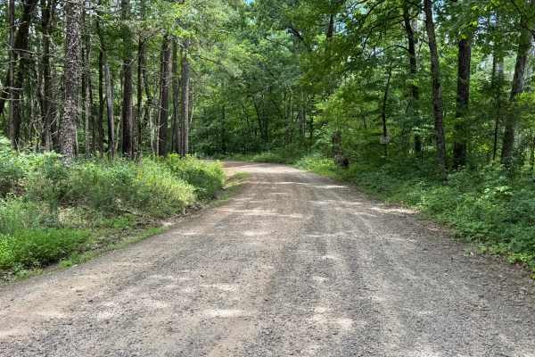
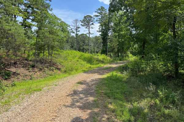
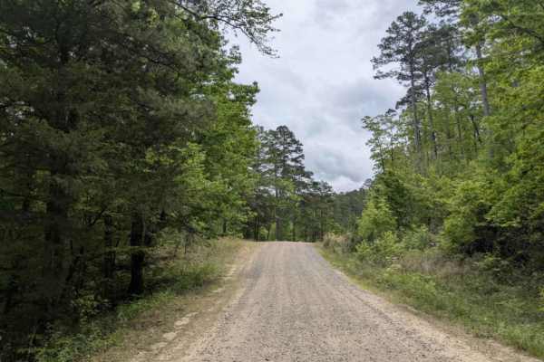
Little Bigger Road
Little Bigger Road is an easy, well-maintained gravel road that serves as a primary access route into deeper trail systems near Mount Magazine, making it ideal for reaching more technical trails without much effort. It had been raining all night, so conditions were pretty wet, but the road held up w...
Learn more about Little Bigger Road
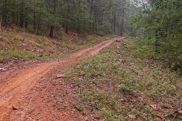
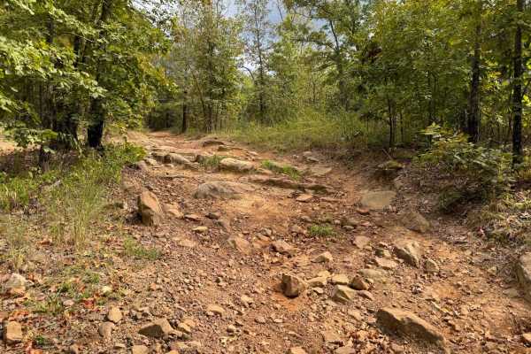
FS 9066D
This trail is a short but punchy hill climb that offers a solid challenge with loose rock, shelves, and steep grades in a classic Ozark hardwood forest setting. The route features a steady climb with multiple technical sections, including rock shelves and ledges that require careful tire placement, ...
Learn more about FS 9066D
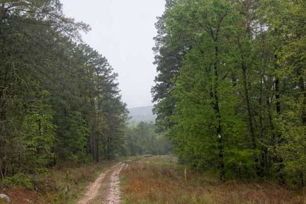
Horne Road
Horne Road is a fun, moderately challenging ridge-top trail that offers a steady descent down to a county road. While not extremely technical, it provides enough obstacles and terrain variety to keep drivers engaged from start to finish. The trail begins along a scenic ridge top with a gradual desce...
Learn more about Horne Road
96076D & 96021D
These two trails combine to make essentially one direct shot up to (or down from) Huckleberry Mountain. Starting from Huckleberry Mountain going north, the trail starts with a steep descent along a narrow trail with many water break humps as you travel downhill. Please take caution going either dire...
Learn more about 96076D & 96021D
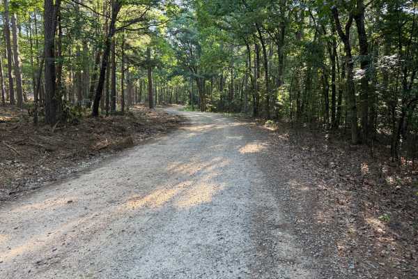
Shoal Creek - FS 1604
Shoal Creek Road is an easy, well-maintained gravel route that follows Shoal Creek and provides access to dispersed camping and nearby trail systems. It’s a great entry-level drive with scenic creek crossings and access to more adventurous trails at the far end. Maintained gravel road getting to Sho...
Learn more about Shoal Creek - FS 1604
Buzzard's Rock (Huckleberry Pond) - Trail 96022B
Very short trail out to the popular Buzzard's Rock overlook. The trail is accessible by OHV (ATV, UTV, MX) only and not legal for any other vehicle type. The trail goes past a very large campsite and pond called Huckleberry Pond. The trail can be very slimy and muddy during wet weather. There is a r...
Learn more about Buzzard's Rock (Huckleberry Pond) - Trail 96022B
Huckleberry Mountain - Trail 2611
This is a seasonal-only trail (June - March) OHV (ATV, UTV, MC) that circles Huckleberry Mountain and is very tight-winding at times through thick forest. This is a very popular trail with several overlooks to walk out to. Views include the Arkansas River, Lake Dardanelle, and the Arkansas Nuclear O...
Learn more about Huckleberry Mountain - Trail 2611
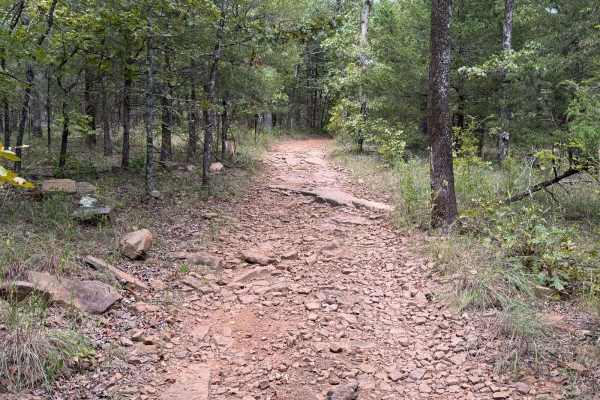
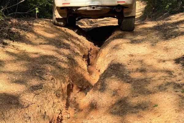
FS 1441
This route is one of the rougher and more technical roads in the surrounding area, featuring long stretches of embedded rock, exposed bedrock, and uneven hill climbs. While it serves as a connector through the forest, it offers a more engaging drive than the neighboring gravel roads. Drivers will en...
Learn more about FS 1441
FS 93237
This route begins on a maintained gravel road before narrowing into a single-vehicle-wide forest trail. Shortly after entering the woods, the trail becomes more technical with numerous whoops, erosion-created washouts, embedded rocks, and a sustained rocky climb featuring ledges up to approximately ...
Learn more about FS 93237
Harker Valley Road
Harker Valley is a wide gravel trail that offers a scenic drive through dense forest, but it is heavily rutted with deep potholes, often hidden in the shade. Drivers are advised to proceed slowly to protect their tires and suspension. Along the route are at least two established dispersed campsites ...
Learn more about Harker Valley Road
Carter Mountain
Carter Mountain trail is a maintained gravel route that becomes rough and rocky, featuring winding segments and areas overgrown with vegetation. Logging activity is evident along the trail, with blue-painted trees marking those selected for harvest, orange paint indicating protected trees, and purpl...
Learn more about Carter Mountain
Bull Springs
This trail is a fun hill climb connector from FS 1813 to Pilot Rock Mountain Road if traveled from South to North. Several water bars keep the trail from stepping upward and your vehicle from pitching up and down. You'll encounter rock obstacles less than 6 inches tall. About halfway, logging has pr...
Learn more about Bull Springs
Sawyer
The route is generally well-traveled and suitable for most high-clearance vehicles, though natural erosion has created scattered whoops, shallow puddles, and uneven sections that may become more pronounced after heavy rainfall. A dispersed campsite is located along the route, providing a convenient ...
Learn more about Sawyer
Mckay
Beginning just off Highway 21, this scenic forest road passes the Pleasant Hill Shooting Range before winding through the Ozark National Forest. The route follows a well-established dirt and gravel road with several stream crossings, gradual elevation changes, and sections of exposed rock. Although ...
Learn more about Mckay
Dripping Springs
Dripping Springs is a narrow, rutted, and rocky climb featuring a mix of loose rock, embedded stone, and short, steep grades. The trail gains approximately 1,000 feet in elevation when traveling south to north, with the majority of that elevation gain occurring on the southern half of the route. It ...
Learn more about Dripping Springs
Sulpher Branch
This route begins on Forest Service Road 93713D off Jake's Creek Road before transitioning onto Sulphur Branch Road (FS 1826). After the junction, the trail narrows to a single-vehicle-wide route and becomes progressively more technical, featuring loose rock, off-camber sections, exposed bedrock, er...
Learn more about Sulpher Branch
FS 1601
Spring Lake Road Access is a maintained gravel route frequently traveled by visitors heading to the lake, resulting in noticeable corrugations and potholes that make moderate driving speeds advisable. The trail eventually leads to a campground open seasonally from Memorial Day to Labor Day. Alongsid...
Learn more about FS 1601
Slo Fork Road
Slo Fork is a well-maintained gravel road characterized by frequent corrugations and bumps, making cautious driving at lower speeds advisable. The route passes through picturesque landscapes dotted with private properties and rural farmsteads, offering scenic views of agricultural land before transi...
Learn more about Slo Fork Road
Wainscott Bottoms
This route takes you into the Wainscott bottoms of Big Piney Creek. The trail starts as a smooth gravel road then transitions into a two-track Forest Service road, then into a narrow loose rock shelf descent into the creek valley. The trail gets very narrow towards the end, so heavy pinstriping is a...
Learn more about Wainscott Bottoms
ATV trails near Knoxville, Arkansas
Explore ATV-friendly trails near you. These trails are accessible for vehicles up to 50 inches wide, perfect for ATVs and smaller off-road machines.
Spring Lake Northern Access Road
Spring Lake Northern Access Road is a wide, well-maintained route that winds through scenic farmland, offering a peaceful and open drive. However, the trail surface is severely corrugated, particularly on the ascents and descents, making cautious driving essential to avoid vehicle damage. While the ...
Learn more about Spring Lake Northern Access Road
Little Bigger Road
Little Bigger Road is an easy, well-maintained gravel road that serves as a primary access route into deeper trail systems near Mount Magazine, making it ideal for reaching more technical trails without much effort. It had been raining all night, so conditions were pretty wet, but the road held up w...
Learn more about Little Bigger Road
FS 9066D
This trail is a short but punchy hill climb that offers a solid challenge with loose rock, shelves, and steep grades in a classic Ozark hardwood forest setting. The route features a steady climb with multiple technical sections, including rock shelves and ledges that require careful tire placement, ...
Learn more about FS 9066D
Horne Road
Horne Road is a fun, moderately challenging ridge-top trail that offers a steady descent down to a county road. While not extremely technical, it provides enough obstacles and terrain variety to keep drivers engaged from start to finish. The trail begins along a scenic ridge top with a gradual desce...
Learn more about Horne Road
UTV/side-by-side trails near Knoxville, Arkansas
Find UTV and side-by-side trails near you. These trails accommodate vehicles up to 60 inches wide, ideal for UTVs, side-by-sides, and wider off-road rigs.
Spring Lake Northern Access Road
Spring Lake Northern Access Road is a wide, well-maintained route that winds through scenic farmland, offering a peaceful and open drive. However, the trail surface is severely corrugated, particularly on the ascents and descents, making cautious driving essential to avoid vehicle damage. While the ...
Learn more about Spring Lake Northern Access Road
Little Bigger Road
Little Bigger Road is an easy, well-maintained gravel road that serves as a primary access route into deeper trail systems near Mount Magazine, making it ideal for reaching more technical trails without much effort. It had been raining all night, so conditions were pretty wet, but the road held up w...
Learn more about Little Bigger Road
FS 9066D
This trail is a short but punchy hill climb that offers a solid challenge with loose rock, shelves, and steep grades in a classic Ozark hardwood forest setting. The route features a steady climb with multiple technical sections, including rock shelves and ledges that require careful tire placement, ...
Learn more about FS 9066D
Horne Road
Horne Road is a fun, moderately challenging ridge-top trail that offers a steady descent down to a county road. While not extremely technical, it provides enough obstacles and terrain variety to keep drivers engaged from start to finish. The trail begins along a scenic ridge top with a gradual desce...
Learn more about Horne Road
The onX Offroad Difference
onX Offroad combines trail photos, descriptions, difficulty ratings, width restrictions, seasonality, and more in a user-friendly interface. Available on all devices, with offline access and full compatibility with CarPlay and Android Auto. Discover what you're missing today!
Open Trail Map