
Dirt Bike Trails
Near Lamar, Arkansas
Explore All Dirt Bike Trails Near Lamar, Arkansas
Dirt Bike Trails Near Lamar, Arkansas
Discover the best dirt bike trails near you. Browse trail maps, check difficulty ratings, and find your next adventure — whether you're looking for a quick ride or an all-day expedition.
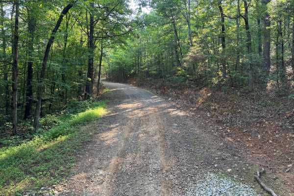
FS 1441
This route is one of the rougher and more technical roads in the surrounding area, featuring long stretches of embedded rock, exposed bedrock, and uneven hill climbs. While it serves as a connector through the forest, it offers a more engaging drive than the neighboring gravel roads. Drivers will en...
Learn more about FS 1441
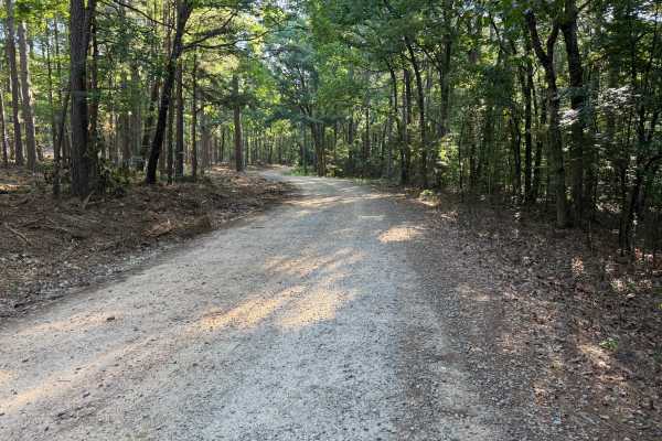
Mckay
Beginning just off Highway 21, this scenic forest road passes the Pleasant Hill Shooting Range before winding through the Ozark National Forest. The route follows a well-established dirt and gravel road with several stream crossings, gradual elevation changes, and sections of exposed rock. Although ...
Learn more about Mckay
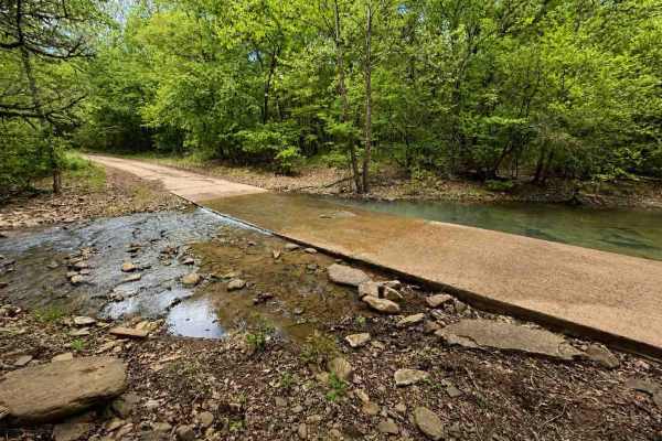
Spadra
This easy trail is a wide, mostly gravel road with intermittent rocky sections. Typically passable by two vehicles. Includes multiple water crossings, with one crossing reaching approximately 12 inches in depth. Shallow ruts running across the trail in several spots. Best used as a low-difficulty co...
Learn more about Spadra
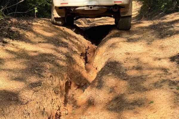
Dripping Springs
Dripping Springs is a narrow, rutted, and rocky climb featuring a mix of loose rock, embedded stone, and short, steep grades. The trail gains approximately 1,000 feet in elevation when traveling south to north, with the majority of that elevation gain occurring on the southern half of the route. It ...
Learn more about Dripping Springs
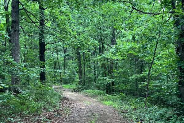
Walker
Use the Forest Service easement off Walker Road to access the trail. The route is heavily overgrown, with tight trees and brush that may cause pinstriping, and a downed tree has a bypass around it. As the trail approaches Murray Creek, it descends through deep ruts and a rock obstacle, with limited ...
Learn more about Walker
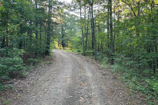
Cazort Tower - FS 1403C
This out-and-back route climbs around Katie Knob Mountain on a generally well-maintained gravel road. The trail is mostly single vehicle width but includes several pull-off areas where oncoming traffic can pass. Drivers will encounter a few minor washouts and rough spots where larger rocks have erod...
Learn more about Cazort Tower - FS 1403C
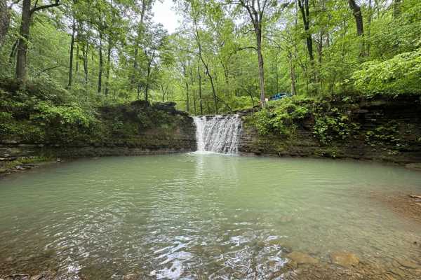
Spainhour Falls 1422A
This is an out-and-back 3.5-mile trail to Spainhour Falls. The trail is very narrow with tight foliage and has very few places to cleanly pass oncoming traffic. Expect several small creek crossings and many mud holes. The mud holes have firm bottoms, so there's no need to bypass any. There's a water...
Learn more about Spainhour Falls 1422A
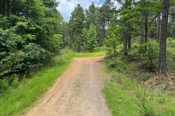
Sulpher Branch
This route begins on Forest Service Road 93713D off Jake's Creek Road before transitioning onto Sulphur Branch Road (FS 1826). After the junction, the trail narrows to a single-vehicle-wide route and becomes progressively more technical, featuring loose rock, off-camber sections, exposed bedrock, er...
Learn more about Sulpher Branch
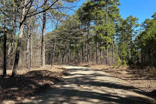
Woods Mountain Road
This starts off as a paved road, but very quickly turns into maintained gravel with room for passing. There are no obstacles. This is a windy, easy drive with several off-shoots. It is scenic, with both mountain and valley views. It's a good option to get from Highway 21 to Highway 123 by driving up...
Learn more about Woods Mountain Road
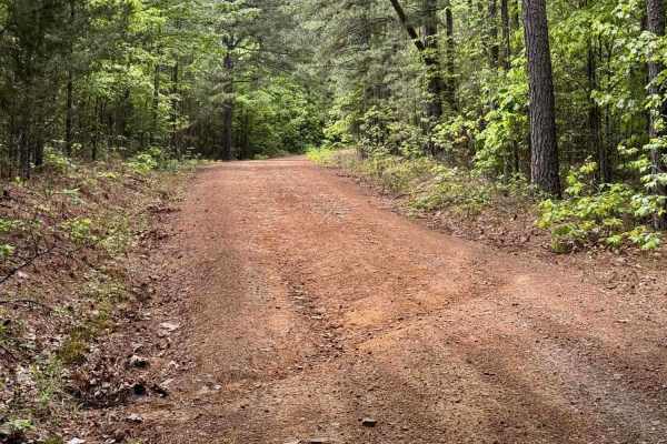
Apple Road
Apple Road is a narrow, winding bench-cut road with a mix of ruts and embedded rocks up to 12 inches. Running south to north, the trail gains over 1,000 feet in elevation but keeps a mild, manageable grade. The route hugs the hillside for much of the climb and passes a small waterfall, adding some s...
Learn more about Apple Road
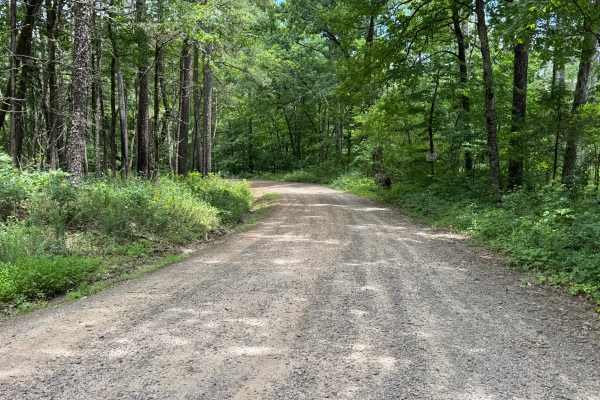
FS 93237
This route begins on a maintained gravel road before narrowing into a single-vehicle-wide forest trail. Shortly after entering the woods, the trail becomes more technical with numerous whoops, erosion-created washouts, embedded rocks, and a sustained rocky climb featuring ledges up to approximately ...
Learn more about FS 93237
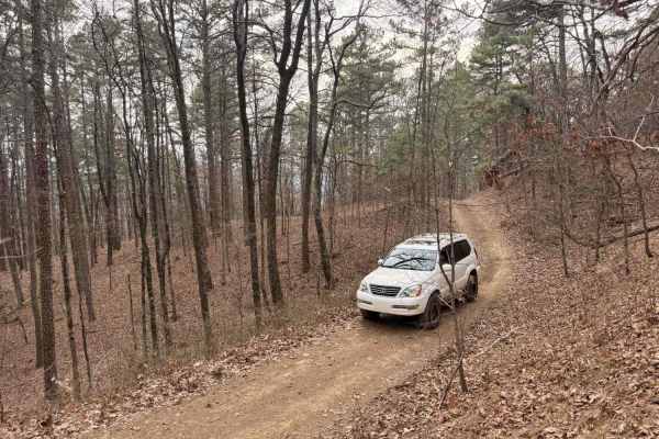
Bull Springs
This trail is a fun hill climb connector from FS 1813 to Pilot Rock Mountain Road if traveled from South to North. Several water bars keep the trail from stepping upward and your vehicle from pitching up and down. You'll encounter rock obstacles less than 6 inches tall. About halfway, logging has pr...
Learn more about Bull Springs
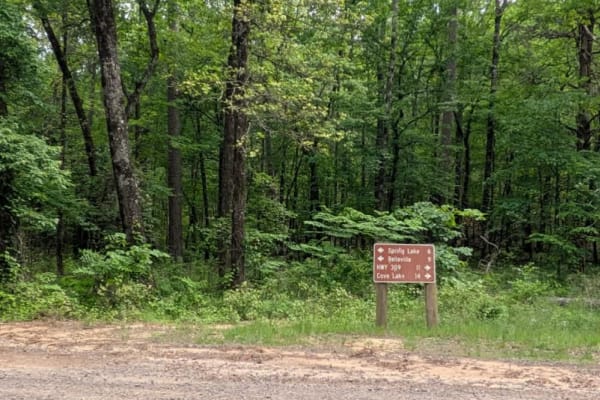
Spring Lake Northern Access Road
Spring Lake Northern Access Road is a wide, well-maintained route that winds through scenic farmland, offering a peaceful and open drive. However, the trail surface is severely corrugated, particularly on the ascents and descents, making cautious driving essential to avoid vehicle damage. While the ...
Learn more about Spring Lake Northern Access Road
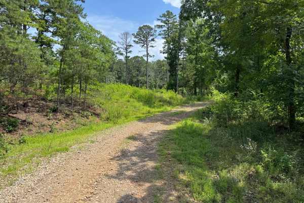
Sawyer
The route is generally well-traveled and suitable for most high-clearance vehicles, though natural erosion has created scattered whoops, shallow puddles, and uneven sections that may become more pronounced after heavy rainfall. A dispersed campsite is located along the route, providing a convenient ...
Learn more about Sawyer
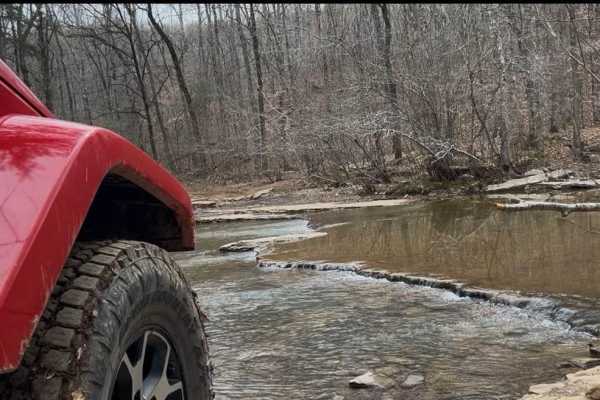
FS 1409
This trail starts with a water crossing at Murray Creek. The creek bottom is all rocks. After crossing, there is a large camp area with a view of Murray Creek's waterfalls. Back on the trail are dirt and rocks with several large, long pools of water to drive through. There are some workarounds if ne...
Learn more about FS 1409
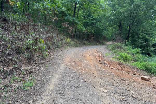
Mikels
This route begins at Woods Mountain Road and winds through a scenic section of the Ozark National Forest before ending at Murray Creek. The first portion follows a well-maintained gravel Forest Service road through dense hardwood forest before gradually becoming narrower and more rugged. As the rout...
Learn more about Mikels
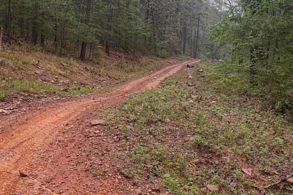
FS 9066D
This trail is a short but punchy hill climb that offers a solid challenge with loose rock, shelves, and steep grades in a classic Ozark hardwood forest setting. The route features a steady climb with multiple technical sections, including rock shelves and ledges that require careful tire placement, ...
Learn more about FS 9066D
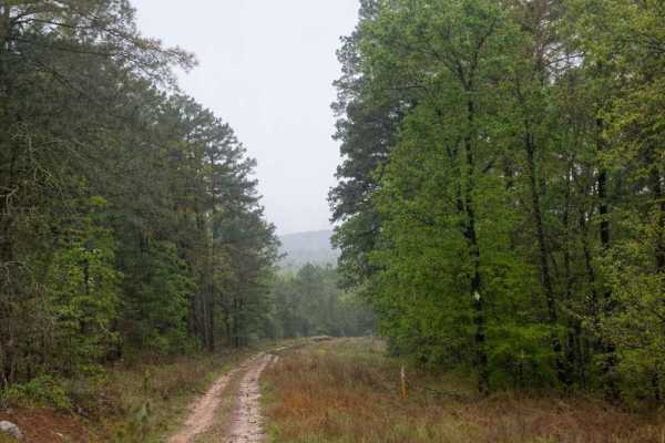
Horne Road
Horne Road is a fun, moderately challenging ridge-top trail that offers a steady descent down to a county road. While not extremely technical, it provides enough obstacles and terrain variety to keep drivers engaged from start to finish. The trail begins along a scenic ridge top with a gradual desce...
Learn more about Horne Road
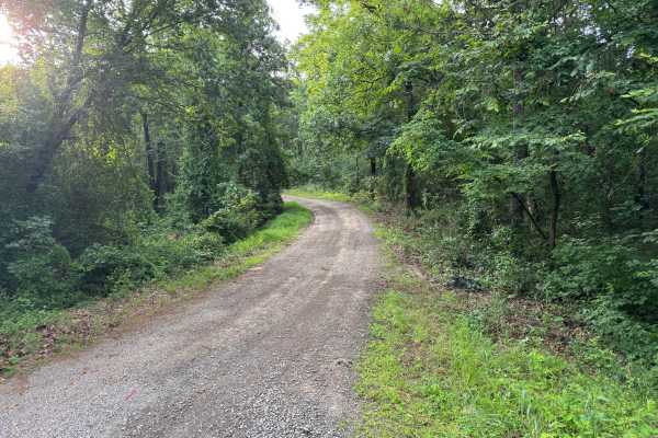
Gillian
This out-and-back route follows a well-maintained gravel and dirt road through a quiet section of forest with no significant obstacles, making it an easy drive for most high-clearance vehicles. The road is generally one vehicle wide, although there are several wider sections where drivers can safely...
Learn more about Gillian
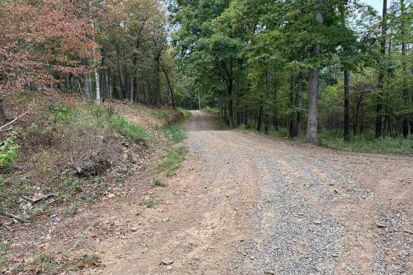
FS 96058A
This through route connects Spiderweb (FS 1622B) with Little Bigger Road through the Mount Magazine Ranger District of the Ozark National Forest. Forest Service maps identify FS 1622B as part of the road network near Sorghum Hollow. The route follows a graded gravel and dirt surface, with loose grav...
Learn more about FS 96058A
ATV trails near Lamar, Arkansas
Explore ATV-friendly trails near you. These trails are accessible for vehicles up to 50 inches wide, perfect for ATVs and smaller off-road machines.
FS 1441
This route is one of the rougher and more technical roads in the surrounding area, featuring long stretches of embedded rock, exposed bedrock, and uneven hill climbs. While it serves as a connector through the forest, it offers a more engaging drive than the neighboring gravel roads. Drivers will en...
Learn more about FS 1441
Mckay
Beginning just off Highway 21, this scenic forest road passes the Pleasant Hill Shooting Range before winding through the Ozark National Forest. The route follows a well-established dirt and gravel road with several stream crossings, gradual elevation changes, and sections of exposed rock. Although ...
Learn more about Mckay
Spadra
This easy trail is a wide, mostly gravel road with intermittent rocky sections. Typically passable by two vehicles. Includes multiple water crossings, with one crossing reaching approximately 12 inches in depth. Shallow ruts running across the trail in several spots. Best used as a low-difficulty co...
Learn more about Spadra
Dripping Springs
Dripping Springs is a narrow, rutted, and rocky climb featuring a mix of loose rock, embedded stone, and short, steep grades. The trail gains approximately 1,000 feet in elevation when traveling south to north, with the majority of that elevation gain occurring on the southern half of the route. It ...
Learn more about Dripping Springs
UTV/side-by-side trails near Lamar, Arkansas
Find UTV and side-by-side trails near you. These trails accommodate vehicles up to 60 inches wide, ideal for UTVs, side-by-sides, and wider off-road rigs.
FS 1441
This route is one of the rougher and more technical roads in the surrounding area, featuring long stretches of embedded rock, exposed bedrock, and uneven hill climbs. While it serves as a connector through the forest, it offers a more engaging drive than the neighboring gravel roads. Drivers will en...
Learn more about FS 1441
Mckay
Beginning just off Highway 21, this scenic forest road passes the Pleasant Hill Shooting Range before winding through the Ozark National Forest. The route follows a well-established dirt and gravel road with several stream crossings, gradual elevation changes, and sections of exposed rock. Although ...
Learn more about Mckay
Spadra
This easy trail is a wide, mostly gravel road with intermittent rocky sections. Typically passable by two vehicles. Includes multiple water crossings, with one crossing reaching approximately 12 inches in depth. Shallow ruts running across the trail in several spots. Best used as a low-difficulty co...
Learn more about Spadra
Dripping Springs
Dripping Springs is a narrow, rutted, and rocky climb featuring a mix of loose rock, embedded stone, and short, steep grades. The trail gains approximately 1,000 feet in elevation when traveling south to north, with the majority of that elevation gain occurring on the southern half of the route. It ...
Learn more about Dripping Springs
The onX Offroad Difference
onX Offroad combines trail photos, descriptions, difficulty ratings, width restrictions, seasonality, and more in a user-friendly interface. Available on all devices, with offline access and full compatibility with CarPlay and Android Auto. Discover what you're missing today!
Open Trail Map