
Dirt Bike Trails
Near Green, Oregon
Explore All Dirt Bike Trails Near Green, Oregon
Dirt Bike Trails Near Green, Oregon
Discover the best dirt bike trails near you. Browse trail maps, check difficulty ratings, and find your next adventure — whether you're looking for a quick ride or an all-day expedition.
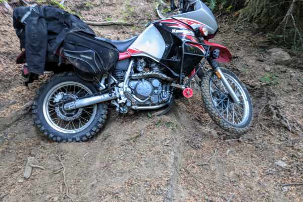
Dead Horse Revenge
This trail is a fun out-and-back route that offers great views and some fun terrain. Originally the trail connects back to Coos Bay Wagon road, however, aside from the trail becoming very difficult at the end of this route, it appears that RFP posted signs closing the trail to motor vehicles. Althou...
Learn more about Dead Horse Revenge
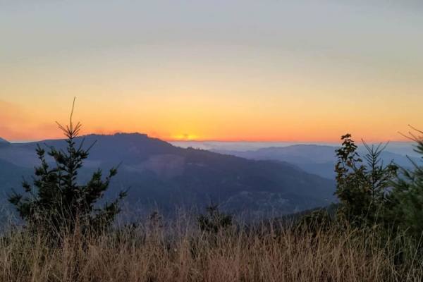
Peel to Wolf Creek Job Corps Bypass Route
This route is a bypass for local residents and employees of Job Corps to avoid fire or road hazards that may arise. It is mostly small tire-friendly. Use caution during the week as it will have moderate log truck traffic in the area and on Little River Road.
Learn more about Peel to Wolf Creek Job Corps Bypass Route
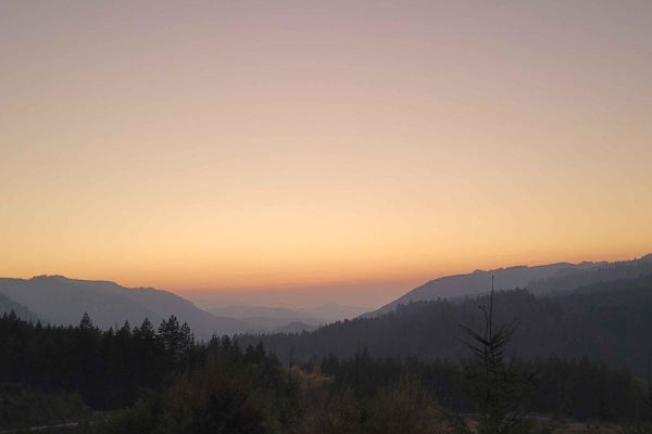
Backroads to Swiftwater to Peel Oregon
Great viewing points of the N. Umpqua River and the area of Thunder Mountain. There are lots of opportunities for mudding and enjoying a nice day on the mountain. It is a great trail for getting from Lil River Side to Rock Creek side in an SxS or 4Wheeler. Come prepared with food, drink, water, and ...
Learn more about Backroads to Swiftwater to Peel Oregon
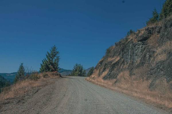
Lookout Mountain
Lookout Mountain road runs through the Umpqua National Forest, it is an easy gravel road with sections that can be gradually steep and curvy. There are some sections of this road that have really cool rock formations and pretty views. There is also a really cool spot at Emile Shelter to stop and enj...
Learn more about Lookout Mountain
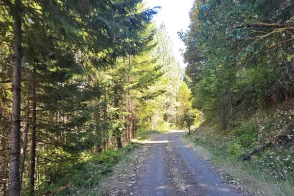
FS 3220900
This well-maintained forest road climbs steadily into the mountains, following a winding, mostly single-lane route with occasional pullouts where vehicles can move aside for passing traffic. The road includes numerous switchbacks, sharp curves, and blind corners, so drivers should stay alert for onc...
Learn more about FS 3220900
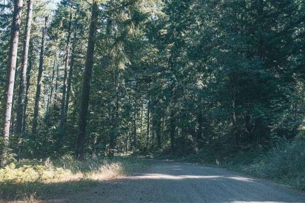
Lower Emily
Lower Emily is an easy, scenic 2.4-mile gravel route in the Umpqua National Forest that provides essential access to the popular Grotto Falls Trailhead, making it perfect for beginners, scenic drivers, and families looking for a classic Pacific Northwest outdoor adventure. Navigating through towerin...
Learn more about Lower Emily
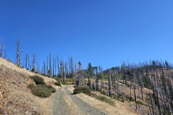
FS 3220300
This trail begins as a well-maintained gravel road and is relatively easy to follow through the first section. Conditions change at a major split, where the road to the right leads toward the 320 and includes a steep descent. Continuing on this route, the trail becomes narrower and more rugged, with...
Learn more about FS 3220300
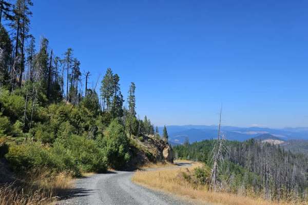
FS 3220000
This trail has sections with sheer cliff drop-offs and significant exposure. It is not recommended for anyone uncomfortable with heights, and drivers should use extreme caution near the unprotected edges. This well-maintained gray gravel road climbs steadily from the main road into the mountains, fo...
Learn more about FS 3220000
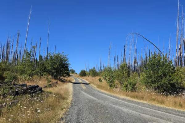
FS 3230200
This beautiful user-maintained forest trail begins in dense woodland before opening into a burned area with views across the surrounding valley. The road remains in relatively good condition for an unmaintained route, although it becomes narrower as it continues, with vegetation closing in around th...
Learn more about FS 3230200
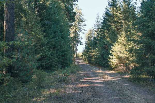
Panther Ridge
Panther Ridge is an easy, scenic 4.1-mile off-road drive through Oregon's Umpqua National Forest. Once a gravel road, it is now an overgrown, unpaved trail heavily encroached upon by dense vegetation, where tight brush can cause pinstriping on larger vehicles. The trail climbs gently from 3,636 to 3...
Learn more about Panther Ridge
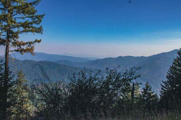
Panther Creek
Panther Creek road runs through the Umpqua National Forest, it is an easy single-car width gravel road with some spots to pull off. There are a couple of sections in the trees that clear out offering a pretty view of the mountains in the distance. There is a hike that gets you to Fairy Shelter Fores...
Learn more about Panther Creek
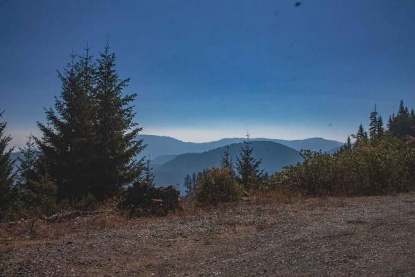
Lookout
Lookout road is a very tight natural surface overgrown road that has sections where you will get deep pinstripes, but the camp spot at the top has a large firepit with a pretty nice view however it is only big enough for two rigs. There was spotty cell phone service at the camp spot.
Learn more about Lookout
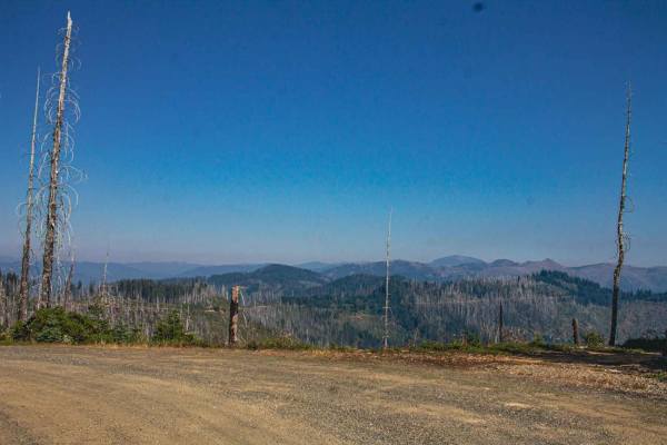
Snowbird
Snowbird is an easy gravel road with sections that have steep but gradual inclines. It runs through the Umpqua National Forest. This road is filled with gorgeous spots to enjoy views, yet it is a burned area in sections so be aware there is a chance of falling rocks, trees, and flash floods. Don't l...
Learn more about Snowbird
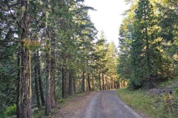
3200620
This trail winds through a beautiful forest but has several distinctly different sections. Starting from the southern end, the route is relatively narrow and heavily wooded, with pinstriping likely as branches and trees encroach on the single-lane road. Many trees have been cut back, although some w...
Learn more about 3200620
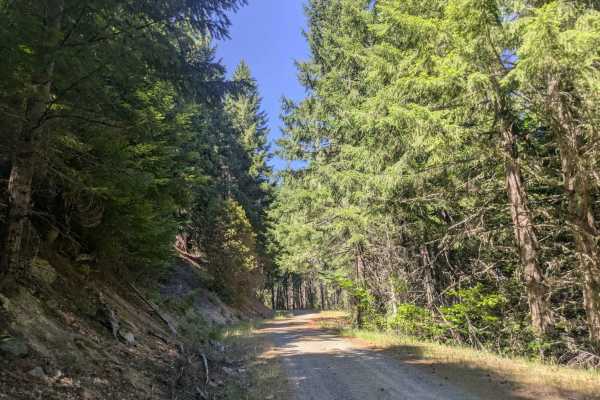
3232000
This well-maintained gravel road connects to Cow Creek Trail and is mostly a narrow, single-lane route with frequent curves and switchbacks. Large potholes are common, especially in shaded sections, and dips and corrugation also require slower speeds. From the Cow Creek side, the road begins with a ...
Learn more about 3232000
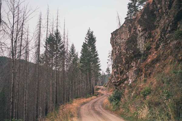
Timber Creek
Timber Creek is an easy gravel and natural surface road that runs through the Umpqua National Forest. There is access to Mott Trailhead at the beginning/ending of the road, depending on where you started your route. A section of the road has an area that often sees falling rocks and small landslides...
Learn more about Timber Creek
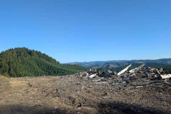
1857
This short but exciting trail features a steep descent, followed by a steep climb, then drops down again. The route eventually reaches a lower staging area with plenty of room to turn around and a large area that may suit dispersed camping. The staging area also has two targets for target shooting. ...
Learn more about 1857
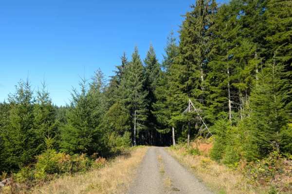
1900
The route moves between wide-open forest, deeper, darker sections, lush green vegetation, and logged areas. The road surface consists of well-maintained gray-brown dirt and gravel, making for a beautiful drive through the area. The trail ends where a sand berm blocks the road and prevents further tr...
Learn more about 1900
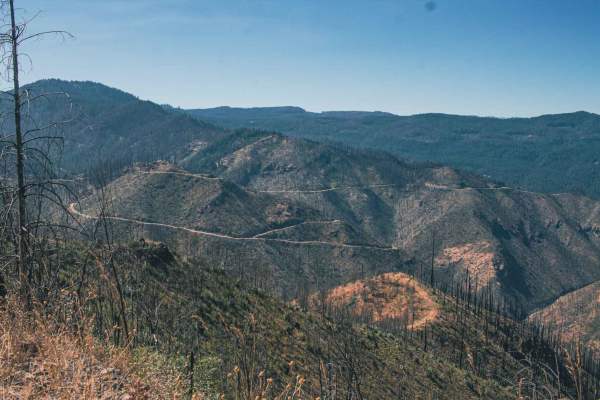
Calf Ridge
Calf Ridge road number 4720 is an easy gravel road that runs through the Umpqua National Forest. There are plenty of beautiful views to enjoy on this route, it is in a burned area so be mindful of rocks and falling debris, but don't like that take away from the stunning views. You will find Horsesho...
Learn more about Calf Ridge
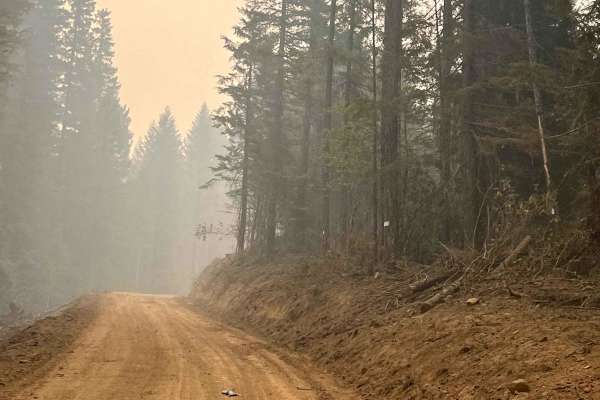
Steamboat Springs - Chilcoot
This route is a well-maintained forest service road that begins at the bridge in Steamboat Springs and follows 3806 Road to the summit. It is suitable for vehicles of all sizes, including big rigs, and is consistently well-kept, with several large pull-offs and natural water sources along the way. T...
Learn more about Steamboat Springs - Chilcoot
ATV trails near Green, Oregon
Explore ATV-friendly trails near you. These trails are accessible for vehicles up to 50 inches wide, perfect for ATVs and smaller off-road machines.
Dead Horse Revenge
This trail is a fun out-and-back route that offers great views and some fun terrain. Originally the trail connects back to Coos Bay Wagon road, however, aside from the trail becoming very difficult at the end of this route, it appears that RFP posted signs closing the trail to motor vehicles. Althou...
Learn more about Dead Horse Revenge
Peel to Wolf Creek Job Corps Bypass Route
This route is a bypass for local residents and employees of Job Corps to avoid fire or road hazards that may arise. It is mostly small tire-friendly. Use caution during the week as it will have moderate log truck traffic in the area and on Little River Road.
Learn more about Peel to Wolf Creek Job Corps Bypass Route
Backroads to Swiftwater to Peel Oregon
Great viewing points of the N. Umpqua River and the area of Thunder Mountain. There are lots of opportunities for mudding and enjoying a nice day on the mountain. It is a great trail for getting from Lil River Side to Rock Creek side in an SxS or 4Wheeler. Come prepared with food, drink, water, and ...
Learn more about Backroads to Swiftwater to Peel Oregon
Lookout Mountain
Lookout Mountain road runs through the Umpqua National Forest, it is an easy gravel road with sections that can be gradually steep and curvy. There are some sections of this road that have really cool rock formations and pretty views. There is also a really cool spot at Emile Shelter to stop and enj...
Learn more about Lookout Mountain
UTV/side-by-side trails near Green, Oregon
Find UTV and side-by-side trails near you. These trails accommodate vehicles up to 60 inches wide, ideal for UTVs, side-by-sides, and wider off-road rigs.
Dead Horse Revenge
This trail is a fun out-and-back route that offers great views and some fun terrain. Originally the trail connects back to Coos Bay Wagon road, however, aside from the trail becoming very difficult at the end of this route, it appears that RFP posted signs closing the trail to motor vehicles. Althou...
Learn more about Dead Horse Revenge
Peel to Wolf Creek Job Corps Bypass Route
This route is a bypass for local residents and employees of Job Corps to avoid fire or road hazards that may arise. It is mostly small tire-friendly. Use caution during the week as it will have moderate log truck traffic in the area and on Little River Road.
Learn more about Peel to Wolf Creek Job Corps Bypass Route
Backroads to Swiftwater to Peel Oregon
Great viewing points of the N. Umpqua River and the area of Thunder Mountain. There are lots of opportunities for mudding and enjoying a nice day on the mountain. It is a great trail for getting from Lil River Side to Rock Creek side in an SxS or 4Wheeler. Come prepared with food, drink, water, and ...
Learn more about Backroads to Swiftwater to Peel Oregon
Lookout Mountain
Lookout Mountain road runs through the Umpqua National Forest, it is an easy gravel road with sections that can be gradually steep and curvy. There are some sections of this road that have really cool rock formations and pretty views. There is also a really cool spot at Emile Shelter to stop and enj...
Learn more about Lookout Mountain
The onX Offroad Difference
onX Offroad combines trail photos, descriptions, difficulty ratings, width restrictions, seasonality, and more in a user-friendly interface. Available on all devices, with offline access and full compatibility with CarPlay and Android Auto. Discover what you're missing today!
Open Trail Map