
Beginner Off-Road Trails
Near Yosemite Valley, California
Explore All Beginner Trails Near Yosemite Valley, California
Beginner Off-Road Trails Near Yosemite Valley, California
Discover the best beginner-friendly off-road trails near you. These easier, lower-rated trails are a great place to start — browse trail maps, check difficulty ratings, and find your next adventure.
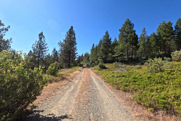
FS 1S25A
FS 1S25A branches off the main FS 1S25 road and opens into a quiet, 1.6-mile single-track through dense, shaded forest. The first short stretch is the narrowest part of the drive, with a bit of grass and brush pressing in close enough to brush the sides of the vehicle, though nothing that demands sp...
Learn more about FS 1S25A
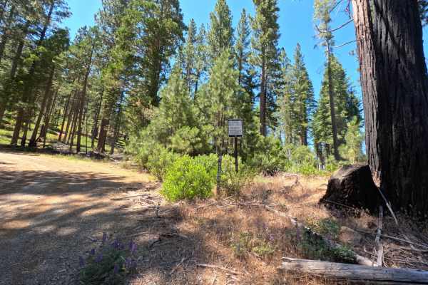
FS 1S24
FS 1S24 is a 3.2-mile, two-way dirt and gravel road, marked by a numbered post at the junction with the main road. The first stretch is easy driving, smooth dirt and gravel through open forest with wide views. Past a fork with a spur road, the road narrows, and grass and brush grow in close on both ...
Learn more about FS 1S24
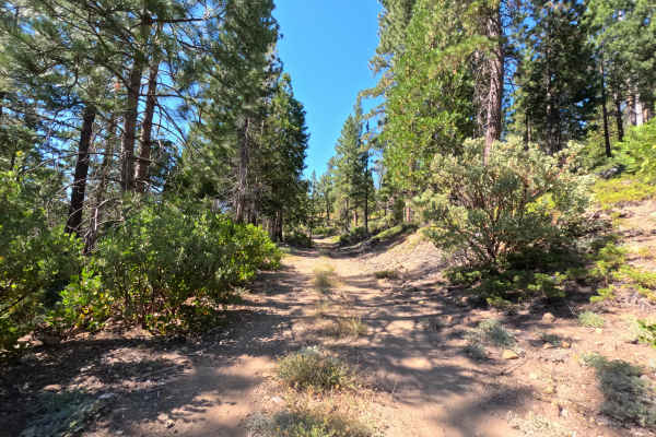
FS 1S89
FS 1S89 branches off the main FS 1S25 road and settles into a calm, single-lane track over firm, packed dirt. The road climbs gradually as it works north, narrowing slightly the further it goes, with scattered small rocks and light debris across the tread here and there. Tall pines line both sides f...
Learn more about FS 1S89
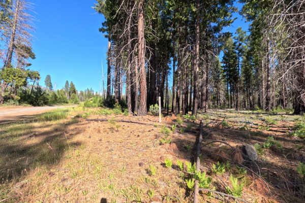
FS 1S25
Set within an open, scenic coniferous forest managed by the Stanislaus National Forest near the western boundary of Yosemite National Park, FS 1S25 climbs steadily up toward an elevation near 5,000 feet. Accessed directly from Evergreen Road, this inviting route serves as a main connector to numerou...
Learn more about FS 1S25
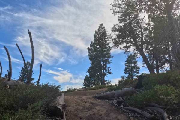
Ten Mile Grade C Spur - FS 4S004C
This is a short, single-lane connector through an area of severe wildfire impact, clearly evidenced by standing silver snags and burnt timber (visible in photos). The route is tight and overgrown due to rapid post-fire vegetation regrowth, and it devolves into an OHV track as it descends to connect ...
Learn more about Ten Mile Grade C Spur - FS 4S004C
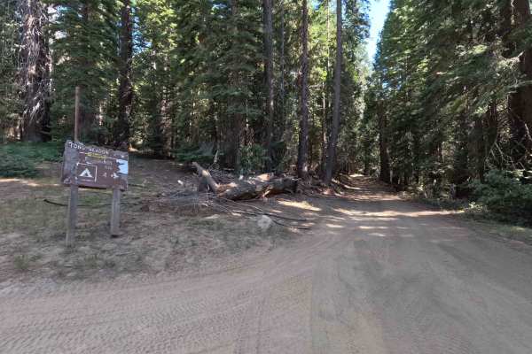
Long Meadow - FS 5S022
Long Meadow (FS 5S022) serves as the scenic glue that holds the local trail network together, acting as a vital two-track connector between the bustling Big Sandy Campground (specifically connecting to FS 6S007) and the more rugged Mt. Raymond Road (FS 5S006) to the north. This 3.2-mile jaunt is a d...
Learn more about Long Meadow - FS 5S022
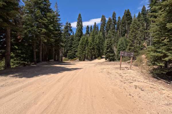
Big Creek Fire Road - North - FS 5S048
Big Creek Fire Road - North (FS 5S048) is the northern twin of a route severed by private property boundaries, but don't let the interruption stop you—this section is a prime gateway to the high country. This 2.8-mile dirt track acts as the primary launchpad for hikers and explorers aiming for the S...
Learn more about Big Creek Fire Road - North - FS 5S048
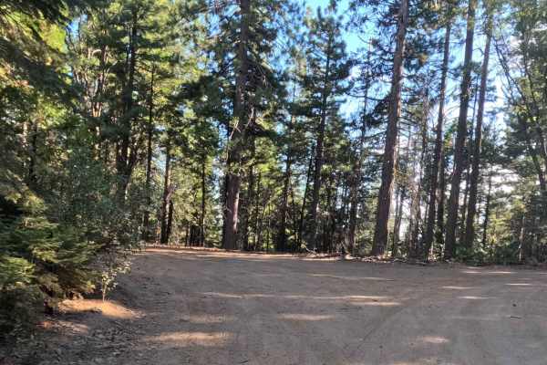
Summit Cutoff - 5S009X
This is an easy, two-lane Forest Service road that efficiently climbs out of the Fish Camp area and connects to the high-country Chowchilla Mountain Road network. The surface is a mixed bag of graded dirt, loose gravel, and rough sections of broken, old pavement (visible in photos), requiring carefu...
Learn more about Summit Cutoff - 5S009X
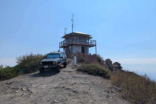
Signal Peak - FS 4S031A
This 1.2-mile spur is a short, intense climb that dramatically departs from the easier roads below to reach a great viewpoint of the surrounding Sierra and the valley below. Branching off Dobler Meadow, the trail immediately tilts upward, becoming a steep, loose, and rocky two-track that winds throu...
Learn more about Signal Peak - FS 4S031A
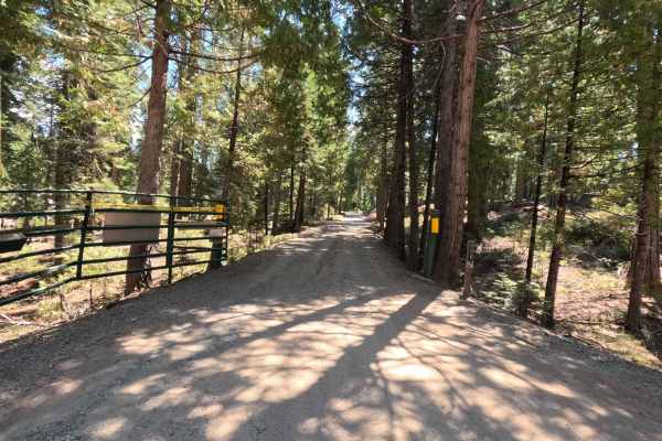
Mount Raymond Road - FS 5S006
Mount Raymond Road (FS 5S006) is a shapeshifter of a trail that offers a little bit of everything for the backcountry explorer. The journey begins innocently enough on a well-graded forest road, lulling you into a false sense of security as you cruise through the pines. However, the character of the...
Learn more about Mount Raymond Road - FS 5S006
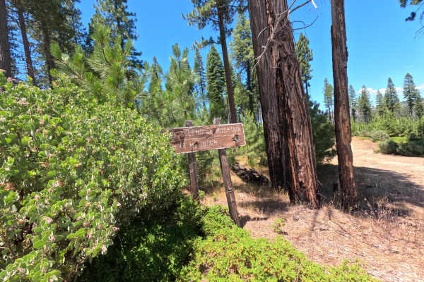
FS 1S05
FS 1S05 is a wide, well-graded dirt and gravel road with great views over the surrounding hills for most of its length. A few stretches narrow a bit, with minor ruts and brush encroaching on both sides. It's mostly used as an access road connecting to other forest service roads, and makes for an eas...
Learn more about FS 1S05
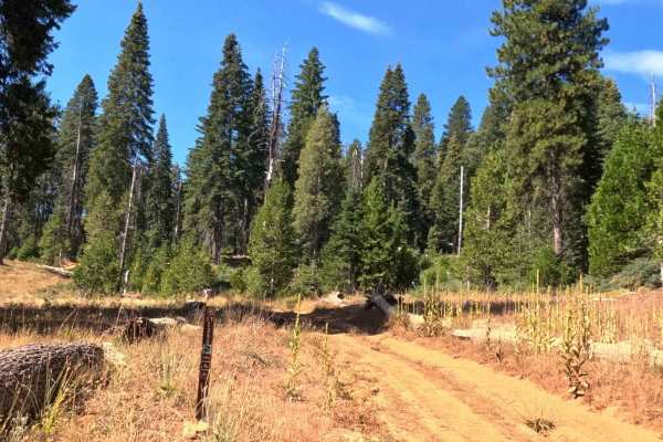
Battalion - FS 21E252
This is a short, fun, and easy dirt Jeep trail through a dense forest environment. The trail features sections of powdery ruts and packed earth that can be driven quickly, making it an excellent connector or introductory route for a shorter off-road blast. While the 4,500-foot elevation is lower tha...
Learn more about Battalion - FS 21E252
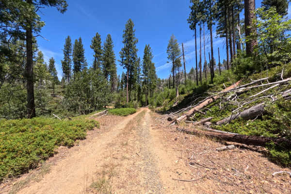
FS 1S16Y
FS 1S16Y starts right off Highway 120 and runs as a single-lane out-and-back spur through dense, quiet forest, terminating at a multi-group campsite rather than connecting through to another route. There's no wide shoulder or passing room to speak of, just a narrow corridor pressed close by trees on...
Learn more about FS 1S16Y
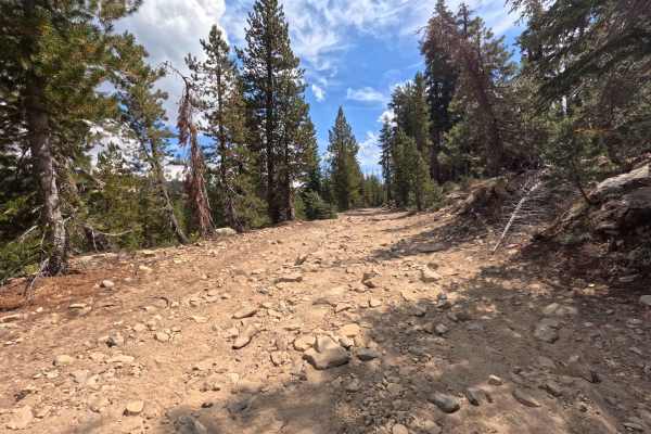
Quartz Mountain - FS 5S040Y
This high alpine traverse is a tale of two forest service roads. It starts on the northern side as a rough, rocky scramble with lots of embedded granite that slows travel and requires focus. However, the trail smooths out beautifully into fast, packed decomposed granite as it drops down to Beasore R...
Learn more about Quartz Mountain - FS 5S040Y
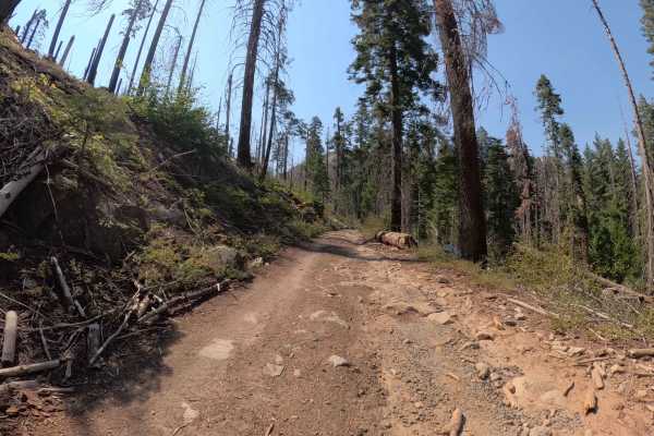
Dobler Meadow - FS 4S031
This 2.9-mile route is a tale of two trails, offering a relaxing cruise that eventually demands a bit more spatial awareness. For the majority of the drive, Dobler Meadow is a breezy, wide forest service road (Rated 2) defined by soft dirt, gravel, and only minor rutting. It winds through a scenic h...
Learn more about Dobler Meadow - FS 4S031
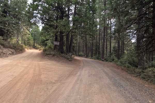
Rainier Creek - FS 5S037
Rainier Creek (FS 5S037) is a fantastic little connector that packs a surprising amount of visual drama into a short, 2.9-mile package. Think of it as the "scenic elevator" of the district. The trail surface is a bit of a history lesson, alternating between crunching gravel and patches of old, forgo...
Learn more about Rainier Creek - FS 5S037
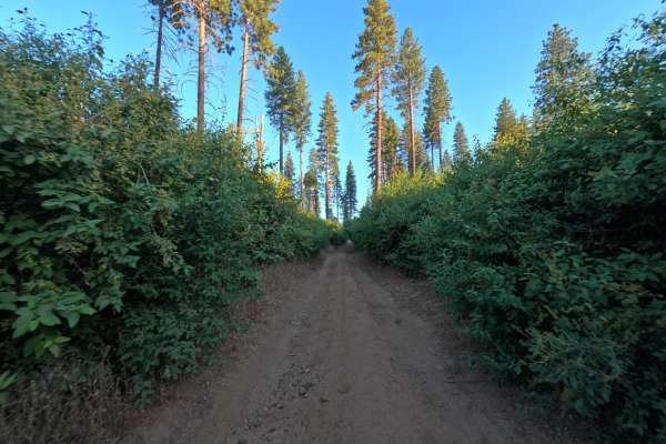
1S19
1S19 is accessed directly from the forest road system on the edge of Stanislaus National Forest, climbing steadily along a single-track packed dirt trail through its first mile. This opening stretch holds the toughest ground on the route, with moderate to severe ruts cutting across the path and loos...
Learn more about 1S19
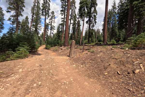
Prospect Mine - FS 5S040X
The Western half of the Quartz Mountain summit loop, connecting with the Quartz Mountain Top spur (FS 5S040XD). This two-track route climbs to over 9,000 feet, offering spectacular views to the East over the Ansel Adams Wilderness. The surface is a mix of loose, chunky rock, embedded granite, and pa...
Learn more about Prospect Mine - FS 5S040X
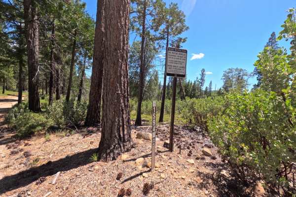
FS 1S94
FS 1S94 is a short connector road linking FS 1S03 to FS 1S04, running as a single-track dirt trail through open forest. It's an easy, pleasant drive with a few minor ruts here and there. A posted Forest Service sign along the route closes it to motor vehicles from December 16 through April 14 each y...
Learn more about FS 1S94
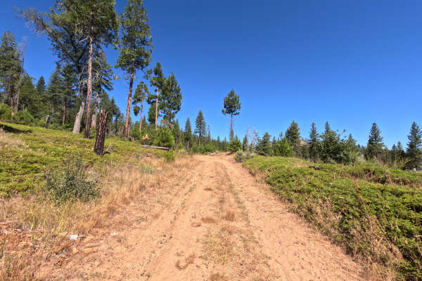
FS 1S41
FS 1S41 is a two-way, moderately rough dirt trail running about a mile and a half from Forest Service Road 1S03, mostly winding through heavily wooded forest on a single-lane road that's comfortably wide for passing. A gate sits at the start bearing an illegible seasonal closure sign, though similar...
Learn more about FS 1S41
Beginner ATV trails near Yosemite Valley, California
Explore ATV-friendly trails near you. These trails are accessible for vehicles up to 50 inches wide, perfect for ATVs and smaller off-road machines.
FS 1S25A
FS 1S25A branches off the main FS 1S25 road and opens into a quiet, 1.6-mile single-track through dense, shaded forest. The first short stretch is the narrowest part of the drive, with a bit of grass and brush pressing in close enough to brush the sides of the vehicle, though nothing that demands sp...
Learn more about FS 1S25A
FS 1S24
FS 1S24 is a 3.2-mile, two-way dirt and gravel road, marked by a numbered post at the junction with the main road. The first stretch is easy driving, smooth dirt and gravel through open forest with wide views. Past a fork with a spur road, the road narrows, and grass and brush grow in close on both ...
Learn more about FS 1S24
FS 1S89
FS 1S89 branches off the main FS 1S25 road and settles into a calm, single-lane track over firm, packed dirt. The road climbs gradually as it works north, narrowing slightly the further it goes, with scattered small rocks and light debris across the tread here and there. Tall pines line both sides f...
Learn more about FS 1S89
FS 1S25
Set within an open, scenic coniferous forest managed by the Stanislaus National Forest near the western boundary of Yosemite National Park, FS 1S25 climbs steadily up toward an elevation near 5,000 feet. Accessed directly from Evergreen Road, this inviting route serves as a main connector to numerou...
Learn more about FS 1S25
Beginner UTV/side-by-side trails near Yosemite Valley, California
Find UTV and side-by-side trails near you. These trails accommodate vehicles up to 60 inches wide, ideal for UTVs, side-by-sides, and wider off-road rigs.
FS 1S25A
FS 1S25A branches off the main FS 1S25 road and opens into a quiet, 1.6-mile single-track through dense, shaded forest. The first short stretch is the narrowest part of the drive, with a bit of grass and brush pressing in close enough to brush the sides of the vehicle, though nothing that demands sp...
Learn more about FS 1S25A
FS 1S24
FS 1S24 is a 3.2-mile, two-way dirt and gravel road, marked by a numbered post at the junction with the main road. The first stretch is easy driving, smooth dirt and gravel through open forest with wide views. Past a fork with a spur road, the road narrows, and grass and brush grow in close on both ...
Learn more about FS 1S24
FS 1S89
FS 1S89 branches off the main FS 1S25 road and settles into a calm, single-lane track over firm, packed dirt. The road climbs gradually as it works north, narrowing slightly the further it goes, with scattered small rocks and light debris across the tread here and there. Tall pines line both sides f...
Learn more about FS 1S89
FS 1S25
Set within an open, scenic coniferous forest managed by the Stanislaus National Forest near the western boundary of Yosemite National Park, FS 1S25 climbs steadily up toward an elevation near 5,000 feet. Accessed directly from Evergreen Road, this inviting route serves as a main connector to numerou...
Learn more about FS 1S25
The onX Offroad Difference
onX Offroad combines trail photos, descriptions, difficulty ratings, width restrictions, seasonality, and more in a user-friendly interface. Available on all devices, with offline access and full compatibility with CarPlay and Android Auto. Discover what you're missing today!
Open Trail Map