
Beginner Off-Road Trails
Near McGee Creek, California
Explore All Beginner Trails Near McGee Creek, California
Beginner Off-Road Trails Near McGee Creek, California
Discover the best beginner-friendly off-road trails near you. These easier, lower-rated trails are a great place to start — browse trail maps, check difficulty ratings, and find your next adventure.
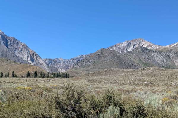
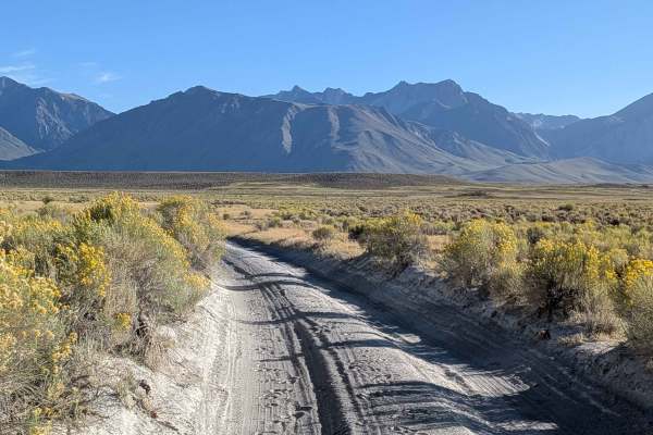
Tobacco Flats
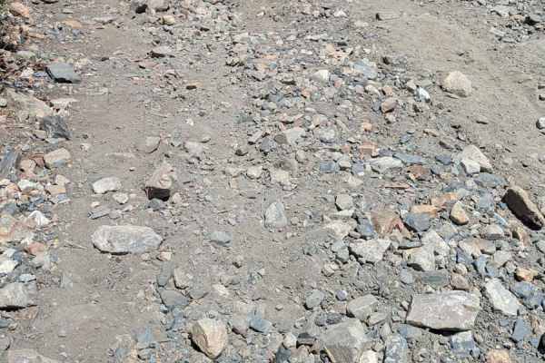
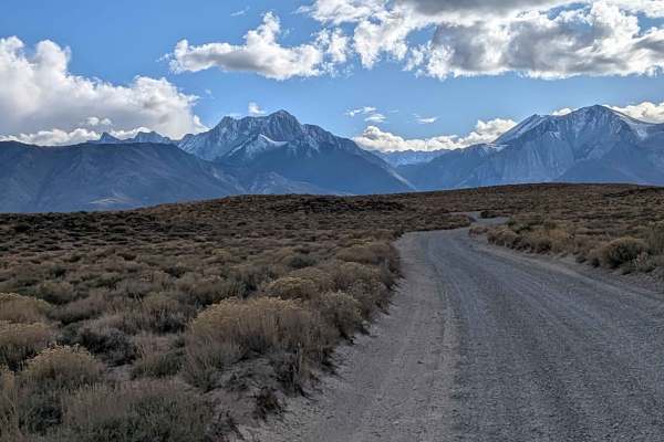
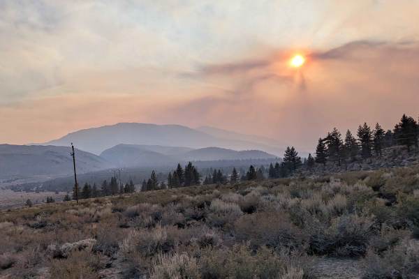
This trail takes you near the 395 up to a viewpoint just below Mono Jim Peak. It travels through a valley where cows graze up to an area overlooking Convict Lake, Mono Lake, Mount Morrison, Laurel Mountain, and the Glass Mountain Range. It starts off sandy but turns into a rocky trail with some very...
Learn more about Tobacco Flats
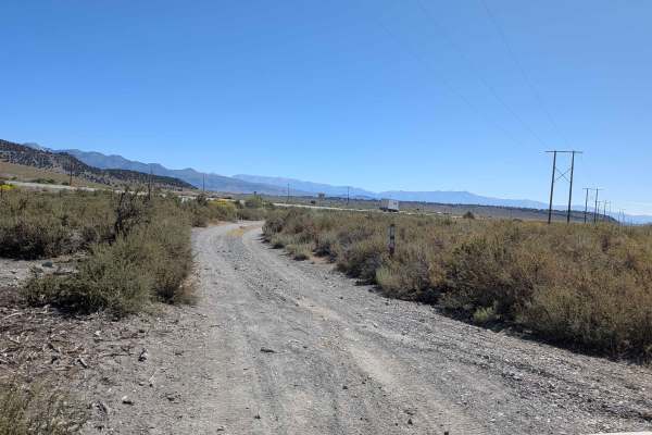
Lake Crowley Northwest Cutoff
Lake Crowley Northwest Cutoff is a short and scenic connector trail that links Lake Crowley North Landing Shoreline Loop with Lake Crowley North Landing 1. The route starts near the lake, gradually heading away from the shoreline through open terrain. The trail winds through low-growing sagebrush th...
Learn more about Lake Crowley Northwest Cutoff
Lake Crowley North Landing 1
This is a scenic route that offers broad, open views of the Eastern Sierra and the Glass Mountains. Beginning just off Benton Crossing Road, this 4.5-mile out-and-back trail travels across high-desert terrain lined with low sagebrush and scattered wildflowers in the spring. The route gradually desce...
Learn more about Lake Crowley North Landing 1
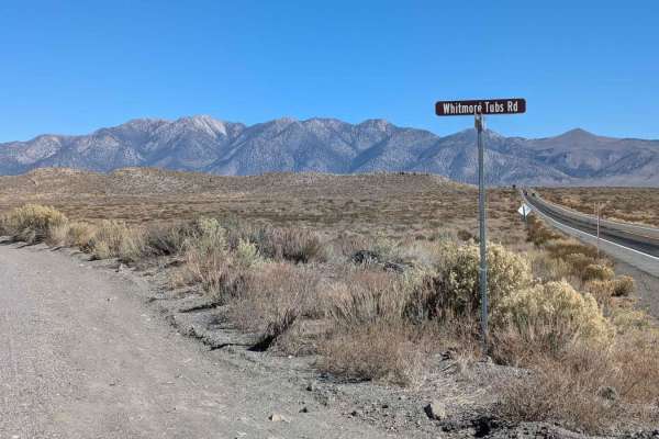
Whitmore Tubs Road
Whitmore Tubs Road is a graded dirt and sand road that connects Owens River Road to Hot Creek Hatchery Road. It is surrounded by BLM land. The road can be full of washboard due to heavy use, especially in early spring and late fall. Many use this road to access the various geological features in the...
Learn more about Whitmore Tubs Road
Sherwin Creek Cutoff FS 4S31
This scenic gravel and sand track runs through Inyo National Forest and lands managed by the City of Los Angeles Water District, offering an immersive backroad experience along the base of the Eastern Sierra. The trail is accessible from either Convict Lake Road or Sherwin Creek Road, with the recom...
Learn more about Sherwin Creek Cutoff FS 4S31
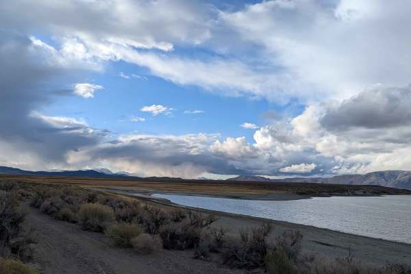
Lake Crowley North Landing Shoreline Loop
Lake Crowley North Landing Shoreline Loop is a scenic 5.15-mile route that begins off Lake Crowley North Landing 1. The trail follows a fence line before dropping gently toward the lake and tracing the shoreline below the North Landing area. It loops back toward Benton Crossing Road, reconnecting wi...
Learn more about Lake Crowley North Landing Shoreline Loop
Lake Crowley North Landing 2
Lake Crowley North Landing 2 is a short scenic route branching off from Lake Crowley North Landing 1. This 2.3-mile out-and-back trail travels across open high-desert terrain covered with sagebrush and volcanic pumice. The drive offers unobstructed 360-degree views of Lake Crowley, the Glass Mountai...
Learn more about Lake Crowley North Landing 2
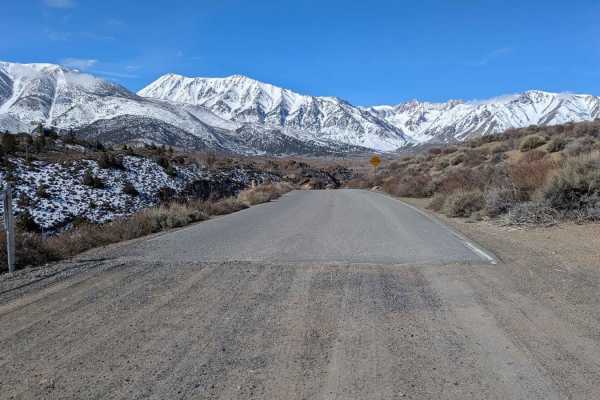
Owens Gorge Road
This full trail actually starts off just off Highway 395 in the locale of Sunny Slopes. It is paved until after it crosses the Long Valley Dam at Lake Crowley. This mapped trail starts just on the dirt trail and travels for over five miles before it terminates at Benton Crossing Road. This relativel...
Learn more about Owens Gorge Road
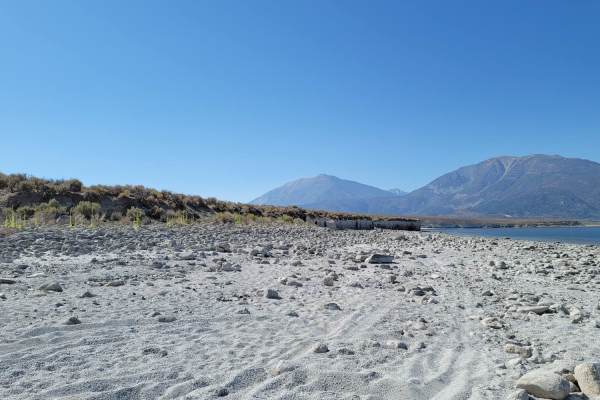
3S151 Side Spur Trail To Beach
A quick drive off the main trail to reach the beach and park on the shoreline. From there you can enjoy the beach and hike to see the beautiful Crowley Columns scattered throughout Crowley Lake and seek some shade during Summer months where it can get quite hot. A nice quick drive with a beautiful ...
Learn more about 3S151 Side Spur Trail To Beach
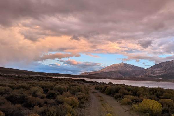
Wild Willy's Hot Springs
This 1.9-mile route starts on Benton Crossing Road, 4 miles from Highway 395, and passes the Wild Willy's Hot Springs parking lot before ending at a posted closure preventing access to Lake Crowley. The first half features a gravel and sand surface, 1.5 to 2 vehicles wide, with pullouts for passing ...
Learn more about Wild Willy's Hot Springs
Sheep Camp Road - FS4S03
Sheep Camp Road is the main west-to-east trail in this area. The trail starts off at Owen Gorge Road and travels over eight miles through open pine forest, high desert, and in and around pretty rock formations. There are stunning views of the Eastern Sierra as well as Casa Diablo Mountain.
Learn more about Sheep Camp Road - FS4S03
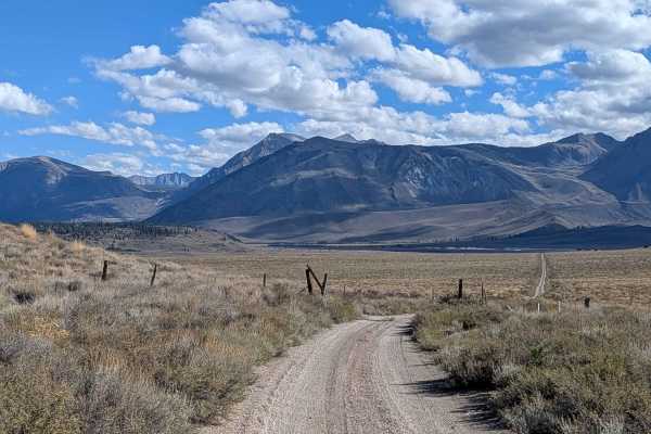
Claypit Cutoff - FS 3S07
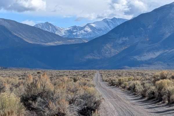
This trail runs through wide open meadows with panoramic views of the Eastern Sierra, the Glass Mountains, and the White Mountains. The track is mostly sand and pumice with sections of gravel and rock that become more common as you progress. From the south, the trail climbs about 260 feet in just ov...
Learn more about Claypit Cutoff - FS 3S07

FS 4S4111
This sandy trail is a spur trail off of Crowley Lake Eastside (FS4S45). It reconnects again at Owens Gorge Rd. There are some pretty views of the Eastern Sierras. There are a few small rocky sections to navigate. The trail winds through a pine tree forest. The trail can be narrow with many tight tur...
Learn more about FS 4S4111
Bishop Tuff Scenic Loop - FS 4S38
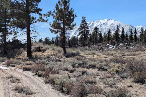
Starting just off Old Gorge Road near Highway 395, this is a scenic trail winding through rolling hills lined with pine trees and brush, with dramatic rock formations in every direction. The Eastern Sierra mountains rise close by, and at about Mile 4, the White Mountains and Casa Diablo Mountain com...
Learn more about Bishop Tuff Scenic Loop - FS 4S38

Hot Creek Crossover
This short trail, just north of the airport, cuts between Hot Creek Road and Whitmore Tubs Road. This trail is a more scenic route than the graded and longer route along Whitmore Tubs Road or Hot Creek Road. It is more challenging with some rocks and more sand. The trail does offer some side spurs t...
Learn more about Hot Creek Crossover
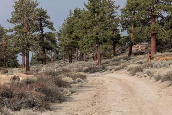
Round Mountain Cutoff - FS 4S67
Round Mountain Cutoff, also known as FS 04S67, is a winding trail through tall pine trees. It is relatively flat. It offers beautiful views of the Eastern Sierra Mountains. The trail is mostly sandy. There are a few rocky sections to navigate through as well as picturesque rock formations to admire....
Learn more about Round Mountain Cutoff - FS 4S67
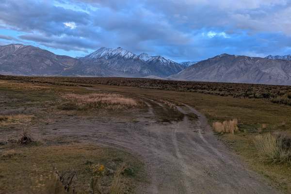
Wilfred Canyon - FS 3S01A
This 5-mile route travels through high-desert meadows filled with Sagebrush before reaching Wilfred Creek in the final mile. Most of the drive crosses open terrain with sweeping views of the Eastern Sierra mountains and Lake Crowley spread out below. The landscape changes dramatically in the last se...
Learn more about Wilfred Canyon - FS 3S01A
South Owens River Access
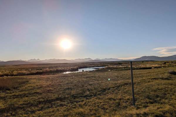
The South Owens Riverbank Trail runs along the east bank of the South Owens River, providing a scenic and somewhat rugged route through open country. This trail is popular with fishermen, offering numerous access points to the river along its length. It’s a mellow, meandering track that hugs the wat...
Learn more about South Owens River Access
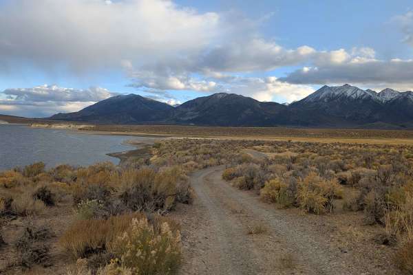
Lake Crowley Beach NE Cutoff
Lake Crowley Beach NE Cutoff is a scenic sandy track that links Benton Crossing Road to the shoreline of Lake Crowley, offering a shortcut to the beach route. As you drive, you're treated to sweeping views of the Eastern Sierra, including iconic peaks like Mount Morrison, Mount Sherwin, Mammoth Moun...
Learn more about Lake Crowley Beach NE Cutoff
NFR 4S103
This dirt and gravel road follows a path parallel to a set of power lines, weaving through open high desert terrain with spectacular panoramic views in all directions. To the west and northwest, you’ll see the dramatic skyline of the Eastern Sierra, including Mammoth Mountain, the Minarets, Banner P...
Learn more about NFR 4S103
Beginner ATV trails near McGee Creek, California
Explore ATV-friendly trails near you. These trails are accessible for vehicles up to 50 inches wide, perfect for ATVs and smaller off-road machines.
Lake Crowley Northwest Cutoff
Lake Crowley Northwest Cutoff is a short and scenic connector trail that links Lake Crowley North Landing Shoreline Loop with Lake Crowley North Landing 1. The route starts near the lake, gradually heading away from the shoreline through open terrain. The trail winds through low-growing sagebrush th...
Learn more about Lake Crowley Northwest Cutoff
Lake Crowley North Landing 1
This is a scenic route that offers broad, open views of the Eastern Sierra and the Glass Mountains. Beginning just off Benton Crossing Road, this 4.5-mile out-and-back trail travels across high-desert terrain lined with low sagebrush and scattered wildflowers in the spring. The route gradually desce...
Learn more about Lake Crowley North Landing 1
Whitmore Tubs Road
Whitmore Tubs Road is a graded dirt and sand road that connects Owens River Road to Hot Creek Hatchery Road. It is surrounded by BLM land. The road can be full of washboard due to heavy use, especially in early spring and late fall. Many use this road to access the various geological features in the...
Learn more about Whitmore Tubs Road
Sherwin Creek Cutoff FS 4S31
This scenic gravel and sand track runs through Inyo National Forest and lands managed by the City of Los Angeles Water District, offering an immersive backroad experience along the base of the Eastern Sierra. The trail is accessible from either Convict Lake Road or Sherwin Creek Road, with the recom...
Learn more about Sherwin Creek Cutoff FS 4S31
Beginner UTV/side-by-side trails near McGee Creek, California
Find UTV and side-by-side trails near you. These trails accommodate vehicles up to 60 inches wide, ideal for UTVs, side-by-sides, and wider off-road rigs.
Lake Crowley Northwest Cutoff
Lake Crowley Northwest Cutoff is a short and scenic connector trail that links Lake Crowley North Landing Shoreline Loop with Lake Crowley North Landing 1. The route starts near the lake, gradually heading away from the shoreline through open terrain. The trail winds through low-growing sagebrush th...
Learn more about Lake Crowley Northwest Cutoff
Lake Crowley North Landing 1
This is a scenic route that offers broad, open views of the Eastern Sierra and the Glass Mountains. Beginning just off Benton Crossing Road, this 4.5-mile out-and-back trail travels across high-desert terrain lined with low sagebrush and scattered wildflowers in the spring. The route gradually desce...
Learn more about Lake Crowley North Landing 1
Whitmore Tubs Road
Whitmore Tubs Road is a graded dirt and sand road that connects Owens River Road to Hot Creek Hatchery Road. It is surrounded by BLM land. The road can be full of washboard due to heavy use, especially in early spring and late fall. Many use this road to access the various geological features in the...
Learn more about Whitmore Tubs Road
Sherwin Creek Cutoff FS 4S31
This scenic gravel and sand track runs through Inyo National Forest and lands managed by the City of Los Angeles Water District, offering an immersive backroad experience along the base of the Eastern Sierra. The trail is accessible from either Convict Lake Road or Sherwin Creek Road, with the recom...
Learn more about Sherwin Creek Cutoff FS 4S31
The onX Offroad Difference
onX Offroad combines trail photos, descriptions, difficulty ratings, width restrictions, seasonality, and more in a user-friendly interface. Available on all devices, with offline access and full compatibility with CarPlay and Android Auto. Discover what you're missing today!
Open Trail Map