
Beginner Off-Road Trails
Near Downieville, California
Explore All Beginner Trails Near Downieville, California
Beginner Off-Road Trails Near Downieville, California
Discover the best beginner-friendly off-road trails near you. These easier, lower-rated trails are a great place to start — browse trail maps, check difficulty ratings, and find your next adventure.
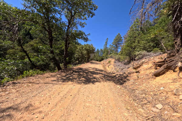
Lavezzola Road
Lavezzola Road is a scenic and relaxing journey through the thick, vibrant pine forest. The adventure begins on a brief paved section passing by some rustic green outbuildings before quickly transitioning into a wide, graded packed-dirt and gravel track. As you wind your way through the tall timber,...
Learn more about Lavezzola Road
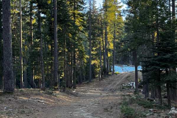
Red Ant
This trail is more like a fire road and features a few climbs and tight turns. It has a couple of areas designated for dispersed camping and offers some views of the canyon. The trail has been recently recut and cleared in certain sections. Additionally, there are some areas that are single-wide wit...
Learn more about Red Ant
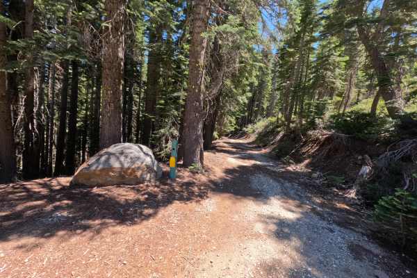
Fir Cap Trail - South Segment - FS 10E22
Fir Cap Trail - South Segment - FS 10E22 is accessed directly from the northern segment of the Fir Cap Trail. This southern section is significantly easier than the northern segment, featuring several flat, smooth areas alongside gentle descents. The trail climbs over a small, unnamed mountain that...
Learn more about Fir Cap Trail - South Segment - FS 10E22
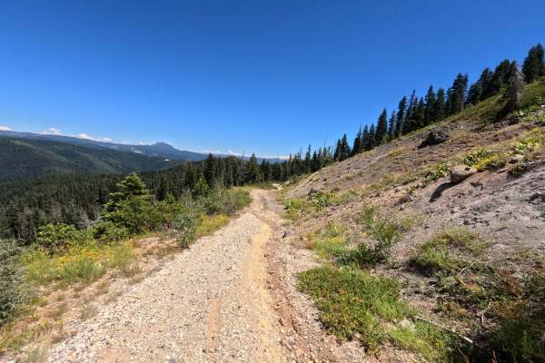
Fir Cap Trail - North Segment - 10E22
Fir Cap Trail - North Segment - FS 10E22 is the northern half of a connector route, accessed via Saddleback Road. The route begins with a slight descent into an area that resembles an old mining site, though no structural signs of a mine remain. From there, the trail climbs over Fir Top Mountain. Al...
Learn more about Fir Cap Trail - North Segment - 10E22
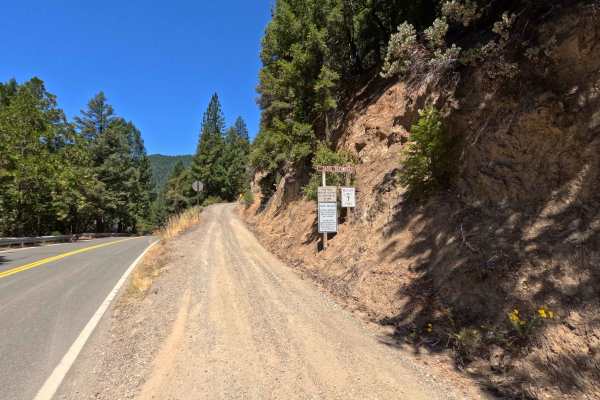
Saddleback Road - CR 509
Accessed directly off Highway 49 just outside the charming town of Downieville, Saddleback Road is a classic, highly enjoyable forest road. The journey begins with a smooth, well-packed dirt surface that offers plenty of fun, sweeping twists and turns under a beautiful canopy of tall, shading pine t...
Learn more about Saddleback Road - CR 509
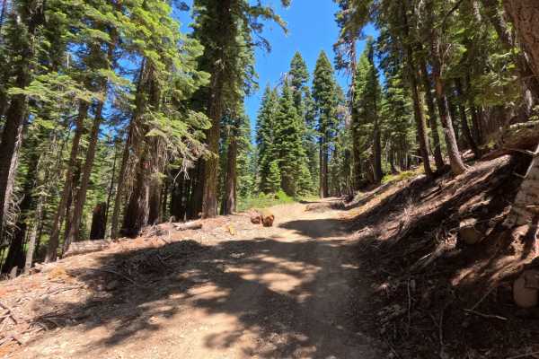
Saddleback - FS 25-023
This beautiful route picks up right where the regular county road maintenance ends, taking you deeper into the dense, shaded woods. As you journey along this path, you will find a very smooth, well-graded gravel surface that seamlessly transitions into sections of soft, packed dirt. The entire drive...
Learn more about Saddleback - FS 25-023
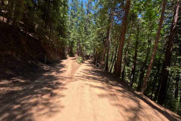
Lower Claycroft - FS 514-008
Lower Claycroft - FS 514-008, a remarkably peaceful and incredibly smooth journey winding through a dense, majestic evergreen forest. As you navigate this winding dirt path, you will experience a long, gradual descent that gently drops over two thousand feet in elevation over the course of the drive...
Learn more about Lower Claycroft - FS 514-008
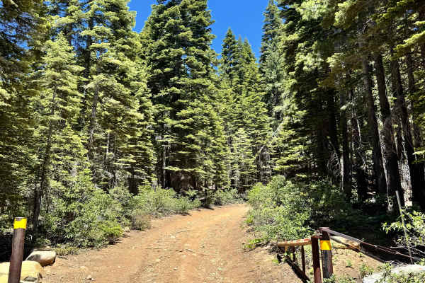
Saddleback Lookout - FS 25
This is a mostly dirt and rocky trail that takes you up to Saddleback Lookout. The trail is kind of steep, and some sections are a shelf road. The trail does start to have quite a bit of rock and is a little more like shale rock the closer you get to the lookout. You can go up to the lookout, it is ...
Learn more about Saddleback Lookout - FS 25
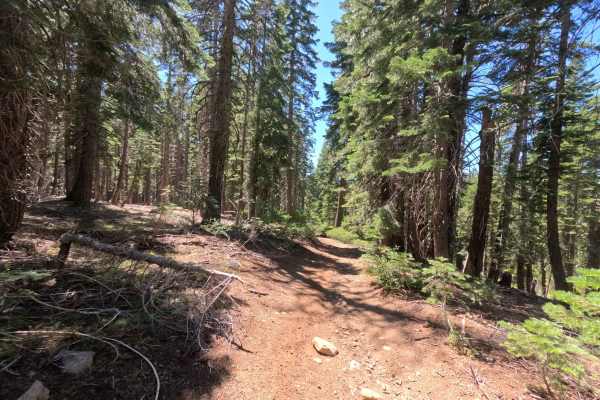
Claycroft Ridge Off-Highway Vehicle Trail - Lower - FS 11E18
Accessed directly from Claycroft Road, this exceptionally narrow off-highway vehicle track plunges you immediately into a beautifully lush, dense tree tunnel. The tight evergreen canopy provides constant, heavy shade, meaning you won't find sweeping scenic vistas or open clearings for dispersed camp...
Learn more about Claycroft Ridge Off-Highway Vehicle Trail - Lower - FS 11E18
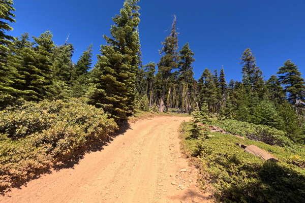
Monarch Spur - FS 93-002-03
Monarch Spur - FS 93-002-03 offers a short but wonderfully scenic drive. This half-mile spur branches off from Monarch Road and gently winds its way up through a beautiful, tall pine forest. The surface is mostly packed reddish-orange dirt mixed with a fair amount of loose gravel and small rocks, bu...
Learn more about Monarch Spur - FS 93-002-03
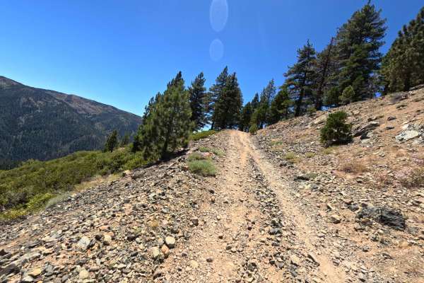
Butcher Ranch Road - FS 12E07
Butcher Ranch Road - FS 12E07 serves as a scenic but rugged connector road linking Sierra Buttes Road with the Monarch - FS 93 trail situated high above Sierra City. Early on, as indicated by the prominent signage marking the end of the county-maintained road in the photos, you will pass through a s...
Learn more about Butcher Ranch Road - FS 12E07
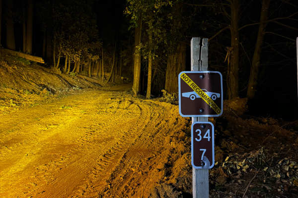
Skinner
The trail varies in width, from single to double, and is freshly cleared. There’s a sign advising against cars driving on the trail. There are drainage ditches and a couple of small washes, each less than 8 inches deep. Depending on the direction, you’ll either climb or descend the west end, and it ...
Learn more about Skinner
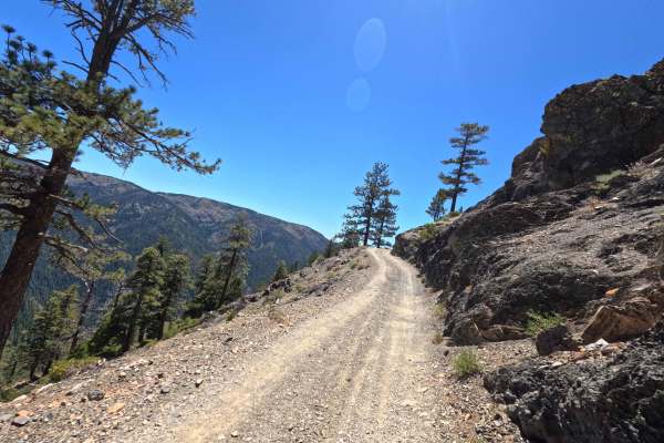
Monarch Road - FS 93-002
Monarch - FS 93-002, accessed from Sierra City via Sierra Buttes Road and Butcher Ranch Road - FS 12E07, delivers a highly scenic but demanding journey as it steadily climbs its way up to Packer Saddle. The trail starts relatively tame before aggressively ramping up the intensity. This route is sign...
Learn more about Monarch Road - FS 93-002
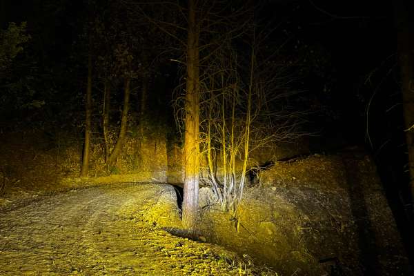
Indian Creek Connector
This new trail connects Indian Creek to Upper Indian Creek, replacing the decommissioned old trail. It’s relatively easy to navigate, but be cautious of the deep drainage cuts, as they can be rough. The trail climbs abruptly from Indian Creek to Upper Indian Creek, be cautious in wet weather.
Learn more about Indian Creek Connector
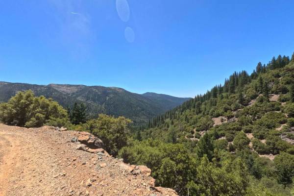
Sierra Buttes Road
Sierra Buttes Road is a very scenic and approachable dirt trail that conveniently kicks off right outside a local neighborhood near the Sierra City transfer station. As you leave the pavement behind, you will embark on a gradual, continuous climb up the forested mountain. The trail primarily consist...
Learn more about Sierra Buttes Road
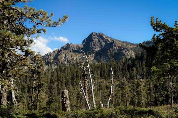
Gold Valley Connector
This is a short connector trail from the Sierra Buttes parking area to the Packer Lake Saddle. It weaves along the hilltop with open views, including a fantastic view towards the Sierra Butte and fire tower and surrounding mountains. The trail is generally pretty easy, just gradually cutting across ...
Learn more about Gold Valley Connector
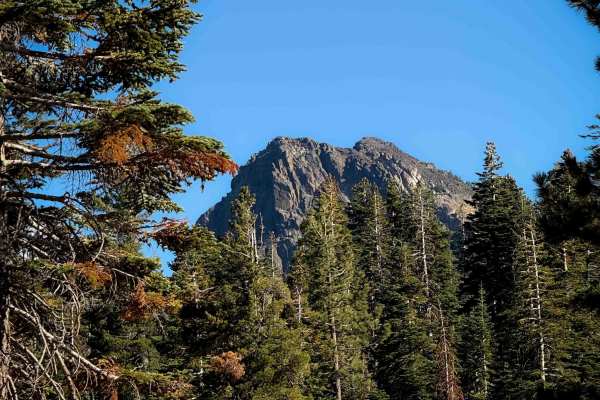
Pack Saddle Drop
This is a short singletrack, half a mile long, that drops down from the road (FS 93-002) near the Sierra Buttes Trailhead. It curves down the hillside through a series of easy and wide switchbacks as it weaves through tall mossy pine trees. The trail is clear of any logs and didn’t have much rock. I...
Learn more about Pack Saddle Drop
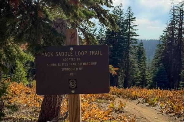
Pack Saddle Loop
This is a short 0.6 mile segment of trail near the Packer Lake Saddle that is easy and beginner-friendly. It starts and ends off of the Sunrise trail, which is similar in easy difficulty. It cuts across the hillsides on a gradual and smooth path, winding through pine trees with open views out over t...
Learn more about Pack Saddle Loop
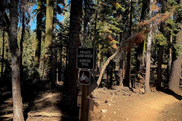
Sunrise
Sunrise is a 1.4-mile-long connecting route between Butcher Ranch Trail and the Sierra Buttes Trailhead. This trail is generally easy, being smooth and flowy, with big banked corners, wide gradual switchbacks, and minor embedded rock. One of the switchbacks has a big root on the inside of the turn, ...
Learn more about Sunrise
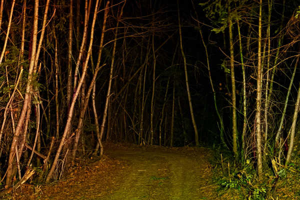
Upper Indian Creek
The trail is wider, and most of the way, it can accommodate two vehicles. The west end is still single-wide and narrow, but they are clearing the trail. There are some washouts that are about a foot deep, and there are also deep water drains. There are many blind turns, so watch your speed.
Learn more about Upper Indian Creek
Beginner ATV trails near Downieville, California
Explore ATV-friendly trails near you. These trails are accessible for vehicles up to 50 inches wide, perfect for ATVs and smaller off-road machines.
Lavezzola Road
Lavezzola Road is a scenic and relaxing journey through the thick, vibrant pine forest. The adventure begins on a brief paved section passing by some rustic green outbuildings before quickly transitioning into a wide, graded packed-dirt and gravel track. As you wind your way through the tall timber,...
Learn more about Lavezzola Road
Red Ant
This trail is more like a fire road and features a few climbs and tight turns. It has a couple of areas designated for dispersed camping and offers some views of the canyon. The trail has been recently recut and cleared in certain sections. Additionally, there are some areas that are single-wide wit...
Learn more about Red Ant
Fir Cap Trail - South Segment - FS 10E22
Fir Cap Trail - South Segment - FS 10E22 is accessed directly from the northern segment of the Fir Cap Trail. This southern section is significantly easier than the northern segment, featuring several flat, smooth areas alongside gentle descents. The trail climbs over a small, unnamed mountain that...
Learn more about Fir Cap Trail - South Segment - FS 10E22
Fir Cap Trail - North Segment - 10E22
Fir Cap Trail - North Segment - FS 10E22 is the northern half of a connector route, accessed via Saddleback Road. The route begins with a slight descent into an area that resembles an old mining site, though no structural signs of a mine remain. From there, the trail climbs over Fir Top Mountain. Al...
Learn more about Fir Cap Trail - North Segment - 10E22
Beginner UTV/side-by-side trails near Downieville, California
Find UTV and side-by-side trails near you. These trails accommodate vehicles up to 60 inches wide, ideal for UTVs, side-by-sides, and wider off-road rigs.
Lavezzola Road
Lavezzola Road is a scenic and relaxing journey through the thick, vibrant pine forest. The adventure begins on a brief paved section passing by some rustic green outbuildings before quickly transitioning into a wide, graded packed-dirt and gravel track. As you wind your way through the tall timber,...
Learn more about Lavezzola Road
Red Ant
This trail is more like a fire road and features a few climbs and tight turns. It has a couple of areas designated for dispersed camping and offers some views of the canyon. The trail has been recently recut and cleared in certain sections. Additionally, there are some areas that are single-wide wit...
Learn more about Red Ant
Fir Cap Trail - South Segment - FS 10E22
Fir Cap Trail - South Segment - FS 10E22 is accessed directly from the northern segment of the Fir Cap Trail. This southern section is significantly easier than the northern segment, featuring several flat, smooth areas alongside gentle descents. The trail climbs over a small, unnamed mountain that...
Learn more about Fir Cap Trail - South Segment - FS 10E22
Saddleback Road - CR 509
Accessed directly off Highway 49 just outside the charming town of Downieville, Saddleback Road is a classic, highly enjoyable forest road. The journey begins with a smooth, well-packed dirt surface that offers plenty of fun, sweeping twists and turns under a beautiful canopy of tall, shading pine t...
Learn more about Saddleback Road - CR 509
The onX Offroad Difference
onX Offroad combines trail photos, descriptions, difficulty ratings, width restrictions, seasonality, and more in a user-friendly interface. Available on all devices, with offline access and full compatibility with CarPlay and Android Auto. Discover what you're missing today!
Open Trail Map