
Beginner Off-Road Trails
Near Dixon Lane-MeadowCreek, California
Explore All Beginner Trails Near Dixon Lane-MeadowCreek, California
Beginner Off-Road Trails Near Dixon Lane-MeadowCreek, California
Discover the best beginner-friendly off-road trails near you. These easier, lower-rated trails are a great place to start — browse trail maps, check difficulty ratings, and find your next adventure.
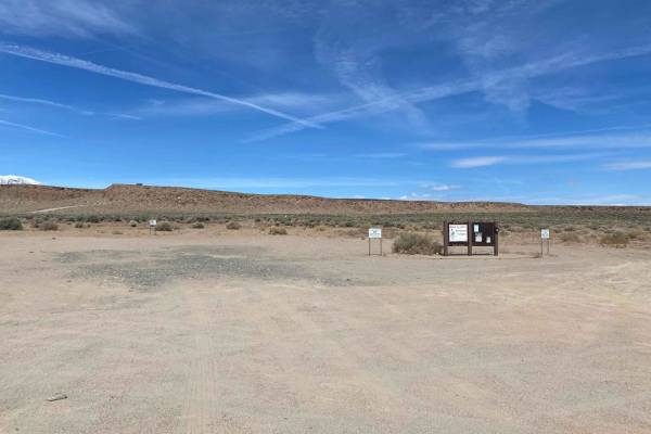
Fish Slough Road (3V01)
Fish Slough Road is a 19-mile long (End to End), 3-vehicle-wide road, and depending on the time of the year, it could be evenly graded or can have washboards of varying degrees. There are amazing views of both the Eastern Sierra Mountains to the west and the White Mountains to the east. Fish Slough ...
Learn more about Fish Slough Road (3V01)
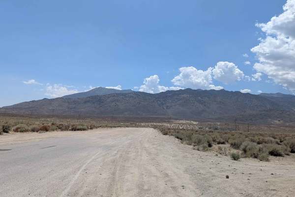
Coyote Valley Road
This route starts off as a wide very sandy road that goes by a very popular mountain bike area, so watch out for bikers throughout the journey. The trail takes you up a canyon with hills on both sides, offering beautiful views of the mountains as you're approaching and giving you a preview of what t...
Learn more about Coyote Valley Road
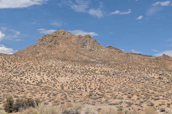
Tungsten City Road
This route starts at Highway 168, just north of Bishop, beginning as a very wide trail before narrowing after 1 mile as you enter the Tungsten Hills OHV area. The trail passes a pet cemetery as well as the Tungsten Hills OHV area, offering beautiful views of the Eastern Sierras and the White Mountai...
Learn more about Tungsten City Road
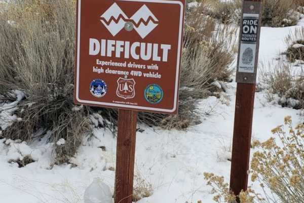
Silver Canyon Road
Silver Canyon Road is a seasonal, one-lane road connecting Bishop, CA to the high alpine White Mountain Road and up to the Ancient Bristlecone Pine Forest. It is best run east to west in late afternoon towards sunset to enjoy the views of the sierra across Owens Valley. Keep an eye out for Bighorn S...
Learn more about Silver Canyon Road
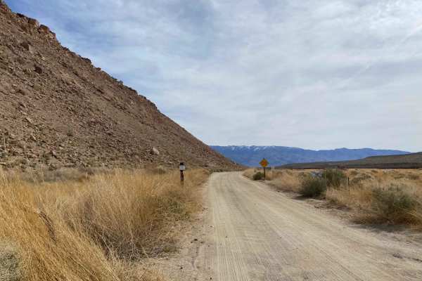
Chalk Bluff Road
Chalk Bluff Road is a graded, well-used road with bouldering on the north side and fishing access to the south side. Chalk Bluff Road is well used. There is a vault toilet at the west side start of the trail and another one about 3/4 of the way into it, with ample parking. Chalk Bluff Road gives gre...
Learn more about Chalk Bluff Road
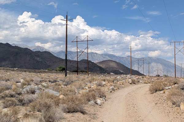
Tungsten Hills Cutoff
This route drops over 200 feet in under 2 miles, winding through the hills while following power lines. The trail offers beautiful views of the Eastern Sierras on one side and the White Mountains on the other, along with views of the town of Bishop below. There are some dispersed campsites along the...
Learn more about Tungsten Hills Cutoff
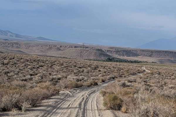
Sawmill Connector
This sandy cutoff trail connects Sawmill Road with Tungsten City Road, dropping almost 300 feet in almost 1.5 miles. The route offers views in all directions, including the Eastern Sierras, the White Mountains, the Buttermilk area, as well as Bishop and Round Valley. The 395 is visible down below, a...
Learn more about Sawmill Connector
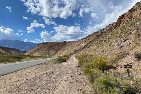
Pole Road (3V04)
On Pole Road (3V04), with the Owens River to the south, the majestic Eastern Sierra mountain range to the west, the sprawling White Mountains to the east, and Casa Diablo to the northwest, you will find no shortage of views. Pole Road (3V04) runs along the transmission lines and is used to maintain ...
Learn more about Pole Road (3V04)
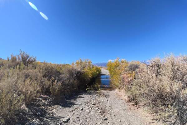
Silver Canyon Road
This easy dirt trail north of Bishop begins near a large staging area with parking for up to 40 vehicles and some shade. Expect 6–8-inch ruts, occasional 2–5-inch rock gardens, and short sections reaching 5–8° off-camber. At 0.2 miles, a level campsite accommodates up to 20 vehicles with some shade....
Learn more about Silver Canyon Road
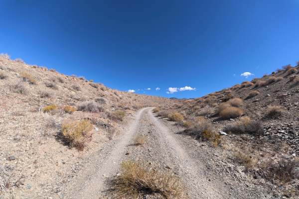
Silver Canyon North
This wide dirt and gravel trail offers plenty of room for vehicles to pass and begins climbing through the surrounding hills after about 0.2 miles. Expect 4–6-inch ruts during the climbs and excellent 360-degree views of the surrounding mountains. Numerous campsites are available throughout the area...
Learn more about Silver Canyon North
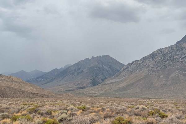
Tungsten Hills North
This very dusty route features sand with various-sized embedded rocks and is part of the larger R1 system. The trail is 1 1/2 vehicles wide with various shelf road sections along the creek, requiring extra caution. After a mile, you're rewarded with 180-degree views of the Eastern Sierra mountains a...
Learn more about Tungsten Hills North
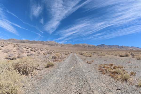
North Poleta Loop
This scenic dirt and gravel trail branches off Big Pine to Silver Canyon and travels through rolling hills with frequent climbs, descents, and whoops. Numerous level campsites are scattered throughout the route, accommodating up to four vehicles each, with excellent 360-degree views. This is one of ...
Learn more about North Poleta Loop
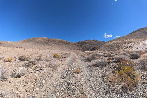
FS 33E313
This dirt and gravel trail continues past Silver Canyon North into national forest land. The route begins with a steady climb over the surrounding hills with 4–6-inch ruts. Around 0.5 miles, the trail passes between unique rock formations worth stopping to explore. At the end, a level hilltop campsi...
Learn more about FS 33E313
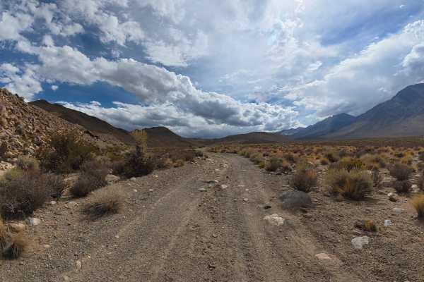
Round Valley Tungsten Road
This sandy trail begins directly off the highway and travels toward Tungsten Hills, with excellent views of Mount Gabb, Mount Morgan, and the surrounding mountains. Expect frequent whoops and 6–8-inch ruts in soft sand, where airing down can significantly improve traction. Around 1.2 miles, minor ro...
Learn more about Round Valley Tungsten Road
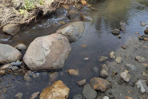
McGee Creek R2
This route drops over 734 feet in 2 miles, offering views of the Eastern Sierras, the White Mountains, the Buttermilk Rock Formations, and the Town of Bishop below as you descend. The trail features some interesting and beautiful rock formations along the way, providing scenic interest beyond just t...
Learn more about McGee Creek R2
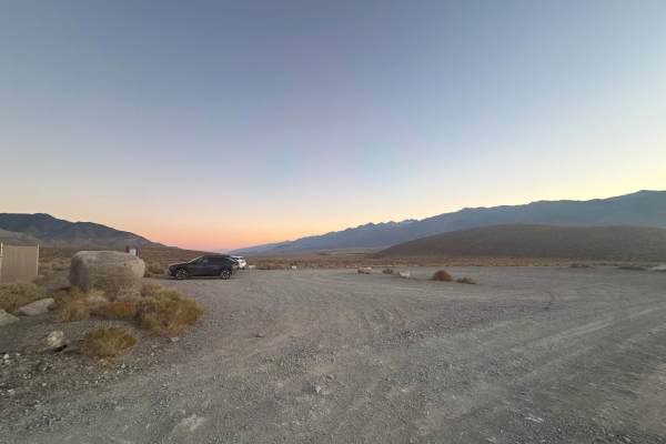
Redding Canyon Road
This well-maintained dirt and gravel road provides access through the OHV area to Inyo National Forest. The route is wide enough for vehicles to pass and travels directly toward the mountains, offering excellent views of the surrounding peaks, including 14,000-foot mountains in the distance. Around ...
Learn more about Redding Canyon Road
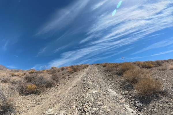
Little Redding Loop
This narrow dirt and gravel trail begins with a steep hill climb featuring 12–14-inch ruts. The route continues over and down steep hills with excellent views of the surrounding mountains, Inyo National Forest, and Bishop below.
Several level hilltop campsites along the route accommodate up to six v...
Learn more about Little Redding Loop
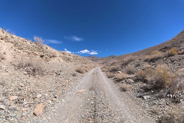
North McNully Canal Road
This narrow sand, rock, and gravel trail begins beside the canal and travels into the surrounding hills and mountains. The route is easy to navigate with no significant obstacles, making it a great option for beginners or anyone looking for a relaxing scenic drive. The trail offers numerous camping ...
Learn more about North McNully Canal Road
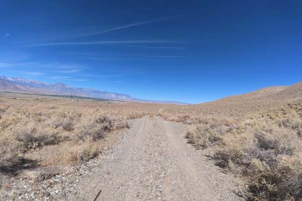
Redding Cross
This narrow gravel and rocky trail travels across the OHV area and is one of the primary routes open to full-size vehicles. Expect frequent washouts, ruts, and hills, with numerous dirt-bike-only trails crossing the route. Drive cautiously and watch for riders. The trail offers excellent views of th...
Learn more about Redding Cross
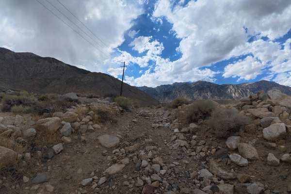
Elderberry Road
This narrow, sandy trail travels west toward Elderberry Trailhead with excellent views of the surrounding mountain range. Expect continuous rock gardens with 2–6-inch rocks, an 8-inch water crossing around 0.7 miles, and a second 2–3-inch crossing around 0.9 miles. Beyond the crossings are more than...
Learn more about Elderberry Road
Beginner ATV trails near Dixon Lane-MeadowCreek, California
Explore ATV-friendly trails near you. These trails are accessible for vehicles up to 50 inches wide, perfect for ATVs and smaller off-road machines.
Fish Slough Road (3V01)
Fish Slough Road is a 19-mile long (End to End), 3-vehicle-wide road, and depending on the time of the year, it could be evenly graded or can have washboards of varying degrees. There are amazing views of both the Eastern Sierra Mountains to the west and the White Mountains to the east. Fish Slough ...
Learn more about Fish Slough Road (3V01)
Coyote Valley Road
This route starts off as a wide very sandy road that goes by a very popular mountain bike area, so watch out for bikers throughout the journey. The trail takes you up a canyon with hills on both sides, offering beautiful views of the mountains as you're approaching and giving you a preview of what t...
Learn more about Coyote Valley Road
Tungsten City Road
This route starts at Highway 168, just north of Bishop, beginning as a very wide trail before narrowing after 1 mile as you enter the Tungsten Hills OHV area. The trail passes a pet cemetery as well as the Tungsten Hills OHV area, offering beautiful views of the Eastern Sierras and the White Mountai...
Learn more about Tungsten City Road
Tungsten Hills Cutoff
This route drops over 200 feet in under 2 miles, winding through the hills while following power lines. The trail offers beautiful views of the Eastern Sierras on one side and the White Mountains on the other, along with views of the town of Bishop below. There are some dispersed campsites along the...
Learn more about Tungsten Hills Cutoff
Beginner UTV/side-by-side trails near Dixon Lane-MeadowCreek, California
Find UTV and side-by-side trails near you. These trails accommodate vehicles up to 60 inches wide, ideal for UTVs, side-by-sides, and wider off-road rigs.
Fish Slough Road (3V01)
Fish Slough Road is a 19-mile long (End to End), 3-vehicle-wide road, and depending on the time of the year, it could be evenly graded or can have washboards of varying degrees. There are amazing views of both the Eastern Sierra Mountains to the west and the White Mountains to the east. Fish Slough ...
Learn more about Fish Slough Road (3V01)
Coyote Valley Road
This route starts off as a wide very sandy road that goes by a very popular mountain bike area, so watch out for bikers throughout the journey. The trail takes you up a canyon with hills on both sides, offering beautiful views of the mountains as you're approaching and giving you a preview of what t...
Learn more about Coyote Valley Road
Tungsten City Road
This route starts at Highway 168, just north of Bishop, beginning as a very wide trail before narrowing after 1 mile as you enter the Tungsten Hills OHV area. The trail passes a pet cemetery as well as the Tungsten Hills OHV area, offering beautiful views of the Eastern Sierras and the White Mountai...
Learn more about Tungsten City Road
Tungsten Hills Cutoff
This route drops over 200 feet in under 2 miles, winding through the hills while following power lines. The trail offers beautiful views of the Eastern Sierras on one side and the White Mountains on the other, along with views of the town of Bishop below. There are some dispersed campsites along the...
Learn more about Tungsten Hills Cutoff
The onX Offroad Difference
onX Offroad combines trail photos, descriptions, difficulty ratings, width restrictions, seasonality, and more in a user-friendly interface. Available on all devices, with offline access and full compatibility with CarPlay and Android Auto. Discover what you're missing today!
Open Trail Map