Land Ownership Maps & Private Parcels in the onX Hunt App
View land ownership maps and identify parcels of private land with the onX Hunt App. Try onX Hunt for free for 7 days.

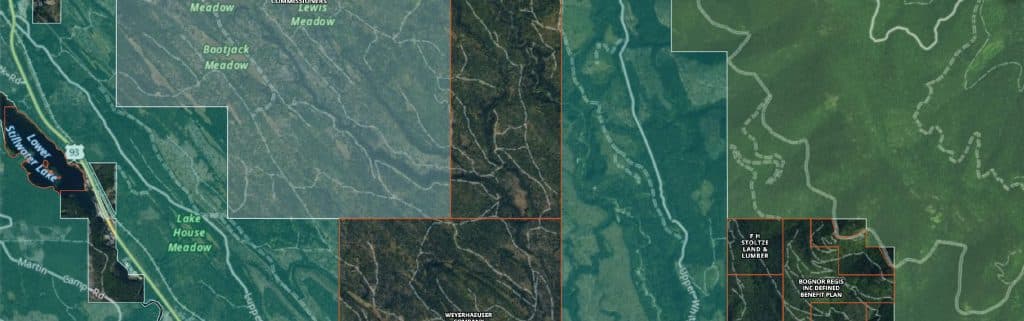
Experience Our Landowner Map Below
Map may take a few seconds to load. Overlay additional features by creating an account.
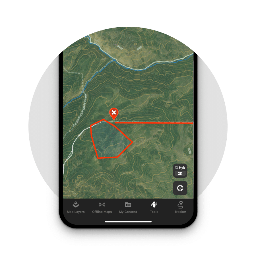
Detailed Maps That Show Property Lines
Knowing who owns the land you stand on can be invaluable in many situations, whether hunting, fishing, or hiking. The onX Hunt App accurately shows property information for private and public lands as well as where the property boundaries are. See maps showing property owner information in the United States. onX Hunt can show you where to hunt, but more importantly where you cannot hunt. Try onX Hunt today and know where you stand.
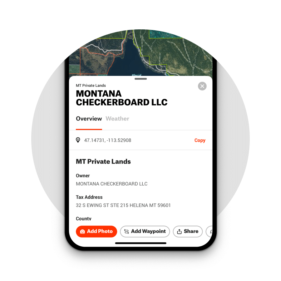
View Landowner Information
View landowner names and tax addresses for any property in the United States with the onX Hunt App. View property lines in Topo, Satellite, or Hybrid views.
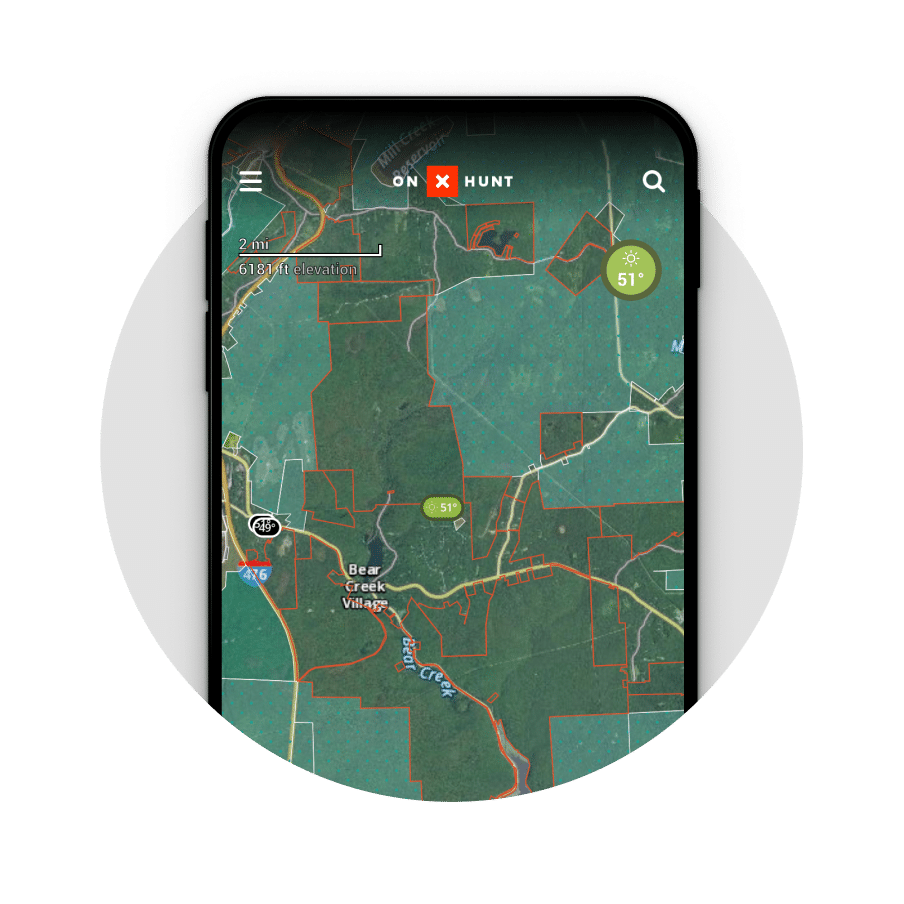
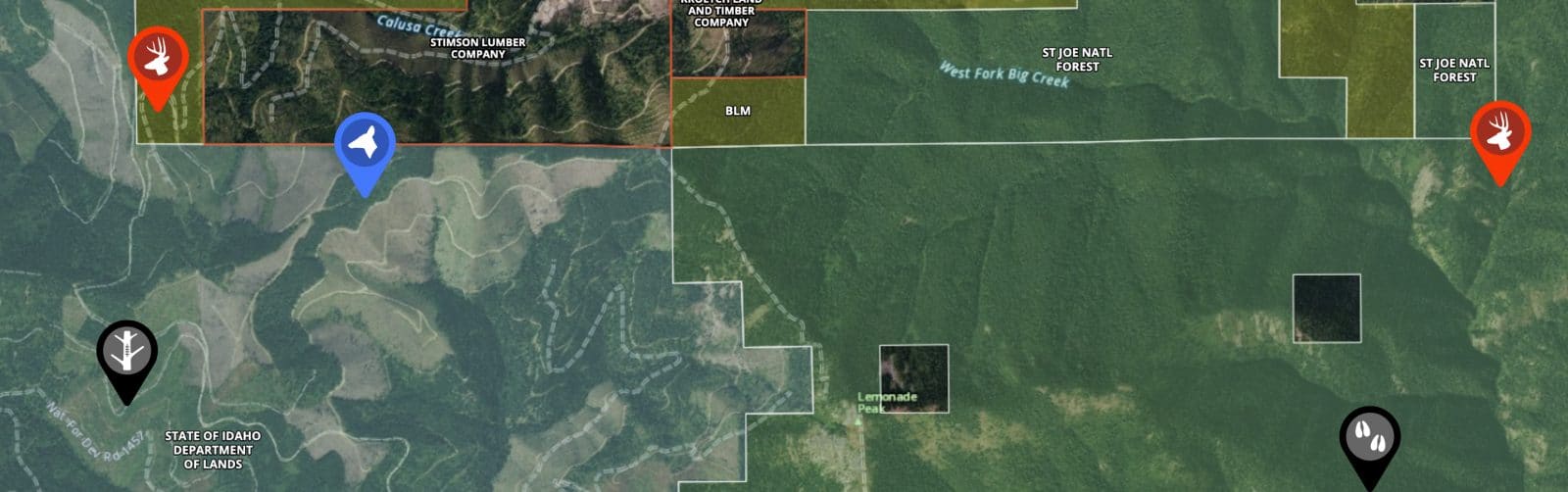
Public Land Boundaries
View boundary lines between public and private land with onX Hunt. Know where you stand at all times with accurate maps that showcase when you are on private vs. public land.
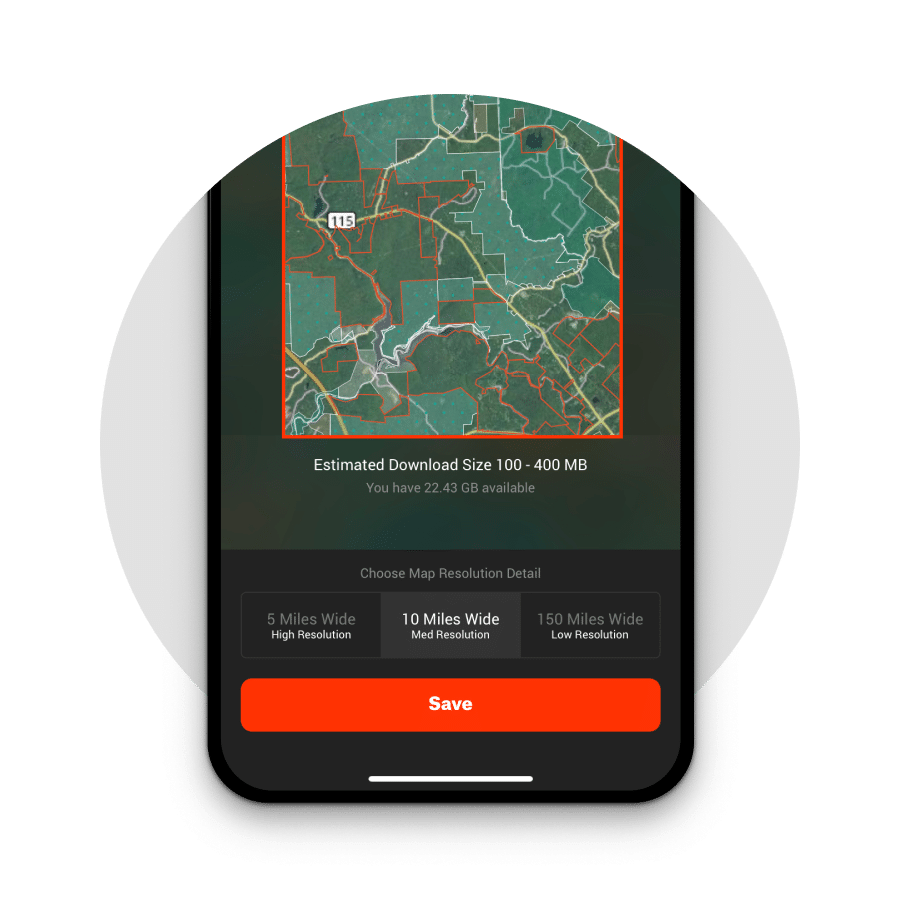
Offline Maps
Take your maps with you, wherever you may roam with Offline Maps. Download Offline Maps before you leave cell service to see accurate land ownership maps even out of cell service.
Customize Your Maps
Use onX Hunt’s suite of Map Tools to mark Waypoints, draw lines, and draw area shapes. Mark access points, draw routes, and customize your maps for your next hunt.
“
Everybody talks about how onX Hunt helps you figure out places to hunt, but I think it’s equally important to find out where you can’t hunt. onX keeps you in the clear and lets you focus on what you’re doing, and what you should be doing, which is hunting. ”
Steven Rinella
Meateater
Need Map Tools Such As Waypoints and Tracking?
Access a full suite of tools by selecting the “Map Tools” option on both device and desktop. Here, you’ll find fully customizable Waypoints, GPS Tracking, Offline Maps for use in areas without cell service and much more.
How to Access Feature Layer

On Desktop
- Login to your account on webmap.onxmaps.com/hunt/login.
- Select Map Layers at the top left of your screen.
- Select Your State or choose it from the layer library.
- Toggle on “Private Lands.”
- Investigate private lands on the onX Hunt ap.

In App
- Open onX Hunt on your mobile device or tablet.
- Select Map Layers on the bottom left of the screen.
- Select your state.
- Toggle on “Private Lands.”
- Investigate private lands on the onX Hunt Map.
App Reviews
Excellent technical support
Great app. I hunt all over in places I’m not necessarily familiar with. Having property lines and “where not to go past” is extremely important. This app helps us respectfully abide rules, regulations, access areas, etc.…
Read more
Great app. I hunt all over in places I’m not necessarily familiar with. Having property lines and “where not to go past” is extremely important. This app helps us respectfully abide rules, regulations, access areas, etc. Customer service is fast and courteous, whenever I’ve had a question. Love it. It has become an important piece of gear.
Highly recommend this
I hunt on mostly public land and trying to figure out what’s where was really hard before I got this app. I absolutely love this app. The ability to add waypoints for tracks, scat, rubs, scraps, etc, add photos of what y…
Read more
I hunt on mostly public land and trying to figure out what’s where was really hard before I got this app. I absolutely love this app. The ability to add waypoints for tracks, scat, rubs, scraps, etc, add photos of what you saw to those waypoints, brief descriptions, etc. It’s just been amazing. Before this I was using Google Maps, and 2 different state websites to look for public and private land boundaries. Impossible to manage. Now it’s all in 1 spot. While hunting I can easily pull up the map and see if I’m legal or not. By far the best $30 I’ve spent in a long time. Highly recommend this especially if you’re unsure of boundaries or you want to detail where all the signs are. You can even attach trailcam pics to the waypoints by using the online version and it’ll sync with your phone. I don’t normally leave reviews but this app…..friggin awesome.
Love the app
I have been using onX Hunt for a few years now. It has helped me stay on private property for hunts. Tracking worked perfectly as needed. Was able to find boundaries and not fear I was in the wrong location. I needed hel…
Read more
I have been using onX Hunt for a few years now. It has helped me stay on private property for hunts. Tracking worked perfectly as needed. Was able to find boundaries and not fear I was in the wrong location. I needed help changing states, prompt response from support made the whole process easy. Love the app.
Frequently Asked Questions
The onX Hunt App can help you discover who owns property by showing landowner information, property lines, and more on a satellite, topo, or hybrid map.
onX Hunt can help you find private land to hunt by displaying property lines and learn how to ask a landowner for permission to hunt private land.
The onX Hunt App can help you evaluate property lines by showcasing this data on a Satellite, Topo, or Hybrid map. Learn more about how to find property lines.