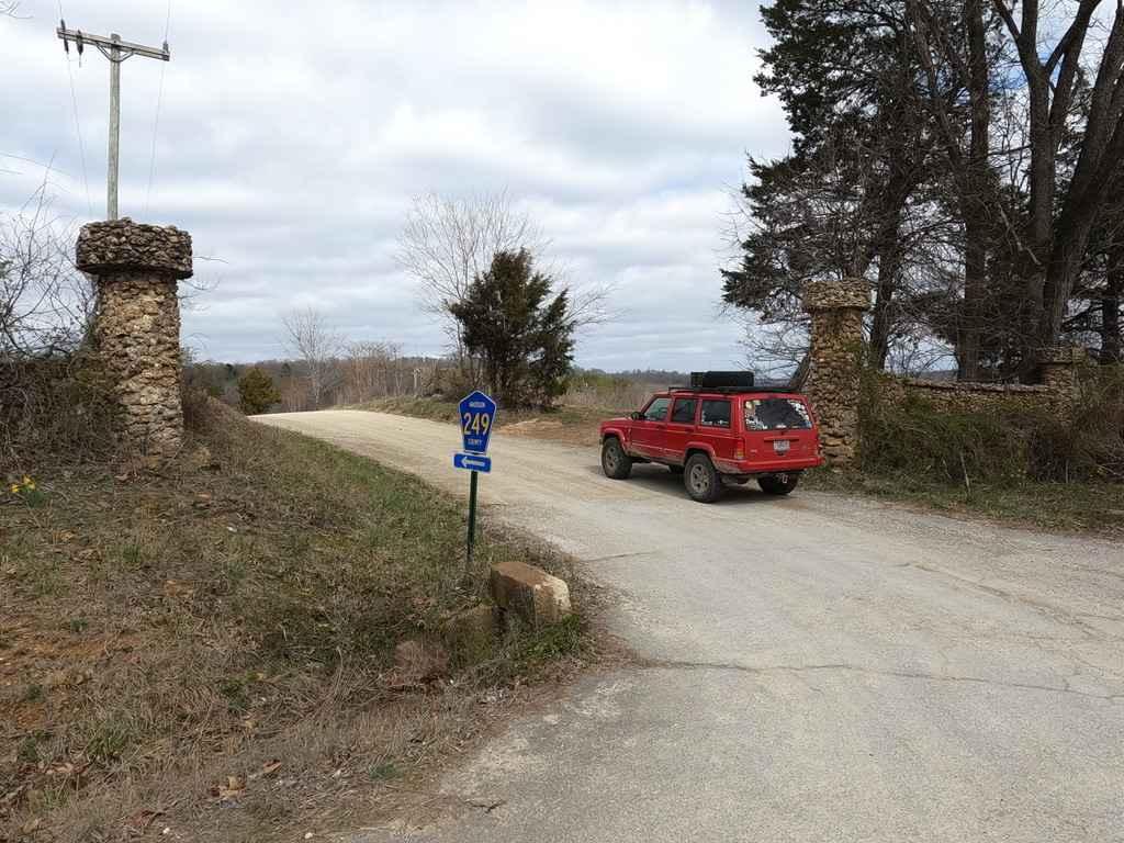
Madison County Road 249
Total Miles
2.3
Technical Rating
Best Time
Spring, Summer, Fall, Winter
Trail Type
Full-Width Road
Accessible By
Trail Overview
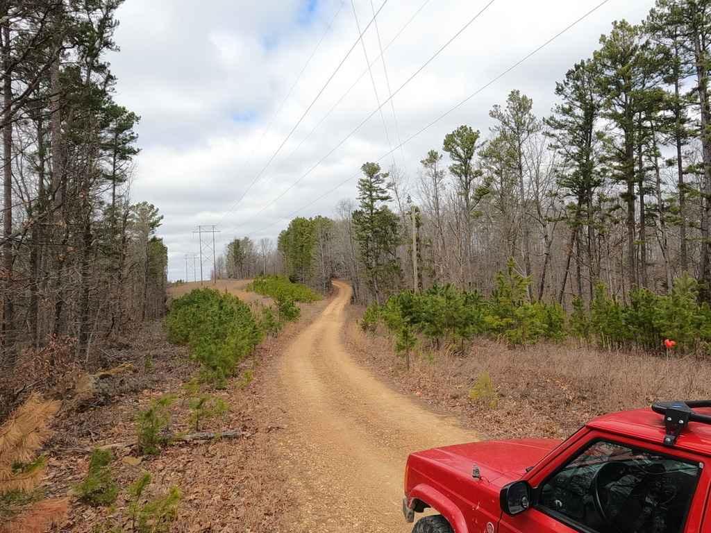
Madison County Road 249 is a gravel-based road that travels through the northeastern hills of Madison County. It features scenic views of Spring Valley Creek and then leads up a moderate grade to weave in and out of the power-line cut out. The trail crosses two cattle guards along the way, be easy on these, they are old and show signs of their age. The road is simple and fun but also serves as a better scenic, more off-road feeling backroad to access Amidon Conservation Area if coming from the east on Missouri-72.
Photos of Madison County Road 249
Difficulty
The road is the reddest course of loose gravel from the local area, features mild rutting, potholes, washboarding, and mounding, and has spots where it fades to dirt and could be slightly muddy. The road is simple and scenic but has a few noteworthy spots, such as the two low-water bridges, and the hill climb from the creek bottoms up. The cattle guards are showing age, be careful and take your time crossing them, to not damage them anymore. This road would be on a different level of difficulty in the Snow or Rain.
Status Reports
Madison County Road 249 can be accessed by the following ride types:
- High-Clearance 4x4
- SUV
Madison County Road 249 Map
Popular Trails

Waterfall Access

Smooth Sailing
Hillside 70.5
The onX Offroad Difference
onX Offroad combines trail photos, descriptions, difficulty ratings, width restrictions, seasonality, and more in a user-friendly interface. Available on all devices, with offline access and full compatibility with CarPlay and Android Auto. Discover what you’re missing today!