
Dirt Bike Trails
Near Warm Springs, Oregon
Explore All Dirt Bike Trails Near Warm Springs, Oregon
Dirt Bike Trails Near Warm Springs, Oregon
Discover the best dirt bike trails near you. Browse trail maps, check difficulty ratings, and find your next adventure — whether you're looking for a quick ride or an all-day expedition.
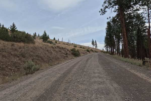
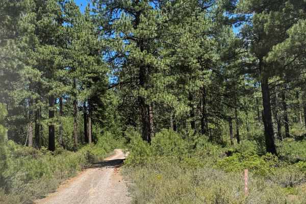
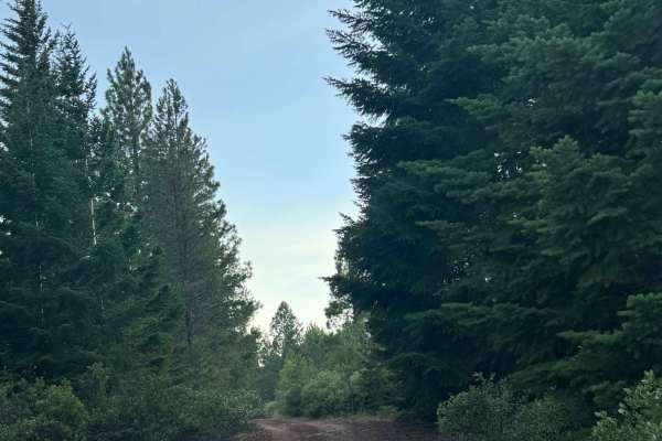
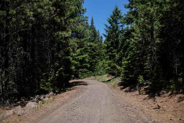
Montgomery - FS 6400
FS 6400, signed Montgomery Road, is a wide, graded two-lane gravel road that climbs and winds along the canyon rim above an arm of Lake Billy Chinook and the Metolius River. The route offers sweeping views of the reservoir and surrounding high desert hillsides before dropping back into ponderosa pin...
Learn more about Montgomery - FS 6400
NF-115
Gravel Forest Service road winding through a landlocked section of the Deschutes National Forest above the Deschutes River. This section is accessible from the South and is surrounded by the nearby Jefferson Wilderness and Warm Springs Reservation. This road varies in elevation from 3500'-4000' in e...
Learn more about NF-115

NF-200
This is an easy gravel forest logging road connecting NF 1170 to Squaw Ridge (NF-1190). It is primarily used when accessing the small portion of the Deschutes National Forest north of Prairie Creek. This road is tight with manzanita overgrowth. Pinstriping is likely to occur, so if you value your pa...
Learn more about NF-200
Squawback Ridge - NF119000
This gravel Forest Service road winds through a landlocked section of the Deschutes National Forest above the Deschutes River. This section is accessible from the South and is surrounded by the nearby Jefferson Wilderness and Warm Springs Reservation. This road varies in elevation from 3500'-4000' i...
Learn more about Squawback Ridge - NF119000
Willow Creek Crossing
So easy that a PT Cruiser can do it...wait, no. Please don't. To do this trail, a rear locker and 35-inch tires are recommended. It's short and sweet but an absolute blast and a great intro to teach people how to use the features of their rig.
Learn more about Willow Creek Crossing
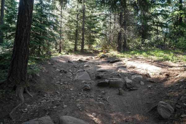
Alder Spring - FS 1149
This is a dirt trail that climbs up to the area near the old Alder Spring Lookout. The trail is narrow, about one vehicle wide, with limited places to pass, and is tight with overgrown vegetation and trees. There are a lot of rock garden sections that are bumpy, some humps/whoops, and then some boul...
Learn more about Alder Spring - FS 1149
Prairie Farm Creek
This route will take you up to Prairie Farm Creek and the top side of Green Ridge. The route provides many camping opportunities with an abundant amount of other spur trails you can branch off on. From this road, you can head west to Green Ridge, which provides amazing views of the Cascade Range, in...
Learn more about Prairie Farm Creek
Jefferson Lake Trail
This is a dirt based forest road that leads to the Jefferson Lake hiking trail head. The first section of this trail is narrow and one vehicle wide with some rocks and tree roots sticking up on the trail, and the second portion is wide enough for two vehicles with some washboard areas and minor ruts...
Learn more about Jefferson Lake Trail
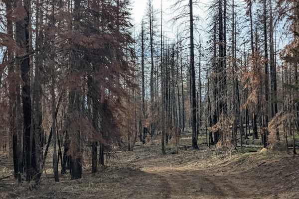
Abbot Butte Loop
This route provides amazing views of Mt. Jefferson and the open hillsides that were hit by a big burn years ago. The route starts out fairly tight, making it not recommended for full-size rigs or those concerned about their paint. The juniper bushes will be rubbing along your sides for the first cou...
Learn more about Abbot Butte Loop
NF-1130300
Tight Forest Service road winding through the landlocked section of the Deschutes National Forest above the Deschutes River. This road parallels nearby NF-113 but is much more interesting route to travel. It varies in elevation from 4000'-4800' and is usually snowbound between December and April. Th...
Learn more about NF-1130300
FS 1270-000
This is a gravel-based forest road that gradually climbs to an elevation of nearly 600 feet, with a couple of switchbacks. The trail is wide enough for two vehicles to pass and has minor wash and ruts under 6 inches deep. This trail is suitable for all vehicle types, and travels through a valley and...
Learn more about FS 1270-000
Cabot Lake Trail
This is a dirt-based forest road in the National Forest that leads to the Cabot Lake hiking trail. The trail is narrow with room to pass, and has minor ruts and wash. The trail gradually climbs and is bumpy with a rock garden, and the higher you go, the rockier it gets, but any vehicle type could tr...
Learn more about Cabot Lake Trail
FS 1120-885
This is a dirt-based forest road through a dense pine forest. The trail is narrow and one vehicle wide, with places to pass. There are minor ruts and washouts around 8 inches deep, but overall this is an easy trail that any vehicle could travel. There are multiple campsites along the trail, and you ...
Learn more about FS 1120-885
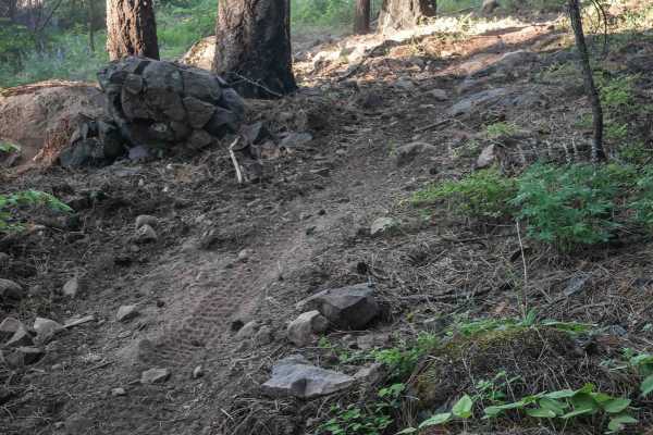
Brush Creek - FS 1230-900
This is a dirt-based forest road in the National Forest that ends at the Brush Creek hiking trail head. The trail is bumpy with rock gardens and ruts/washouts up to a foot and a half deep. The trail gradually climbs nearly 800 feet in elevation in just under 2 miles, and is suitable for any vehicle ...
Learn more about Brush Creek - FS 1230-900
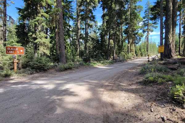
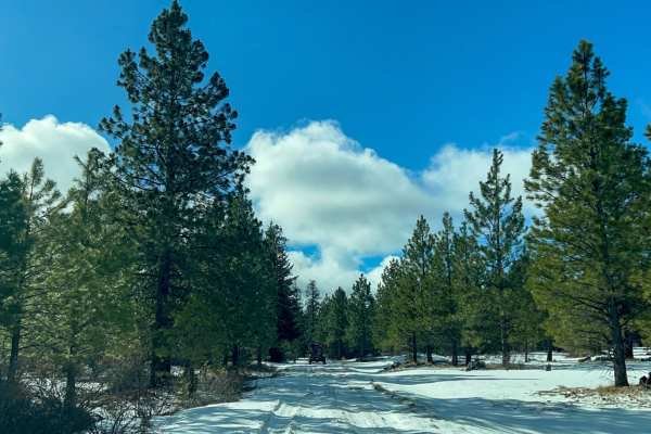
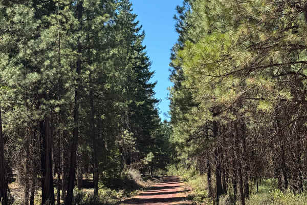
Skyline Road/Olallie Lake - FR 4220
Forest Road 4220 - Skyline Road/Olallie Lake - leads to several campgrounds and lakes in the area. The road is an easy dirt trail and seems maintained for access to the lake and campgrounds. Easy enough for 2WD with plenty of space for vehicles to pass. There is active logging in the area - be cauti...
Learn more about Skyline Road/Olallie Lake - FR 4220
575
Trail 575 in the McCubbins OHV Area is a long 10-mile intermediate trail. On the east end, a short segment runs from the McCubbins staging area to the campground and across a bridge, weaving tightly through trees with big rocks and winding turns. The main trail heads west from the staging area and i...
Learn more about 575
596
Trail 596 begins as a narrow descent from 586, more like a single-track, offering an easy, smooth forest trail with potential downed logs. After intersecting with 587, the trail heads west with several small climbs featuring loose and embedded rocks. At 0.7 miles long, it remains narrow and primitiv...
Learn more about 596
576F
Trail 576F begins at the staging area and runs for 1.3 miles as a wide, gravelly trail with small rocks and a smooth, gradual incline. It's more like an old road. It provides an easy and direct connection to other trails by continuing onto Trail 576G, making it a key access route from the main parki...
Learn more about 576F
Two Springs - FS 1237
This is a dirt-based forest road with some rock mixed in, and it has humps/whoops on the trail that will make you control your speed. The trail is narrow and one vehicle wide, with places to pass up to the switchback. From the switchback, the trail narrows to the point you are constantly scratching,...
Learn more about Two Springs - FS 1237
592
The east end of Trail 592 starts as a wide, gravelly road along the edge of a burn area, then narrows into a curvy two-track with small climbs on loose dirt and rocks. While some sections are narrow between the bushes with small embedded roots, the trail remains mostly smooth and easy. Several unmar...
Learn more about 592
ATV trails near Warm Springs, Oregon
Explore ATV-friendly trails near you. These trails are accessible for vehicles up to 50 inches wide, perfect for ATVs and smaller off-road machines.
Montgomery - FS 6400
FS 6400, signed Montgomery Road, is a wide, graded two-lane gravel road that climbs and winds along the canyon rim above an arm of Lake Billy Chinook and the Metolius River. The route offers sweeping views of the reservoir and surrounding high desert hillsides before dropping back into ponderosa pin...
Learn more about Montgomery - FS 6400
NF-115
Gravel Forest Service road winding through a landlocked section of the Deschutes National Forest above the Deschutes River. This section is accessible from the South and is surrounded by the nearby Jefferson Wilderness and Warm Springs Reservation. This road varies in elevation from 3500'-4000' in e...
Learn more about NF-115
NF-200
This is an easy gravel forest logging road connecting NF 1170 to Squaw Ridge (NF-1190). It is primarily used when accessing the small portion of the Deschutes National Forest north of Prairie Creek. This road is tight with manzanita overgrowth. Pinstriping is likely to occur, so if you value your pa...
Learn more about NF-200
Squawback Ridge - NF119000
This gravel Forest Service road winds through a landlocked section of the Deschutes National Forest above the Deschutes River. This section is accessible from the South and is surrounded by the nearby Jefferson Wilderness and Warm Springs Reservation. This road varies in elevation from 3500'-4000' i...
Learn more about Squawback Ridge - NF119000
UTV/side-by-side trails near Warm Springs, Oregon
Find UTV and side-by-side trails near you. These trails accommodate vehicles up to 60 inches wide, ideal for UTVs, side-by-sides, and wider off-road rigs.
Montgomery - FS 6400
FS 6400, signed Montgomery Road, is a wide, graded two-lane gravel road that climbs and winds along the canyon rim above an arm of Lake Billy Chinook and the Metolius River. The route offers sweeping views of the reservoir and surrounding high desert hillsides before dropping back into ponderosa pin...
Learn more about Montgomery - FS 6400
NF-115
Gravel Forest Service road winding through a landlocked section of the Deschutes National Forest above the Deschutes River. This section is accessible from the South and is surrounded by the nearby Jefferson Wilderness and Warm Springs Reservation. This road varies in elevation from 3500'-4000' in e...
Learn more about NF-115
NF-200
This is an easy gravel forest logging road connecting NF 1170 to Squaw Ridge (NF-1190). It is primarily used when accessing the small portion of the Deschutes National Forest north of Prairie Creek. This road is tight with manzanita overgrowth. Pinstriping is likely to occur, so if you value your pa...
Learn more about NF-200
Squawback Ridge - NF119000
This gravel Forest Service road winds through a landlocked section of the Deschutes National Forest above the Deschutes River. This section is accessible from the South and is surrounded by the nearby Jefferson Wilderness and Warm Springs Reservation. This road varies in elevation from 3500'-4000' i...
Learn more about Squawback Ridge - NF119000
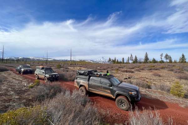
The onX Offroad Difference
onX Offroad combines trail photos, descriptions, difficulty ratings, width restrictions, seasonality, and more in a user-friendly interface. Available on all devices, with offline access and full compatibility with CarPlay and Android Auto. Discover what you're missing today!
Open Trail Map