
Dirt Bike Trails
Near Pitkin, Colorado
Explore All Dirt Bike Trails Near Pitkin, Colorado
Dirt Bike Trails Near Pitkin, Colorado
Discover the best dirt bike trails near you. Browse trail maps, check difficulty ratings, and find your next adventure — whether you're looking for a quick ride or an all-day expedition.
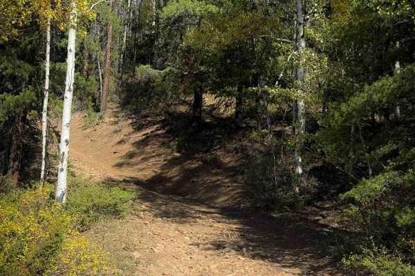
Powderhouse Trail - FS 647
Trail 647 is a rocky and steep climb up a wide path through the Gunnison National Forest, near Pitkin, Colorado. The west end of the trail starts off of FS 763 Wuanita Pass Road, southwest of the town of Pitkin. The west entrance is unmarked, and the trail looks like it’s been rerouted to not be as ...
Learn more about Powderhouse Trail - FS 647
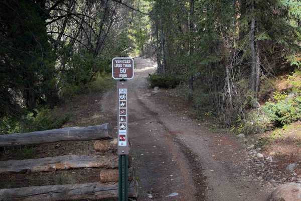
Middle Quartz Trail - FS 622
Middle Quartz Trail is a short ATV trail connecting full-width road sections of FS 622. There are pinch points at each entrance preventing wider vehicles from entering. The section of ATV trail is only about a half mile long. There are dispersed campsites on either end of the trail along FS Road 622...
Learn more about Middle Quartz Trail - FS 622
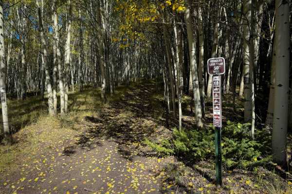
North Bald Pitkin Cut-Off Trail - FS 649
The North Bald Pitkin Cut-Off Trail is a 1.2-mile-long, steep and rocky ATV trail through the Gunnison National Forest south of Pitkin, Colorado. The north end starts at an intersection with ATV Trail 647, and it enters a scenic aspen grove on a wide two-track full of rocks and roots. It is a very s...
Learn more about North Bald Pitkin Cut-Off Trail - FS 649
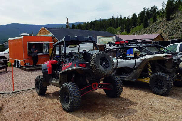
Hancock Pass
This trail connects St. Elmo to Pitkin via the 12,140-foot Hancock Pass. After taking in the views, descend to Brittle Silver Basin, on through to Pitkin, and the
Learn more about Hancock Pass
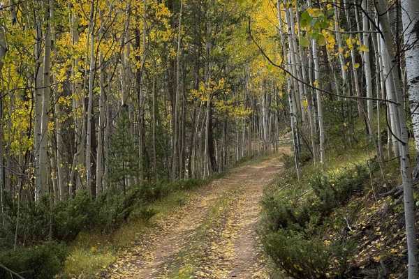
Wuanita Pass Trail - FS 640
Wuanita Pass is an easy and winding ATV trail through the Gunnison National Forest south of Pitkin, Colorado. Although designated as a 50” trail on the MVUM, the trail signs lacked any width designation, so you may see wider vehicles on this trail unintentionally. There are a lot of unmarked roads o...
Learn more about Wuanita Pass Trail - FS 640
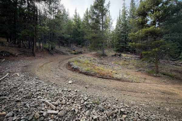
Bald Mountain Trail - FS 644
Trail 644 is an easy and winding ATV trail through the Gunnison National Forest south of Pitkin, Colorado. Although designated as a 50” trail on the MVUM, the trail signs lacked any width designation, so you may see wider vehicles on this trail unintentionally. There are a lot of unmarked roads out ...
Learn more about Bald Mountain Trail - FS 644
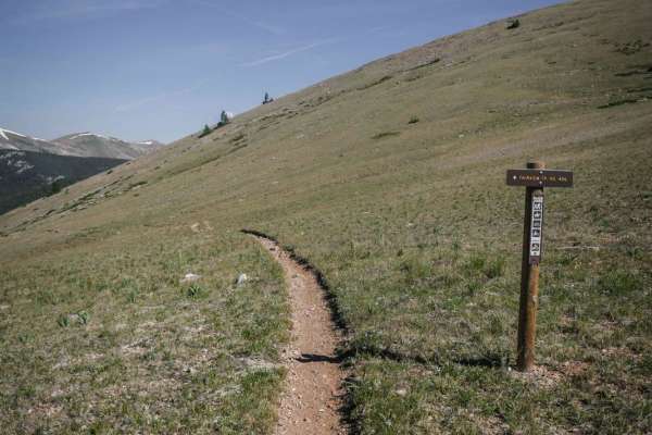
Fairview
Fairview is a fun single-track trail in the Gunnison National Forest that side-hills for 3 miles at the edge of the timberline at around 11,500 feet elevation. It dips in and out of the trees and the tundra. It goes through several rock scree fields on a shelfy trail with some exposure. These scree ...
Learn more about Fairview
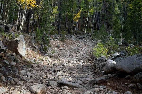
South Quartz Trail - FS 483
South Quartz Trail is a rocky ATV trail that accesses the South Quartz singletrack. It starts on FS Road 769 at an unmarked entrance and is completely covered in a layer of river rock right away. The rocks range in size from small baby heads to big boulders. It is a single-lane width, ideal for ATVs...
Learn more about South Quartz Trail - FS 483

Gold Creek (South)
This 2.3-mile intermediate/advanced single-track trail is a very rocky and rooty climb from south to north, gaining 1,300 feet from bottom to top. On the south side, it starts off of the jeep road (Gold Creek Road) and goes past a huge boulder field before entering a lush pine tree forest with lots ...
Learn more about Gold Creek (South)
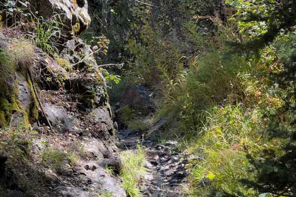
Bear Gulch Trail - FS 610
Bear Gulch Trail is a 4 mile long intermediate single track through the Gunnison National Forest. It’s a scenic and challenging route that is a mix of flowy dirt single track through beautiful aspen groves, and big technical rock problems. There are frequent rock gardens made of big boulders, with u...
Learn more about Bear Gulch Trail - FS 610

Scenic Cumberland Pass
Scenic Cumberland Pass is a scenic 15.8-mile route climbing from 9,744 feet to a peak of 12,027 feet near Napoleon Mountain. The trail follows narrow, steep, and rocky historic mining roads parallel to the main pass, offering panoramic high-alpine views, pine forests, and remnants of Colorado’s mini...
Learn more about Scenic Cumberland Pass
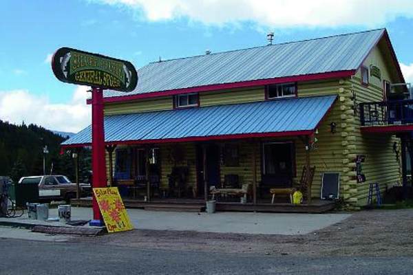
Napoleon Pass
Climb along Continental Divide with 12,000-foot views at Napoleon Pass. You'll cross several creeks, so expect to get muddy. Take time to explore Tincup Cemetery and the old Gold Cup Mine. This route may close unexpectedly for weather.
Learn more about Napoleon Pass
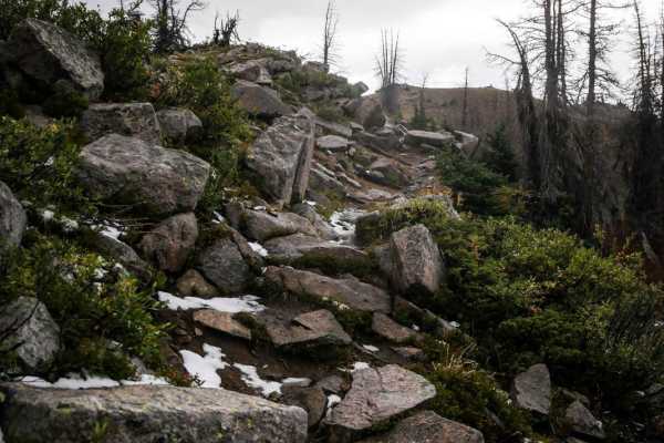
South Quartz
South Quartz Trail is a very challenging trail if ridden in the uphill direction (west to east) that is a 7 difficulty, and is even harder if it's muddy out. It's much easier if ridden downhill (east to west starting at the intersection with Canyon Creek Trail). From top to bottom, you drop down a s...
Learn more about South Quartz
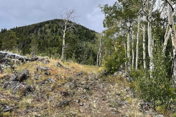
Willow Mine Trail
This short single track in the Gunnison National Forest is accessed from the south off of a very steep jeep road (Willow Creek Mine Road). The 1-mile trail meanders through the pine tree forest, but slowly loses elevation all the way down until it intersects with Bear Gulch trail in a meadow. It's v...
Learn more about Willow Mine Trail
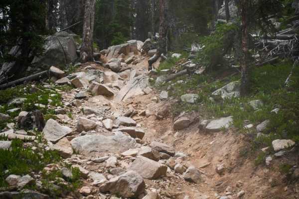
Horseshoe
Horseshoe Trail has the reputation of being one of the hardest trails in Colorado. Ride this one for 6 miles and 3,500 feet elevation gain of unrelenting rocks and arm-pumping climbs. It starts and ends off of the Canyon Creek single-track trail, which is a much easier, fast, and flowy trail. Horses...
Learn more about Horseshoe
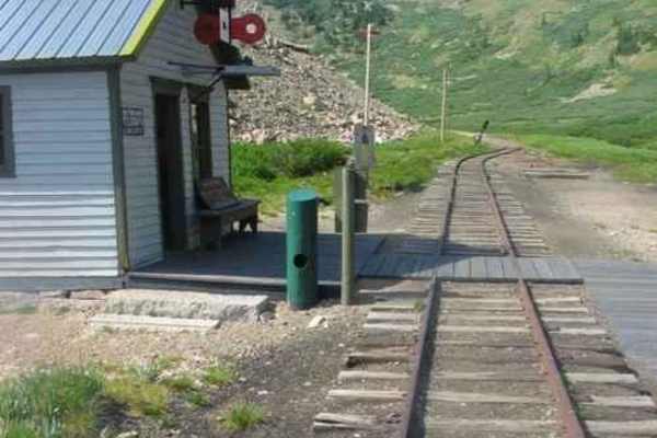
Alpine Tunnel
The Alpine Tunnel was once the highest railroad tunnel in the world. At an altitude of 11,523 feet, it was the first tunnel to be built through the Continental Divide. The Denver, South Park and Pacific Railroad began the work of connecting St Elmo to Pitkin, Colorado in November 1879 with a constr...
Learn more about Alpine Tunnel
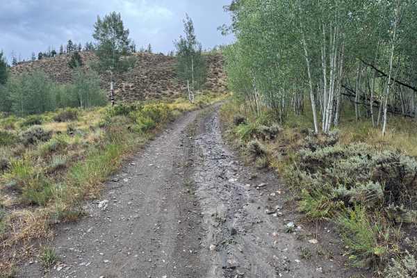
Willow Creek Mine Road
This out-and-back route travels through a changing mountain landscape as it steadily climbs toward a high ridgeline. The surface varies from packed dirt and gravel to sections covered with loose and embedded rock, with some areas showing erosion and exposed bedrock. Lower portions pass through thick...
Learn more about Willow Creek Mine Road

Cameron Gulch
Cameron Gulch is a very rocky single track between Pitkin and Taylor Park in the Gunnison National Forest. It is full of really steep climbs that are full of roots and rocks. The trail is uphill the whole way if riding north to south, gaining 1,000 feet in 1.7 miles. There are cinder blocks built in...
Learn more about Cameron Gulch
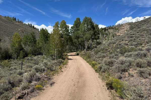
Willow Creek Road
This is a longer out-and-back route that can take around four hours to complete, so plan accordingly before starting. Only three legally open spur routes branch from the main trail. The route begins with wider, smoother dirt surfaces surrounded by sagebrush, rocky hillsides, and pockets of aspens be...
Learn more about Willow Creek Road
East Willow Creek
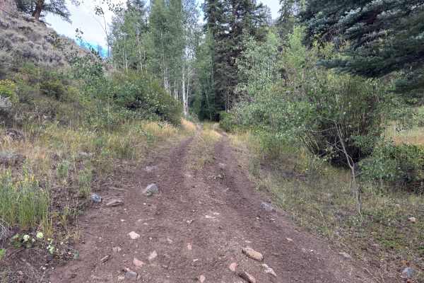
This out-and-back route travels through the Gunnison National Forest along a narrow trail that is primarily one vehicle wide. The surrounding landscape consists of dense stands of aspen and conifer trees, with thick shrubs and other low-growing vegetation lining much of the route. The surface change...
Learn more about East Willow Creek
ATV trails near Pitkin, Colorado
Explore ATV-friendly trails near you. These trails are accessible for vehicles up to 50 inches wide, perfect for ATVs and smaller off-road machines.
Powderhouse Trail - FS 647
Trail 647 is a rocky and steep climb up a wide path through the Gunnison National Forest, near Pitkin, Colorado. The west end of the trail starts off of FS 763 Wuanita Pass Road, southwest of the town of Pitkin. The west entrance is unmarked, and the trail looks like it’s been rerouted to not be as ...
Learn more about Powderhouse Trail - FS 647
Middle Quartz Trail - FS 622
Middle Quartz Trail is a short ATV trail connecting full-width road sections of FS 622. There are pinch points at each entrance preventing wider vehicles from entering. The section of ATV trail is only about a half mile long. There are dispersed campsites on either end of the trail along FS Road 622...
Learn more about Middle Quartz Trail - FS 622
North Bald Pitkin Cut-Off Trail - FS 649
The North Bald Pitkin Cut-Off Trail is a 1.2-mile-long, steep and rocky ATV trail through the Gunnison National Forest south of Pitkin, Colorado. The north end starts at an intersection with ATV Trail 647, and it enters a scenic aspen grove on a wide two-track full of rocks and roots. It is a very s...
Learn more about North Bald Pitkin Cut-Off Trail - FS 649
Hancock Pass
This trail connects St. Elmo to Pitkin via the 12,140-foot Hancock Pass. After taking in the views, descend to Brittle Silver Basin, on through to Pitkin, and the
Learn more about Hancock Pass
UTV/side-by-side trails near Pitkin, Colorado
Find UTV and side-by-side trails near you. These trails accommodate vehicles up to 60 inches wide, ideal for UTVs, side-by-sides, and wider off-road rigs.
Hancock Pass
This trail connects St. Elmo to Pitkin via the 12,140-foot Hancock Pass. After taking in the views, descend to Brittle Silver Basin, on through to Pitkin, and the
Learn more about Hancock Pass
Scenic Cumberland Pass
Scenic Cumberland Pass is a scenic 15.8-mile route climbing from 9,744 feet to a peak of 12,027 feet near Napoleon Mountain. The trail follows narrow, steep, and rocky historic mining roads parallel to the main pass, offering panoramic high-alpine views, pine forests, and remnants of Colorado’s mini...
Learn more about Scenic Cumberland Pass
Napoleon Pass
Climb along Continental Divide with 12,000-foot views at Napoleon Pass. You'll cross several creeks, so expect to get muddy. Take time to explore Tincup Cemetery and the old Gold Cup Mine. This route may close unexpectedly for weather.
Learn more about Napoleon Pass
Alpine Tunnel
The Alpine Tunnel was once the highest railroad tunnel in the world. At an altitude of 11,523 feet, it was the first tunnel to be built through the Continental Divide. The Denver, South Park and Pacific Railroad began the work of connecting St Elmo to Pitkin, Colorado in November 1879 with a constr...
Learn more about Alpine Tunnel
The onX Offroad Difference
onX Offroad combines trail photos, descriptions, difficulty ratings, width restrictions, seasonality, and more in a user-friendly interface. Available on all devices, with offline access and full compatibility with CarPlay and Android Auto. Discover what you're missing today!
Open Trail Map