
Dirt Bike Trails
Near Garfield, Colorado
Explore All Dirt Bike Trails Near Garfield, Colorado
Dirt Bike Trails Near Garfield, Colorado
Discover the best dirt bike trails near you. Browse trail maps, check difficulty ratings, and find your next adventure — whether you're looking for a quick ride or an all-day expedition.
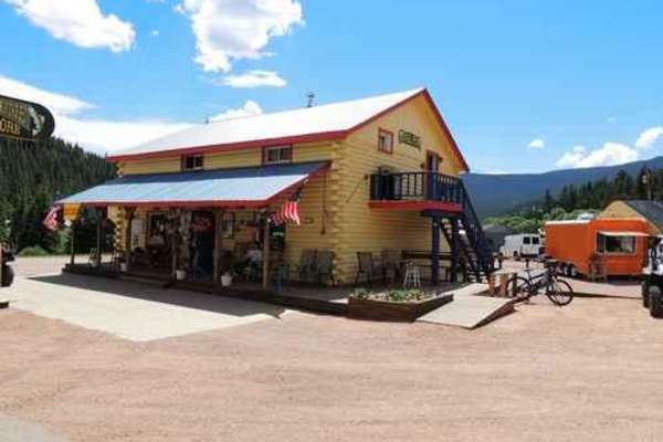
Old Monarch Pass
This scenic and historic 52-mile point-to-point route is perfect for overland enthusiasts and families looking for a mild yet breathtaking drive through the Gunnison National Forest and over a historic mountain pass. Starting off Highway 50, the well-graded dirt road climbs steadily to the summit of...
Learn more about Old Monarch Pass

Billings Lake
The Billings Lake trail is an exceptional high-alpine route for intermediate offroaders seeking stunning Colorado scenery and a classic mountain driving experience. Climbing steadily through the rugged Sawatch Range, this narrow, one-lane path winds through dense pine and aspen forests before openin...
Learn more about Billings Lake

Tomichi Pass
Tomichi Pass divides Middle Quartz Creek to the north from Tomichi Creek to the south. From Brittle Silver Basin at the north end, you reach the top of Tomichi Pass quickly. The 4WD road comes out of Brittle Silver Basin near a mine and heads up a narrow ledge road toward Tomichi Pass between Paywel...
Learn more about Tomichi Pass
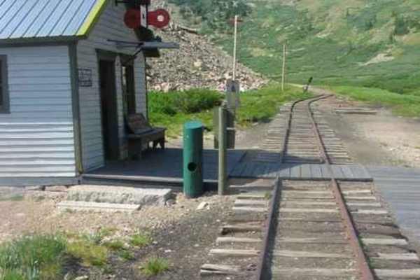
Alpine Tunnel
The Alpine Tunnel was once the highest railroad tunnel in the world. At an altitude of 11,523 feet, it was the first tunnel to be built through the Continental Divide. The Denver, South Park and Pacific Railroad began the work of connecting St Elmo to Pitkin, Colorado in November 1879 with a constr...
Learn more about Alpine Tunnel
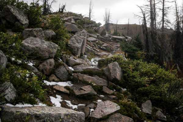
South Quartz
South Quartz Trail is a very challenging trail if ridden in the uphill direction (west to east) that is a 7 difficulty, and is even harder if it's muddy out. It's much easier if ridden downhill (east to west starting at the intersection with Canyon Creek Trail). From top to bottom, you drop down a s...
Learn more about South Quartz
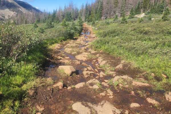
Williams Pass Trail
Williams Pass Trail is a rugged, 2.9-mile out-and-back off-road route near St. Elmo that climbs to an elevation of 11,776 feet. The trail follows the historic Denver, South Park and Pacific Railroad grade through dense subalpine forests and onto fragile alpine tundra, ending near the west portal of ...
Learn more about Williams Pass Trail
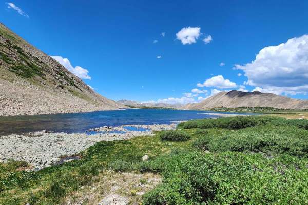
Pomeroy Lake - FS 297
This is a spur off the popular Hancock Pass, before the town of Hancock. This trail will take you past the Mary Murphy tram towers to some mining structures at the trams lower and midpoint terminus. From there you can continue up to Pomeroy Lake, or take a short spur to the Mary Murphy to see the ma...
Learn more about Pomeroy Lake - FS 297
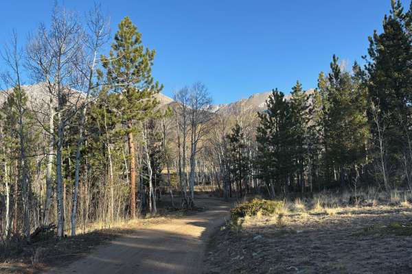
Mount Shavano - Aspen Cutoff
This trail breaks off from the main Mt. Shavano trail and provides an alternate route to the trailhead at the end. Where the main road leads through open plains, this route winds through an impressive series of aspen groves. This area is rich with wildlife, so expect to see mule deer and elk feeding...
Learn more about Mount Shavano - Aspen Cutoff
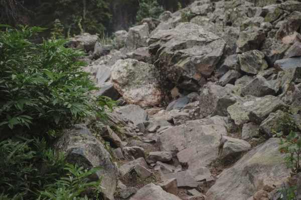
Greens Creek
Greens Creek is a fun alpine single track in the San Isabel National Forest near Poncha Springs, Colorado. Going southwest to northeast, it starts on a ridgeline that is the Continental Divide, at the intersection with Monarch Crest Trail and drops 2,900 feet over 7 miles. It has epic views of the c...
Learn more about Greens Creek
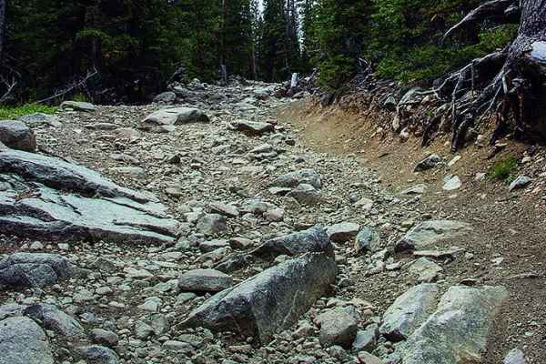
Baldwin Lakes, Boulder Mountain
This challenging high-altitude route is designed for experienced drivers seeking spectacular alpine scenery, mountain lakes, and high-clearance four-wheel-drive exploration. Stretching approximately 8.8 miles through the San Isabel National Forest, the trail climbs from 10,265 feet to a breathtaking...
Learn more about Baldwin Lakes, Boulder Mountain
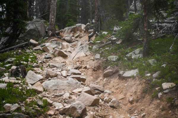
Horseshoe
Horseshoe Trail has the reputation of being one of the hardest trails in Colorado. Ride this one for 6 miles and 3,500 feet elevation gain of unrelenting rocks and arm-pumping climbs. It starts and ends off of the Canyon Creek single-track trail, which is a much easier, fast, and flowy trail. Horses...
Learn more about Horseshoe
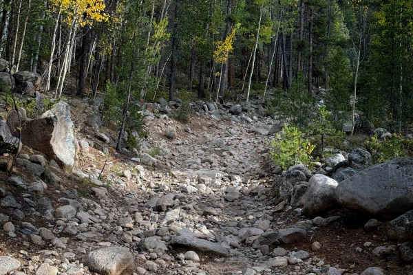
South Quartz Trail - FS 483
South Quartz Trail is a rocky ATV trail that accesses the South Quartz singletrack. It starts on FS Road 769 at an unmarked entrance and is completely covered in a layer of river rock right away. The rocks range in size from small baby heads to big boulders. It is a single-lane width, ideal for ATVs...
Learn more about South Quartz Trail - FS 483
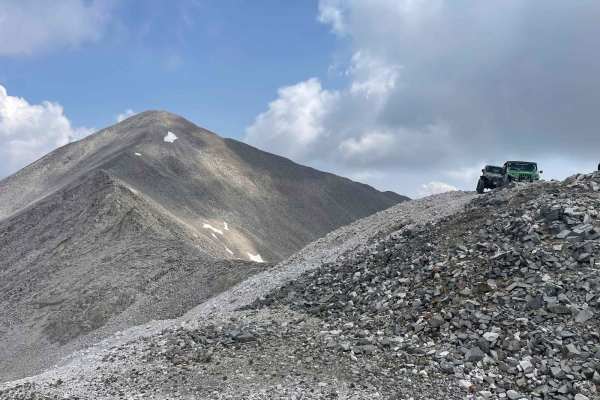
Mount Antero Pass
This epic trail to the top of Mount Antero starts off Browns Creek trail. Combine with Mount Antero Access trail and portions of Baldwin Lakes and Browns Creek trails for a full day of off-roading from the trailhead to Mount Antero at over 13,700 feet. The views along the trail are amazing. There is...
Learn more about Mount Antero Pass
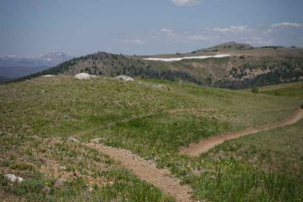
Monarch Crest
The Monarch Crest Trail is a 9-mile single-track trail that goes from the summit of Monarch Pass (Highway 50) south to Marshall Pass. It's a shelfy trail the whole way, side-hilling on a gradual mountain slope in and out of tree-line in the high alpine tundra. The trail rides along between 11,500 - ...
Learn more about Monarch Crest
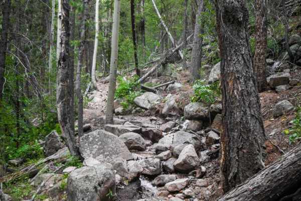
Agate Creek
The Agate Creek Trail is a fun and challenging trail in the Gunnison National Forest near Sargents, Colorado, that starts right off of Highway 50 at the Agate Campground. It's a really rocky single track that follows a creek the entire way, with multiple creek crossings. It's made up of big boulders...
Learn more about Agate Creek
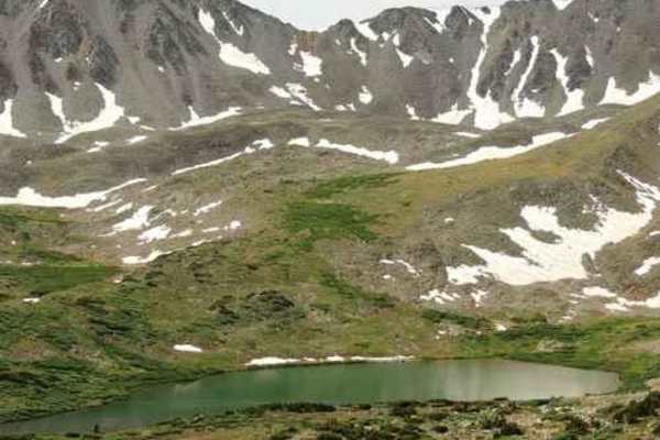
Baldwin Lake
Baldwin Lake is an in-and-out Jeep trail from Mount Antero road to Baldwin Mine and back. Fairly bumpy, but the last part is above the treeline and offers some very nice views.The final section of the trail leading to the mine is the most difficult and is where the 5 rating comes from.You can hike...
Learn more about Baldwin Lake
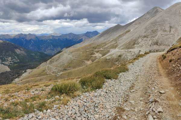
Browns Creek Trail
This route is a high-elevation road that takes you above treeline with scenic views of the surrounding mountains, and at the end of the trail, there is a short hike to Brown's Lake. The trail starts out from the Baldwin Lakes Trail and as it takes you above treeline, there is a series of switchbacks...
Learn more about Browns Creek Trail
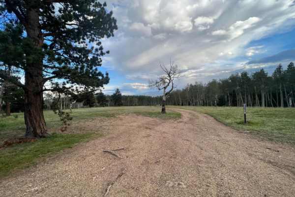
Mt. Shavano
Mt. Shavano is a scenic 6.3-mile point-to-point trail near Poncha Springs, Colorado, that is ideal for beginners, high-clearance four-wheel-drive vehicles, and SxSs looking for scenic access to high-altitude trailheads. Climbing from an elevation of 7,976 feet to 9,749 feet, this route starts on Cou...
Learn more about Mt. Shavano
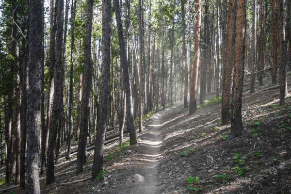
Quakey Mountain
This 3.7-mile single track is mostly a rocky trail through a forest of tall pine trees near Sargents, Colorado. The north end starts out with a lot of small loose jagged rocks covering the surface of the trail, on a side-hilling shelfy trail. It widens up as you ride south, but still has some roots ...
Learn more about Quakey Mountain
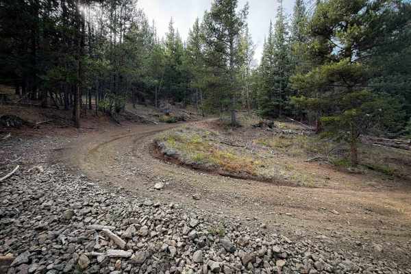
Bald Mountain Trail - FS 644
Trail 644 is an easy and winding ATV trail through the Gunnison National Forest south of Pitkin, Colorado. Although designated as a 50” trail on the MVUM, the trail signs lacked any width designation, so you may see wider vehicles on this trail unintentionally. There are a lot of unmarked roads out ...
Learn more about Bald Mountain Trail - FS 644
ATV trails near Garfield, Colorado
Explore ATV-friendly trails near you. These trails are accessible for vehicles up to 50 inches wide, perfect for ATVs and smaller off-road machines.
Old Monarch Pass
This scenic and historic 52-mile point-to-point route is perfect for overland enthusiasts and families looking for a mild yet breathtaking drive through the Gunnison National Forest and over a historic mountain pass. Starting off Highway 50, the well-graded dirt road climbs steadily to the summit of...
Learn more about Old Monarch Pass
Billings Lake
The Billings Lake trail is an exceptional high-alpine route for intermediate offroaders seeking stunning Colorado scenery and a classic mountain driving experience. Climbing steadily through the rugged Sawatch Range, this narrow, one-lane path winds through dense pine and aspen forests before openin...
Learn more about Billings Lake
Tomichi Pass
Tomichi Pass divides Middle Quartz Creek to the north from Tomichi Creek to the south. From Brittle Silver Basin at the north end, you reach the top of Tomichi Pass quickly. The 4WD road comes out of Brittle Silver Basin near a mine and heads up a narrow ledge road toward Tomichi Pass between Paywel...
Learn more about Tomichi Pass
Alpine Tunnel
The Alpine Tunnel was once the highest railroad tunnel in the world. At an altitude of 11,523 feet, it was the first tunnel to be built through the Continental Divide. The Denver, South Park and Pacific Railroad began the work of connecting St Elmo to Pitkin, Colorado in November 1879 with a constr...
Learn more about Alpine Tunnel
UTV/side-by-side trails near Garfield, Colorado
Find UTV and side-by-side trails near you. These trails accommodate vehicles up to 60 inches wide, ideal for UTVs, side-by-sides, and wider off-road rigs.
Old Monarch Pass
This scenic and historic 52-mile point-to-point route is perfect for overland enthusiasts and families looking for a mild yet breathtaking drive through the Gunnison National Forest and over a historic mountain pass. Starting off Highway 50, the well-graded dirt road climbs steadily to the summit of...
Learn more about Old Monarch Pass
Billings Lake
The Billings Lake trail is an exceptional high-alpine route for intermediate offroaders seeking stunning Colorado scenery and a classic mountain driving experience. Climbing steadily through the rugged Sawatch Range, this narrow, one-lane path winds through dense pine and aspen forests before openin...
Learn more about Billings Lake
Tomichi Pass
Tomichi Pass divides Middle Quartz Creek to the north from Tomichi Creek to the south. From Brittle Silver Basin at the north end, you reach the top of Tomichi Pass quickly. The 4WD road comes out of Brittle Silver Basin near a mine and heads up a narrow ledge road toward Tomichi Pass between Paywel...
Learn more about Tomichi Pass
Alpine Tunnel
The Alpine Tunnel was once the highest railroad tunnel in the world. At an altitude of 11,523 feet, it was the first tunnel to be built through the Continental Divide. The Denver, South Park and Pacific Railroad began the work of connecting St Elmo to Pitkin, Colorado in November 1879 with a constr...
Learn more about Alpine Tunnel
The onX Offroad Difference
onX Offroad combines trail photos, descriptions, difficulty ratings, width restrictions, seasonality, and more in a user-friendly interface. Available on all devices, with offline access and full compatibility with CarPlay and Android Auto. Discover what you're missing today!
Open Trail Map