
Dirt Bike Trails
Near Parker, Idaho
Explore All Dirt Bike Trails Near Parker, Idaho
Dirt Bike Trails Near Parker, Idaho
Discover the best dirt bike trails near you. Browse trail maps, check difficulty ratings, and find your next adventure — whether you're looking for a quick ride or an all-day expedition.
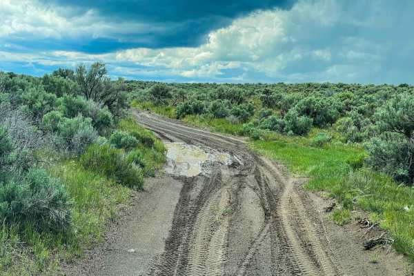
Beer Run
The trail starts near Saint Anthony Sand Dunes in open desert cattle land. The route, then takes you through forests by the Island Park Reservoir, and ends by following between the road and Henrys Fork. The trail is easy with only two minor ledges that could be avoided by taking the road. Half of t...
Learn more about Beer Run
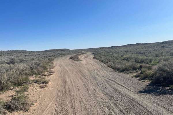
East 2200 North
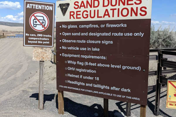
Smooth, flat, and loose gravel is what this route is all about. It's super wide with no washboard. There is access to the St. Antony Sand Dunes Open Area off this trail. These access trails head off to the north side of the dunes. Just be sure to follow all posted signs if you head out to the dunes ...
Learn more about East 2200 North
Civil Defense Cave
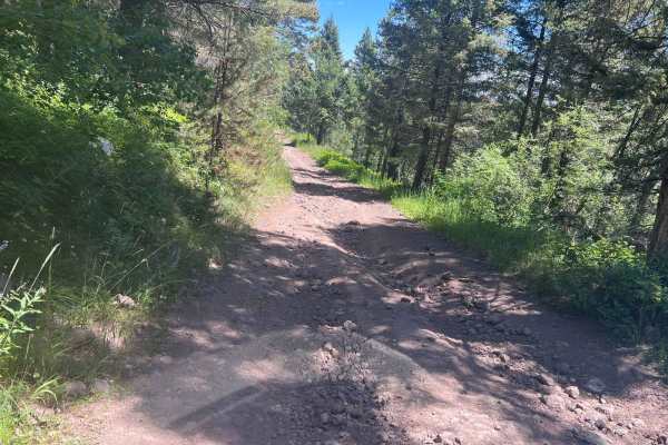
The Civil Defense Cave trail is a well-maintained, grated road for the first 4 miles until the turn off of Crooked Road onto Civil Defense Cave Road. The last mile is not grated but still well traveled. I would recommend a higher clearance vehicle as there is potential for lower vehicles to bottom o...
Learn more about Civil Defense Cave
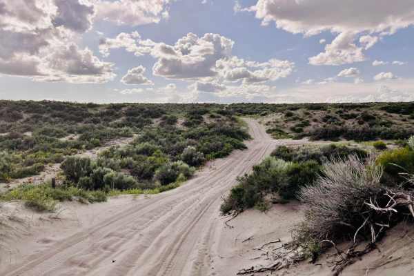
St. Anthony Sand Dunes Western Access
This trail is sandy and offers access to the western side of the St. Anthony Sand Dunes Open Riding area. The western side has really big sand dunes. The route is heavily whooped and bumpy from cattle traffic. There are quite a few cattle out here grazing in this area, so use caution when traveling....
Learn more about St. Anthony Sand Dunes Western Access
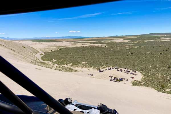
St. Anthony Sand Dunes-Egin Lake to Devils Dune
This is a free ride route over the St. Anthony Dunes. The route will take you along the southern route of the Sand Dunes and cuts up over the top to Devil's Dune. The return route travels along the north route of the dunes to Choke Cherry Hill (a popular hill climb destination). Make a return to Egi...
Learn more about St. Anthony Sand Dunes-Egin Lake to Devils Dune
A Mile and a Half Road
First of all, it's closer to three miles, but maybe they first ran it on foot, and it seemed shorter. This is a fun trail that is mostly traveled by cattle. It is a sandy route back up to the main road. The sand gets quite deep at times. There is also the occasional boulder field to watch for. The t...
Learn more about A Mile and a Half Road
West Y
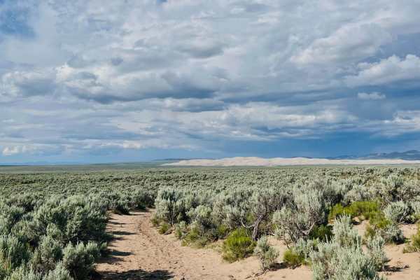
This lightly traveled two-track trail cuts through fields of sagebrush. In the Springtime and even into early summer, wildflowers dot the sides of the trial. The route is sandy, with little cactus scattered here and there. Occasionally there's a firm rocky section, but they don't last for long. The ...
Learn more about West Y
July Creek Road (20303)
This is a main byway Forest Service Road that will connect Highway 20 (through additional roads) and the St. Anthony area if other roads are followed. People can go to the St. Anthony Sand Dunes via roads along this path. You will need a higher clearance vehicle to get over some of the washed areas ...
Learn more about July Creek Road (20303)
Menan Butte to Market Lake
This is a fun route to explore the desert area between the Menan Buttes and Market Lake Wildlife Area. The trail starts out at the parking area across from the buttes and winds through the sagebrush and lava rock eventually ending at Market Lake wildlife refuge. The difficulty of this trail is weath...
Learn more about Menan Butte to Market Lake
Market Canal Road
Market Canal Road is a simple trail that takes you through the sagebrush just west of the Menan Butte. The trail is wide and mostly flat with sections of lava rock and sand but offers several obstacles along the way for more of a challenge. This is a great location to enjoy in the evening as the sun...
Learn more about Market Canal Road
Webster Dam
This trail begins off of Browns road and the beginning section is the power line road, it is an out and back trail once you turn away from the power line road and begin the decent into Websters Dam. There is an abundance of ruts, washouts, steep climbs and descents as you make your way towards the d...
Learn more about Webster Dam
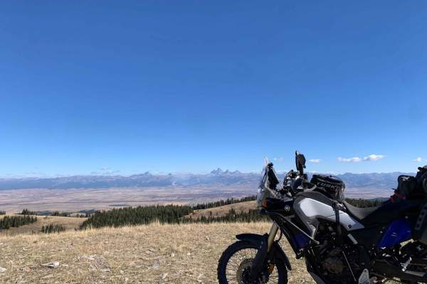
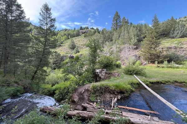
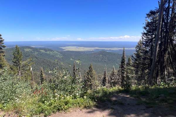
Relay Ridge
Want one of the best views of the Tetons outside Grand Teton National Park? Relay Ridge is the ride just for that. You start near Green Canyon Hot Springs without no idea of how picturesque of a view you are about to experience climbing to just under 9k feet (one of the highest points in the Big Hol...
Learn more about Relay Ridge
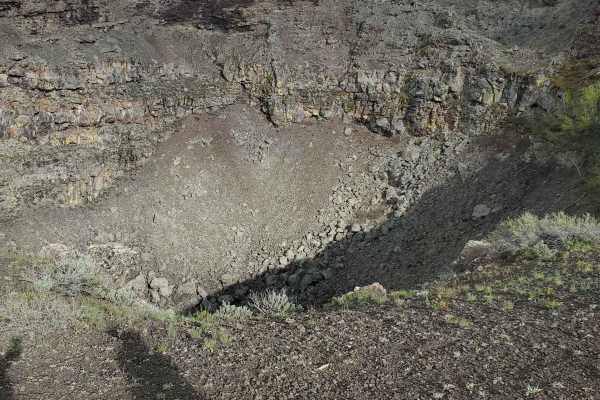
Collapsed Lava Dome Trail
The terrain is pockmarked with collapsed lava tubes and lava domes that have come to form the hills and valleys of this area. While the trail is relatively moderately traversed, lava rock pops out of the dirt and could cause potential issues with tires and low-clearance vehicles. It is not maintaine...
Learn more about Collapsed Lava Dome Trail
Sadorus Hill Road (20169)
This is a Forest Service Road that connects to Highway 20 and the St. Anthony area. People can go to the St. Anthony Sand Dunes via roads along this path. There are also numerous 50-inch restricted trails along this road. You will need a higher-clearance vehicle to get over some of the washed areas ...
Learn more about Sadorus Hill Road (20169)
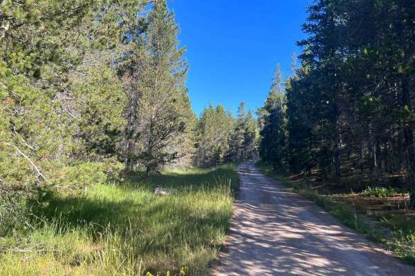
South Antelope Flat Road (20553)
This is a main byway on Forest Service Road. It is well-maintained and can be traversed by a 2WD vehicle most of the time. Caution should be exercised during inclement weather but this is a good gravel/dirt-based road. You will be traveling through some very beautiful forested areas that are broken ...
Learn more about South Antelope Flat Road (20553)

Poison Flats Trail Exploring
The route begins at Poison Flats Trailhead, climbs to Poison Flats, and follows the trail to Long Canyon Road. Cut off to the weather station and park at the pond below. Walk up to the old Morning Glory Mine. (The only registered mine in Madison County, ID). Continue down the cutoff trail to Wolveri...
Learn more about Poison Flats Trail Exploring
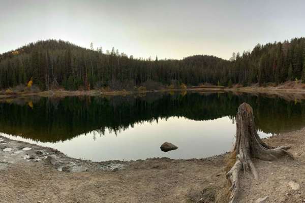
Packsaddle Lake
This route takes you to a natural lake named Packsaddle Lake from the northern edges of the Big Hole Range. There are amazing views of the Tetons along the way, including views across the Snake River Plain and of Big Southern Butte, the Menan Buttes, the Bitterroot, Lemhi, and Lost River Ranges. Thi...
Learn more about Packsaddle Lake
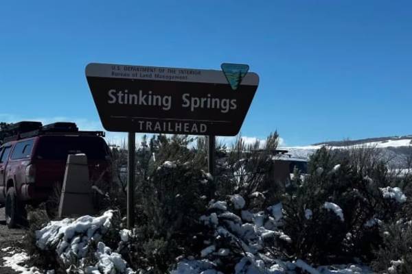
Stinking Springs
This foothill climb is fun for beginners and anyone looking to bypass riding the river road to get to more flowy double and single track. The trail is more or less a two-stage climb; the first stage is switchbacks, and the second stage is rocks and ledges. Leading up to the first switchbacks is a ni...
Learn more about Stinking Springs
Bishop Mountain Road (20120)
This is a fun trail that has some great views as you get near the top. The destination is at the top: an old fire lookout tower and cabin used for those assigned to it when it was operational. While you can't climb the tower, you can get a glimpse of the views that they had to the east and north thr...
Learn more about Bishop Mountain Road (20120)
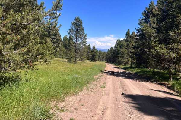
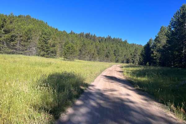
North Antelope Flat Road (20168)
This is a main byway on Forest Service Road. It is well-maintained and can be traversed by a 2WD vehicle most of the time. Caution should be exercised during inclement weather but this is a good gravel/dirt-based road. You will be traveling through some very beautiful forested areas that are broken ...
Learn more about North Antelope Flat Road (20168)
ATV trails near Parker, Idaho
Explore ATV-friendly trails near you. These trails are accessible for vehicles up to 50 inches wide, perfect for ATVs and smaller off-road machines.
Beer Run
The trail starts near Saint Anthony Sand Dunes in open desert cattle land. The route, then takes you through forests by the Island Park Reservoir, and ends by following between the road and Henrys Fork. The trail is easy with only two minor ledges that could be avoided by taking the road. Half of t...
Learn more about Beer Run
East 2200 North
Smooth, flat, and loose gravel is what this route is all about. It's super wide with no washboard. There is access to the St. Antony Sand Dunes Open Area off this trail. These access trails head off to the north side of the dunes. Just be sure to follow all posted signs if you head out to the dunes ...
Learn more about East 2200 North
Civil Defense Cave
The Civil Defense Cave trail is a well-maintained, grated road for the first 4 miles until the turn off of Crooked Road onto Civil Defense Cave Road. The last mile is not grated but still well traveled. I would recommend a higher clearance vehicle as there is potential for lower vehicles to bottom o...
Learn more about Civil Defense Cave
St. Anthony Sand Dunes Western Access
This trail is sandy and offers access to the western side of the St. Anthony Sand Dunes Open Riding area. The western side has really big sand dunes. The route is heavily whooped and bumpy from cattle traffic. There are quite a few cattle out here grazing in this area, so use caution when traveling....
Learn more about St. Anthony Sand Dunes Western Access
UTV/side-by-side trails near Parker, Idaho
Find UTV and side-by-side trails near you. These trails accommodate vehicles up to 60 inches wide, ideal for UTVs, side-by-sides, and wider off-road rigs.
Beer Run
The trail starts near Saint Anthony Sand Dunes in open desert cattle land. The route, then takes you through forests by the Island Park Reservoir, and ends by following between the road and Henrys Fork. The trail is easy with only two minor ledges that could be avoided by taking the road. Half of t...
Learn more about Beer Run
East 2200 North
Smooth, flat, and loose gravel is what this route is all about. It's super wide with no washboard. There is access to the St. Antony Sand Dunes Open Area off this trail. These access trails head off to the north side of the dunes. Just be sure to follow all posted signs if you head out to the dunes ...
Learn more about East 2200 North
Civil Defense Cave
The Civil Defense Cave trail is a well-maintained, grated road for the first 4 miles until the turn off of Crooked Road onto Civil Defense Cave Road. The last mile is not grated but still well traveled. I would recommend a higher clearance vehicle as there is potential for lower vehicles to bottom o...
Learn more about Civil Defense Cave
St. Anthony Sand Dunes Western Access
This trail is sandy and offers access to the western side of the St. Anthony Sand Dunes Open Riding area. The western side has really big sand dunes. The route is heavily whooped and bumpy from cattle traffic. There are quite a few cattle out here grazing in this area, so use caution when traveling....
Learn more about St. Anthony Sand Dunes Western Access
The onX Offroad Difference
onX Offroad combines trail photos, descriptions, difficulty ratings, width restrictions, seasonality, and more in a user-friendly interface. Available on all devices, with offline access and full compatibility with CarPlay and Android Auto. Discover what you're missing today!
Open Trail Map