
Dirt Bike Trails
Near Long Lake, Wisconsin
Explore All Dirt Bike Trails Near Long Lake, Wisconsin
Dirt Bike Trails Near Long Lake, Wisconsin
Discover the best dirt bike trails near you. Browse trail maps, check difficulty ratings, and find your next adventure — whether you're looking for a quick ride or an all-day expedition.
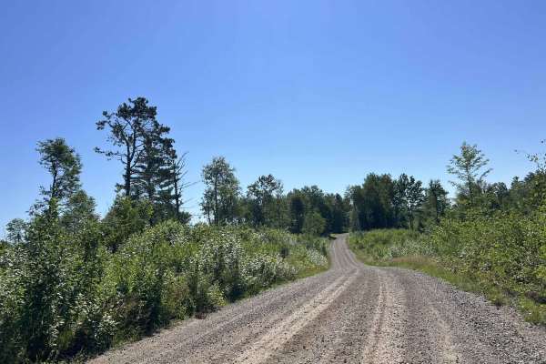
FS 2398
FS 2398 navigates from its northern intersection with FS 2161 to its southern intersection with FS 2162. This trail is open to all vehicle types and is moderately maintained, meaning the gravel surface is typically graded at least once a year. This trail travels through a large variety of scenery ty...
Learn more about FS 2398
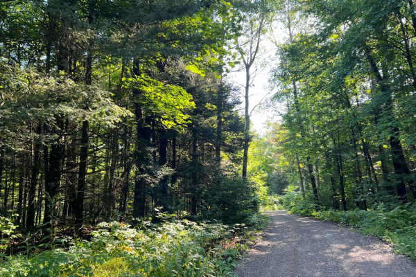
FS 2156L
This is the westernmost section of Florence County's F14 Trail. This trail navigates from its intersection with FS 2156 to its intersection with FS 2832. (FS 2832 is also a part of the F14 Trail but is open to 4x4s.) The trail surface is mostly smooth gravel, which eliminates any of the obstacles th...
Learn more about FS 2156L
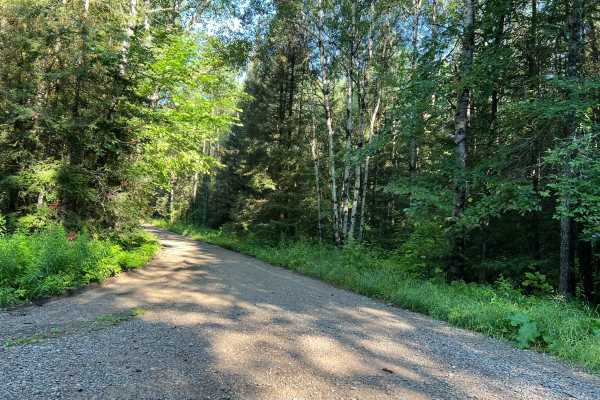
Dead Mans Road - FS 2832
This trail begins as a semi-maintained gravel forest road that is just over one vehicle wide, with good sight lines and good traction thanks to the surface. At roughly the halfway mark, the trail transitions to a two-track dirt trail. This section of the trail has several steep hills, as well as man...
Learn more about Dead Mans Road - FS 2832
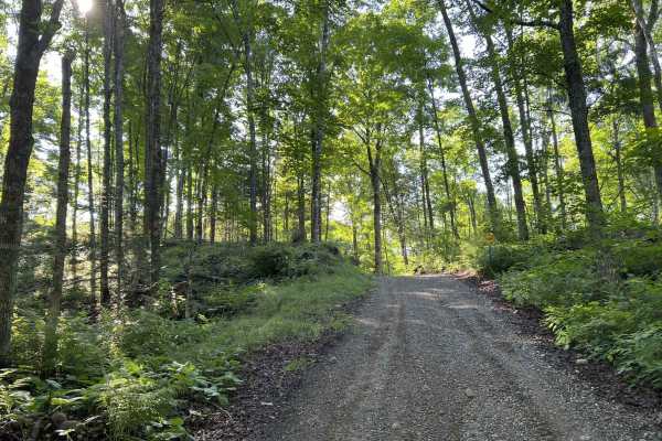
Rock Creek Road - Florence County F14
When starting this trail from FR 2832 to FR 2161, the route begins in the National Forest. This section of the national forest is very hilly, with lots of elevated points as well as deep bowls. The trail follows a good amount of this terrain as it winds through this section of forest. The trail in t...
Learn more about Rock Creek Road - Florence County F14
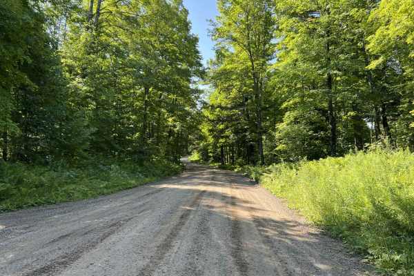
Morgan Lake Road - FS 2161
FS 2161 runs from its intersection with State Highway 139 to its intersection with FS 2159. This trail is a moderately maintained gravel forest road that varies in width; most of the trail is wide enough for vehicles to pass each other at slow speeds, but some portions of the trail are narrow and wi...
Learn more about Morgan Lake Road - FS 2161
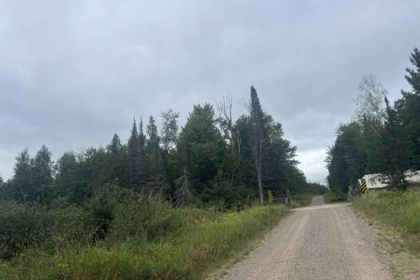
FS 2387
FS 2387 is a large, mostly two-lane gravel forest road that runs from its intersection with Dick Samz Road to its northern intersection with FS 2166. This forest road is mostly straight with only a couple of small curves; however, there is a good mix of gentle rolling elevation changes that add a lo...
Learn more about FS 2387
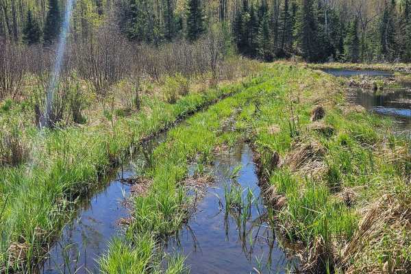
Stoney Creek Loop
Starting at Purdy Lake Road, this scenic trail heads toward Stoney Creek before looping back. There is a T-intersection that goes to/through the creek (depending on water level). The remainder of the trail is a little muddy and rocky, but overall enjoyable. Lots of new-growth trees, so the tree cano...
Learn more about Stoney Creek Loop
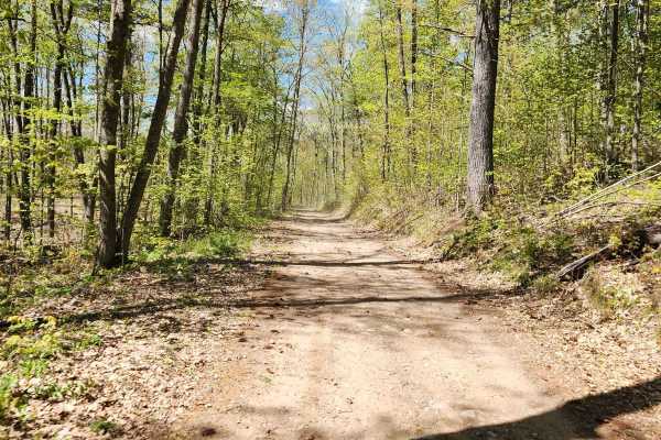
Bushafer 3876
This trail has an easy-going gravel and dirt base and will be greatly enjoyed by anyone traveling by ATV or SxS, though it's open to other road-going vehicles. It's a tight forest road with some of the most elevation changes in the area. A winding trail towards the beginning stretch, it straightens ...
Learn more about Bushafer 3876
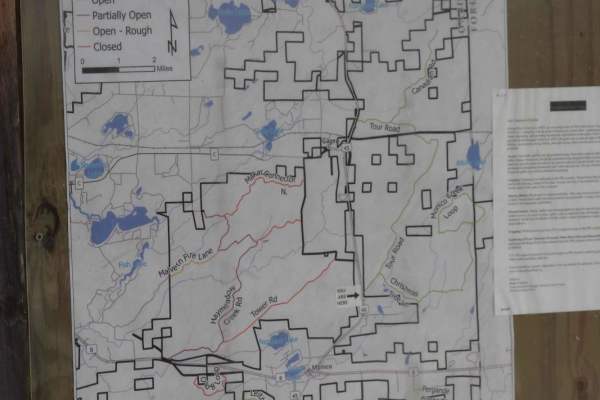
Tour Road
The route takes you through the Pelican River Forest in the North Woods of Wisconsin. The Pelican River Forest is privately owned by The Conservation Fund and open for public use when the gates are open and the roads are passable. This route loops from US 45 to the east back to US 45 on a gentle rol...
Learn more about Tour Road
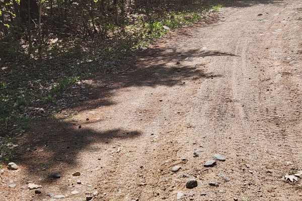
Nicolet State Trail - Bushafer to Wabeno
This is an easy railroad grade that takes over the end of Bushafer and can take you far north or quickly south into Wabeno for some food, drinks, and fuel, You can continue for many more miles. The short spur has a large gravel and rock base with a few road crossings that you need to stop for, so wa...
Learn more about Nicolet State Trail - Bushafer to Wabeno
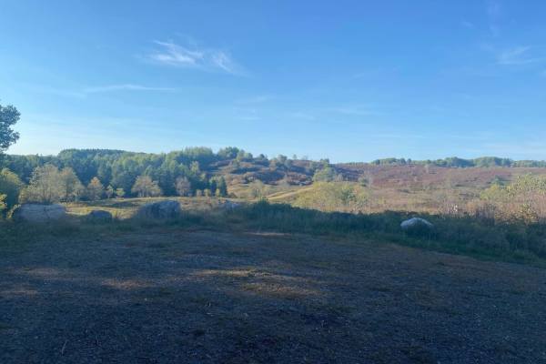
Barrens Loop
This is a twisting trail through the stunning Barrens Nature Area. This trail's surface is a lot like most other trails in this area and is made up of rocks and sand. There are several great picture opportunities along this loop and access to Sand Lake and Pine River Overlook.
Learn more about Barrens Loop
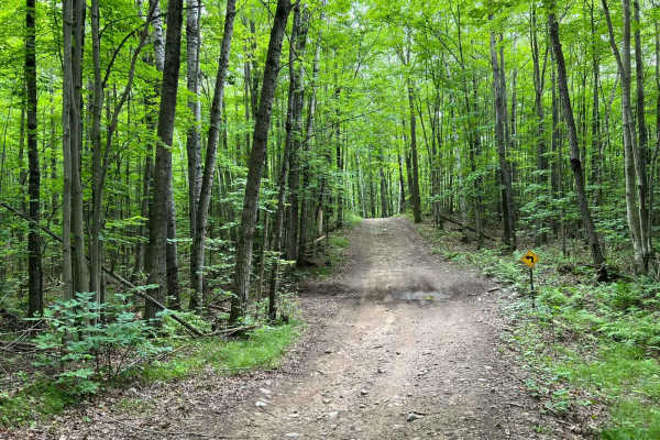
Snowmobile Trl Lkln Forest 55541
This trail consists of a tight two-track running through tight twist hills. There is little area on either side of the trail for run-off or room to pull over. The trail has several small water/mudholes with an average depth of roughly 1 foot. This is a slow technical trail due to the width. There is...
Learn more about Snowmobile Trl Lkln Forest 55541
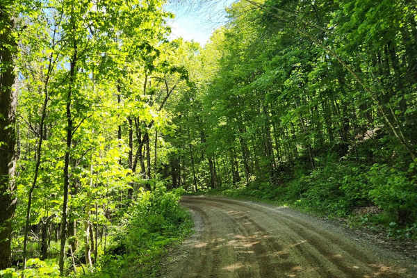
Roberts Lake - FS 2144
This trail has a packed gravel base with areas of loose gravel. Traffic flows in both directions and the trail is fairly wide. There are plenty of areas to pull over on the side and take a break. Passing a few lakes, there are opportunities for some other recreation during your trip.
Learn more about Roberts Lake - FS 2144
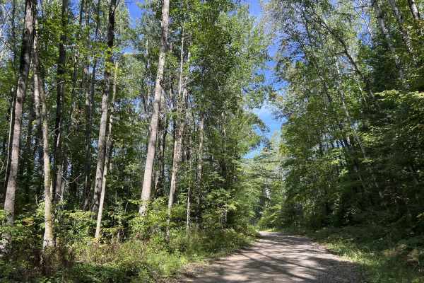
Rat River Road - FS 2134
Rat River Road - FS 2134 is a well-maintained gravel forest road. This trail is just under two vehicles wide for its entire length. The trail passes along miles of gentle rolling hills with long, sweeping corners. Surrounded by dense forest full of a variety of hardwoods, as well as softwoods, this ...
Learn more about Rat River Road - FS 2134
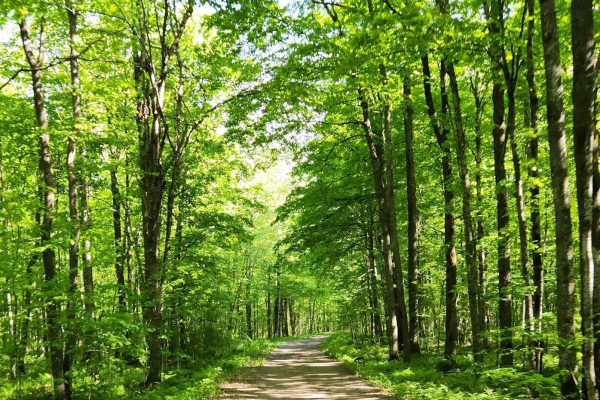
Jones 2359
Heading southwest from Wabeno, this trail starts from a town road and begins as a dirt trail that transitions to gravel around the halfway point. Early on, the trail is not very wide and has plenty of turns to keep your attention. At the gravel transition, things straighten out and become pretty eas...
Learn more about Jones 2359
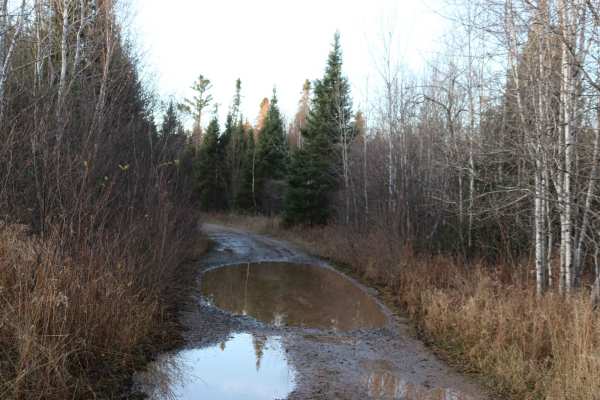
Swan Rd
This trail, a mix of gravel road and unmaintained 2-track, will take you deep into the UP woods. It is mostly flat with gentle grades and several blind corners with potential for 2-way traffic. The water holes have solid bottoms but can be a foot deep following a rain or Spring runoff.
Learn more about Swan Rd
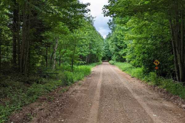
The Wolf - Jungle Lake Stretch
North of Woodlawn past Jungle Lake, this is part of the Wolf River Trail system. Mostly gravel with some large rocks mixed in and running north/south, this trail has a ton of spurs that can be taken. Even in this short stretch, they're just waiting to be explored. The trail itself is mostly flat and...
Learn more about The Wolf - Jungle Lake Stretch
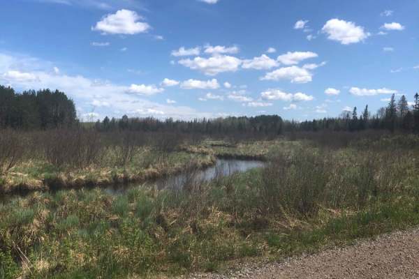
Pratt Junction
The best trail to take that conjoins Post Lake with Pelican Lake, which can then lead to the Harrison Hills system. The trail is mostly a gravel road, but has a small section of dirt on the Pelican Lake side. Along the way, there are excellent views of the woodlands and a stream. Good chance to see ...
Learn more about Pratt Junction
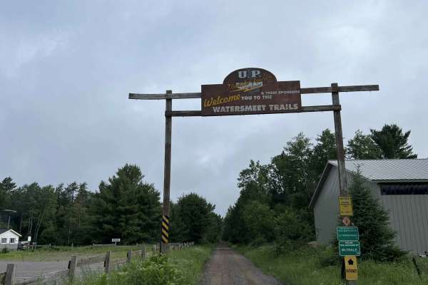
Gogebic County MI Trail LL/3
This is trail LL/ 3 located in Gogebic County, Michigan. This trail runs from its starting point at the Michigan/ Wisconsin border, and continues north to the town of Watersmeet, where it ends at the intersection of the Iron River-Marenisco Trail and Trail LL Bass Lake Road. This trail is a wide and...
Learn more about Gogebic County MI Trail LL/3
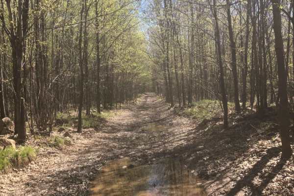
South Pelican
South Pelican is an easy, scenic 1.9-mile trail ideal for beginners and casual offroaders looking for a quick woodland escape near Pelican Lake. The route offers a pleasant mix of roadside riding and deeper forest immersion, beginning near the Boiling Springs Tavern on the east side and winding west...
Learn more about South Pelican
ATV trails near Long Lake, Wisconsin
Explore ATV-friendly trails near you. These trails are accessible for vehicles up to 50 inches wide, perfect for ATVs and smaller off-road machines.
FS 2398
FS 2398 navigates from its northern intersection with FS 2161 to its southern intersection with FS 2162. This trail is open to all vehicle types and is moderately maintained, meaning the gravel surface is typically graded at least once a year. This trail travels through a large variety of scenery ty...
Learn more about FS 2398
FS 2156L
This is the westernmost section of Florence County's F14 Trail. This trail navigates from its intersection with FS 2156 to its intersection with FS 2832. (FS 2832 is also a part of the F14 Trail but is open to 4x4s.) The trail surface is mostly smooth gravel, which eliminates any of the obstacles th...
Learn more about FS 2156L
Dead Mans Road - FS 2832
This trail begins as a semi-maintained gravel forest road that is just over one vehicle wide, with good sight lines and good traction thanks to the surface. At roughly the halfway mark, the trail transitions to a two-track dirt trail. This section of the trail has several steep hills, as well as man...
Learn more about Dead Mans Road - FS 2832
Rock Creek Road - Florence County F14
When starting this trail from FR 2832 to FR 2161, the route begins in the National Forest. This section of the national forest is very hilly, with lots of elevated points as well as deep bowls. The trail follows a good amount of this terrain as it winds through this section of forest. The trail in t...
Learn more about Rock Creek Road - Florence County F14
UTV/side-by-side trails near Long Lake, Wisconsin
Find UTV and side-by-side trails near you. These trails accommodate vehicles up to 60 inches wide, ideal for UTVs, side-by-sides, and wider off-road rigs.
FS 2398
FS 2398 navigates from its northern intersection with FS 2161 to its southern intersection with FS 2162. This trail is open to all vehicle types and is moderately maintained, meaning the gravel surface is typically graded at least once a year. This trail travels through a large variety of scenery ty...
Learn more about FS 2398
FS 2156L
This is the westernmost section of Florence County's F14 Trail. This trail navigates from its intersection with FS 2156 to its intersection with FS 2832. (FS 2832 is also a part of the F14 Trail but is open to 4x4s.) The trail surface is mostly smooth gravel, which eliminates any of the obstacles th...
Learn more about FS 2156L
Dead Mans Road - FS 2832
This trail begins as a semi-maintained gravel forest road that is just over one vehicle wide, with good sight lines and good traction thanks to the surface. At roughly the halfway mark, the trail transitions to a two-track dirt trail. This section of the trail has several steep hills, as well as man...
Learn more about Dead Mans Road - FS 2832
Rock Creek Road - Florence County F14
When starting this trail from FR 2832 to FR 2161, the route begins in the National Forest. This section of the national forest is very hilly, with lots of elevated points as well as deep bowls. The trail follows a good amount of this terrain as it winds through this section of forest. The trail in t...
Learn more about Rock Creek Road - Florence County F14
The onX Offroad Difference
onX Offroad combines trail photos, descriptions, difficulty ratings, width restrictions, seasonality, and more in a user-friendly interface. Available on all devices, with offline access and full compatibility with CarPlay and Android Auto. Discover what you're missing today!
Open Trail Map