
Dirt Bike Trails
Near Igo, California
Explore All Dirt Bike Trails Near Igo, California
Dirt Bike Trails Near Igo, California
Discover the best dirt bike trails near you. Browse trail maps, check difficulty ratings, and find your next adventure — whether you're looking for a quick ride or an all-day expedition.
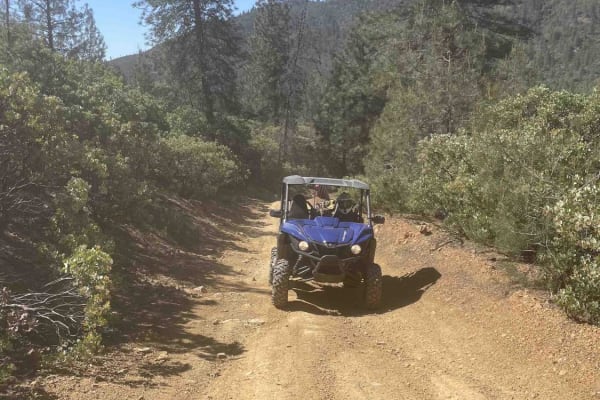
Matheson Trams
This is a fantastic trail located in the Chappie OHV area. Expect beautiful views and a nice trail that can be done in a stock UTV, dirt bike, or 4-wheeler. Be sure to stop and look at Shasta Dam, Iron Mountain Mine, and the old hang glider ramp. Bring a lunch. Multiple places along the trail are wi...
Learn more about Matheson Trams
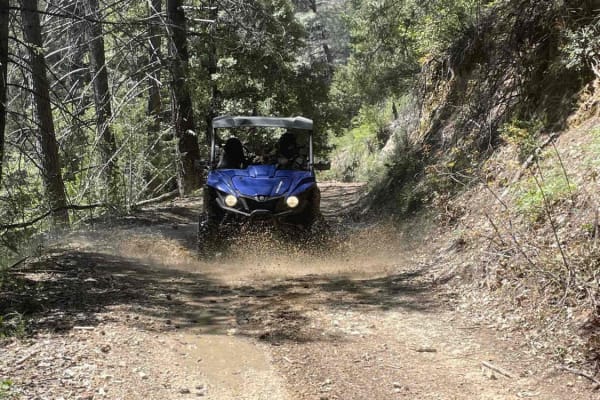
Midway Ridge
This route takes you to the top of Midway Ridge. The trail starts as a nice wide road. The road is maintained very well and follows a mid-slope road. The trail narrows at the first creek crossing and winds through the forest. At this point, it's still easy for a side-by-side or quad. A dirt bike is ...
Learn more about Midway Ridge
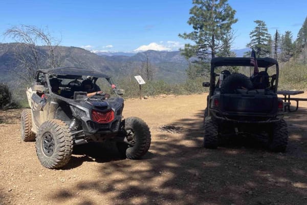
Mammoth Mountain Trail 1
This is a wide-open easy trail from the Chappie staging area, past Mammoth Mountain, to a lunch spot. It's easy for all riding abilities, with a ton of overlooks along the way. During the spring, you will find a lot of waterfalls along the road. This route also goes through several burn scars, which...
Learn more about Mammoth Mountain Trail 1
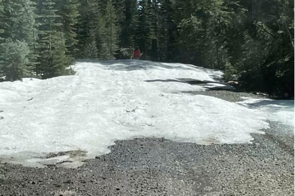
Jack's Backbone
This is a fun drive up through the mountains that will require 4x4 high clearance. However, it does not require lockers. Bring a lunch and enjoy the backcountry, with some great views of valleys and mountains.
Learn more about Jack's Backbone
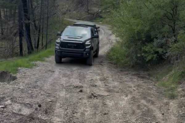
Pillsbury-Indian Dick Road
Pillsberry to Black Butte Trail is a calm, scenic gravel road with some campsites along the river. It's an easy driving, wide road, not normally passable in the wintertime because of snow. There is one small landslide that you can fit a large 4 x 4 through; besides that, the trail is well maintained...
Learn more about Pillsbury-Indian Dick Road
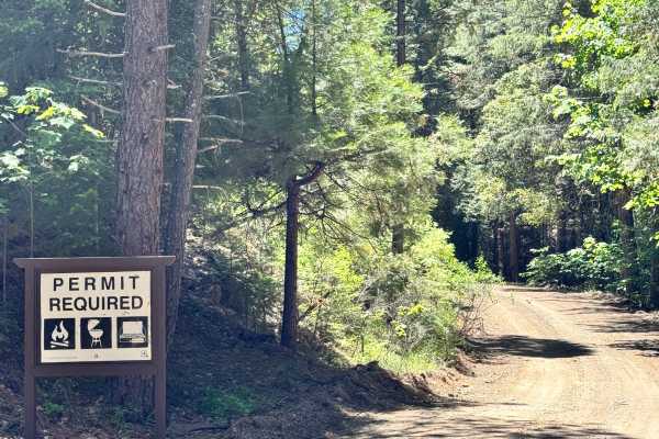
North Philbrook - 27N06
This trail is long but easy with plenty of camping options along the way, with many that will fit multiple vehicles. No obstacles along the trail. There are great views of Lassen Peak from multiple spots on the trail. Some camp spots have views of Lassen Peak from them as well.
Learn more about North Philbrook - 27N06
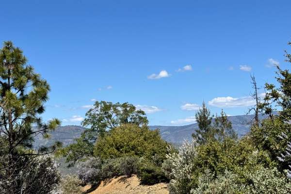
Alder Springs W.C. - FS 21N30
This trail starts off looking like it was freshly graded and then turns into a rutted-out trail. Nothing too difficult, just some sections where water was flowing down and created a rut in the road. This trail does have a few spots where you can pull off to camp as well, with some beautiful views.
Learn more about Alder Springs W.C. - FS 21N30
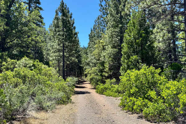
Calf Spur South - FS 27N12Y
This trail is a mix of gravel and dirt. This is a short 1-mile trail that does have some narrow spots and shelf sections. There was also a nice-sized camp spot on the trail that had a nice view of the mountains and valleys in the distance.
Learn more about Calf Spur South - FS 27N12Y
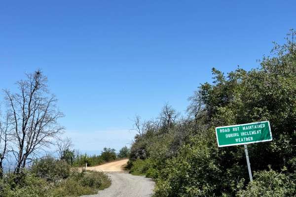
Road 307
This trail is a combination of dirt and gravel. The trail is fairly flat with the occasional rutted wash from water flow. Not far down the trail is the Rattlesnake Firefighter Memorial and the trailhead leading to their gravesites. This road states that it is not maintained in inclement weather. The...
Learn more about Road 307
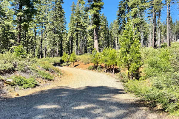
Rattlesnake - FS 27N12
This is a long trail that is a mix of dirt and gravel. There are some sections of the trail that have great views of Lassen Peak. There are a few washes along the trail and some shelf roads. There is also a small creek crossing. There are plenty of spots to pull off and camp as well. Some that can h...
Learn more about Rattlesnake - FS 27N12
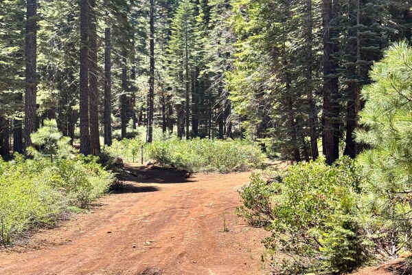
Colby Loop - FS 27N06B
This is a beautiful trail with dense green trees around it. The trail is dirt with a layer of dried pine needles. There aren't any ruts or washes along this trail at the time of mapping, but there are dead branches in and along the side of the trail. There is a nice, wide-open camp spot along the tr...
Learn more about Colby Loop - FS 27N06B
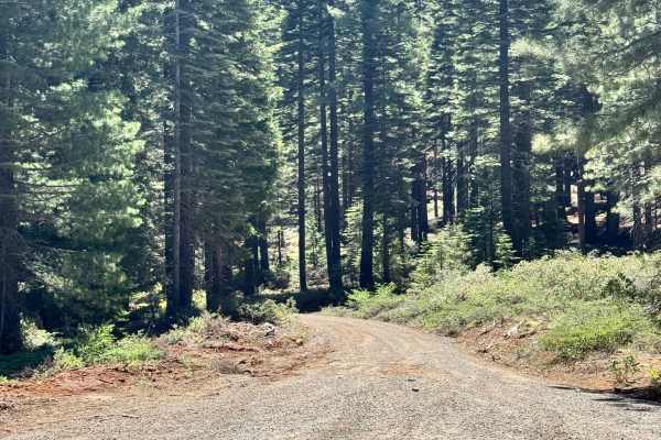
Colby Mountain Lookout - FS 27N36
This dirt trail leads up to the Colby Mountain Lookout. The trail itself is easy. Colby Mountain Lookout is at the end of the trail, and the lookout has been manned by Ken Jordan from 1985 to 2024, and will be opening back up in the 2026 season before retiring. There are obviously some great views a...
Learn more about Colby Mountain Lookout - FS 27N36
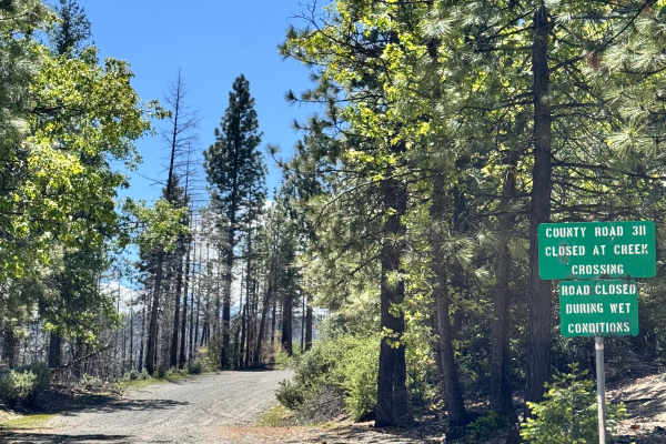
Road 311
At the beginning of the trail, there is a sign that states "closed at creek crossing". However, we did not encounter a creek crossing or any closures along this trail before it meets at M3. Where the road continues after M3 states that it's closed. This trail is a gravel trail with some rutted out s...
Learn more about Road 311
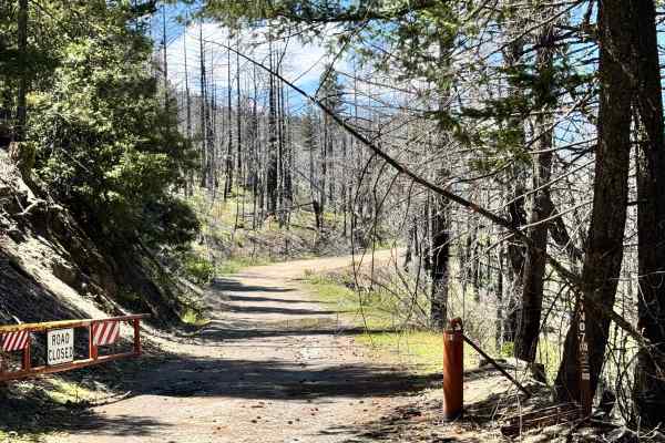
Lower Middle Ridge - FS 21N07
This trail has a gate, so it is likely closed for the winter. The trail is a hard-pack gravel road with some potholes and rutted-out sections. There are a couple of spots that get a little narrow. but does have beautiful trails. The trail looks like it was recently cleared, as there are trees along ...
Learn more about Lower Middle Ridge - FS 21N07
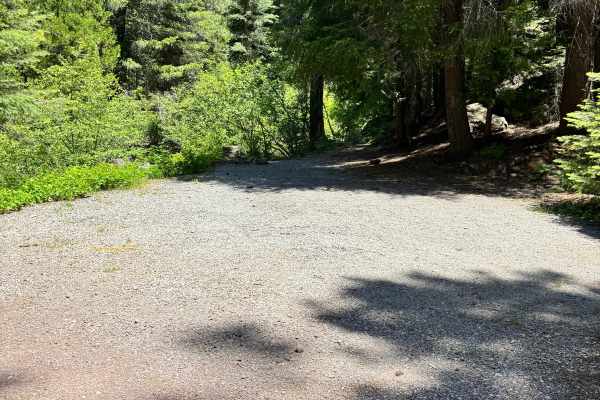
Elam Carter - FS 28N12
This is a long, mostly gravel trail. The first half of the trail is pretty flat and smooth; the second half has more wash/rut damage. There are multiple spots to pull off to camp along the trail, some spots being pretty big for multiple vehicles. The trail ends at a large area to camp as well.
Learn more about Elam Carter - FS 28N12
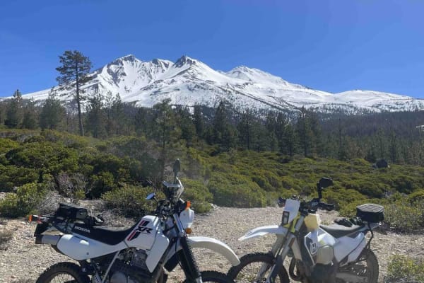
Rocky Road
This is an awesome route that takes you through some timber cuts and up and over some hills into weeds. The road is full of sun with some challenges along the way. Be aware that this route will go all the way through the weeds or to Mount Shasta City, depending on the route of travel.
Learn more about Rocky Road
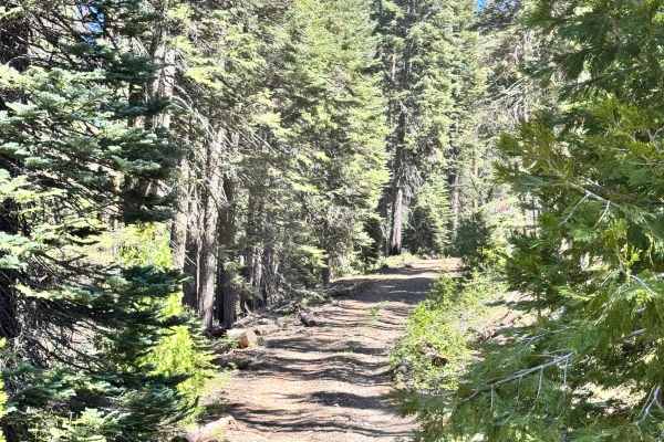
Humboldt North West - FS 27N80
This trail is a mix of dirt and gravel. The trail has small ruts but nothing big. Some of the bushes come into the trail, making it a little narrower in some sections, but it is mostly open. The trail ends with a very large flat area to camp, which can hold multiple vehicles.
Learn more about Humboldt North West - FS 27N80
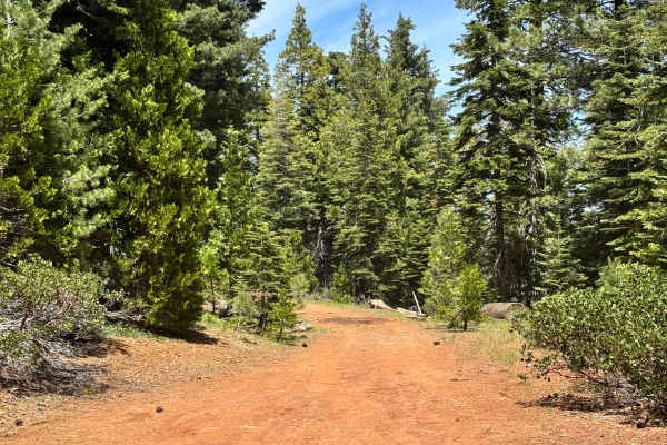
Deer Creek S - FS 28N12G
This is a dirt trail and isn't too long. There are no washes or ruts or any obstacles along this trail; it's pretty straightforward. Has a couple of cool views along the trail. There is a large camping area at the end of the trail that looks like a nice spot. Can fit multiple vehicles in it.
Learn more about Deer Creek S - FS 28N12G
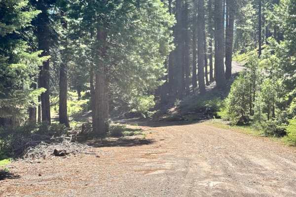
Colby Creek - FS 26N59
This trail is a mix of dirt and gravel. This trail is closed during the winter, 11/1-5/1, or as conditions allow, and has a sign and gate closing it off during the season. There are some fairly large ruts along the trail, which make some of those sections of the trail fairly narrow.
Learn more about Colby Creek - FS 26N59
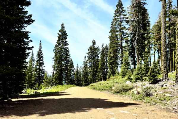
Deer Creek South - FS 28N49
This trail does go farther than it's mapped, but there was a very large tree that fell on the trail that looks like it's been there for a little bit, with the amount of dirt/ground that has grown around the sides of it. This is the eastern section of the trail. The trail did have some small washes a...
Learn more about Deer Creek South - FS 28N49
ATV trails near Igo, California
Explore ATV-friendly trails near you. These trails are accessible for vehicles up to 50 inches wide, perfect for ATVs and smaller off-road machines.
Matheson Trams
This is a fantastic trail located in the Chappie OHV area. Expect beautiful views and a nice trail that can be done in a stock UTV, dirt bike, or 4-wheeler. Be sure to stop and look at Shasta Dam, Iron Mountain Mine, and the old hang glider ramp. Bring a lunch. Multiple places along the trail are wi...
Learn more about Matheson Trams
Midway Ridge
This route takes you to the top of Midway Ridge. The trail starts as a nice wide road. The road is maintained very well and follows a mid-slope road. The trail narrows at the first creek crossing and winds through the forest. At this point, it's still easy for a side-by-side or quad. A dirt bike is ...
Learn more about Midway Ridge
Mammoth Mountain Trail 1
This is a wide-open easy trail from the Chappie staging area, past Mammoth Mountain, to a lunch spot. It's easy for all riding abilities, with a ton of overlooks along the way. During the spring, you will find a lot of waterfalls along the road. This route also goes through several burn scars, which...
Learn more about Mammoth Mountain Trail 1
Jack's Backbone
This is a fun drive up through the mountains that will require 4x4 high clearance. However, it does not require lockers. Bring a lunch and enjoy the backcountry, with some great views of valleys and mountains.
Learn more about Jack's Backbone
UTV/side-by-side trails near Igo, California
Find UTV and side-by-side trails near you. These trails accommodate vehicles up to 60 inches wide, ideal for UTVs, side-by-sides, and wider off-road rigs.
Matheson Trams
This is a fantastic trail located in the Chappie OHV area. Expect beautiful views and a nice trail that can be done in a stock UTV, dirt bike, or 4-wheeler. Be sure to stop and look at Shasta Dam, Iron Mountain Mine, and the old hang glider ramp. Bring a lunch. Multiple places along the trail are wi...
Learn more about Matheson Trams
Midway Ridge
This route takes you to the top of Midway Ridge. The trail starts as a nice wide road. The road is maintained very well and follows a mid-slope road. The trail narrows at the first creek crossing and winds through the forest. At this point, it's still easy for a side-by-side or quad. A dirt bike is ...
Learn more about Midway Ridge
Mammoth Mountain Trail 1
This is a wide-open easy trail from the Chappie staging area, past Mammoth Mountain, to a lunch spot. It's easy for all riding abilities, with a ton of overlooks along the way. During the spring, you will find a lot of waterfalls along the road. This route also goes through several burn scars, which...
Learn more about Mammoth Mountain Trail 1
Jack's Backbone
This is a fun drive up through the mountains that will require 4x4 high clearance. However, it does not require lockers. Bring a lunch and enjoy the backcountry, with some great views of valleys and mountains.
Learn more about Jack's Backbone
The onX Offroad Difference
onX Offroad combines trail photos, descriptions, difficulty ratings, width restrictions, seasonality, and more in a user-friendly interface. Available on all devices, with offline access and full compatibility with CarPlay and Android Auto. Discover what you're missing today!
Open Trail Map