
Dirt Bike Trails
Near Heeney, Colorado
Explore All Dirt Bike Trails Near Heeney, Colorado
Dirt Bike Trails Near Heeney, Colorado
Discover the best dirt bike trails near you. Browse trail maps, check difficulty ratings, and find your next adventure — whether you're looking for a quick ride or an all-day expedition.
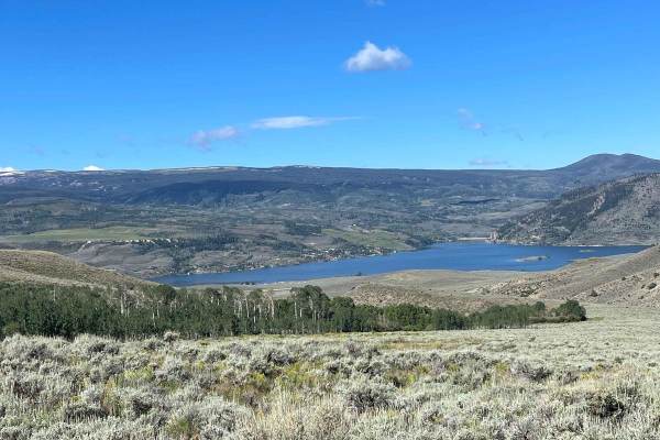
Mumford Gulch Trail
Mumford Gulch Trail is a loop trail that can be done in either direction. It is primarily dirt with 1 section with a moderate pitch. The trail goes around the perimeter of Cow Camp Gulch and Mumford Gulch. This trail features beautiful views of the Green Mountain Reservoir. There are a few camp...
Learn more about Mumford Gulch Trail
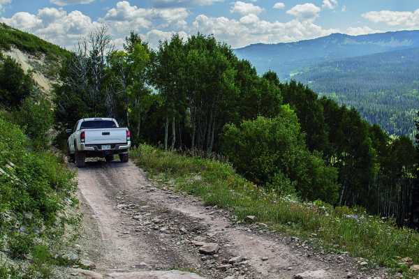
Sheephorn Mountain
Sheephorn Mountain is a scenic 15-mile off-road trail suited for stock, high-clearance SUVs, offering a blend of moderate shelf road driving and gentle dirt paths with historic farm ruins. The route starts on varied terrain as it climbs toward Sheephorn Mountain, winding through dense pine forests a...
Learn more about Sheephorn Mountain
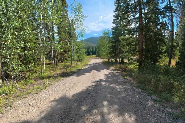
Spruce Creek Road
This short, scenic trail is accessed by a fully maintained county road that any car can drive. Within the first 40 yards, two large, level campsites can each accommodate up to 14 vehicles, with fire rings, shade, and excellent forest views. After the campsites, the trail narrows as it winds through ...
Learn more about Spruce Creek Road
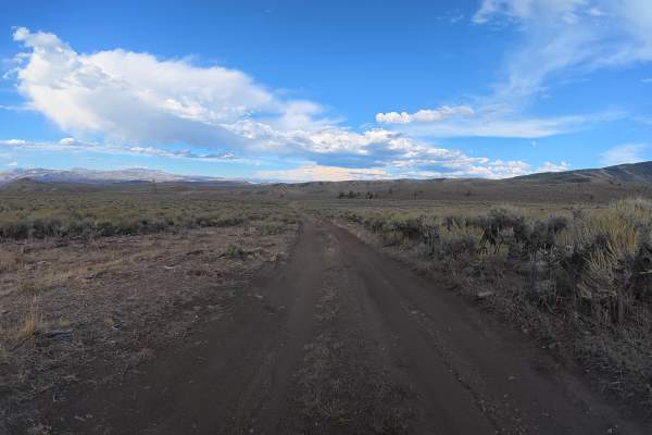
Elliot Creek
This trail is more challenging than Lawson Ridge due to the deeper ruts, off-camber sections, narrow route, and potentially slick dirt. A level campsite at the end can accommodate up to four vehicles and offers incredible mountain views. A minimum of 14 inches of front-end clearance is recommended, ...
Learn more about Elliot Creek
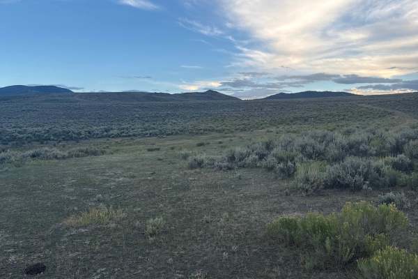
Mountain View Road
This short, scenic trail winds through overgrown vegetation with direct views toward Moore Reservoir and the surrounding mountain ranges. The narrow dirt route begins with 6–8-inch ruts, increasing to 10–14 inches farther in, with sections putting you up to 10° off-camber. Wet or rainy conditions ca...
Learn more about Mountain View Road
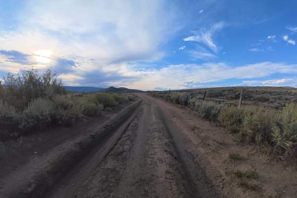
Blue Ridge Mine
This scenic trail continues beyond Elliot Creek and consists mostly of dirt on a narrow route with no room for vehicles to pass. Around 0.5 miles, a long section puts you up to 10° off-camber, which may be uncomfortable for tall Sprinter vans or other top-heavy vehicles. The trail also features uniq...
Learn more about Blue Ridge Mine
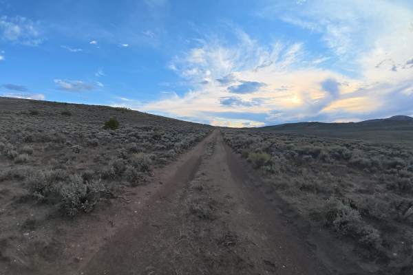
Moore Dam Road
This short, scenic trail consists mostly of dirt and climbs uphill with 5–6-inch ruts near the beginning. The narrow route does not have enough room for vehicles to pass and can become extremely difficult to drive when wet or raining. At 0.9 miles, the trail ends at a small, level campsite for one o...
Learn more about Moore Dam Road
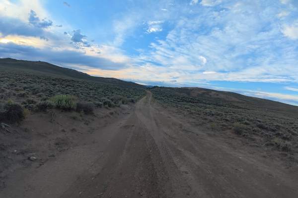
Big Lake Ditch
This short, scenic trail is mostly dirt and can become extremely difficult to drive when wet or raining. The narrow route has 6–8-inch ruts beginning around 0.4 miles, with no room for vehicles to pass. At 0.5 miles, a historic cabin sits behind a gate and can be explored on foot, making it a unique...
Learn more about Big Lake Ditch
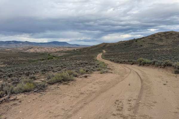
Crossover Road
This route crosses a section of BLM land between two private-property gates, providing access through a scenic valley with expansive views in every direction. Along the way, there are several dispersed campsites and a handful of short spur roads that offer opportunities to explore the surrounding te...
Learn more about Crossover Road
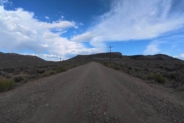
Lawson Ridge
This scenic trail breaks off Highway 9 and winds deeper into the valley, surrounded by mountains with access to other BLM trails. The wide, well-maintained route consists mostly of dirt and gravel and is suitable for cars, vans, campers, and fifth wheels. Several excellent campsites are available, i...
Learn more about Lawson Ridge
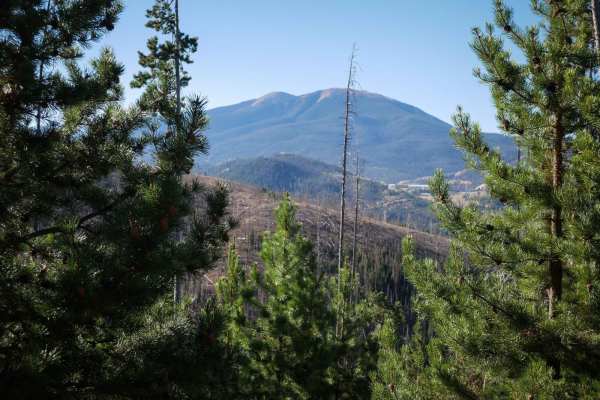
No See Um ATV Trail
This is a 5.5-mile-long ATV trail through the Arapahoe National Forest. The west end starts out behind a gate off of Keyser Ridge Road. It looks like an old Jeep road that has been repurposed into an ATV Trail. It goes straight and flat for a long while through pine trees along the edge of a hillsid...
Learn more about No See Um ATV Trail
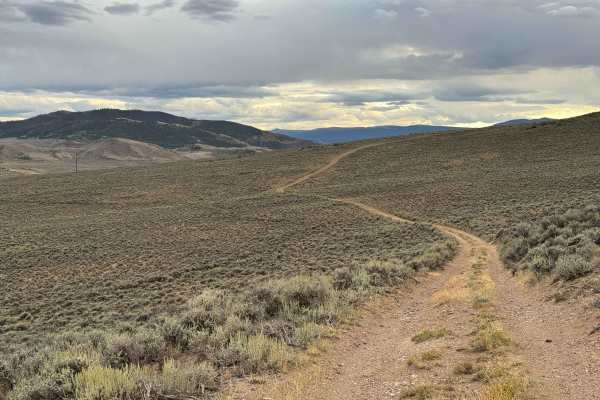
High Road
This is a relatively short and scenic backcountry road that follows the base of the mountain, winding gently along the natural contours of the terrain. The route travels through open sagebrush country and offers several short spur roads along the way, providing access to different viewpoints and a f...
Learn more about High Road
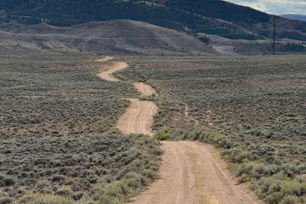
Junction Butte Road
This is a relatively short and straightforward off-road route that provides an enjoyable climb to a small mesa with expansive views across the surrounding landscape. The trail begins with a steady, consistent ascent and, once reaching the top of the mesa, transitions into a mostly level route with e...
Learn more about Junction Butte Road
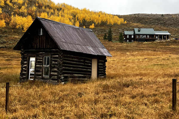
County Road 1
County Road 1 is a very easy, gravel, fun, and scenic road that connects you to other activities such as access to the Blue and Colorado River, Gore Canyon, and fall peeping. The entire CR-1 road is mostly unpaved. There will be a beautiful vista further down the road, the headwaters of the Colorado...
Learn more about County Road 1
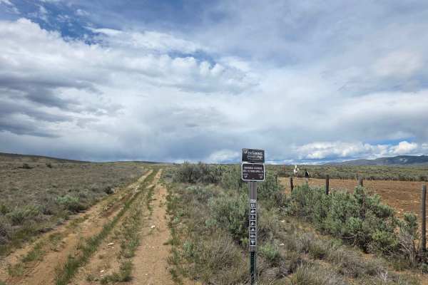
Red Mountain Trail
Rutted and dusty, but easy in any stock SUV or Pickup. Great ride on an adventure bike to get your feet wet while you warm up for some of the more challenging trails around. This 1.9-mile road will have you climb 565 feet from US HWY 40 to the top of Red Mountain, where a beautiful view and a nice f...
Learn more about Red Mountain Trail
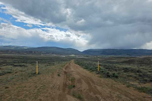
West Red Mountain
Off-road trail with some heavy rutting through Sate and BLM land. Lifted vehicles, adventure bikes, and other off-road capable machines only through here, as the rutting can get deep enough to high-center smaller vehicles. Pleasant ride while dry, but will be almost impassable in the wrong vehicle i...
Learn more about West Red Mountain
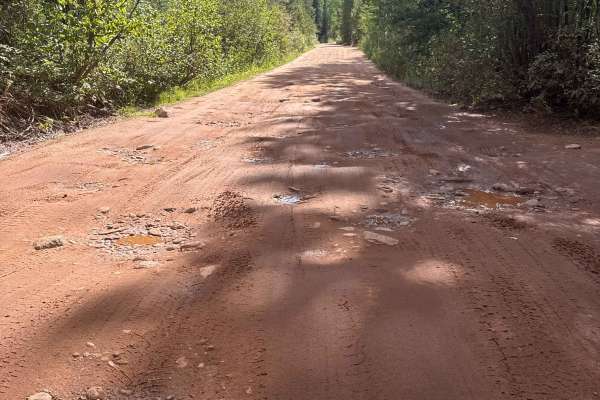
South Fork Piney - FS 701
This historic trail is a hard packed dirt trail, plentiful with small boulders, mud holes and washboard surfaces. The trail is wide enough for vehicles to pass and offers many camp sites along the route ending at Piney River Ranch. The route is typically open June 21 til November 22, check with Wh...
Learn more about South Fork Piney - FS 701
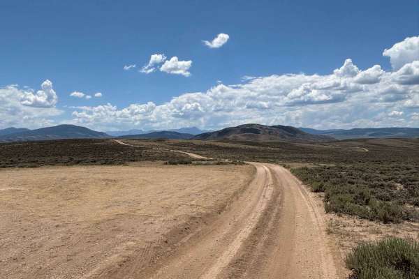
North Red Mountain Cutoff
This trail provides another way to access the popular Red Mountain Trail while offering expansive views of the beautiful surrounding hills, valleys, and distant mountain peaks. The route itself is a simple dirt road with no significant obstacles, making it an easy and scenic approach to one of the a...
Learn more about North Red Mountain Cutoff
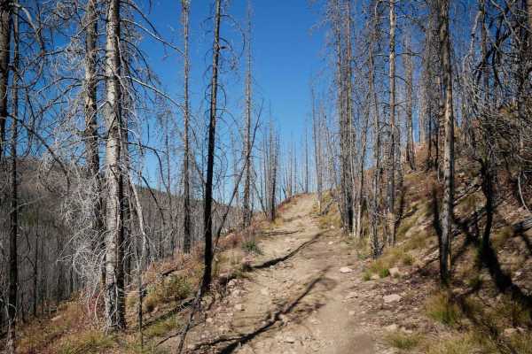
Richey Creek ATV Trail
Richey Creek is a wide two-track through pine trees, with small loose rocks in the trail. It has easy curves as it follows the edge of the mountain, with lots of branches and cut logs sticking out from the trees that you need to watch out for. It crosses a little muddy section, and goes pretty strai...
Learn more about Richey Creek ATV Trail
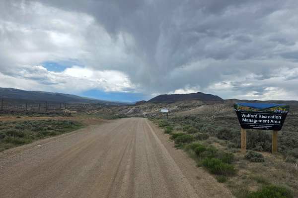
County Highway 224
County Highway 224 through the Wolford Open are and OHV Play area.
The route varies from well to poorly maintained and has potential for a water crossing. While there are no ledges or obstacles to be concerned about (other than the potential water crossing at 40.09633, --106.37961), caution should...
Learn more about County Highway 224
ATV trails near Heeney, Colorado
Explore ATV-friendly trails near you. These trails are accessible for vehicles up to 50 inches wide, perfect for ATVs and smaller off-road machines.
Sheephorn Mountain
Sheephorn Mountain is a scenic 15-mile off-road trail suited for stock, high-clearance SUVs, offering a blend of moderate shelf road driving and gentle dirt paths with historic farm ruins. The route starts on varied terrain as it climbs toward Sheephorn Mountain, winding through dense pine forests a...
Learn more about Sheephorn Mountain
Spruce Creek Road
This short, scenic trail is accessed by a fully maintained county road that any car can drive. Within the first 40 yards, two large, level campsites can each accommodate up to 14 vehicles, with fire rings, shade, and excellent forest views. After the campsites, the trail narrows as it winds through ...
Learn more about Spruce Creek Road
Elliot Creek
This trail is more challenging than Lawson Ridge due to the deeper ruts, off-camber sections, narrow route, and potentially slick dirt. A level campsite at the end can accommodate up to four vehicles and offers incredible mountain views. A minimum of 14 inches of front-end clearance is recommended, ...
Learn more about Elliot Creek
Mountain View Road
This short, scenic trail winds through overgrown vegetation with direct views toward Moore Reservoir and the surrounding mountain ranges. The narrow dirt route begins with 6–8-inch ruts, increasing to 10–14 inches farther in, with sections putting you up to 10° off-camber. Wet or rainy conditions ca...
Learn more about Mountain View Road
UTV/side-by-side trails near Heeney, Colorado
Find UTV and side-by-side trails near you. These trails accommodate vehicles up to 60 inches wide, ideal for UTVs, side-by-sides, and wider off-road rigs.
Sheephorn Mountain
Sheephorn Mountain is a scenic 15-mile off-road trail suited for stock, high-clearance SUVs, offering a blend of moderate shelf road driving and gentle dirt paths with historic farm ruins. The route starts on varied terrain as it climbs toward Sheephorn Mountain, winding through dense pine forests a...
Learn more about Sheephorn Mountain
Spruce Creek Road
This short, scenic trail is accessed by a fully maintained county road that any car can drive. Within the first 40 yards, two large, level campsites can each accommodate up to 14 vehicles, with fire rings, shade, and excellent forest views. After the campsites, the trail narrows as it winds through ...
Learn more about Spruce Creek Road
Elliot Creek
This trail is more challenging than Lawson Ridge due to the deeper ruts, off-camber sections, narrow route, and potentially slick dirt. A level campsite at the end can accommodate up to four vehicles and offers incredible mountain views. A minimum of 14 inches of front-end clearance is recommended, ...
Learn more about Elliot Creek
Mountain View Road
This short, scenic trail winds through overgrown vegetation with direct views toward Moore Reservoir and the surrounding mountain ranges. The narrow dirt route begins with 6–8-inch ruts, increasing to 10–14 inches farther in, with sections putting you up to 10° off-camber. Wet or rainy conditions ca...
Learn more about Mountain View Road
The onX Offroad Difference
onX Offroad combines trail photos, descriptions, difficulty ratings, width restrictions, seasonality, and more in a user-friendly interface. Available on all devices, with offline access and full compatibility with CarPlay and Android Auto. Discover what you're missing today!
Open Trail Map