
Dirt Bike Trails
Near Halls Crossing, Utah
Explore All Dirt Bike Trails Near Halls Crossing, Utah
Dirt Bike Trails Near Halls Crossing, Utah
Discover the best dirt bike trails near you. Browse trail maps, check difficulty ratings, and find your next adventure — whether you're looking for a quick ride or an all-day expedition.
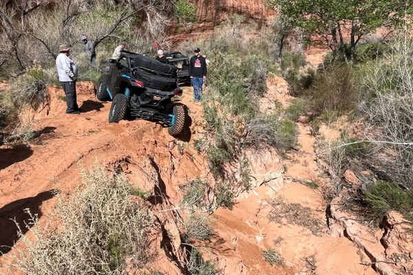
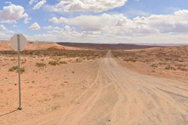
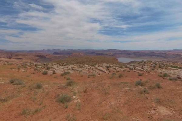
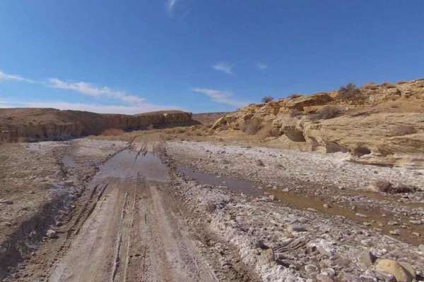
Hole in the Rock
This was part of the original route to the hole in the rock. It was washed out and a new route was created. Fun route to go to where the washout is, with some nice red rock climbs and decent. some sand to deal with and lots of erosion at the end. We were not aware of the washout till we came upon it...
Learn more about Hole in the Rock
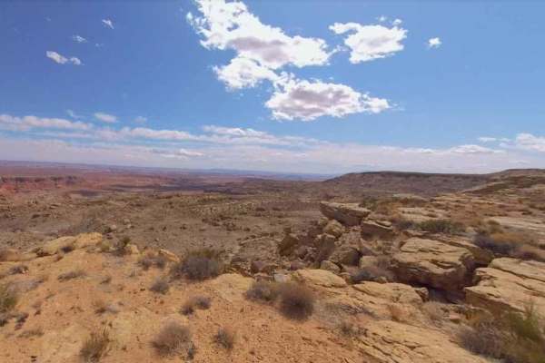
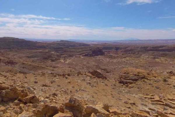
Saleratus Point-BLM13260
Saleratus Point-BLM13260 is a 3.1-mile out-and-back trail rated 3 of 10 located in Garfield County, Utah on the southernmost section of the Henry Mountains. Saleratus Point is the last major point on the south end of the Henry Mountains. The trail does extend past the point, however, it is not advis...
Learn more about Saleratus Point-BLM13260
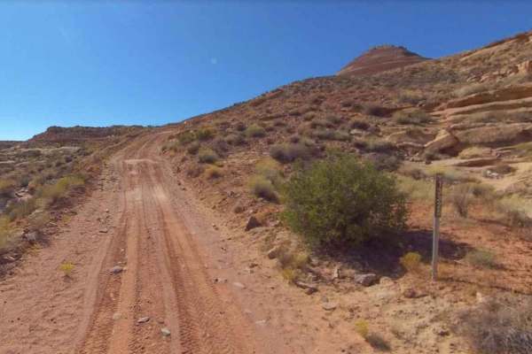
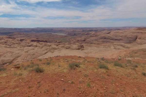
Lookout Point
This trail was most likely a route to get water to livestock. There is a solar-powered pump at the end of the road. It starts with a steep climb that is very off-camber--that is the reason for a higher rating. It follows the plateau with nice views of the surrounding area. If you look carefully, you...
Learn more about Lookout Point
BLM13430
BLM13430 is a 5.8-mile loop trail rated 3 of 10 located in Garfield County, Utah, just north of the Glen Canyon National Recreational Area. BLM13430 is one of the easternmost accessible trails within the Cane Spring Desert. This looping single-track trail connects to Ticaboo Mesa Road on both ends. ...
Learn more about BLM13430
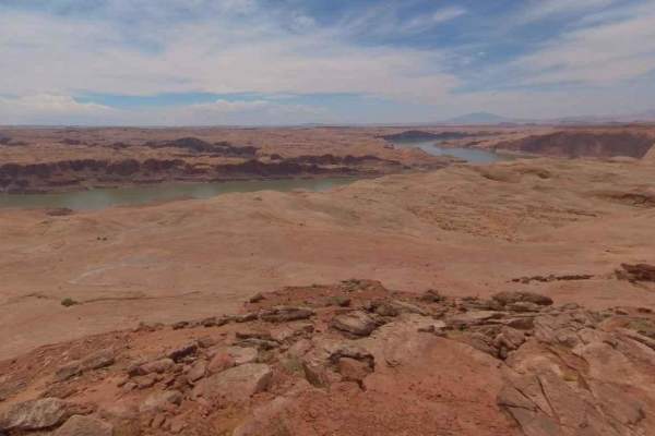
Spring Desert Road - BLM13410
Spring Desert Road-BLM13410 is an 8.6-mile point-to-point trail rated 3 of 10 located in Garfield County, Utah, just north of the Glen Canyon National Recreational Area. Spring Desert Road is the primary north/south trail that provides access to a series of trails that overlook Powell Lake and the C...
Learn more about Spring Desert Road - BLM13410
Ticaboo Mesa Road - BLM13400
Ticaboo Mesa Rd-BLM13400 is a 10-mile out-and-back trail rated 3 of 10 located in Garfield County, Utah just north of the Glen Canyon National Recreational Area. Ticaboo Mesa Road is the primary access to a series of trails that overlook Powell Lake and the Colorado River. The trail crosses a sectio...
Learn more about Ticaboo Mesa Road - BLM13400
Tom Canyon-BLM13200
Tom Canyon-BLM13200 is a 4.1-mile out-and-back rated 3 of 10 located in Garfield County, Utah on the southernmost section of the Henry Mountains. Tom Canyon is the easternmost view point of the four fingers made up of Clay, Clay South Saleratus Points, and Tom Canyon. This is a single-track dirt tra...
Learn more about Tom Canyon-BLM13200

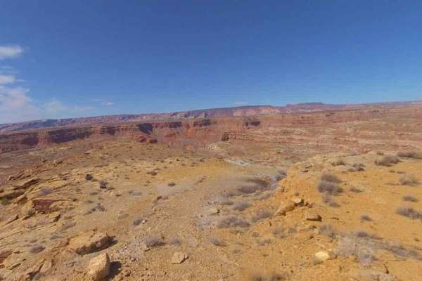
Hansen Creek-BLM13390
Hansen Creek-BLM13390 is a 7.4-mile point-to-point trail rated 3 of 10 located in Garfield County, Utah on the southernmost section of the Henry Mountains. Hansen Creek Trail runs through a narrow canyon of red rock and generally follows the Hansen Creek. The trail crosses the creek several times, s...
Learn more about Hansen Creek-BLM13390
Clay Point South-BLM13225
Clay Point South-BLM13225 is a 2.1-mile out-and-back trail rated 3 of 10 located in Garfield County, Utah on the southernmost section of the Henry Mountains. This trail and the sister trail Clay Point ends at Vista views of Clay Canyon and Creek and points south. Looking west beyond Clay Canyon the ...
Learn more about Clay Point South-BLM13225
BLM13480
BLM13480 is a 4.5-mile loop trail rated 3 of 10 located in Garfield County, Utah, just north of the Glen Canyon National Recreational Area. BLM13480 is one of the easternmost accessible trails within the Cane Spring Desert. This looping single-track trail runs from the eastern end of Ticaboo Mesa Ro...
Learn more about BLM13480
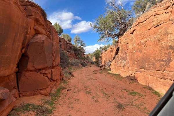
Mule Shoe
Mule Shoe is a sand wash that leads to a narrow canyon. It has a few gates to open and close due to it being in an open range. It's very interesting to see what ranchers use to hold up their solar panels for the water wells throughout the area. This is a fun little in-and-out trail; it probably goes...
Learn more about Mule Shoe

BLM13476
BLM13476 is a 1.7-mile trail rated 3 of 10 located in Garfield County, Utah just north of the Glen Canyon National Recreational Area. BLM13476 is a connector trail that provides access to BLM13480 and the overlook view at Good Hope Bar. This single-track trail has no significant points of interest o...
Learn more about BLM13476
BLM13470
BLM13470 is a 1.1-mile out-and-back trail rated 3 of 10 located in Garfield County, Utah, just north of the Glen Canyon National Recreational Area. BLM13470 is the easternmost accessible trail within the Cane Spring Desert. This short, single-track trail runs from the eastern end of Ticaboo Mesa Roa...
Learn more about BLM13470
Clay Point-BLM13220
Clay Point-BLM13220 is a 2-mile out-and-back trail rated 3 of 10 located in Garfield County, Utah on the southernmost section of the Henry Mountains. This trail and the sister trail Clay Point South ends at vista views of Clay Canyon and Creek and points south. Looking west beyond Clay Canyon the Gr...
Learn more about Clay Point-BLM13220
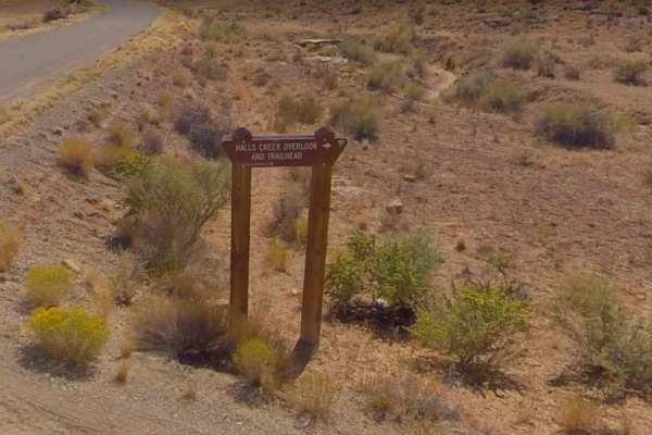
Big Thompson Mesa Road-BLM12200
Big Thompson Mesa Road-BLM12200 is a 9.2-mile point-to-point trail rated 3 of 10 located in Garfield County, Utah on the southernmost section of the Henry Mountains. This is a dirt single-track trail that starts and ends on Burr Trail Road (BLM12000). A key feature of this trail is a stop at Halls C...
Learn more about Big Thompson Mesa Road-BLM12200
BLM13310
BLM13310 is a 2.5-mile point-to-point trail rated 3 of 10 located in Garfield County, Utah on the southernmost section of the Henry Mountains. BLM13310 transits some of the most unique geological formations within the Henry Mountain area. There are several short (less than half mile) trails leading ...
Learn more about BLM13310

BLM13325
BLM13325 is a 1.5-mile point-to-point trail rated 3 of 10 located in Garfield County, Utah on the southernmost section of the Henry Mountains. BLM13325 runs through some of the most unique geological formations within the Henry Mountain area. There are several short (less than half mile) trails lead...
Learn more about BLM13325
BLM13040
BLM13040 is a 7-mile point-to-point trail rated 3 of 10 located in Garfield County, Utah on the southernmost section of the Henry Mountains. BLM13040 is a single-lane desert track that runs north/south and connects the lower desert wash area and the southern end of the Henry Mountains. There are sev...
Learn more about BLM13040
Purple Hills Road
Purple Hills Road is a 6.6-mile out-and-back trail rated 3 of 10 located in Garfield County, Utah. The Purple Hills Road is a side trail off the Moody Hills Road which leads to the center of the named area "Purple Hills." The Purple Hills are a remote area within the Glen Canyon National Recreationa...
Learn more about Purple Hills Road
Eggnog Star Springs Road-BLM13000
Eggnog Star Springs Road-BLM13000 is a 26.7-mile point-to-point trail rated 3 of 10 located in Garfield County, Utah on the southernmost section of the Henry Mountains. Eggnog Star is a two-track road that is generally suited for 2 or 4WD vehicles. However, it should be noted that several creek cros...
Learn more about Eggnog Star Springs Road-BLM13000
ATV trails near Halls Crossing, Utah
Explore ATV-friendly trails near you. These trails are accessible for vehicles up to 50 inches wide, perfect for ATVs and smaller off-road machines.
Hole in the Rock
This was part of the original route to the hole in the rock. It was washed out and a new route was created. Fun route to go to where the washout is, with some nice red rock climbs and decent. some sand to deal with and lots of erosion at the end. We were not aware of the washout till we came upon it...
Learn more about Hole in the Rock
Saleratus Point-BLM13260
Saleratus Point-BLM13260 is a 3.1-mile out-and-back trail rated 3 of 10 located in Garfield County, Utah on the southernmost section of the Henry Mountains. Saleratus Point is the last major point on the south end of the Henry Mountains. The trail does extend past the point, however, it is not advis...
Learn more about Saleratus Point-BLM13260
Lookout Point
This trail was most likely a route to get water to livestock. There is a solar-powered pump at the end of the road. It starts with a steep climb that is very off-camber--that is the reason for a higher rating. It follows the plateau with nice views of the surrounding area. If you look carefully, you...
Learn more about Lookout Point
BLM13430
BLM13430 is a 5.8-mile loop trail rated 3 of 10 located in Garfield County, Utah, just north of the Glen Canyon National Recreational Area. BLM13430 is one of the easternmost accessible trails within the Cane Spring Desert. This looping single-track trail connects to Ticaboo Mesa Road on both ends. ...
Learn more about BLM13430
UTV/side-by-side trails near Halls Crossing, Utah
Find UTV and side-by-side trails near you. These trails accommodate vehicles up to 60 inches wide, ideal for UTVs, side-by-sides, and wider off-road rigs.
Hole in the Rock
This was part of the original route to the hole in the rock. It was washed out and a new route was created. Fun route to go to where the washout is, with some nice red rock climbs and decent. some sand to deal with and lots of erosion at the end. We were not aware of the washout till we came upon it...
Learn more about Hole in the Rock
Saleratus Point-BLM13260
Saleratus Point-BLM13260 is a 3.1-mile out-and-back trail rated 3 of 10 located in Garfield County, Utah on the southernmost section of the Henry Mountains. Saleratus Point is the last major point on the south end of the Henry Mountains. The trail does extend past the point, however, it is not advis...
Learn more about Saleratus Point-BLM13260
Lookout Point
This trail was most likely a route to get water to livestock. There is a solar-powered pump at the end of the road. It starts with a steep climb that is very off-camber--that is the reason for a higher rating. It follows the plateau with nice views of the surrounding area. If you look carefully, you...
Learn more about Lookout Point
BLM13430
BLM13430 is a 5.8-mile loop trail rated 3 of 10 located in Garfield County, Utah, just north of the Glen Canyon National Recreational Area. BLM13430 is one of the easternmost accessible trails within the Cane Spring Desert. This looping single-track trail connects to Ticaboo Mesa Road on both ends. ...
Learn more about BLM13430
The onX Offroad Difference
onX Offroad combines trail photos, descriptions, difficulty ratings, width restrictions, seasonality, and more in a user-friendly interface. Available on all devices, with offline access and full compatibility with CarPlay and Android Auto. Discover what you're missing today!
Open Trail Map