
Dirt Bike Trails
Near Graniteville, California
Explore All Dirt Bike Trails Near Graniteville, California
Dirt Bike Trails Near Graniteville, California
Discover the best dirt bike trails near you. Browse trail maps, check difficulty ratings, and find your next adventure — whether you're looking for a quick ride or an all-day expedition.
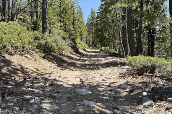
Weaver Lake
Weaver Lake FS 843-043 is a trail in the Tahoe National Forest that branches off from Bowman Lake Road. The trail starts at 5600 feet, climbs to 5900 feet, and descends to 5300 feet. The trail begins with a climb up over rocks and roots and has some scenic views of Lake Bowman. The trail continues u...
Learn more about Weaver Lake
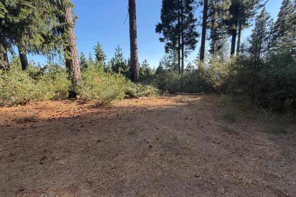
Clear Creek - FS 18-014
Clear Creek - FS 18-014 is an out-and-back single track dirt road that branches off Bowman Lake Road in Tahoe National Forest. Pull offs with room for a single vehicle appear periodically along the way, including a spot around 0.3 miles that opens to filtered views across the hillside through the tr...
Learn more about Clear Creek - FS 18-014
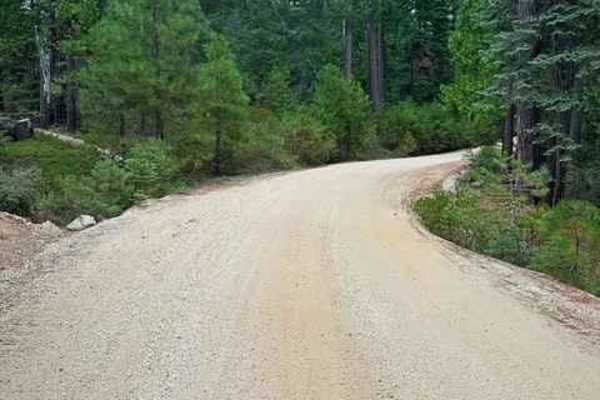
Washington Gaston
The trail begins just beyond the charming town of Washington, nestled among towering, lush green pine trees. Shortly after the town, the well-maintained gravel road winds through dense forests of pine and spruce trees, traversing the mountain slopes. Along the way, you will pass a few private proper...
Learn more about Washington Gaston
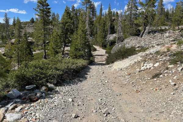
Meadow Lake Road
Meadow Lake Road is the continuation of the Bowman Lake Road trail. The scenery is breathtaking and the camping and recreational opportunities are plentiful. This area of the Sierra Nevada usually is snow-free sometime in late May. A California campfire permit is necessary, and later in the season, ...
Learn more about Meadow Lake Road
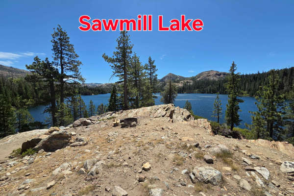
Sawmill Lake
Sawmill Lake Trail begins with a gentle climb from the Faucherie Lake Trail. As you crest the first hill, you’ll catch your first glimpse of Sawmill Lake. There are campsites on the lakeside of the trail just after the crest, making them a good choice for those with stock rigs. As you continue, the ...
Learn more about Sawmill Lake
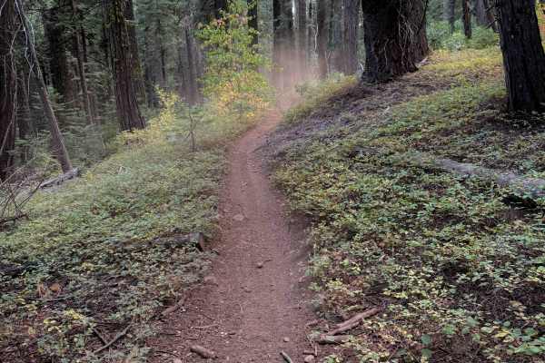
Last Chance (#55)
This is a fun singletrack on the north side of the Burlington Trail System, easily accessed from FS 20-016, which has a couple dispersed campsites and an area to park a few vehicles to stage. From the west entrance to the trail, it curves tightly through the forest for about 2 miles, making quick ha...
Learn more about Last Chance (#55)
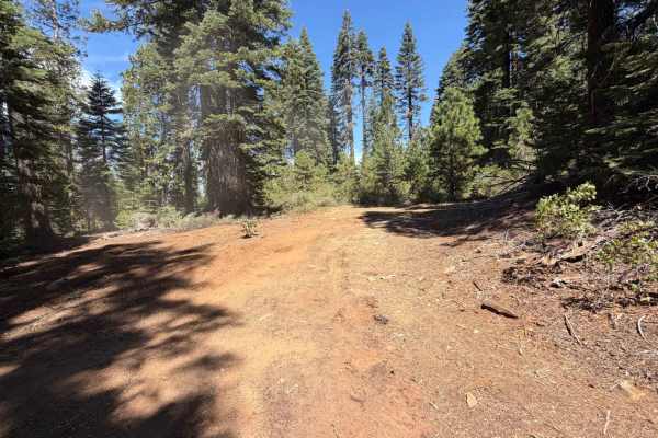
Diamond Creek - FS 20-016
Diamond Creek is a wide dirt spur that branches off Highway 20 in Tahoe National Forest, running north into a network of dispersed camping areas and connecting trails. The surface stays flat and well-traveled for its full 4 miles, easily supporting two-way travel throughout. Several large, open clea...
Learn more about Diamond Creek - FS 20-016
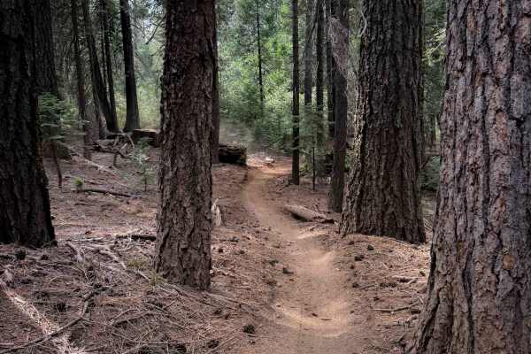
Omega Overlook (#54)
This easy singletrack runs along the north side of the Burlington Trail System, north of Highway 20. The west end crosses the highway to access the rest of the Burlington Trail System, while the east end connects to the singletrack Last Chance #55. The Omega Observation Site/Scenic View Area is a gr...
Learn more about Omega Overlook (#54)
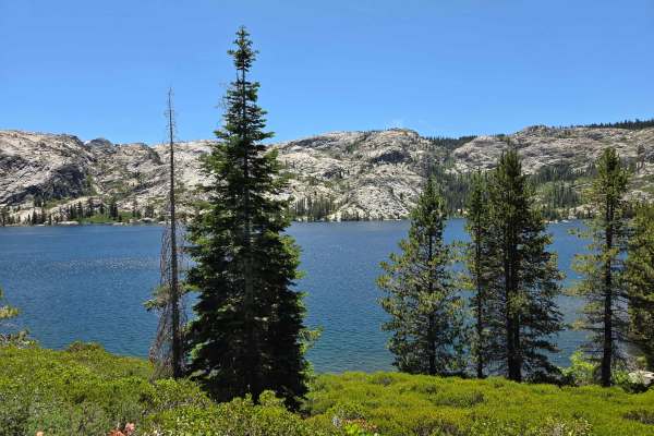
Faucherie Lake
This trail begins just east of Bowman Lake at the Jackson Creek Campground. The trail is marked with a few signs and features a large pullout at the starting point. It offers a bumpy, rocky ride with several water bars and small creek crossings, which most stock SUVs can handle, depending on the sea...
Learn more about Faucherie Lake
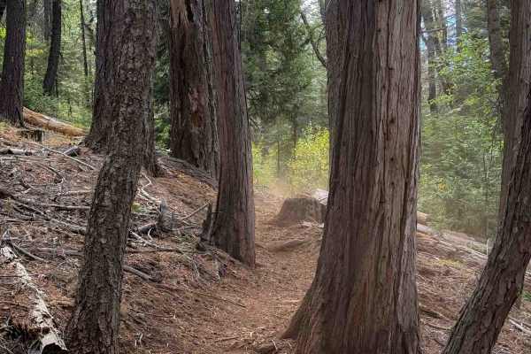
Stanton (#9)
The majority of this trail is a tight and winding singletrack through a dry pine forest on dusty loose dirt. Some of the sections are tighter between the leafy dogwoods, and other sections are more open and sparsely lined with big pines and cedars. There was a lot of stick debris in the trail and lo...
Learn more about Stanton (#9)
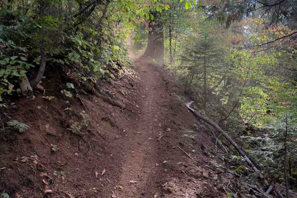
Omega (#5)
This is a 4-mile-long easy singletrack in the Burlington Trail System. The entrance off of FS 32-004 starts out as a wide corridor between the trees, more like an old shelf road, as it gradually descends down to the intersection with #9. Continuing clockwise, it goes through a narrow corridor betwee...
Learn more about Omega (#5)
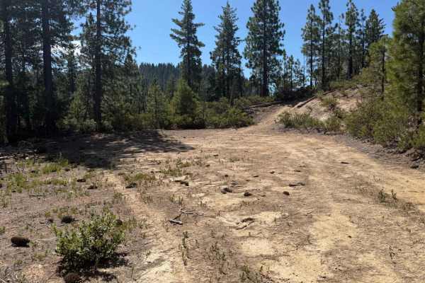
East Excelsior Point - FS 20-017-04
East Excelsior Point is a wide, single-track dirt spur that runs out-and-back to the southeast, part of the Burlington OHV Trail System off Highway 20 in Tahoe National Forest. The route holds a flat, easy grade for its full 2.1 miles, opening into occasional clearings with room to pull off along th...
Learn more about East Excelsior Point - FS 20-017-04
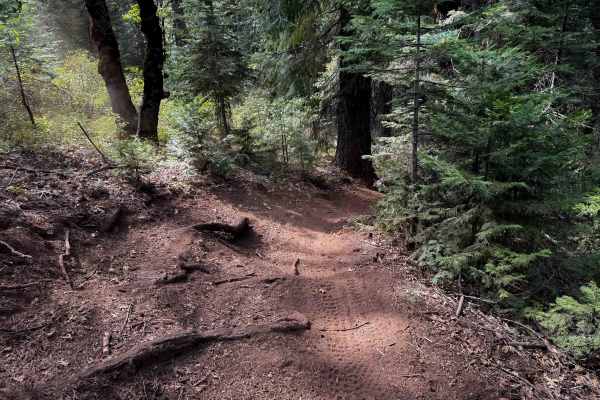
Towle Mill (#66)
Towle Mill is a 10 mile long tight and winding singletrack loop in the Burlington Trail System. It is easily accessed south of the Skillman Campground off of FS 20-012. The terrain is very similar throughout the entire route, as it continuously winds throughout the rolling forest floor, curving arou...
Learn more about Towle Mill (#66)
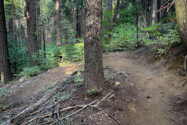
Deer Creek (#25)
This is a long route that winds through the forest on a smooth dirt path with constant sharp turns. The terrain is very similar through the majority of the route, as the trail winds through the tall pine trees, constantly doubling back on itself with big switchbacks and hairpins like a turn track. S...
Learn more about Deer Creek (#25)
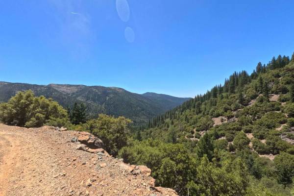
Sierra Buttes Road
Sierra Buttes Road is a very scenic and approachable dirt trail that conveniently kicks off right outside a local neighborhood near the Sierra City transfer station. As you leave the pavement behind, you will embark on a gradual, continuous climb up the forested mountain. The trail primarily consist...
Learn more about Sierra Buttes Road
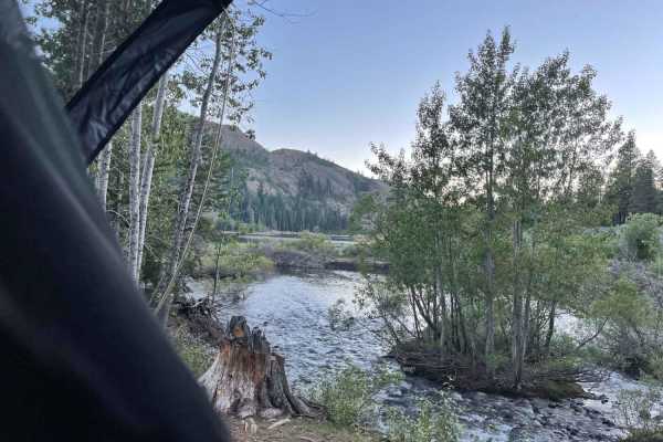
Bowman Lake
The first part of the trail is paved. About 2/3rds of the way in, it becomes rocky and dirty. High clearance is recommended. There is one tricky hairpin about 1 mile from camp. Other than that, it is a relatively easy track. The last bit is super nice because you are driving right along the lake and...
Learn more about Bowman Lake
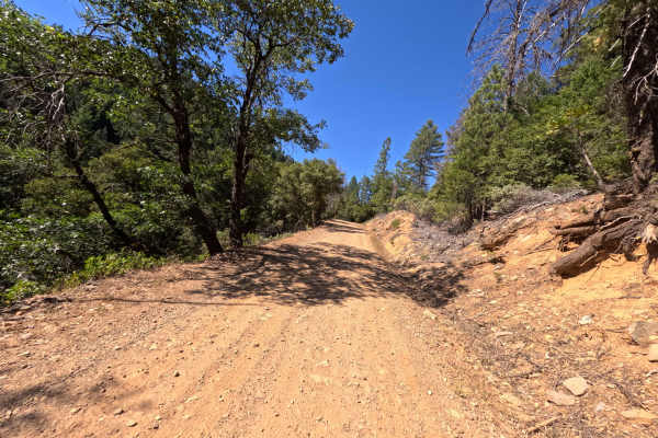
Lavezzola Road
Lavezzola Road is a scenic and relaxing journey through the thick, vibrant pine forest. The adventure begins on a brief paved section passing by some rustic green outbuildings before quickly transitioning into a wide, graded packed-dirt and gravel track. As you wind your way through the tall timber,...
Learn more about Lavezzola Road
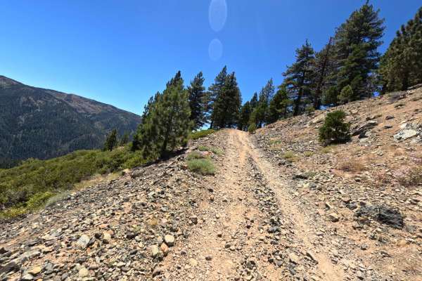
Butcher Ranch Road - FS 12E07
Butcher Ranch Road - FS 12E07 serves as a scenic but rugged connector road linking Sierra Buttes Road with the Monarch - FS 93 trail situated high above Sierra City. Early on, as indicated by the prominent signage marking the end of the county-maintained road in the photos, you will pass through a s...
Learn more about Butcher Ranch Road - FS 12E07
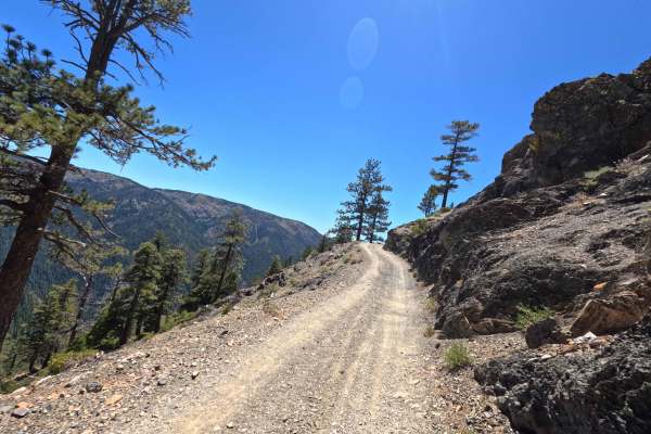
Monarch Road - FS 93-002
Monarch - FS 93-002, accessed from Sierra City via Sierra Buttes Road and Butcher Ranch Road - FS 12E07, delivers a highly scenic but demanding journey as it steadily climbs its way up to Packer Saddle. The trail starts relatively tame before aggressively ramping up the intensity. This route is sign...
Learn more about Monarch Road - FS 93-002
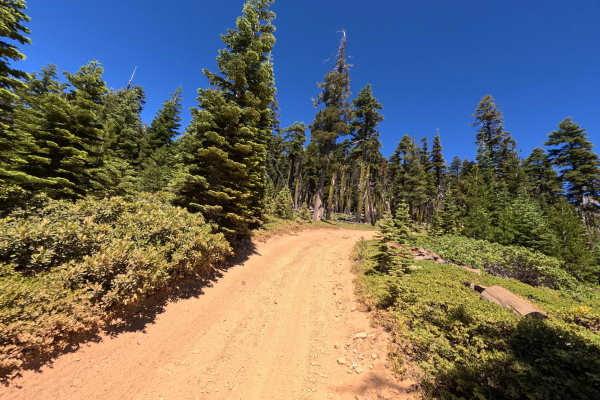
Monarch Spur - FS 93-002-03
Monarch Spur - FS 93-002-03 offers a short but wonderfully scenic drive. This half-mile spur branches off from Monarch Road and gently winds its way up through a beautiful, tall pine forest. The surface is mostly packed reddish-orange dirt mixed with a fair amount of loose gravel and small rocks, bu...
Learn more about Monarch Spur - FS 93-002-03
ATV trails near Graniteville, California
Explore ATV-friendly trails near you. These trails are accessible for vehicles up to 50 inches wide, perfect for ATVs and smaller off-road machines.
Weaver Lake
Weaver Lake FS 843-043 is a trail in the Tahoe National Forest that branches off from Bowman Lake Road. The trail starts at 5600 feet, climbs to 5900 feet, and descends to 5300 feet. The trail begins with a climb up over rocks and roots and has some scenic views of Lake Bowman. The trail continues u...
Learn more about Weaver Lake
Clear Creek - FS 18-014
Clear Creek - FS 18-014 is an out-and-back single track dirt road that branches off Bowman Lake Road in Tahoe National Forest. Pull offs with room for a single vehicle appear periodically along the way, including a spot around 0.3 miles that opens to filtered views across the hillside through the tr...
Learn more about Clear Creek - FS 18-014
Washington Gaston
The trail begins just beyond the charming town of Washington, nestled among towering, lush green pine trees. Shortly after the town, the well-maintained gravel road winds through dense forests of pine and spruce trees, traversing the mountain slopes. Along the way, you will pass a few private proper...
Learn more about Washington Gaston
Meadow Lake Road
Meadow Lake Road is the continuation of the Bowman Lake Road trail. The scenery is breathtaking and the camping and recreational opportunities are plentiful. This area of the Sierra Nevada usually is snow-free sometime in late May. A California campfire permit is necessary, and later in the season, ...
Learn more about Meadow Lake Road
UTV/side-by-side trails near Graniteville, California
Find UTV and side-by-side trails near you. These trails accommodate vehicles up to 60 inches wide, ideal for UTVs, side-by-sides, and wider off-road rigs.
Weaver Lake
Weaver Lake FS 843-043 is a trail in the Tahoe National Forest that branches off from Bowman Lake Road. The trail starts at 5600 feet, climbs to 5900 feet, and descends to 5300 feet. The trail begins with a climb up over rocks and roots and has some scenic views of Lake Bowman. The trail continues u...
Learn more about Weaver Lake
Clear Creek - FS 18-014
Clear Creek - FS 18-014 is an out-and-back single track dirt road that branches off Bowman Lake Road in Tahoe National Forest. Pull offs with room for a single vehicle appear periodically along the way, including a spot around 0.3 miles that opens to filtered views across the hillside through the tr...
Learn more about Clear Creek - FS 18-014
Washington Gaston
The trail begins just beyond the charming town of Washington, nestled among towering, lush green pine trees. Shortly after the town, the well-maintained gravel road winds through dense forests of pine and spruce trees, traversing the mountain slopes. Along the way, you will pass a few private proper...
Learn more about Washington Gaston
Meadow Lake Road
Meadow Lake Road is the continuation of the Bowman Lake Road trail. The scenery is breathtaking and the camping and recreational opportunities are plentiful. This area of the Sierra Nevada usually is snow-free sometime in late May. A California campfire permit is necessary, and later in the season, ...
Learn more about Meadow Lake Road
The onX Offroad Difference
onX Offroad combines trail photos, descriptions, difficulty ratings, width restrictions, seasonality, and more in a user-friendly interface. Available on all devices, with offline access and full compatibility with CarPlay and Android Auto. Discover what you're missing today!
Open Trail Map