
Dirt Bike Trails
Near Grand Canyon West, Arizona
Explore All Dirt Bike Trails Near Grand Canyon West, Arizona
Dirt Bike Trails Near Grand Canyon West, Arizona
Discover the best dirt bike trails near you. Browse trail maps, check difficulty ratings, and find your next adventure — whether you're looking for a quick ride or an all-day expedition.
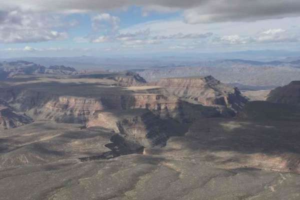
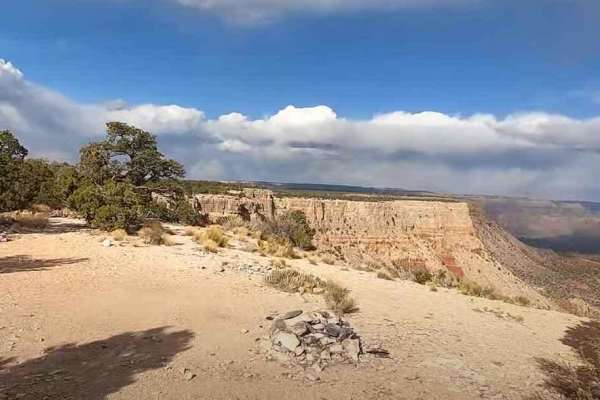
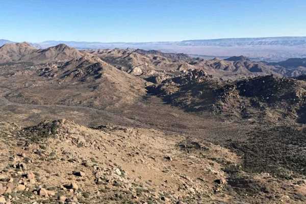
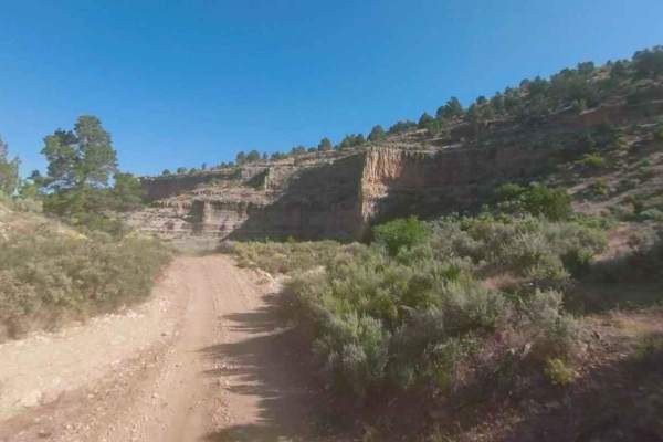
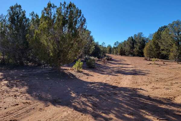
Snap Point BLM 1680
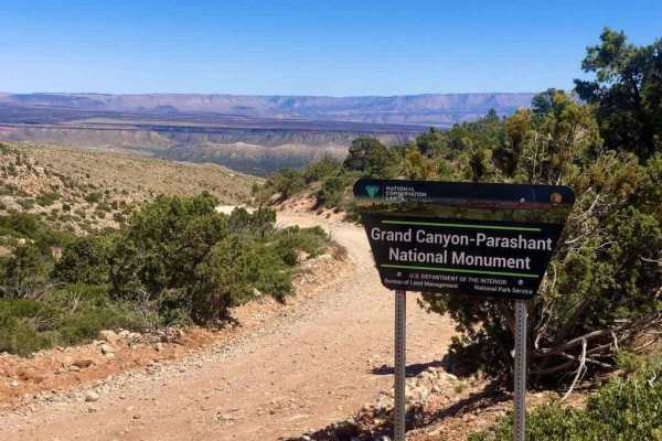
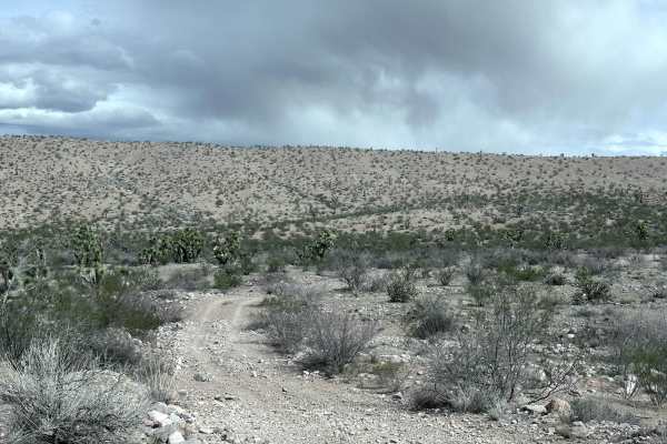
Snap Point BLM 1680 is a 7.2-mile out-and-back trail rated 4 of 10 located on the southern edge of the Grand Canyon-Parashant National Monument. Snap Point is the official western end of the Grand Canyon North Rim. The road to Snap Point is deeply rutted and during certain parts of the year can be c...
Learn more about Snap Point BLM 1680
Kelly Point Trail NPS 1203
Kelly Point Trail is a 31-mile point-to-point trail rated 4 of 10 located within the Grand Canyon-Parashant National Monument and the Grand Canyon National Park. Stay left on County Road 103 which is the beginning of Kelly Point Trail. At 4.8 miles from the start, the trail passes the Mount Dellenba...
Learn more about Kelly Point Trail NPS 1203
Snap Point Road BLM 1012
Snap Point Road BLM 1012 is a 19.1-mile point-to-point trail rated 3 of 10 located within the Grand Canyon-Parashant National Monument. Snap Point Road is the only way to access Snap Point BLM 1680. The approach from either the north or the east is relatively open using the single-track road. As the...
Learn more about Snap Point Road BLM 1012
Golden Mile Trail
This 5.2-mile out-and-back trail takes you to an old abandoned gold mine. You will pass through the Hualapai Wash and come up to the first of three gates on this trail. Always close all gates after passing through. At the end of this trail is an old abandoned mining site, a good place to stop for lu...
Learn more about Golden Mile Trail
Scanlon Ferry Road
Scanlon Ferry Road is an 18-mile point-to-point trail rated 4 out of 10 located within the Gold Butte National Monument and the Lake Mead National Recreation Area. Scanlon Road is dying from neglect. The northern portions of the road are passable in a 2WD high-clearance vehicle, but farther south al...
Learn more about Scanlon Ferry Road
Golden Gate Mine Trail
This 6.5-mile point-to-point trail goes from the Hualapai Wash in the Lake Mead National Recreation area, over the Grand Wash Cliffs, and into Meadview. Stop at the old Golden Gate Mine at 3.1 miles into the trail. There you will find many remnants of the closed mine. The trail is passable by most 4...
Learn more about Golden Gate Mine Trail
Grand Gulch Road/Azure Ridge Draw BLM 1215
Grand Gulch Road/Azure Ridge Draw BLM 1215 is a 1.7-mile single-track road that is rated 3 of 10. It is comprised of a dirt road and sandy wash that generally runs north to south from the intersection with Grand Gulch Road. Azure Ridge Draw is located within the Million Hills Wilderness Study Area (...
Learn more about Grand Gulch Road/Azure Ridge Draw BLM 1215
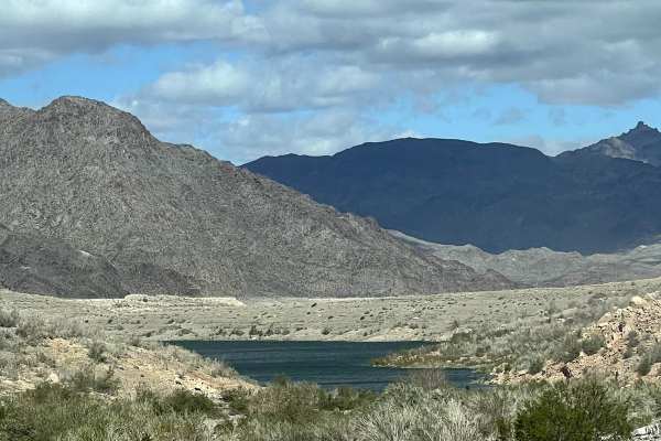
Hualapai Wash Trail
This 16.6-mile out-and-back trail takes you down the Hualapai Wash to a small cove on Lake Mead. This trail starts as a dirt trail and then quickly turns into a sandy wash. There are a few narrow sections where you must negotiate between rocks approximately 18-24 inches in height, but wide enough fo...
Learn more about Hualapai Wash Trail
Pigeon Canyon Road-BLM1002
Pigeon Canyon Road-BLM1002 is a 10-mile double-track road that is rated 3 of 10. Pigeon Canyon Road generally runs east/west and is located within the Grand Canyon-Parashant National Monument. The two main features along this trail are the Upper and Lower Pigeon Springs. The upper springs are locate...
Learn more about Pigeon Canyon Road-BLM1002
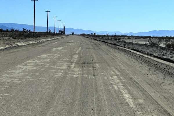
Antares Road
This 31.7 mile point-to-point trail takes you from Route 66 to N Pierce Ferry Road giving you access to the town of Meadview and Lake Mead National Recreation area. This is a well-maintained County Road with washboard sections. Any 2WD, AWD, or 4WD vehicle can traverse this trail with ease.
Learn more about Antares Road
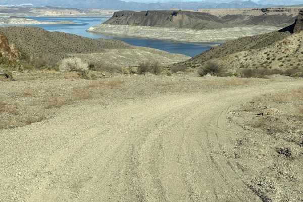
Gregg's Hideout Trail
This 37.2 mile out-and-back trail takes you to Gregg's Hideout Cove on Lake Mead. The first 9 miles of this trail is maintained county roads. Once you enter the Lake Mead Recreation Area the road is not maintained and has sections of loose gravel and washes up to 10" in depth. There is a camping are...
Learn more about Gregg's Hideout Trail
BLM 1649
BLM Road 1649 is one of the many little connector trails off County Highway 103. It is unmarked (no trail numbers) and is an alternate route to BLM 1648. In the three miles, there are several steep drop-ins into the river wash, some of which are a few feet tall, which bump the difficulty rating up. ...
Learn more about BLM 1649
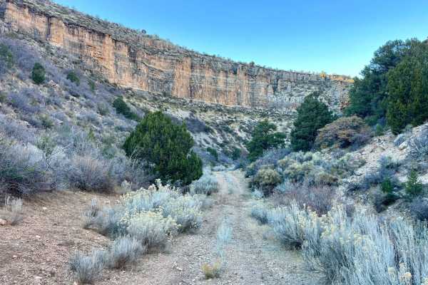
Grand Wash Cliffs - BLM 1061
Grand Wash Cliffs is a 14.4-mile point-to-point trail that skirts the edge of the Grand Wash Cliffs Wilderness area. This is a great trail that gives expansive views of the Pakoon Basin and the Grand Wash Cliffs. It is very common to see wildlife such as Burros and Coyotes on this trail. The trail h...
Learn more about Grand Wash Cliffs - BLM 1061
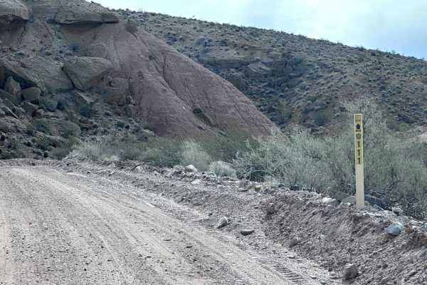
Pakoon Spring - CR 111
Pakoon Spring is a 4.3-mile point-to-point county road within the Grand Canyon-Parashant National Monument. To reach the Pakoon Springs trailhead head you will need to travel approximately. 4 miles north on the Grand Mulch Mine and Staircase trail. This trail is a maintained county road and is passa...
Learn more about Pakoon Spring - CR 111
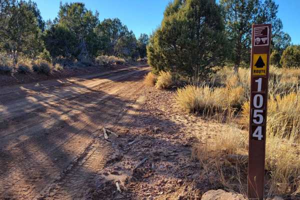
BLM 1054
This section of BLM 1054 connects Rattlesnake Canyon Road (BLM 1054) and County Highway 103, in addition to several other trails in the area such as BLM 1071/Last Chance Canyon and Hudson Point Overlook. This route connects to some advanced/expert-level trails--be advised. Trail number markers are p...
Learn more about BLM 1054
BLM 1647
BLM 1647 is an unmarked (no trail markers) connector trail between County Highway 103 and BLM 1648/Grassy Point Road (BLM 1046). This route is a wide two-track trail that is suitable for full-size vehicles and is an alternative route for BLM 1648. Beginning off County Highway 103, the trail is easy ...
Learn more about BLM 1647
BLM 1648
BLM 1648 is an unmarked trail (no trail markers) that connects from Grassy Point Road (BLM 1046) to County Highway 103. This trail is more advanced and technical with loose, large rocks, brief off-camber sections, and deep erosion ruts. The western half of the trail, directly off County Highway 103,...
Learn more about BLM 1648
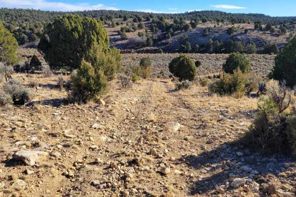
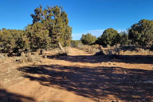
Rattlesnake Canyon 1054
The higher elevation section of the trail is beautiful as it rolls through the trees and crosses over a large amount of deep ruts. Careful tire placement should be used. This terrain continues for a mile or so. Then, the trail opens up to a stunning, flatter section of sagebrush meadows, with grouse...
Learn more about Rattlesnake Canyon 1054
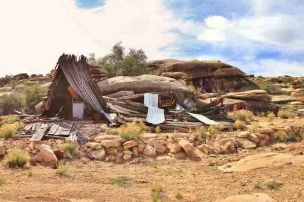
Copper Mine-George Spring Overlook - BLM 1232
BLM 1232 is a 1.9-mile point-to-point trail rated 4 of 10 located within the Grand Canyon-Parashant National Monument. This trail is comprised mostly of hardpacked dirt with some embedded rock. BLM 1232 is a side adventure from the BLM 1230-Parachant Canyon-Mollies Nipple trail. Leading to one of th...
Learn more about Copper Mine-George Spring Overlook - BLM 1232
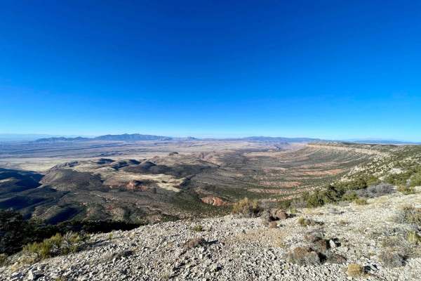
Hudson Point Overlook
This short out-and-back is a very worthwhile side trip. It's technically relatively easy, with only a few small rock piles to navigate. It quickly arrives near the cliff edge and follows it until you arrive at the Hudson viewpoint that overlooks the expansive Grand Wash Cliffs Wilderness and beyond....
Learn more about Hudson Point Overlook
ATV trails near Grand Canyon West, Arizona
Explore ATV-friendly trails near you. These trails are accessible for vehicles up to 50 inches wide, perfect for ATVs and smaller off-road machines.
Snap Point BLM 1680
Snap Point BLM 1680 is a 7.2-mile out-and-back trail rated 4 of 10 located on the southern edge of the Grand Canyon-Parashant National Monument. Snap Point is the official western end of the Grand Canyon North Rim. The road to Snap Point is deeply rutted and during certain parts of the year can be c...
Learn more about Snap Point BLM 1680
Kelly Point Trail NPS 1203
Kelly Point Trail is a 31-mile point-to-point trail rated 4 of 10 located within the Grand Canyon-Parashant National Monument and the Grand Canyon National Park. Stay left on County Road 103 which is the beginning of Kelly Point Trail. At 4.8 miles from the start, the trail passes the Mount Dellenba...
Learn more about Kelly Point Trail NPS 1203
Golden Mile Trail
This 5.2-mile out-and-back trail takes you to an old abandoned gold mine. You will pass through the Hualapai Wash and come up to the first of three gates on this trail. Always close all gates after passing through. At the end of this trail is an old abandoned mining site, a good place to stop for lu...
Learn more about Golden Mile Trail
Scanlon Ferry Road
Scanlon Ferry Road is an 18-mile point-to-point trail rated 4 out of 10 located within the Gold Butte National Monument and the Lake Mead National Recreation Area. Scanlon Road is dying from neglect. The northern portions of the road are passable in a 2WD high-clearance vehicle, but farther south al...
Learn more about Scanlon Ferry Road
UTV/side-by-side trails near Grand Canyon West, Arizona
Find UTV and side-by-side trails near you. These trails accommodate vehicles up to 60 inches wide, ideal for UTVs, side-by-sides, and wider off-road rigs.
Snap Point BLM 1680
Snap Point BLM 1680 is a 7.2-mile out-and-back trail rated 4 of 10 located on the southern edge of the Grand Canyon-Parashant National Monument. Snap Point is the official western end of the Grand Canyon North Rim. The road to Snap Point is deeply rutted and during certain parts of the year can be c...
Learn more about Snap Point BLM 1680
Kelly Point Trail NPS 1203
Kelly Point Trail is a 31-mile point-to-point trail rated 4 of 10 located within the Grand Canyon-Parashant National Monument and the Grand Canyon National Park. Stay left on County Road 103 which is the beginning of Kelly Point Trail. At 4.8 miles from the start, the trail passes the Mount Dellenba...
Learn more about Kelly Point Trail NPS 1203
Snap Point Road BLM 1012
Snap Point Road BLM 1012 is a 19.1-mile point-to-point trail rated 3 of 10 located within the Grand Canyon-Parashant National Monument. Snap Point Road is the only way to access Snap Point BLM 1680. The approach from either the north or the east is relatively open using the single-track road. As the...
Learn more about Snap Point Road BLM 1012
Golden Mile Trail
This 5.2-mile out-and-back trail takes you to an old abandoned gold mine. You will pass through the Hualapai Wash and come up to the first of three gates on this trail. Always close all gates after passing through. At the end of this trail is an old abandoned mining site, a good place to stop for lu...
Learn more about Golden Mile Trail
The onX Offroad Difference
onX Offroad combines trail photos, descriptions, difficulty ratings, width restrictions, seasonality, and more in a user-friendly interface. Available on all devices, with offline access and full compatibility with CarPlay and Android Auto. Discover what you're missing today!
Open Trail Map