
Dirt Bike Trails
Near Fulford, Colorado
Explore All Dirt Bike Trails Near Fulford, Colorado
Dirt Bike Trails Near Fulford, Colorado
Discover the best dirt bike trails near you. Browse trail maps, check difficulty ratings, and find your next adventure — whether you're looking for a quick ride or an all-day expedition.
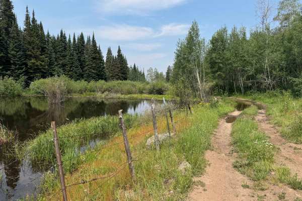
Old Fulford Road - FS 419
Old Fulford Road is an out-and-back route, as access through the historic town of Fulford is blocked by gated closures, no-through-traffic notices, and private property restrictions at both ends. Despite the lack of a through connection, this trail delivers an outstanding backcountry experience, off...
Learn more about Old Fulford Road - FS 419
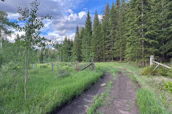
FS 435
This U.S. Forest Service route branches off from FS 418 and descends into a beautiful canyon filled with dispersed campsites, open meadows, and popular hunting areas. Several excellent campsites can be found within the first mile, after which the trail becomes progressively narrower and more rugged,...
Learn more about FS 435
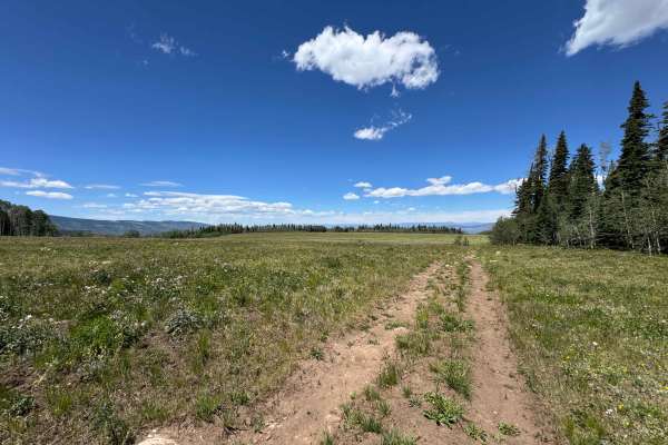
FS 421
As soon as you turn off FS 418 onto this route, it is highly recommended to air down your tires, as the first several miles consist of a relentless stretch of chunky rocks and uneven terrain. Beyond this section, the trail transitions into a series of steep rock chutes filled with increasingly large...
Learn more about FS 421
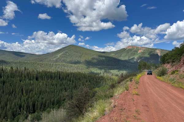
Nolan Creek Road - FS 418
This route begins off East Brush Creek Road and follows a wide, well-maintained Forest Service road where two vehicles can easily pass, at least as far as the historic town of Fulford. During the first few miles, travelers will find several excellent dispersed campsites, with additional camping oppo...
Learn more about Nolan Creek Road - FS 418
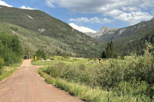
East Brush Creek Road
This route leads from Eagle into the network of roads and trails surrounding Sylvan Lake State Park. Serving as a primary access corridor to the area, it provides connections to the historic mining town of Fulford as well as the extensive backcountry trail system west of the Holy Cross Wilderness. T...
Learn more about East Brush Creek Road
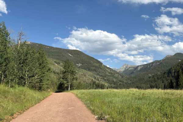
Fulford / Lake Charles Access
This route climbs from Yeoman Park Campground toward Lake Charles and the nearby Fulford Mine. The trail offers beautiful views of rolling hills, mountain streams, and small alpine lakes. The road is somewhat narrow in places and features occasional rocky sections, but it should be manageable for mo...
Learn more about Fulford / Lake Charles Access
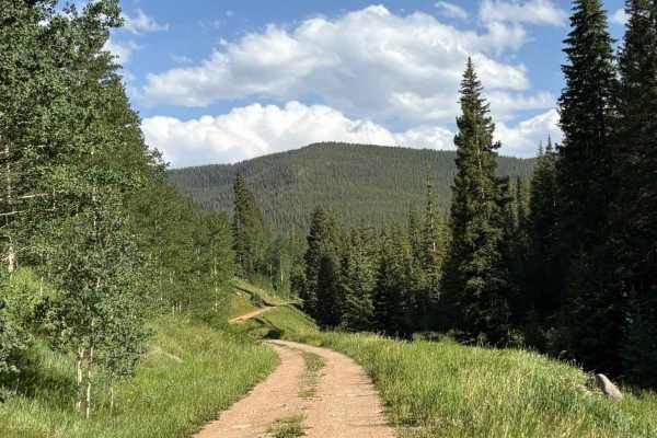
Peter Estin Hut
This route climbs from Yeoman Park Campground to the historic Peter Estin Hut. The road passes through dense pine forests, crosses stretches of distinctive red-soil terrain, and traverses open mountain meadows before reaching the hut. While the route is steep for much of its length and can be somewh...
Learn more about Peter Estin Hut
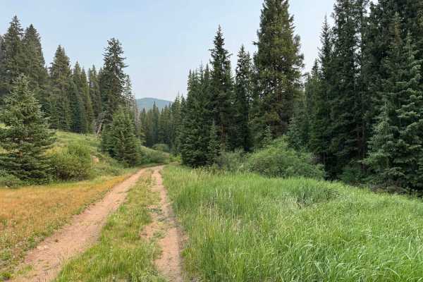
FS 436
This out-and-back route begins near Yeoman Park Campground, branching off from another U.S. Forest Service road that continues toward Eagle–Thomasville Road. Lightly traveled and seemingly used primarily by hunters and for firewood collection, this hidden gem is one of the most scenic trails in the ...
Learn more about FS 436
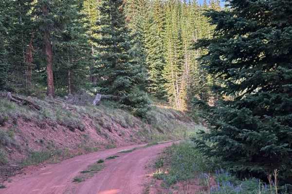
Hat Creek Road
This route branches off Crooked Creek Pass and climbs toward the historic Peter Estin Hut. The road winds through forests of aspen and pine, traversing striking red-soil terrain that contrasts beautifully with the surrounding landscape. Along the way, occasional openings in the trees provide glimpse...
Learn more about Hat Creek Road
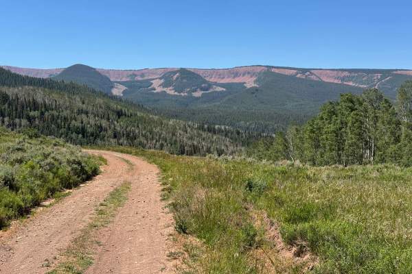
FS 414
This Forest Service route begins near the Sylvan Lake recreation area and climbs high into the mountains toward Gypsum, traversing a diverse and scenic landscape along the way. The road ascends out of one canyon, descends into another, and then climbs once again to a beautiful high-elevation meadow ...
Learn more about FS 414
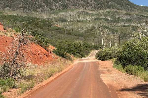
East Brush Creek Road - Ingress
This route climbs from the entrance area of Sylvan Lake State Park near the Meadows Day Use Area into the broader network of backcountry roads and trails surrounding the park. The route serves as a convenient gateway to the area's extensive trail system, offering access to forests, meadows, and moun...
Learn more about East Brush Creek Road - Ingress
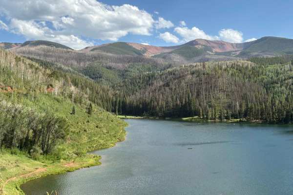
Sylvan Lake Road
This route climbs from the entrance of Sylvan Lake State Park to the lake itself, providing access to Fisherman's Paradise Campground and the many recreational opportunities found throughout the park. The drive offers pleasant views of the surrounding forests, meadows, and mountain terrain as it gai...
Learn more about Sylvan Lake Road
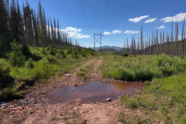
FS 431
This trail begins at the summit of Crooked Creek Pass and descends through a beautiful canyon toward the Sylvan Lake State Park area. It is a particularly unique route because much of the trail passes through areas affected by the 2022 Sylvan Lake Fire, creating dramatic scenery and ever-changing la...
Learn more about FS 431
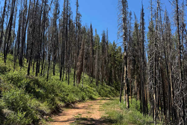
FS 417
This short one-mile spur route branches off FS Road 414 and provides a pleasant drive through a quiet section of forest. Beginning with a gentle climb over soft, sandy terrain, the trail winds through a stand of tall pine trees before reaching a large, secluded dispersed campsite tucked away from th...
Learn more about FS 417
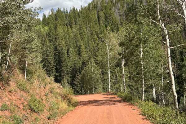
Eagle-Thomasville Road
This is the primary route connecting Crooked Creek Pass with Sylvan Lake State Park and Fisherman's Paradise Campground. The road offers exceptionally scenic views as it descends through the area, passing striking red rock formations that are unique to this part of Colorado. Surrounded by forests, m...
Learn more about Eagle-Thomasville Road
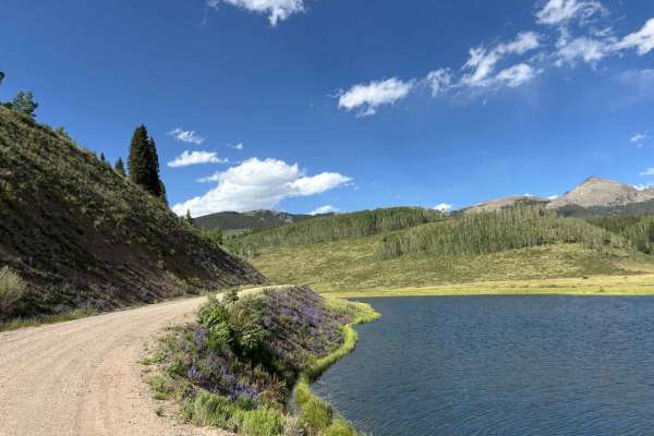
Crooked Creek Reservoir
This route travels from the trail junction near Slim Jim Gulch to Crooked Creek Pass, passing the scenic Crooked Creek Reservoir along the way. The road winds through a stunning mix of forests, open meadows, and mountain terrain, with frequent views of the surrounding peaks and valleys. The reservoi...
Learn more about Crooked Creek Reservoir
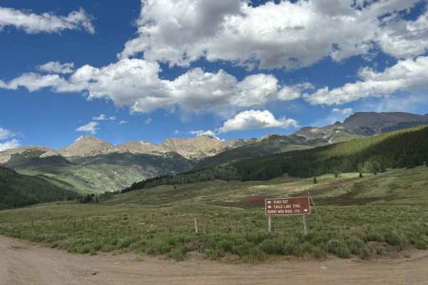
Woods Lake
This route leads to the beautiful Woods Lake and the trailheads that provide access to the surrounding backcountry. Along the way, travelers are treated to spectacular views of the rugged peaks and alpine landscapes of the Holy Cross Wilderness. The lake itself is a scenic destination, offering oppo...
Learn more about Woods Lake
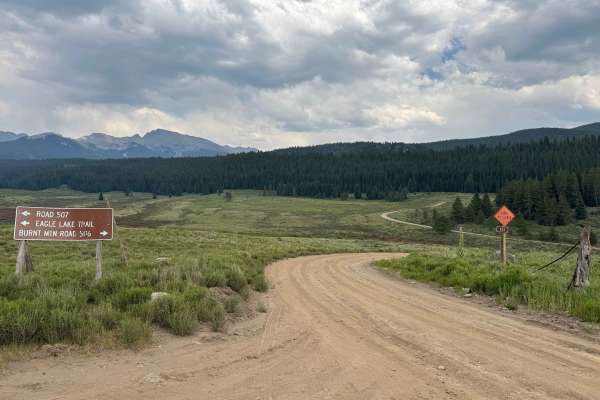
FS 506
This route begins off FS 507, the main road leading to Woods Lake. Almost immediately after starting the trail, you’ll find a turnoff to Lime Park, a scenic canyon known for its impressive cliffs, rock climbing opportunities, and camping areas. From there, the route climbs steadily through the fores...
Learn more about FS 506
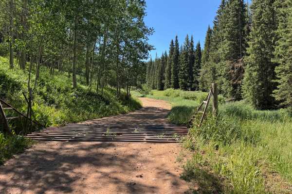
Upper Gypsum Creek Road - FS 101
This short and easy route climbs from Lower Gypsum Creek Road to the scenic LEDE Reservoir. Under normal dry conditions, any vehicle with decent ground clearance should be able to reach the reservoir without difficulty. The drive is particularly enjoyable, winding through beautiful mountain scenery ...
Learn more about Upper Gypsum Creek Road - FS 101
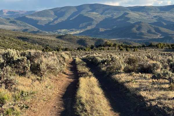
BLM 8410
This BLM route begins where Trail 21 ends and descends into the scenic canyon and meadow below. The trail offers an enjoyable mix of flowing terrain, with several steeper cutoff options that add a bit of challenge for those seeking a more technical line. As the route drops into the meadow, a series ...
Learn more about BLM 8410
ATV trails near Fulford, Colorado
Explore ATV-friendly trails near you. These trails are accessible for vehicles up to 50 inches wide, perfect for ATVs and smaller off-road machines.
Old Fulford Road - FS 419
Old Fulford Road is an out-and-back route, as access through the historic town of Fulford is blocked by gated closures, no-through-traffic notices, and private property restrictions at both ends. Despite the lack of a through connection, this trail delivers an outstanding backcountry experience, off...
Learn more about Old Fulford Road - FS 419
FS 435
This U.S. Forest Service route branches off from FS 418 and descends into a beautiful canyon filled with dispersed campsites, open meadows, and popular hunting areas. Several excellent campsites can be found within the first mile, after which the trail becomes progressively narrower and more rugged,...
Learn more about FS 435
FS 421
As soon as you turn off FS 418 onto this route, it is highly recommended to air down your tires, as the first several miles consist of a relentless stretch of chunky rocks and uneven terrain. Beyond this section, the trail transitions into a series of steep rock chutes filled with increasingly large...
Learn more about FS 421
Nolan Creek Road - FS 418
This route begins off East Brush Creek Road and follows a wide, well-maintained Forest Service road where two vehicles can easily pass, at least as far as the historic town of Fulford. During the first few miles, travelers will find several excellent dispersed campsites, with additional camping oppo...
Learn more about Nolan Creek Road - FS 418
UTV/side-by-side trails near Fulford, Colorado
Find UTV and side-by-side trails near you. These trails accommodate vehicles up to 60 inches wide, ideal for UTVs, side-by-sides, and wider off-road rigs.
Old Fulford Road - FS 419
Old Fulford Road is an out-and-back route, as access through the historic town of Fulford is blocked by gated closures, no-through-traffic notices, and private property restrictions at both ends. Despite the lack of a through connection, this trail delivers an outstanding backcountry experience, off...
Learn more about Old Fulford Road - FS 419
FS 435
This U.S. Forest Service route branches off from FS 418 and descends into a beautiful canyon filled with dispersed campsites, open meadows, and popular hunting areas. Several excellent campsites can be found within the first mile, after which the trail becomes progressively narrower and more rugged,...
Learn more about FS 435
FS 421
As soon as you turn off FS 418 onto this route, it is highly recommended to air down your tires, as the first several miles consist of a relentless stretch of chunky rocks and uneven terrain. Beyond this section, the trail transitions into a series of steep rock chutes filled with increasingly large...
Learn more about FS 421
Nolan Creek Road - FS 418
This route begins off East Brush Creek Road and follows a wide, well-maintained Forest Service road where two vehicles can easily pass, at least as far as the historic town of Fulford. During the first few miles, travelers will find several excellent dispersed campsites, with additional camping oppo...
Learn more about Nolan Creek Road - FS 418
The onX Offroad Difference
onX Offroad combines trail photos, descriptions, difficulty ratings, width restrictions, seasonality, and more in a user-friendly interface. Available on all devices, with offline access and full compatibility with CarPlay and Android Auto. Discover what you're missing today!
Open Trail Map