
Dirt Bike Trails
Near East Wenatchee, Washington
Explore All Dirt Bike Trails Near East Wenatchee, Washington
Dirt Bike Trails Near East Wenatchee, Washington
Discover the best dirt bike trails near you. Browse trail maps, check difficulty ratings, and find your next adventure — whether you're looking for a quick ride or an all-day expedition.
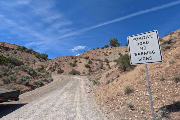
Swakane Canyon Road - FS 7415
Swakane Canyon Road is a 12.1-mile point-to-point route that begins directly off Highway 97 as a wide two-lane gravel road before narrowing and becoming rougher past the shooting range at mile 1.3. As the route climbs, it features some rutted, narrow sections where low-clearance vehicles are not rec...
Learn more about Swakane Canyon Road - FS 7415
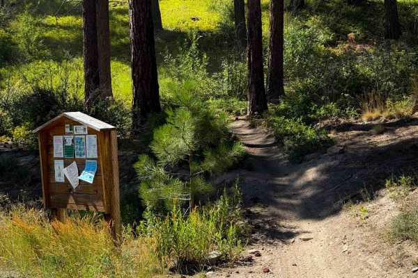
Beehive Trail 1202
Beehive Trail is a short and easy single track in the Wenatchee National Forest. It gradually climbs from east to west, starting near the Beehive Reservoir and ending at an intersection with the Devil’s Spur Trail, gaining about 500 feet over the climb. It makes several tight switchbacks as it ascen...
Learn more about Beehive Trail 1202
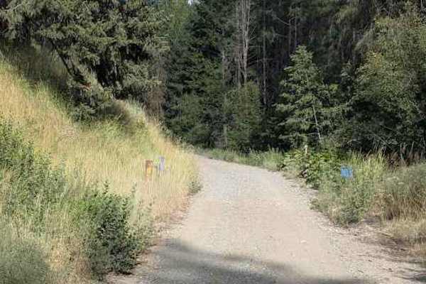
FS 7101
This single-lane dirt and gravel road connects from the Number 2 Canyon Rd to what's left of FS 7100 road, leading to the Devil's Gulch dirt bike trailhead. The road has water bars a couple feet high, but they're not abrupt. It has some erosion damage and soft silty spots. There weren't a lot of exp...
Learn more about FS 7101
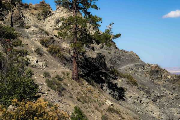
Devil’s Spur 1203
The south end of Devil’s Spur starts at a paved parking area on Mission Ridge Road. The trail begins as a forest road with a bit of embedded and loose rock. It narrows into more of a singletrack after about a mile, and it becomes less rocky as it starts side-hilling along the hillside next to big po...
Learn more about Devil’s Spur 1203
Devil’s Gulch - FS 1220
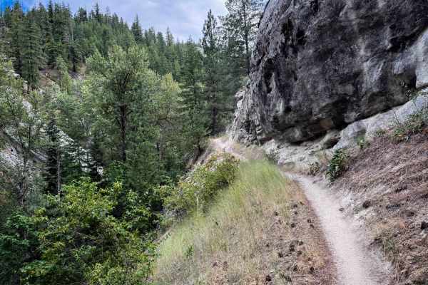
Devil’s Gulch is a long intermediate route through the Wenatchee National Forest that is full of narrow and exposed side-hilling, fun flowy forested segments, and a few techy rocky sections. In general, the trail is a gradual descent from south to north, losing about 3,300 feet over 12 miles. The so...
Learn more about Devil’s Gulch - FS 1220
FS 7100
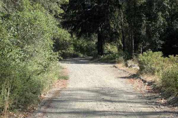
This road is presently quite different from what appears on the base map. At the south end, close to where it shows meeting FS 9712, it is gated off at the private land boundary. The north end near Mission Creek Rd has been washed out. And the part south of FS 7101 has been decommissioned. But there...
Learn more about FS 7100
Mission Ridge - FS 1201
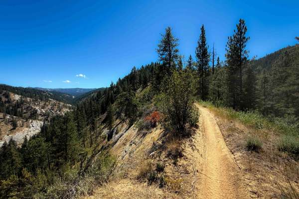
Mission Ridge is an 8 mile long intermediate route through the Wenatchee National Forest with scenic views and fun flowy terrain. In general the trail ascends from north to south, gaining over 3,200 feet elevation over the course of the route. The north end starts off with a few moderate switchbacks...
Learn more about Mission Ridge - FS 1201
Red Devil Trail #1221
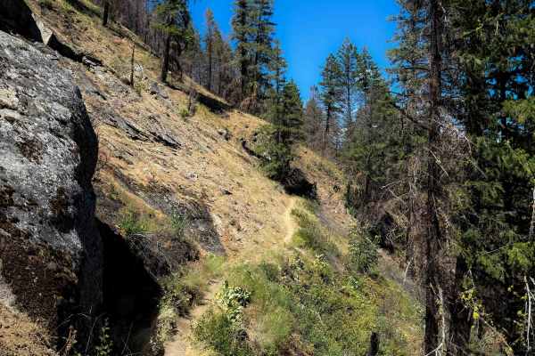
The north end of the Red Devil trail starts at the Red Hill off-highway vehicle trailhead, crosses a bridge and a road, then continues up the hillside on a wide side-hilling trail on packed-down dirt through a recent burn area. The trail is wide to start, with brake bumps, but later narrows and begi...
Learn more about Red Devil Trail #1221
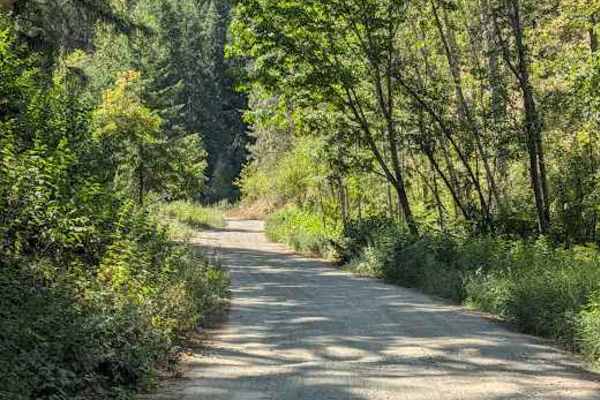
Sand Creek - FS 7104
This gravel road provides access to the Red Hill / Sand Creek dirt bike trailhead. The continuing portion of the 7104 road is blocked by a closed gate. The road looks a bit rough where it starts, with discarded cars, RVs, and whatever lining the road. The rest of the road is in good shape. There are...
Learn more about Sand Creek - FS 7104
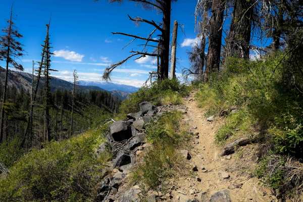
Upper Mission Ridge 1201.1
Upper Mission Ridge is 3.7 miles of intermediate single track through the Wenatchee National Forest. This is one of the rockier trails in the area, making it unique compared to Devils Gulch and Mission Ridge. The north half is similar to Mission Ridge, being a smooth and flowy trail with several swe...
Learn more about Upper Mission Ridge 1201.1
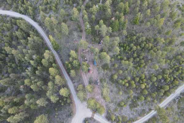
Washington Backcountry Discovery Route - Section 4
The Washington Backcountry Discovery Route (WABDR) is a trail that runs from Canada to Oregon, initially designed for adventure, dual-sport motorcycles, and 4X4 vehicles. This trail covers most of section 4. Unfortunately, the tail end of section 4 was still snowed in at this particular time and was...
Learn more about Washington Backcountry Discovery Route - Section 4
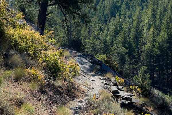
Red Hill Trail 1223
Red Hill is a nearly 8-mile-long intermediate singletrack through the Wenatchee National Forest. It ascends over 3,400 feet from north to south. From the north end, it starts off as a wide side-hilling trail on packed-down dirt through leafy bushes and brambles. The trail starts climbing up the hill...
Learn more about Red Hill Trail 1223
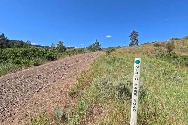
Moses Carr Road
Moses Carr Road is a 6.1-mile point-to-point single-lane route that begins at an intersection with Ingersoll Road before climbing out of a canyon, reaching approximately 4,100 feet before ending at an intersection with Kingsbury Road. The road is rocky and narrow, with a winding climb through the up...
Learn more about Moses Carr Road
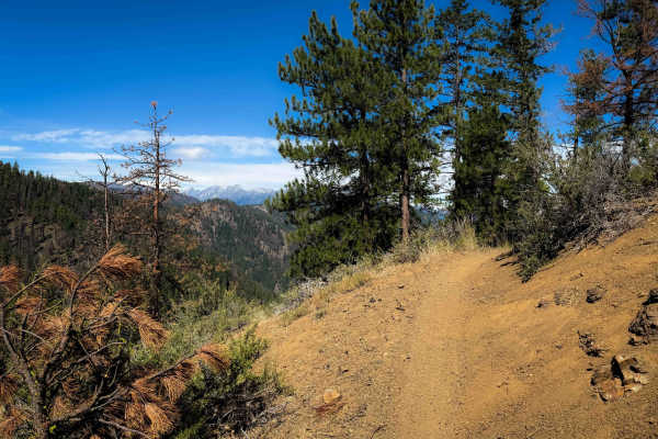
Red Hill Spur 1223.1
Red Hill Spur is an intermediate connector trail between the Red Hill and Devils Gulch single tracks. The trail is very similar to the Red Hill and Red Devil trails, riding through a recent burn area with a mix of flowy hilltop riding and narrow side-hilling, but with more exposure. The trail traver...
Learn more about Red Hill Spur 1223.1
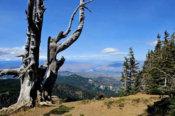
N3610
The trail to Naneum Tower offers beautiful scenery throughout the journey. The views in every direction are stunning. At an elevation of 6,600 feet, temperatures are chilly, and it will be very windy. Be prepared by packing a hoodie or a hat. The trail consists of a mixture of dirt and small to medi...
Learn more about N3610
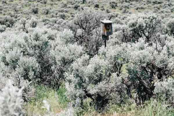
Colokum Road
The trail showcases rocky slopes, rolling ridges, and canyons, predominantly covered by shrub-steppe habitat. It features hard-packed dirt strewn with sharp basalt rocks. The terrain transitions from high desert landscapes to alpine forest. Numerous viewpoints provide stunning vistas of the Cascade ...
Learn more about Colokum Road
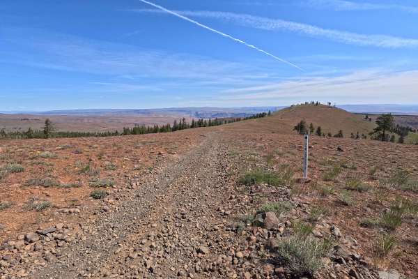
North Fork Spur Road
North Fork Spur Road is a 0.6-mile out-and-back single-lane route that climbs to a summit viewpoint along the top of a ridgeline. The trail is rocky throughout, with a few small rock steps along the climb. It ends just past the summit, where two established fire rings and a viewpoint provide a place...
Learn more about North Fork Spur Road
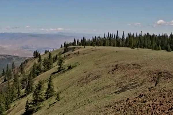
Naneum Ridge
Gradually, the landscape transitions from high desert to alpine forest as you look down into the Wenatchee Valley. The ridge trail offers breathtaking mountain views that stretch as far as the eye can see, but be prepared for a substantial elevation gain. If you plan to go in the spring, be aware th...
Learn more about Naneum Ridge
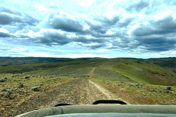
Whiskey Dick Scenic Overlook Trail
The Whiskey Dick Scenic Overlook Trail is ideal for high-clearance four-wheel-drive vehicles and SxSs looking for a rugged, slow-going journey rewarded with breathtaking panoramic vistas. Spanning approximately 13.2 miles through the Wenatchee Mountains, this route features a technical rating of 2 b...
Learn more about Whiskey Dick Scenic Overlook Trail
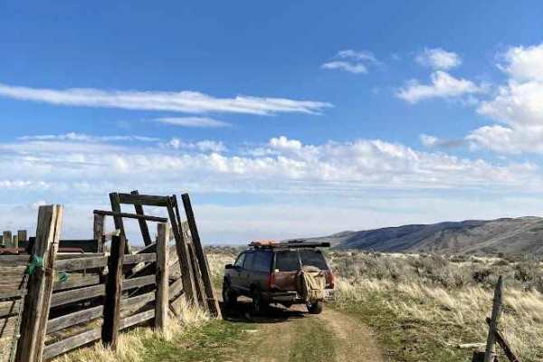
Duffy Creek Overlook
The Duffy Creek route takes you across some of the most scenic BLM land in central Washington. Most of the route overlooks the stunning Waterville Plateau. The route eventually descends into Duffy Creek; however, that section of the route is less used, overgrown, and narrow. Full-sized vehicles will...
Learn more about Duffy Creek Overlook
ATV trails near East Wenatchee, Washington
Explore ATV-friendly trails near you. These trails are accessible for vehicles up to 50 inches wide, perfect for ATVs and smaller off-road machines.
Swakane Canyon Road - FS 7415
Swakane Canyon Road is a 12.1-mile point-to-point route that begins directly off Highway 97 as a wide two-lane gravel road before narrowing and becoming rougher past the shooting range at mile 1.3. As the route climbs, it features some rutted, narrow sections where low-clearance vehicles are not rec...
Learn more about Swakane Canyon Road - FS 7415
FS 7101
This single-lane dirt and gravel road connects from the Number 2 Canyon Rd to what's left of FS 7100 road, leading to the Devil's Gulch dirt bike trailhead. The road has water bars a couple feet high, but they're not abrupt. It has some erosion damage and soft silty spots. There weren't a lot of exp...
Learn more about FS 7101
FS 7100
This road is presently quite different from what appears on the base map. At the south end, close to where it shows meeting FS 9712, it is gated off at the private land boundary. The north end near Mission Creek Rd has been washed out. And the part south of FS 7101 has been decommissioned. But there...
Learn more about FS 7100
Sand Creek - FS 7104
This gravel road provides access to the Red Hill / Sand Creek dirt bike trailhead. The continuing portion of the 7104 road is blocked by a closed gate. The road looks a bit rough where it starts, with discarded cars, RVs, and whatever lining the road. The rest of the road is in good shape. There are...
Learn more about Sand Creek - FS 7104
UTV/side-by-side trails near East Wenatchee, Washington
Find UTV and side-by-side trails near you. These trails accommodate vehicles up to 60 inches wide, ideal for UTVs, side-by-sides, and wider off-road rigs.
Swakane Canyon Road - FS 7415
Swakane Canyon Road is a 12.1-mile point-to-point route that begins directly off Highway 97 as a wide two-lane gravel road before narrowing and becoming rougher past the shooting range at mile 1.3. As the route climbs, it features some rutted, narrow sections where low-clearance vehicles are not rec...
Learn more about Swakane Canyon Road - FS 7415
FS 7101
This single-lane dirt and gravel road connects from the Number 2 Canyon Rd to what's left of FS 7100 road, leading to the Devil's Gulch dirt bike trailhead. The road has water bars a couple feet high, but they're not abrupt. It has some erosion damage and soft silty spots. There weren't a lot of exp...
Learn more about FS 7101
FS 7100
This road is presently quite different from what appears on the base map. At the south end, close to where it shows meeting FS 9712, it is gated off at the private land boundary. The north end near Mission Creek Rd has been washed out. And the part south of FS 7101 has been decommissioned. But there...
Learn more about FS 7100
Sand Creek - FS 7104
This gravel road provides access to the Red Hill / Sand Creek dirt bike trailhead. The continuing portion of the 7104 road is blocked by a closed gate. The road looks a bit rough where it starts, with discarded cars, RVs, and whatever lining the road. The rest of the road is in good shape. There are...
Learn more about Sand Creek - FS 7104
The onX Offroad Difference
onX Offroad combines trail photos, descriptions, difficulty ratings, width restrictions, seasonality, and more in a user-friendly interface. Available on all devices, with offline access and full compatibility with CarPlay and Android Auto. Discover what you're missing today!
Open Trail Map