
Dirt Bike Trails
Near Castle Valley, Utah
Explore All Dirt Bike Trails Near Castle Valley, Utah
Dirt Bike Trails Near Castle Valley, Utah
Discover the best dirt bike trails near you. Browse trail maps, check difficulty ratings, and find your next adventure — whether you're looking for a quick ride or an all-day expedition.
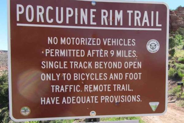
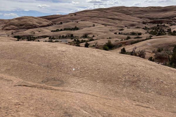
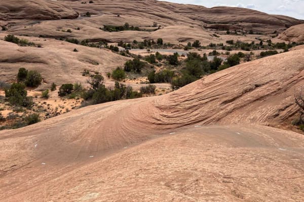
Porcupine Rim
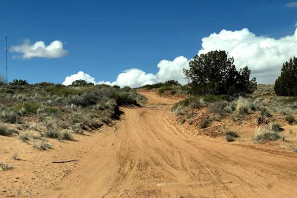
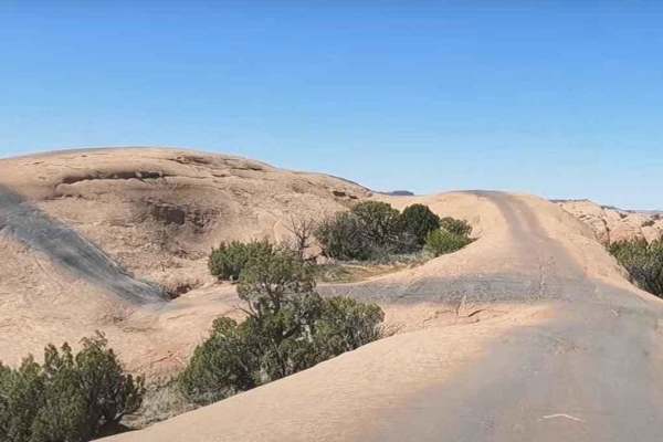
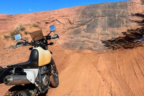
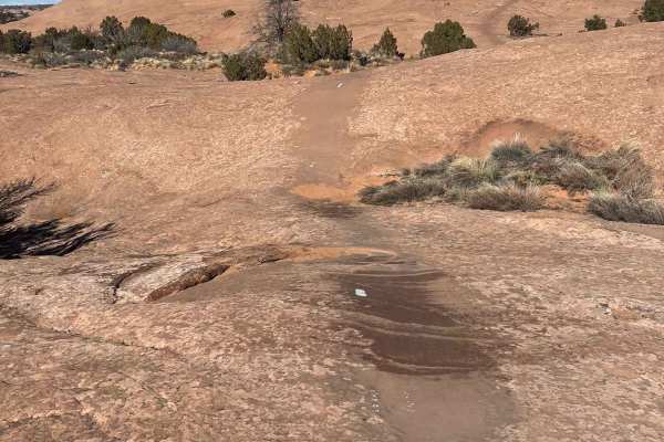
Porcupine Rim is a 21.4-mile loop trail rated 5 of 10 located in Grand County, Utah. Porcupine Rim trail is located in the Sand Flats Recreation Area which is fee entry area (see image for fee schedule). A National Parks Access Pass is also valid for entry. The Porcupine Rim trail starts off the gra...
Learn more about Porcupine Rim
Fins & Things Cutoff
This 0.6-mile point-to-point trail provides an early cutoff for the popular Fins and Things Trail. This trail allows off-roaders to depart the trail early if time does not permit completion of the entire trail. This trail can also be used to enter the Fins and Things trail to finish the last third o...
Learn more about Fins & Things Cutoff
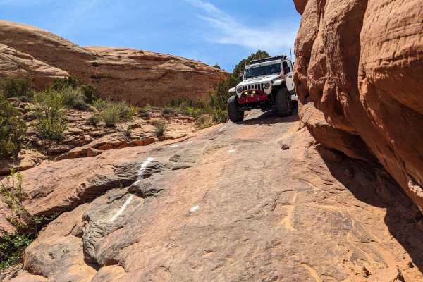
Fins and Things
Fins & Things, located in the Sand Flats Recreation Area in Moab, is accessible from the Sand Flats road. A one-day pass for private vehicles is $5, a 7-day pass is $10, and an annual pass is $25. Out of state ATVs or UTVs require a permit. OHV permits are valid for 12 months and cost $30. Passes an...
Learn more about Fins and Things
Fins n Things (First Half)
This route has something for everyone. The trail is wide enough for 4x4 vehicles, while still providing enough challenging terrain and technical features to make it fun for dirt bikes. This particular route I have mapped is intermediate and still possible to achieve on light adventure bikes and heav...
Learn more about Fins n Things (First Half)
Onion Creek
Onion Creek is one of those rare Moab routes that feels different around every bend. The trail begins in wide-open desert with sweeping views of towering mesas, Fisher Towers, and distant mountain backdrops before narrowing into a colorful canyon lined with layered red rock walls. As you continue, t...
Learn more about Onion Creek

Loop Road Trail FR Rd 636
This loop road goes from the Kokopelli Trail to the Tracking Station Road. It winds around, up and down with several crossings of the Jimmy Keen hike and bike trail. There is a single spot to camp in the lower section of the road next to one of the crossings. The road mainly serves the purpose of co...
Learn more about Loop Road Trail FR Rd 636
Professor Valley Rim
Non-Resident OHV permits apply to ATVs, UTVs, and dirt bikes. Plated street-legal vehicles typically do not need one on legal motorized routes. This short 1.6-mile dead-end spur follows the southwest end of Dome Plateau to a dramatic rim nearly 2,000 feet above Professor Valley. For more than half a...
Learn more about Professor Valley Rim
Tracking Station Road
Tracking Station Road is a nice short road off Mountain Loop Road going back to Sand Flats Recreation Area. Towards the Mountain Loop Road's end, there are several primitive campsite spots. The road gets a bit rougher near Sand Flats Road where 4WD may be necessary. The drive towards Sand Flats in t...
Learn more about Tracking Station Road
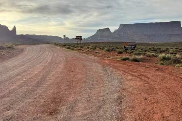
Fisher Tower Road
This route follows a wide, well-traveled gravel road through one of the most scenic desert landscapes near Moab. Suitable for most stock high-clearance vehicles in dry conditions, the road is generally easy to navigate but features frequent washboards that can make the ride rough at higher speeds. A...
Learn more about Fisher Tower Road
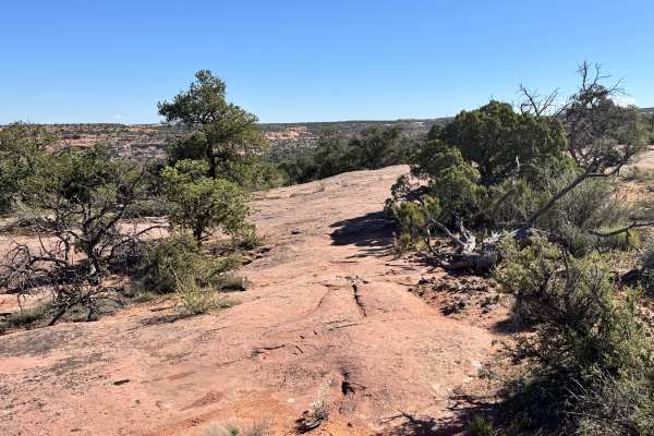
Slickrock Trail Practice Loop
The Slickrock Bike Trail is one of Moab's most famous trails, and rightfully so. This trail offers superior traction for dirt bikes and mountain bikes while offering a rigorous line with steep inclines and declines. This trail provides scenic views of the desert accompanied by the silhouette of the ...
Learn more about Slickrock Trail Practice Loop
Slickrock 1
Slickrock 1 trail is the only trail branching off from the Slickrock Practice Loop that will take you to the main Slickrock Trail System. Heading west, this 0.7-mile-long track takes you up a decent climb before descending near the midpoint. From here, there are several smaller elevation changes and...
Learn more about Slickrock 1
Kokopelli Trail (Castle Valley Overlook to Sand Flats Road)
This 3.8-mile point-to-point trail is part of the larger Kokopelli Trail System. This portion takes you from the Castle Valley Overlook on La-Sal Mountain Loop Road to Sand Flats Road. Sand Flats Road goes into the Sand Flats Recreation Area which is a Grand County Fee area. The first half of this t...
Learn more about Kokopelli Trail (Castle Valley Overlook to Sand Flats Road)
Baby Lions Back
This short trail is a fun obstacle within Sand Flats Recreation Area. If you are skeptical of running Hell's Revenge, you can use this short trail to get a taste of the obstacles on Hell's Revenge. This is a short steep climb up the Lion's Back to traverse across it and then take a quick drop off th...
Learn more about Baby Lions Back
Steel Bender Loop Route
This is a challenging trail with one particular ledge that has become impossible for most Jeeps. The trail is particularly difficult for ATVs and UTVs as the switchbacks descend. Please avoid the illegal bypass that some have used in the past. A wilderness study area surrounds this trail and must be...
Learn more about Steel Bender Loop Route
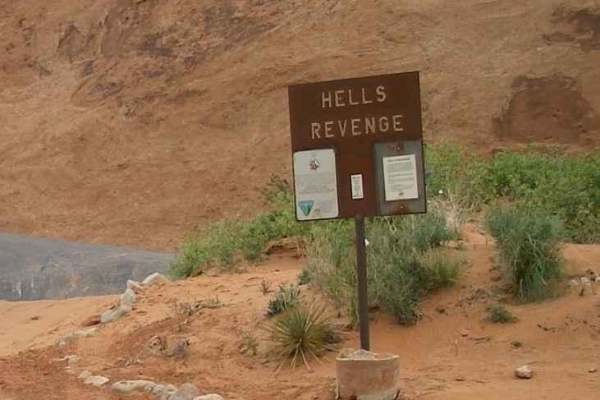
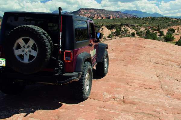
Hell's Revenge
Part of the treasured Sand Flats Recreations Area, Hells Revenge is one of the most popular trails near Moab. Due to hazardous conditions, this trail is recommended for experienced riders only. These challenges, combined with breathtaking scenery, make this a rewarding adventure. Hell's Revenge inte...
Learn more about Hell's Revenge
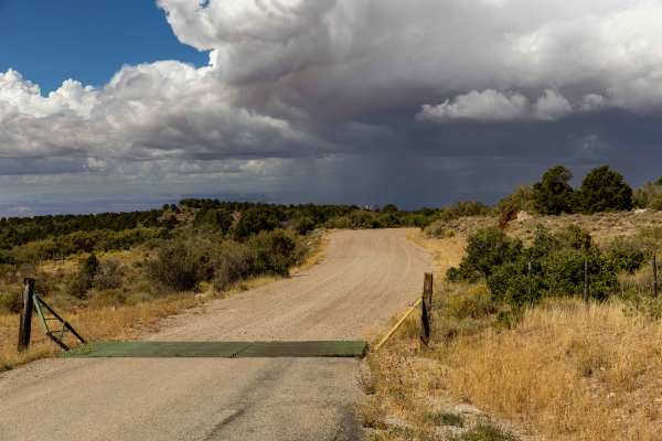
Sand Flats Road
Sand Flats Road is a wide, generally easy route that connects Moab to the Manti-La Sal National Forest. The drive has no major obstacles, though some narrow sections and washboarded stretches keep you attentive. Being close to town, it’s a well-trafficked corridor with trailheads and recreation acce...
Learn more about Sand Flats Road
Arches View Connector
This route feels like a forgotten backcountry connector and offers a more exploratory experience than many of the better-known trails nearby. Because it sees less traffic, the path can be difficult to follow at times if there are no recent tire tracks or visible route marks, so navigation tools and ...
Learn more about Arches View Connector
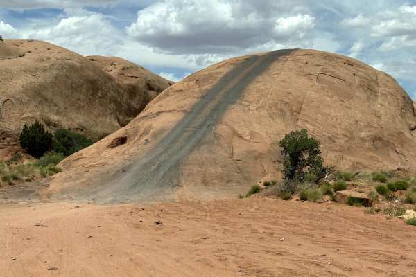
Slickrock 3
Slickrock 3 branches off of Slickrock 1 after about 0.4 miles and heads north/west to the Slickrock Main Loop. This trail is 2.2 miles long across smooth slickrock. The white paint markings on this route are worn and hard to see--especially in the beginning. Be aware: the markings do not match the O...
Learn more about Slickrock 3
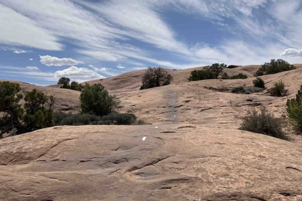
Slickrock 2
Slickrock 2 begins at Hell's Revenge Staircase Bypass & Overlook and continues northeast to the Slickrock Main Loop. This trail covers 0.7 miles across smooth slickrock and is well-marked with white painted lines on the ground. The trail has a few small bumps along the way but generally travels uphi...
Learn more about Slickrock 2
The Devil's Staircase
This is a previously closed portion of the Sand Flats recreation area. It is a connector on the Hell's Revenge trail from Tip-Over Challenge to the main trail towards the entrance/exit. The drop-in requires you to squeeze by a wall on the driver's side that has evidence of rigs getting too close. On...
Learn more about The Devil's Staircase
ATV trails near Castle Valley, Utah
Explore ATV-friendly trails near you. These trails are accessible for vehicles up to 50 inches wide, perfect for ATVs and smaller off-road machines.
Porcupine Rim
Porcupine Rim is a 21.4-mile loop trail rated 5 of 10 located in Grand County, Utah. Porcupine Rim trail is located in the Sand Flats Recreation Area which is fee entry area (see image for fee schedule). A National Parks Access Pass is also valid for entry. The Porcupine Rim trail starts off the gra...
Learn more about Porcupine Rim
Fins & Things Cutoff
This 0.6-mile point-to-point trail provides an early cutoff for the popular Fins and Things Trail. This trail allows off-roaders to depart the trail early if time does not permit completion of the entire trail. This trail can also be used to enter the Fins and Things trail to finish the last third o...
Learn more about Fins & Things Cutoff
Fins and Things
Fins & Things, located in the Sand Flats Recreation Area in Moab, is accessible from the Sand Flats road. A one-day pass for private vehicles is $5, a 7-day pass is $10, and an annual pass is $25. Out of state ATVs or UTVs require a permit. OHV permits are valid for 12 months and cost $30. Passes an...
Learn more about Fins and Things
Fins n Things (First Half)
This route has something for everyone. The trail is wide enough for 4x4 vehicles, while still providing enough challenging terrain and technical features to make it fun for dirt bikes. This particular route I have mapped is intermediate and still possible to achieve on light adventure bikes and heav...
Learn more about Fins n Things (First Half)
UTV/side-by-side trails near Castle Valley, Utah
Find UTV and side-by-side trails near you. These trails accommodate vehicles up to 60 inches wide, ideal for UTVs, side-by-sides, and wider off-road rigs.
Porcupine Rim
Porcupine Rim is a 21.4-mile loop trail rated 5 of 10 located in Grand County, Utah. Porcupine Rim trail is located in the Sand Flats Recreation Area which is fee entry area (see image for fee schedule). A National Parks Access Pass is also valid for entry. The Porcupine Rim trail starts off the gra...
Learn more about Porcupine Rim
Fins & Things Cutoff
This 0.6-mile point-to-point trail provides an early cutoff for the popular Fins and Things Trail. This trail allows off-roaders to depart the trail early if time does not permit completion of the entire trail. This trail can also be used to enter the Fins and Things trail to finish the last third o...
Learn more about Fins & Things Cutoff
Fins and Things
Fins & Things, located in the Sand Flats Recreation Area in Moab, is accessible from the Sand Flats road. A one-day pass for private vehicles is $5, a 7-day pass is $10, and an annual pass is $25. Out of state ATVs or UTVs require a permit. OHV permits are valid for 12 months and cost $30. Passes an...
Learn more about Fins and Things
Fins n Things (First Half)
This route has something for everyone. The trail is wide enough for 4x4 vehicles, while still providing enough challenging terrain and technical features to make it fun for dirt bikes. This particular route I have mapped is intermediate and still possible to achieve on light adventure bikes and heav...
Learn more about Fins n Things (First Half)
The onX Offroad Difference
onX Offroad combines trail photos, descriptions, difficulty ratings, width restrictions, seasonality, and more in a user-friendly interface. Available on all devices, with offline access and full compatibility with CarPlay and Android Auto. Discover what you're missing today!
Open Trail Map