
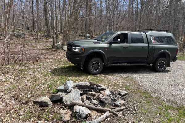
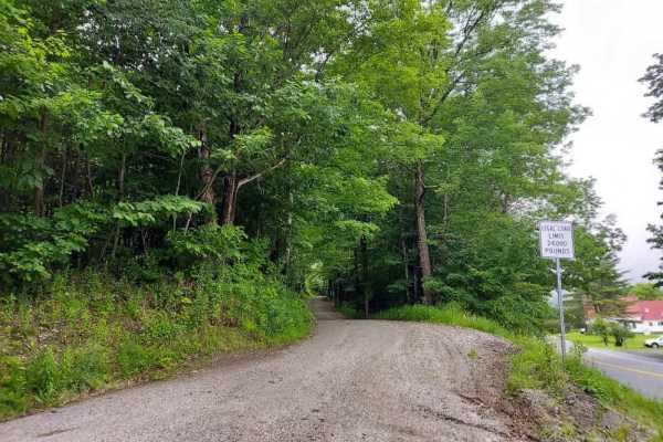
Beginner Off-Road Trails
Near Willsboro, New York
Explore All Beginner Trails Near Willsboro, New York
Beginner Off-Road Trails Near Willsboro, New York
Discover the best beginner-friendly off-road trails near you. These easier, lower-rated trails are a great place to start — browse trail maps, check difficulty ratings, and find your next adventure.

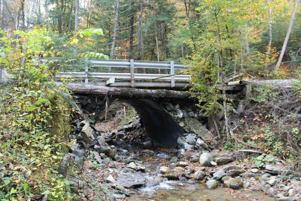
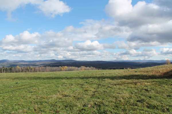
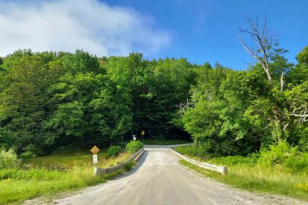
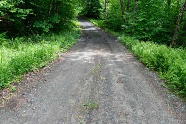
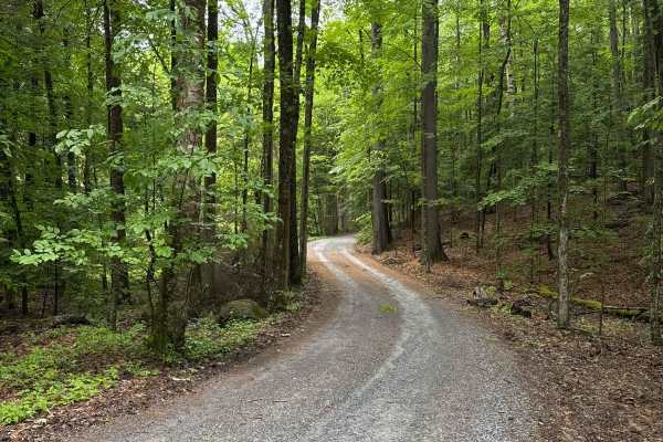
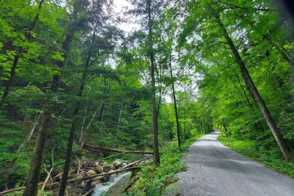
Lake Glen Road
This is a nice ride through the backwoods of the Lake Placid area. Most of the surrounding area on the western end is owned by a forest products company and they have blocked side trail access. The trail takes you around the southern flank of 3,550-foot Saddleback Mountain through the Adirondack For...
Learn more about Lake Glen Road
Big Hollow Road
Starts as a Vermont Farm gravel road, then transitions to a standard class 4 road with some small obstacles. You will pass some abandoned homes and a lot of maple sugaring equipment. best to avoid this trail during the spring sugaring season. At the halfway point, the road will narrow, and you will ...
Learn more about Big Hollow Road
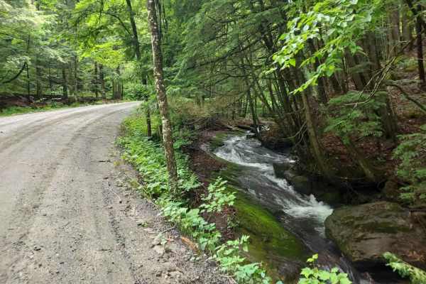
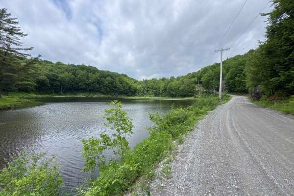
Patterson Brook Road Fire Service 50
A very well-maintained fire service road that follows the boundary of the bread loaf wilderness in the Green Mountain Forest. There are many amazing off-grid camping spots with some amazing views. This out-and-back road crosses mountain streams with good bridges and solid road surfaces. Verizon has ...
Learn more about Patterson Brook Road Fire Service 50
Explore Vermont
This route is comprised of Vermont dirt farm roads and some class 4 roads. This scenic drive samples some of northern Vermont's beautiful country settings and looks into the farming community. It is not a very technical drive, just very beautiful and enjoyable. Great drive during the summer but the ...
Learn more about Explore Vermont
Upper Works Road - 25A
This easy gravel and graded dirt road provides access to the Upper Works trailheads and ends at a large parking area with a pit toilet. Along the way, you'll pass the historic McIntyre Blast Furnace, one of the remaining landmarks of Tahawus ghost town. While you can drive to the gate, you'll need t...
Learn more about Upper Works Road - 25A
Symonds Mill Road
A very scenic Vermont back road drive. Road surface was mostly packed gravel with some muddy section. These are mainly farm roads so be on the look out for farm equipment or live stock . This pairs well with Woodbury mountain road if in a vehicle capable of the trail. Or it's a great drive on it's o...
Learn more about Symonds Mill Road
New Boston Road
A quick journey up this well-maintained gravel road offers beautiful views of the White River Valley below. There is one pull-off spot along the route, which is wide enough to accommodate passing traffic. The trail concludes at the entrance of a private horse ranch marked with "No Trespassing" signs...
Learn more about New Boston Road
Liberty Hill / FR 223
Located in Vermont's Green Mountain National Forest this short trail bypasses a section of Scenic Route 100 north of Pittsfield. A fairly narrow and sometimes muddy section of a few miles is back-ended by a smooth well maintained gravel road. There are some slightly off-camber sections, but nothing ...
Learn more about Liberty Hill / FR 223
Stock Bridge Road to Woodstock
Mainly a dirt and farm road with short sections of class 4. Be on the look out for dairy cattle and farm equipment. This is a great drive any time of the year, but when fall foliage is at peak it's mind-blowing. This scenic drive through central Vermont can be connected with other routes in the area...
Learn more about Stock Bridge Road to Woodstock
South Hill Road
This trail is open seasonally from May 23rd until the first snowfall. The route begins at the bridge just off the highway, starting on a gravel surface before transitioning to dirt as you climb the side of South Hill, where you will be rewarded with sporadic mountain views. Please exercise caution, ...
Learn more about South Hill Road
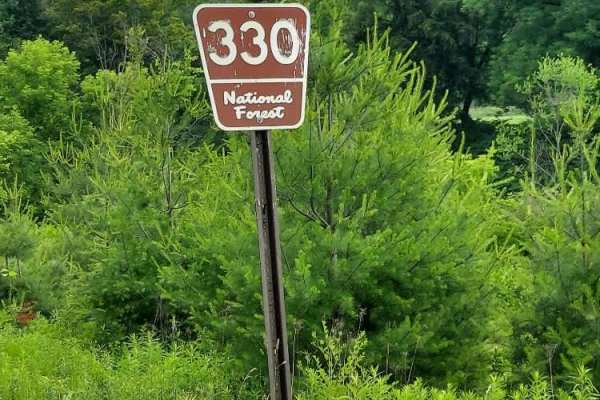
Pit Road
Also known as Forest Road 330, this route follows the White River to a dead-end turnaround point. The road surface consists of well-maintained gravel with occasional potholes. Several pull-offs along the route are large enough for car camping, and there is a dedicated parking area for White River ac...
Learn more about Pit Road
Fletcher Brook Road
Fletcher Brook Road is a seasonal route that opens on May 23rd and closes at the first snowfall. The surface consists primarily of loose dirt and gravel, featuring several rough sections. Please be aware that this is an active logging road and a popular powersports route; remain vigilant and always ...
Learn more about Fletcher Brook Road
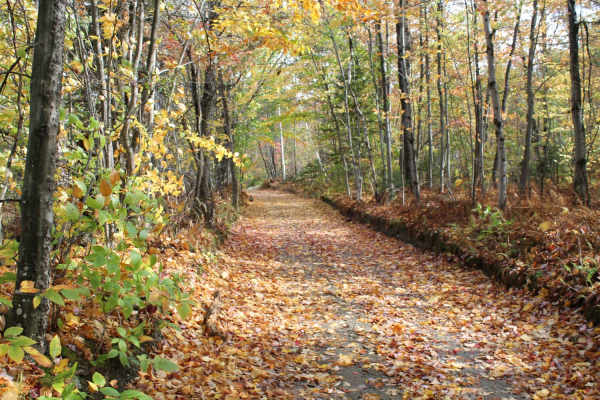
Deer Pond Road
This easy dirt two-track winds through heavily wooded forest, opening up occasionally into small meadows with plenty of opportunities to spot wildlife. The surface is mostly smooth, with only a few potholes along the way, though puddles can fill with water after rain and make conditions more challen...
Learn more about Deer Pond Road
Woody's Road
This road begins by passing through private property around Goodnow Flow, but eventually enters the Adirondack Forest Preserve, which sits on the south side of the road. At this point, the northern side of this road still borders private land, so be sure to respect all posted signs and remain on pub...
Learn more about Woody's Road
Rix Road
This scenic route winds through the heart of Vermont’s picturesque farm country, following a meandering creek through forested sections and open pasture land. Featuring smooth gravel surfaces and frequent opportunities to stop and admire the numerous waterfalls located directly alongside the road, t...
Learn more about Rix Road
Edan Road
This is a very scenic drive that cuts through a wilderness management area and logging land. This trail was recently regraded for a logging operation so it's in great shape. There are some low wet spots, but they have a hard bottom and can be driven around. The only real challenge is the washed-out ...
Learn more about Edan Road
Mill Road
Beginning at the historic mill site bridge over the First Branch of the White River, this route follows a feeder stream toward its source. The trail features a well-maintained gravel road that winds through the countryside, offering several scenic pull-offs ideal for trout fishing. Please note that ...
Learn more about Mill Road
Dacy Clearing Road
The Dacy Clearing Road starts at the Shelving Rock Road and takes you to several primitive campsites and the Dacy Clearing Trailhead in the Lake George Wild Forest in the eastern part of the Adirondack Park. It is a gravel forestry road with some soft sand spots that can turn into mud holes after he...
Learn more about Dacy Clearing Road
Hog Town Road
Hog Town Road connects Shelving Rock Road at the west end and County Road 16 at the east end of the trail. The road takes you to a few hiking trails and a fishing pond in the Lake George Wild Forest in the eastern part of Adirondack Park. It is a gravel forestry road with some soft sand spots that c...
Learn more about Hog Town Road
White Brook Road
This route begins at Route 14, where you will head upstream following Whitewater Brook. The trail winds through a picturesque rural corridor defined by its well-preserved stacked stone walls that trace the boundaries of the landscape, alongside relics of early agriculture, including weathered old ba...
Learn more about White Brook Road
Beginner ATV trails near Willsboro, New York
Explore ATV-friendly trails near you. These trails are accessible for vehicles up to 50 inches wide, perfect for ATVs and smaller off-road machines.
South Hill Road
This trail is open seasonally from May 23rd until the first snowfall. The route begins at the bridge just off the highway, starting on a gravel surface before transitioning to dirt as you climb the side of South Hill, where you will be rewarded with sporadic mountain views. Please exercise caution, ...
Learn more about South Hill Road
Fletcher Brook Road
Fletcher Brook Road is a seasonal route that opens on May 23rd and closes at the first snowfall. The surface consists primarily of loose dirt and gravel, featuring several rough sections. Please be aware that this is an active logging road and a popular powersports route; remain vigilant and always ...
Learn more about Fletcher Brook Road
Chateauguay Road
This scenic, well-maintained route follows the North Branch Ottauquechee River, gradually gaining elevation to offer sweeping vistas before winding back into the forest. Along the way, you will encounter historic barns and charming houses that border a local conservation area, providing a perfect bl...
Learn more about Chateauguay Road
Rangers Road
This is a smooth gravel trail leading into Coolidge State Forest. Whetstone Brook runs alongside the route for much of the way, offering numerous scenic photo opportunities and fishing spots for the adventurous. Please be mindful that the southern end of the trail features a large parking area for V...
Learn more about Rangers Road
Beginner UTV/side-by-side trails near Willsboro, New York
Find UTV and side-by-side trails near you. These trails accommodate vehicles up to 60 inches wide, ideal for UTVs, side-by-sides, and wider off-road rigs.
South Hill Road
This trail is open seasonally from May 23rd until the first snowfall. The route begins at the bridge just off the highway, starting on a gravel surface before transitioning to dirt as you climb the side of South Hill, where you will be rewarded with sporadic mountain views. Please exercise caution, ...
Learn more about South Hill Road
Fletcher Brook Road
Fletcher Brook Road is a seasonal route that opens on May 23rd and closes at the first snowfall. The surface consists primarily of loose dirt and gravel, featuring several rough sections. Please be aware that this is an active logging road and a popular powersports route; remain vigilant and always ...
Learn more about Fletcher Brook Road
Chateauguay Road
This scenic, well-maintained route follows the North Branch Ottauquechee River, gradually gaining elevation to offer sweeping vistas before winding back into the forest. Along the way, you will encounter historic barns and charming houses that border a local conservation area, providing a perfect bl...
Learn more about Chateauguay Road
Rangers Road
This is a smooth gravel trail leading into Coolidge State Forest. Whetstone Brook runs alongside the route for much of the way, offering numerous scenic photo opportunities and fishing spots for the adventurous. Please be mindful that the southern end of the trail features a large parking area for V...
Learn more about Rangers Road
The onX Offroad Difference
onX Offroad combines trail photos, descriptions, difficulty ratings, width restrictions, seasonality, and more in a user-friendly interface. Available on all devices, with offline access and full compatibility with CarPlay and Android Auto. Discover what you're missing today!
Open Trail Map