
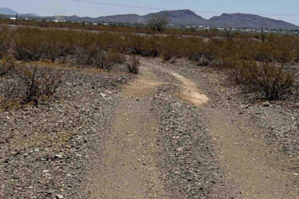
Beginner Off-Road Trails
Near Vicksburg, Arizona
Explore All Beginner Trails Near Vicksburg, Arizona
Beginner Off-Road Trails Near Vicksburg, Arizona
Discover the best beginner-friendly off-road trails near you. These easier, lower-rated trails are a great place to start — browse trail maps, check difficulty ratings, and find your next adventure.
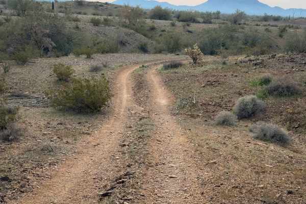
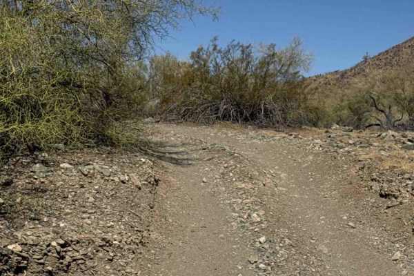
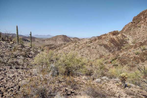
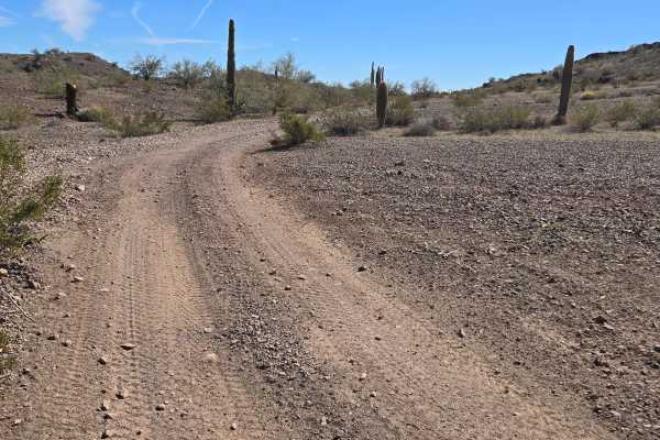
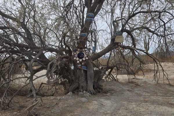
Vicksburg Flats
This is a flat and wide trail through the BLM desert near Vicksburg, Arizona. It is unmarked and has no signs for width designation, but there are tracks to follow. It rides across a flat desert terrain over packed loose rocks, then starts going over some rolling hills next to paloverde trees and va...
Learn more about Vicksburg Flats
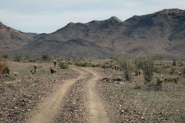
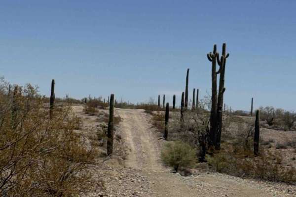
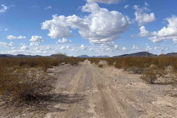
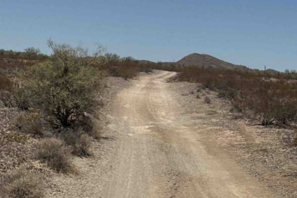
Vicksburg Valley
This is an unmarked desert trail north of Vicksburg, Arizona, that is wide like a road, going fast and straight through a barren desert landscape. It rides over a mix of dirt and packed dark-colored small loose rocks, next to giant saguaro cactus and gardens of cholla cactus. The trail dips into a c...
Learn more about Vicksburg Valley
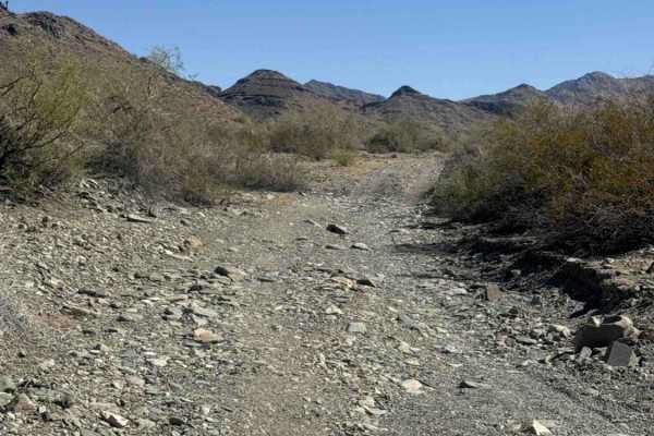
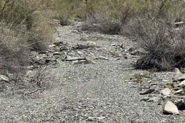
Calcite Wash
This wide, open wash trail begins just off Tank Pass coming from the south offers an excellent riding area for dirt bikes and ATVs. A staging area is available just before the entrance to the trail, with additional parking at the entrance to the wash. The route consists of a broad gravel wash with m...
Learn more about Calcite Wash
Vicksburg Wash
This trail rides along the desert floor north of Vicksburg, Arizona, riding through barren fields of cactus and creosote bushes. The trail parallels a wash, and you can see lots of RVs camped in the distance, as this is a popular camping area. The trail enters a wash that is a mix of small loose roc...
Learn more about Vicksburg Wash
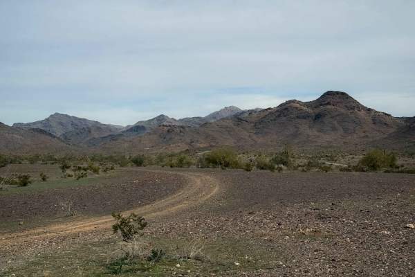
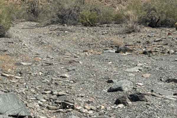
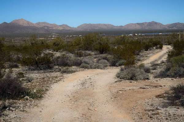
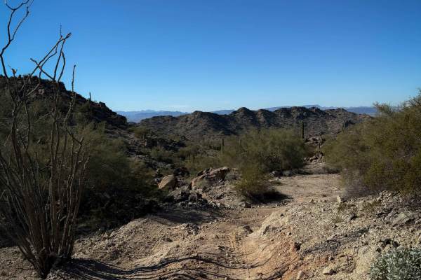
Cholla Ridge
This scenic desert trail begins in a broad wash before climbing through a couple of washed-out sections to the higher terrain. Once on top, the trail widens into an easy-to-follow route that winds through classic Sonoran Desert landscapes. The surface consists primarily of dirt and loose gravel, wit...
Learn more about Cholla Ridge
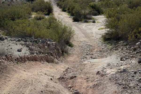
West Calcite Wash
Beginning off Tank Wash, this scenic wash trail starts as a narrow route along the wash wall before quickly opening into the broad expanse of Calcite Wash to the north. An experienced rider is recommended for the last section of this trail. The trail is a wide 2-track with a surface of loose grave...
Learn more about West Calcite Wash
Waterfall Wash
Beginning at Tank Pass, this trail offers two distinct routes, each providing a different off-road experience. Heading east, the trail follows a loose rock wash filled with countless small- to medium-sized rock waterfalls. Multiple lines are available through most obstacles, allowing drivers and rid...
Learn more about Waterfall Wash
Up Over
This is a scenic trail that goes up and over the mountains. Very narrow and not recommended for anything over 60 inches wide. High clearance and 4 wheel drive recommended as well. There are rocky washes to cross, and several downhill grades and climbs out again. This is not a two-vehicle wide trail....
Learn more about Up Over
Rockin' Ram Trail - Southern Section
This trail, combined with the Rockin' Ram Trail - Northern Section, will take you round-trip from Quartzsite to Brenda and back, all on dirt.From Brenda, AZ, take the Spur Loop to Brenda trail west until you can cross under the interstate. The tunnels under the interstate will fit a 75" SXS IF we t...
Learn more about Rockin' Ram Trail - Southern Section
Standing Tall
Standing Tall Trail begins off Tank Trail and travels east to west, point to point, through a beautiful stretch of Sonoran Desert. This wide 2-track is surrounded by towering saguaros, mature Palo Verde trees, desert creosote, and the backdrop of a large rocky mountain, offering scenic views through...
Learn more about Standing Tall
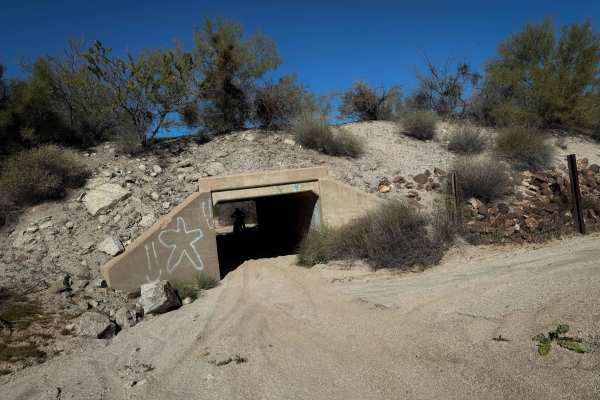
Hs66q
The north end of this trail starts north of Highway 60 and enters a couple of tunnels to go under the highway. The overhead clearance in the tunnels was really low, so watch your head. The northern half of the trail goes through a sand wash with deep sand and curvy, narrow sections in between oak tr...
Learn more about Hs66q
AZ Peace Trail Hovatter to Vicksburg Road
This connector trail leads from the Arizona Peace Trail across the desert toward Vicksburg Rd. There are a few options to refuel and restock at the truck stops. The eastern section of the trail is very moondust powdery. A northern section could be taken to bypass this, but the mesquite trees are ver...
Learn more about AZ Peace Trail Hovatter to Vicksburg Road
Head for Lunch Trail
This trail starts at the end of Preacher Pass Trail and goes to Brenda, Arizona. It meanders through the desert in mostly dirt and gravel. There are some shallow washes and turns in this trail. You will pass some rugged mountains on your left as you proceed toward town. This trail is narrow in place...
Learn more about Head for Lunch Trail
Palo Verde Run
Palo Verde Run begins off Tank Trail and heads east toward the Verde Row private property boundary. This easy 2-track follows the wash to the south through a beautiful section of Sonoran Desert filled with lush Palo Verde trees, towering saguaros, ocotillo, and native desert vegetation. The loose gr...
Learn more about Palo Verde Run
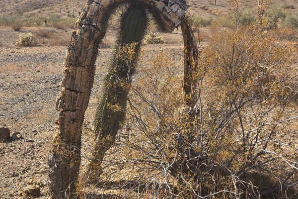
LP 859- LP 3143
This point-to-point trail meanders through the desert, allowing you to bypass Frontside from Ramsey Mine Road all the way to Vicksburg Road. It has various wash crossings and some sand. There are stunning views along the way, some of which include a natural arch formation. If it has been raining rec...
Learn more about LP 859- LP 3143
Hs42l
This is an easy desert trail that is mostly flat and straight through the BLM land near Salome, Arizona. It rides past giant ocotillo cactus and scraggly creosote bushes in a remote and barren landscape. There are giant boulders lining the trail at times, making it more scenic and unique. The trail ...
Learn more about Hs42l
Black Rock Trail
A scenic trail that cuts almost straight from Hillbilly around to Hovatter-Hope Road. Parts are rocky, parts are sandy, typical desert trail. There are lots of flora and fauna to see on the route, as well as saguaro cacti towering over smaller brush. This trail has mountain views and beautiful rock ...
Learn more about Black Rock Trail
The Wishing Rock
The Wishing Rock Trail begins off Tank Trail or from Standing Tall is an out and back and leads to an impressive rock mountain that serves as the centerpiece of the route. This unique area features a popular wishing rock, a spacious dispersed camping area, and plenty of opportunities to stop and enj...
Learn more about The Wishing Rock
Hs64l
This route makes a fun and easy loop through the BLM land near Salome, Arizona, with some mild rocky sections and a couple of great viewpoints. The trail starts out flat through the desert floor, meandering through the cactus with lots of easy straight sections and gradual curves. There is minor loo...
Learn more about Hs64l
Hs71l
This is a short desert trail less than a mile long that mostly goes straight and flat through the BLM land near Salome, Arizona. It rides through a dry desert landscape of paloverde trees and creosote bushes, with tall saguaro cactus dispersed through the brush. The trail has little dips across ravi...
Learn more about Hs71l
Beginner ATV trails near Vicksburg, Arizona
Explore ATV-friendly trails near you. These trails are accessible for vehicles up to 50 inches wide, perfect for ATVs and smaller off-road machines.
Vicksburg Flats
This is a flat and wide trail through the BLM desert near Vicksburg, Arizona. It is unmarked and has no signs for width designation, but there are tracks to follow. It rides across a flat desert terrain over packed loose rocks, then starts going over some rolling hills next to paloverde trees and va...
Learn more about Vicksburg Flats
Vicksburg Valley
This is an unmarked desert trail north of Vicksburg, Arizona, that is wide like a road, going fast and straight through a barren desert landscape. It rides over a mix of dirt and packed dark-colored small loose rocks, next to giant saguaro cactus and gardens of cholla cactus. The trail dips into a c...
Learn more about Vicksburg Valley
Calcite Wash
This wide, open wash trail begins just off Tank Pass coming from the south offers an excellent riding area for dirt bikes and ATVs. A staging area is available just before the entrance to the trail, with additional parking at the entrance to the wash. The route consists of a broad gravel wash with m...
Learn more about Calcite Wash
Vicksburg Wash
This trail rides along the desert floor north of Vicksburg, Arizona, riding through barren fields of cactus and creosote bushes. The trail parallels a wash, and you can see lots of RVs camped in the distance, as this is a popular camping area. The trail enters a wash that is a mix of small loose roc...
Learn more about Vicksburg Wash
Beginner UTV/side-by-side trails near Vicksburg, Arizona
Find UTV and side-by-side trails near you. These trails accommodate vehicles up to 60 inches wide, ideal for UTVs, side-by-sides, and wider off-road rigs.
Up Over
This is a scenic trail that goes up and over the mountains. Very narrow and not recommended for anything over 60 inches wide. High clearance and 4 wheel drive recommended as well. There are rocky washes to cross, and several downhill grades and climbs out again. This is not a two-vehicle wide trail....
Learn more about Up Over
Rockin' Ram Trail - Southern Section
This trail, combined with the Rockin' Ram Trail - Northern Section, will take you round-trip from Quartzsite to Brenda and back, all on dirt.From Brenda, AZ, take the Spur Loop to Brenda trail west until you can cross under the interstate. The tunnels under the interstate will fit a 75" SXS IF we t...
Learn more about Rockin' Ram Trail - Southern Section
AZ Peace Trail Hovatter to Vicksburg Road
This connector trail leads from the Arizona Peace Trail across the desert toward Vicksburg Rd. There are a few options to refuel and restock at the truck stops. The eastern section of the trail is very moondust powdery. A northern section could be taken to bypass this, but the mesquite trees are ver...
Learn more about AZ Peace Trail Hovatter to Vicksburg Road
Head for Lunch Trail
This trail starts at the end of Preacher Pass Trail and goes to Brenda, Arizona. It meanders through the desert in mostly dirt and gravel. There are some shallow washes and turns in this trail. You will pass some rugged mountains on your left as you proceed toward town. This trail is narrow in place...
Learn more about Head for Lunch Trail
The onX Offroad Difference
onX Offroad combines trail photos, descriptions, difficulty ratings, width restrictions, seasonality, and more in a user-friendly interface. Available on all devices, with offline access and full compatibility with CarPlay and Android Auto. Discover what you're missing today!
Open Trail Map