
Beginner Off-Road Trails
Near St. Helen, Michigan
Explore All Beginner Trails Near St. Helen, Michigan
Beginner Off-Road Trails Near St. Helen, Michigan
Discover the best beginner-friendly off-road trails near you. These easier, lower-rated trails are a great place to start — browse trail maps, check difficulty ratings, and find your next adventure.
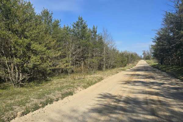
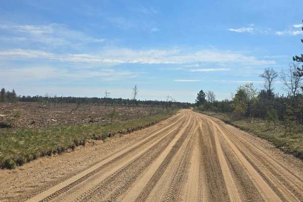
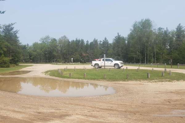
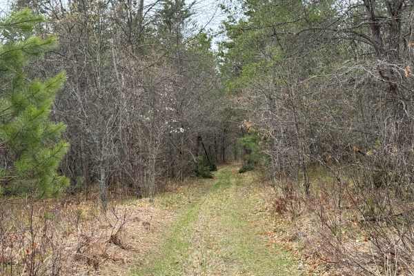
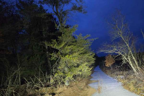
St. Helen Trail
St Helen Trail is a 3ish-wide vehicle sandy trail that will take you through new growth forest and older forest. This trail will take you to the St. Helen area or the West Branch area for food and fuel. Plenty of other trails branch off this trail for more areas to explore the area. Also, there is a...
Learn more about St. Helen Trail
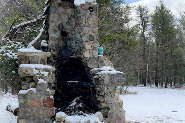
Sacred Chimney Trail
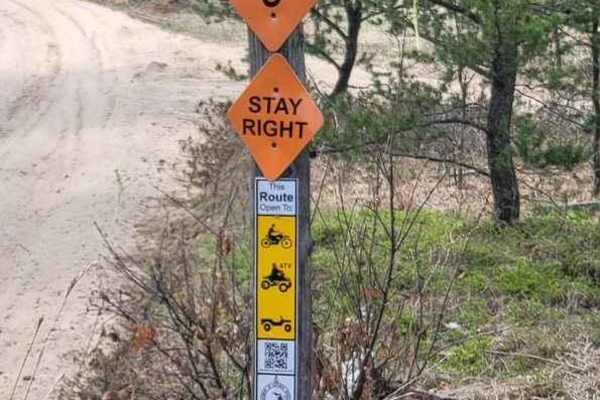
This trail is a point-to-point section of DNR Trail 6, which is part of extensive off-road vehicle trails that branch out from the ORV-friendly community of St. Helen, Michigan. This short but popular section of trail begins at a large parking lot, maintained by the Roscommon State Forest Area, near...
Learn more about Sacred Chimney Trail
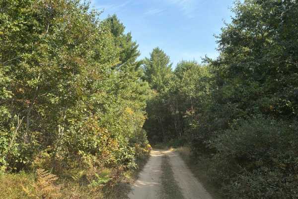
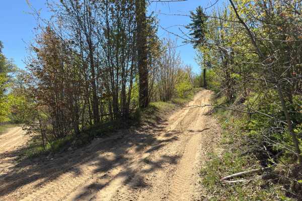
Jack's Trail
This is a single-lane two-track trail made up of compact sand and dirt, often featuring whoops similar to other popular trails in the area. The south end of the trail winds through a patch of dense jack pines, creating a natural tunnel with their low-hanging, overarching branches. Navigate this one-...
Learn more about Jack's Trail
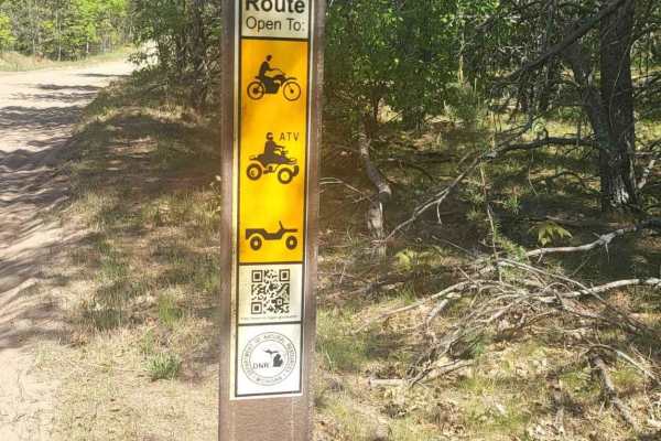
Ogemaw Hills ORV Route
This Michigan DNR ORV Route is open to full-size, 50-inch, and motorcycles with ORV permits and trail permit stickers. This area connects with St. Helen ORV Route on the west side. The west side of this trail is very wide and deep sand with possible water crossings. The east side is a narrow two-tra...
Learn more about Ogemaw Hills ORV Route
Beaver Lake Trail
Beaver Lake Trail is a 3 or so vehicle-wide sandy trail that will take you through new growth forest, older forest, and recently clear-cut areas. This trail will take you to the St. Helen area or the Clear Lake area for food and fuel. Plenty of other trails branch off this trail for more areas to ex...
Learn more about Beaver Lake Trail
St. Helen ORV Route - West
Michigan DNR ORV Route is open to full-size vehicles, 50 inch, and 24 inch with ORV and trail permits. The route is mostly soft sand. This section of the route is a connector between St. Helen Route and Denton Hills Route. It's mostly very wide and flat. The trail becomes washboard quickly with the ...
Learn more about St. Helen ORV Route - West
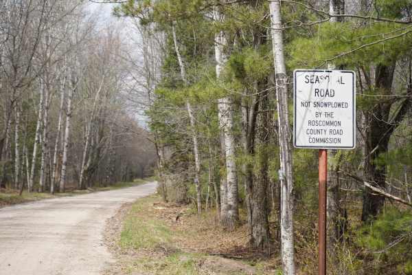
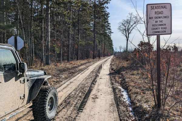
Third Lake Road
This is a very easy, seasonal, unmaintained road that can be used as a connector trail between the Roscommon Route, Geels Loop, and Saint Helen. It is nothing more than a simple dirt road from spring through fall. Since it is seasonal, the snow will not be plowed in winter, which may make it more di...
Learn more about Third Lake Road
Saunter Trail
Saunter Trail is a narrow two-track connector trail running between Pine Drive and North Saint Helen Road through a quiet section of pine forest near Saint Helen. The trail is a combination of smooth hard-pack dirt and sand with grassy sections throughout. Tall pine trees line much of the route, cre...
Learn more about Saunter Trail
Geels South Loop
Geels South Loop is a fast paced 50" trail, roughly 25 miles long. It contains mostly shallow sand with some soft dirt, in the wooded sections. The trail is well maintained with intersections clearly marked. Geels South Loop is the perfect trail for day trip riders and for beginners trying to learn ...
Learn more about Geels South Loop
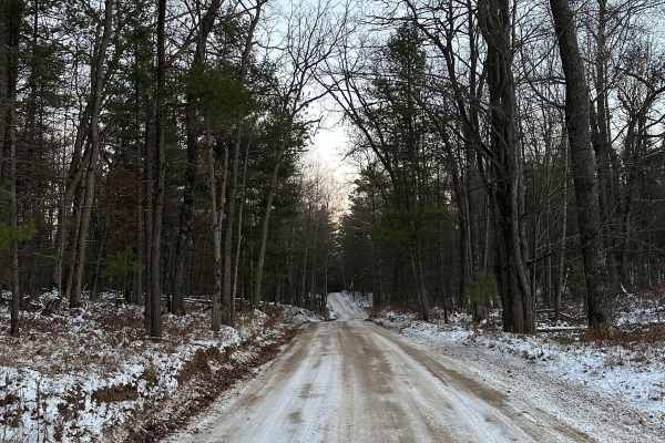
Moore Road
This is an unmaintained seasonal road that has sand and dirt terrain. It passes through dense woods, open areas, wetlands, and then has a rewarding view of Lake Saint Helen at the end, which is often used as a dispersed camping area. Heavy snow could make this trail more difficult, but in any other ...
Learn more about Moore Road
Geels North Loop
This loop is a great way to enjoy the beautiful trails of Michigan in any AWD vehicle, and it's not too far from Houghton Lake. The terrain is hard-packed sand and doesn't have any low-lying areas or puddles. As common with the high-trafficked trails in the St. Helens area, there are a few short are...
Learn more about Geels North Loop
Geels Loop
This loop can be found off of Old Michigan Highway 76 and consists of Geels Trail on the north and Geels Road on the south. The north trail has large whoops on it and will be slow-moving as you make your way down the power line trail. There are many motorcycle trails as well as an open area called ...
Learn more about Geels Loop
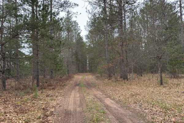
Wandering Trail
This scenic two-track begins alongside a small creek that parallels the trail for a short distance, adding a peaceful backdrop to the opening section. The trail surface consists primarily of hard-packed dirt mixed with sandy stretches and occasional grassy sections. Frequent twists and turns keep th...
Learn more about Wandering Trail
Hippie Circle Trail
This challenging two-track begins with a short stretch of soft sand before quickly transitioning to hard-packed sandy terrain. From there, the trail takes on a rollercoaster-like character, over a series of steep hills, sharp descents, and constant elevation changes. The route becomes increasingly r...
Learn more about Hippie Circle Trail
Pine Drive
This trail runs east and west. The west side of this trail is wide and represents a dirt road. This area is a mixed-traffic trail, so expect to see side-by-sides, quads, motorcycles, and snowmobiles in the winter. This section of the trail is hard-packed sand. The trail narrows down towards the east...
Learn more about Pine Drive
Aginaw Loop
Aginaw Loop to Knoch is part of multiple trail systems in the area of the checkerboard. This trail is made up of pines and hardwood and starts as double-lane dirt and then drops to single-lane dirt. If you're looking for a nice ride, this is the trail for you. The trail does cross the Ogemaw Hills O...
Learn more about Aginaw Loop
Odessa Road
This route is mostly 1.5 vehicles wide the whole way. This will take you through mostly wooded areas with ample opportunity to see various creatures roaming the woods. This route intersects various other trails and roads and many opportunities to explore more areas. If you head to the north you will...
Learn more about Odessa Road
Perry Holt Rod
The south end of the road is 3 cars wide, as you travel further north the road narrows down to 1.5 cars wide. Most of the road is sandy with occasional small mud holes. At the north end of the road is a hill in the road along with several other hills just off the road to climb. This road intersects ...
Learn more about Perry Holt Rod
Oyster Road/4476
This trail maintains 2-4 car widths the entire way. The trail only has a few small elevation changes. For the most part, the ground is hard-packed sand and has some smaller shallow mud holes. You'll find some nice views as the trail runs along the edge of a beautiful wooded area with open fields to ...
Learn more about Oyster Road/4476
Turney Ranch Trail
This trail runs between Stoney Ridge and Meridian Road east and west. It is sandy with some loose spots and shallow mud holes. The trail width ranges between 2 and 4 cars wide. Along this trail, you'll experience small elevation changes as you drive through a beautiful wooded setting. You can expect...
Learn more about Turney Ranch Trail
Beginner ATV trails near St. Helen, Michigan
Explore ATV-friendly trails near you. These trails are accessible for vehicles up to 50 inches wide, perfect for ATVs and smaller off-road machines.
St. Helen Trail
St Helen Trail is a 3ish-wide vehicle sandy trail that will take you through new growth forest and older forest. This trail will take you to the St. Helen area or the West Branch area for food and fuel. Plenty of other trails branch off this trail for more areas to explore the area. Also, there is a...
Learn more about St. Helen Trail
Sacred Chimney Trail
This trail is a point-to-point section of DNR Trail 6, which is part of extensive off-road vehicle trails that branch out from the ORV-friendly community of St. Helen, Michigan. This short but popular section of trail begins at a large parking lot, maintained by the Roscommon State Forest Area, near...
Learn more about Sacred Chimney Trail
Jack's Trail
This is a single-lane two-track trail made up of compact sand and dirt, often featuring whoops similar to other popular trails in the area. The south end of the trail winds through a patch of dense jack pines, creating a natural tunnel with their low-hanging, overarching branches. Navigate this one-...
Learn more about Jack's Trail
Ogemaw Hills ORV Route
This Michigan DNR ORV Route is open to full-size, 50-inch, and motorcycles with ORV permits and trail permit stickers. This area connects with St. Helen ORV Route on the west side. The west side of this trail is very wide and deep sand with possible water crossings. The east side is a narrow two-tra...
Learn more about Ogemaw Hills ORV Route
Beginner UTV/side-by-side trails near St. Helen, Michigan
Find UTV and side-by-side trails near you. These trails accommodate vehicles up to 60 inches wide, ideal for UTVs, side-by-sides, and wider off-road rigs.
St. Helen Trail
St Helen Trail is a 3ish-wide vehicle sandy trail that will take you through new growth forest and older forest. This trail will take you to the St. Helen area or the West Branch area for food and fuel. Plenty of other trails branch off this trail for more areas to explore the area. Also, there is a...
Learn more about St. Helen Trail
Sacred Chimney Trail
This trail is a point-to-point section of DNR Trail 6, which is part of extensive off-road vehicle trails that branch out from the ORV-friendly community of St. Helen, Michigan. This short but popular section of trail begins at a large parking lot, maintained by the Roscommon State Forest Area, near...
Learn more about Sacred Chimney Trail
Jack's Trail
This is a single-lane two-track trail made up of compact sand and dirt, often featuring whoops similar to other popular trails in the area. The south end of the trail winds through a patch of dense jack pines, creating a natural tunnel with their low-hanging, overarching branches. Navigate this one-...
Learn more about Jack's Trail
Ogemaw Hills ORV Route
This Michigan DNR ORV Route is open to full-size, 50-inch, and motorcycles with ORV permits and trail permit stickers. This area connects with St. Helen ORV Route on the west side. The west side of this trail is very wide and deep sand with possible water crossings. The east side is a narrow two-tra...
Learn more about Ogemaw Hills ORV Route
The onX Offroad Difference
onX Offroad combines trail photos, descriptions, difficulty ratings, width restrictions, seasonality, and more in a user-friendly interface. Available on all devices, with offline access and full compatibility with CarPlay and Android Auto. Discover what you're missing today!
Open Trail Map