
Beginner Off-Road Trails
Near New Pine Creek, Oregon
Explore All Beginner Trails Near New Pine Creek, Oregon
Beginner Off-Road Trails Near New Pine Creek, Oregon
Discover the best beginner-friendly off-road trails near you. These easier, lower-rated trails are a great place to start — browse trail maps, check difficulty ratings, and find your next adventure.
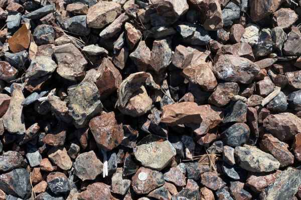
Warner Mountains
This area is part of Modoc National Forest. There are several obsidian collection areas that require a permit that can be obtained at the Alturas Forest Service building. Once you get into the range, the obsidian is everywhere, so beware of flat tires. The area is known for its pink and rainbow obsi...
Learn more about Warner Mountains
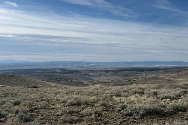
Sheldon Wildlife Refuge & Yellow Peak
This beautiful trail leads you into the Sheldon Wildlife Refuge, with a short side trip to Yellow Peak, where a fire lookout offers expansive views of the Nevada desert. The trail surface is primarily a mix of dirt and gravel, making for an enjoyable ride. Be sure to stop by Catnip Reservoir and tak...
Learn more about Sheldon Wildlife Refuge & Yellow Peak
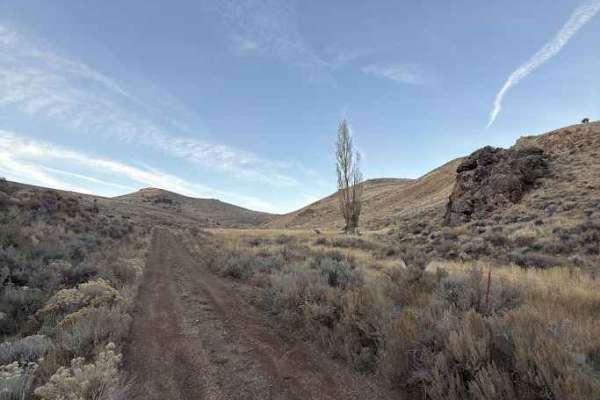
Miner's Draw Cabin - FS 6175, 6145, 6105
Forest Service Road 6175 offers a fun, easygoing route from Plush, Oregon, to the Sunstone Collection Area, making it a great option for anyone looking to explore Oregon’s high desert without tackling technical terrain. The road surface is generally well-graded gravel with stretches of compact dirt ...
Learn more about Miner's Draw Cabin - FS 6175, 6145, 6105
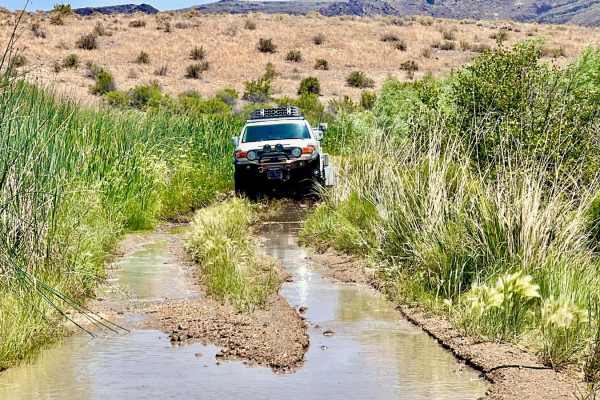
Virgin Valley Road
This trail starts out at a small campground and then winds its way past the Opal and Peacock Mining area and by a few old abandoned houses and mining ruins. This road has several spur trails off it and is a great place to look for cool rocks, opals, and other gemstones.
Learn more about Virgin Valley Road
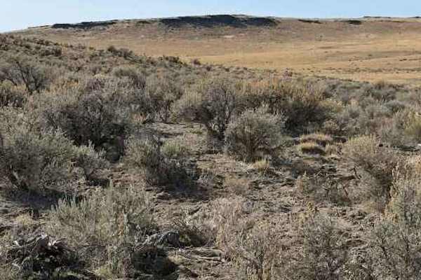
Christmas Valley Desert Crossing
This remote BLM route connecting Plush to Christmas Valley delivers a classic Oregon high desert experience, with long stretches of open two-track winding through sagebrush flats and rolling volcanic terrain. Expect a mix of firm gravel, sandy sections, and occasional rutted dirt that can get rough ...
Learn more about Christmas Valley Desert Crossing
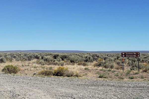
Sunstone Collection Area
This route will take you from HWY 395 to the Sunstone Collection Site and camping area. Along the route, you will have nice views of the high-desert landscapes and Hart Mountain. The camping area has a vault toilet and a few developed sites. There is also a large dispersed camping area.
Learn more about Sunstone Collection Area
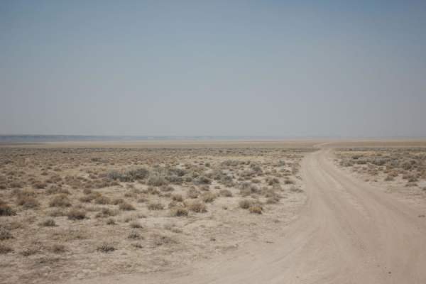
Flook Lake
This trail accesses the Flook Lake playa, which is a dried up lake bed. This trail is very dusty in summer and extreme caution should be taken in spring or fall especially if there has been recent rain. Off-road travel should not be attempted for two reasons: this trail is inside the Hart Mountain W...
Learn more about Flook Lake
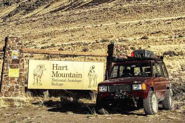
Flook Lake Bypass - Hart Mountain Antelope Refuge
This is a sensitive wildlife area. Please follow all posted signs, even if they direct you off this onX route. Stay on designated routes at all times. Camping is limited to designated areas and by permit only. Visit the official website for the latest access and conditions information: https://www.f...
Learn more about Flook Lake Bypass - Hart Mountain Antelope Refuge
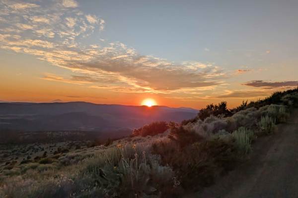
Mount Lively South Fork Mountain Road
This trail begins just off Highway 395 south of the village of Likely, starting on BLM land before transitioning in and out of Modoc National Forest. The first stretch is a recently graded dirt road with scattered loose and embedded rocks, surrounded by sagebrush and stands of pine. After about thre...
Learn more about Mount Lively South Fork Mountain Road
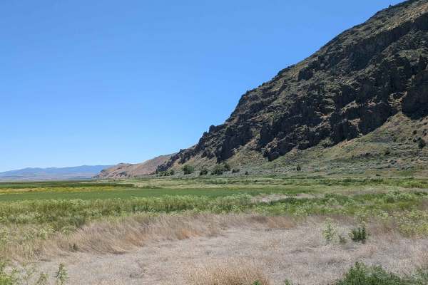
Auto Tour Route Along Sump 1 A and South Sump 1B
This scenic auto tour route offers a tranquil journey along the southern shore of Tule Lake, located within the Tule Lake National Wildlife Refuge. The landscape is a study in contrasts, featuring the expansive, water-filled reservoir on one side and vast, verdant grass meadows on the other. As you ...
Learn more about Auto Tour Route Along Sump 1 A and South Sump 1B
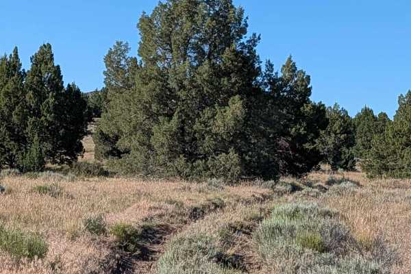
Barntop Spur Bypass
This bypass route serves as an optional loop that begins and ends along the Barntop Spur. It offers a concise journey through the rolling landscape of the region, providing travelers with elevated perspectives of the surrounding hills and mountains. A significant highlight of this trail is the promi...
Learn more about Barntop Spur Bypass
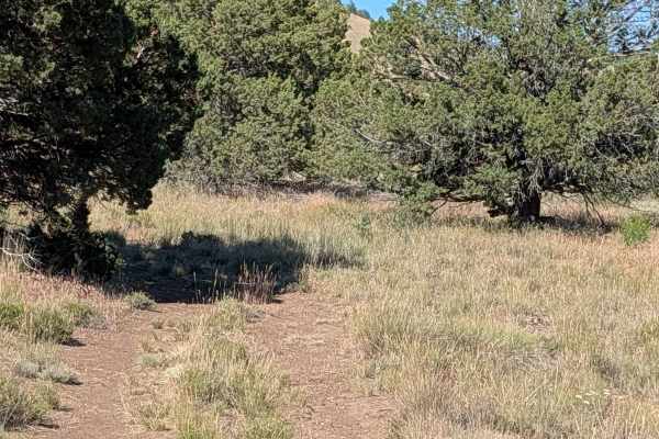
FS 47A14E
This short, functional connector trail provides a direct path through a picturesque landscape defined by rolling grass fields, sparse clusters of small brush, and occasional trees. As you travel from west to east, the route offers pleasant, elevated views of the surrounding mountains and hills, prov...
Learn more about FS 47A14E
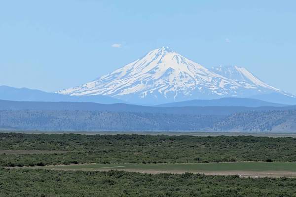
Lower Klamath Road
Embarking on this historical passage offers travelers a fascinating journey through time, tracing a segment of the storied California Trail system. As you traverse this route, the landscape unfolds in a majestic display of high-desert beauty, dominated by expansive horizons and rolling topography. T...
Learn more about Lower Klamath Road
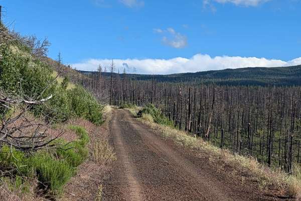
FS 44N23
This route serves as a significant transit line through the Modoc National Forest, traversing an area heavily impacted by the 2021 Antelope Forest Fire. While the fire's legacy is still clearly visible in the many standing dead trees throughout the landscape, the forest is beginning to recover with ...
Learn more about FS 44N23
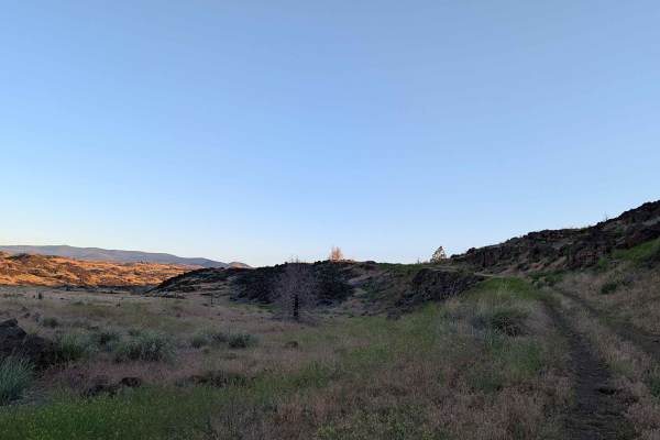
Gold Digger Pass - FS 46N21
This route begins on the east side, diverging from Hill Road within the bounds of the Lava Beds National Monument. The landscape is profoundly defined by ancient volcanic activity, with the trail winding through an environment dominated by sprawling lava rock formations interspersed with patches of ...
Learn more about Gold Digger Pass - FS 46N21
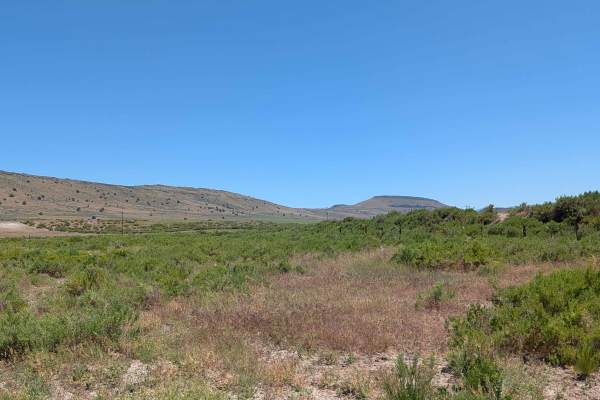
Brownell Lava Bed Road
This route begins as a divergence from the Lower Klamath Road, serving as an entry point into a distinctive landscape characterized by expansive, grassy meadows and rolling topography. The terrain is notably influenced by ancient volcanic activity, featuring gradual hills formed from weathered lava ...
Learn more about Brownell Lava Bed Road
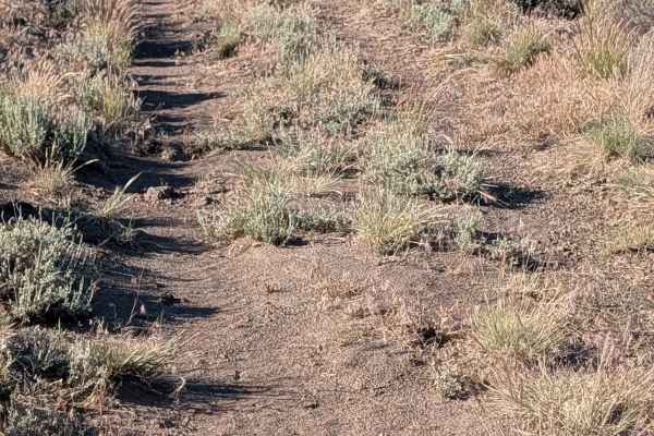
FS 47A14D
This short route offers an immersive experience within the Modoc National Forest, winding through a narrow canyon framed by dramatic walls of volcanic rock. The path provides a consistent, scenic transit, highlighted by expansive views of Mount Shasta and the broader panorama of surrounding Californ...
Learn more about FS 47A14D
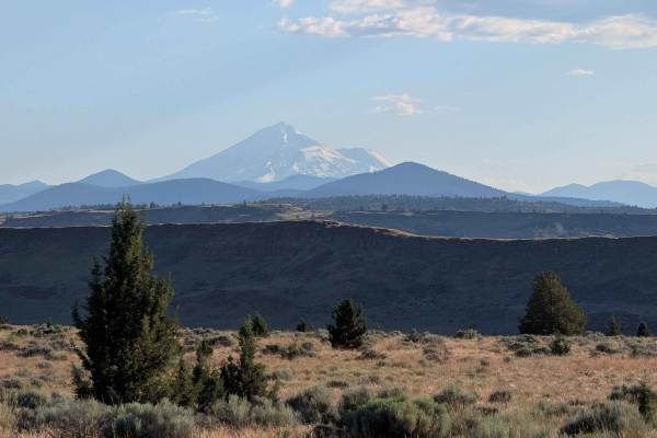
Barntop Spur - FS 47A14C
This 4.5-mile out-and-back route serves as an engaging diversion from the Barntop Trail, inviting travelers to explore the varied terrain of the Modoc National Forest. The journey begins with a transit through rugged forest landscapes before the path splits near the third-mile mark, where drivers ha...
Learn more about Barntop Spur - FS 47A14C
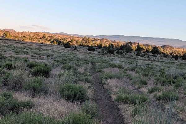
FS 46A21A
This connecting route serves as an efficient bridge between Gold Digger Pass and the Barntop Trail, offering a focused look at the distinct volcanic geology of the region. As you traverse the path, the landscape is defined by a series of mounds and rolling hills constructed of ancient volcanic rock,...
Learn more about FS 46A21A
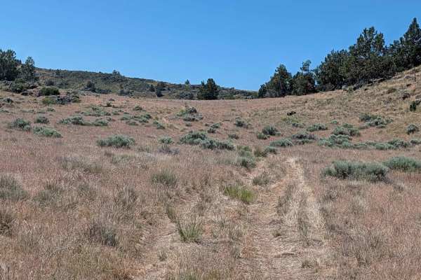
Sheep Camp Spur A - FS 47N18A
This 3.5-mile point-to-point trail connects Sheep Camp Butte to Lower Klamath Road, traveling through a meadow environment flanked by volcanic lava bed ridges. The trail surface consists of loose dirt with occasional small to medium volcanic rocks, some of which can appear unexpectedly since overgro...
Learn more about Sheep Camp Spur A - FS 47N18A
Beginner ATV trails near New Pine Creek, Oregon
Explore ATV-friendly trails near you. These trails are accessible for vehicles up to 50 inches wide, perfect for ATVs and smaller off-road machines.
Warner Mountains
This area is part of Modoc National Forest. There are several obsidian collection areas that require a permit that can be obtained at the Alturas Forest Service building. Once you get into the range, the obsidian is everywhere, so beware of flat tires. The area is known for its pink and rainbow obsi...
Learn more about Warner Mountains
Miner's Draw Cabin - FS 6175, 6145, 6105
Forest Service Road 6175 offers a fun, easygoing route from Plush, Oregon, to the Sunstone Collection Area, making it a great option for anyone looking to explore Oregon’s high desert without tackling technical terrain. The road surface is generally well-graded gravel with stretches of compact dirt ...
Learn more about Miner's Draw Cabin - FS 6175, 6145, 6105
Christmas Valley Desert Crossing
This remote BLM route connecting Plush to Christmas Valley delivers a classic Oregon high desert experience, with long stretches of open two-track winding through sagebrush flats and rolling volcanic terrain. Expect a mix of firm gravel, sandy sections, and occasional rutted dirt that can get rough ...
Learn more about Christmas Valley Desert Crossing
Sunstone Collection Area
This route will take you from HWY 395 to the Sunstone Collection Site and camping area. Along the route, you will have nice views of the high-desert landscapes and Hart Mountain. The camping area has a vault toilet and a few developed sites. There is also a large dispersed camping area.
Learn more about Sunstone Collection Area
Beginner UTV/side-by-side trails near New Pine Creek, Oregon
Find UTV and side-by-side trails near you. These trails accommodate vehicles up to 60 inches wide, ideal for UTVs, side-by-sides, and wider off-road rigs.
Warner Mountains
This area is part of Modoc National Forest. There are several obsidian collection areas that require a permit that can be obtained at the Alturas Forest Service building. Once you get into the range, the obsidian is everywhere, so beware of flat tires. The area is known for its pink and rainbow obsi...
Learn more about Warner Mountains
Miner's Draw Cabin - FS 6175, 6145, 6105
Forest Service Road 6175 offers a fun, easygoing route from Plush, Oregon, to the Sunstone Collection Area, making it a great option for anyone looking to explore Oregon’s high desert without tackling technical terrain. The road surface is generally well-graded gravel with stretches of compact dirt ...
Learn more about Miner's Draw Cabin - FS 6175, 6145, 6105
Christmas Valley Desert Crossing
This remote BLM route connecting Plush to Christmas Valley delivers a classic Oregon high desert experience, with long stretches of open two-track winding through sagebrush flats and rolling volcanic terrain. Expect a mix of firm gravel, sandy sections, and occasional rutted dirt that can get rough ...
Learn more about Christmas Valley Desert Crossing
Flook Lake
This trail accesses the Flook Lake playa, which is a dried up lake bed. This trail is very dusty in summer and extreme caution should be taken in spring or fall especially if there has been recent rain. Off-road travel should not be attempted for two reasons: this trail is inside the Hart Mountain W...
Learn more about Flook Lake
The onX Offroad Difference
onX Offroad combines trail photos, descriptions, difficulty ratings, width restrictions, seasonality, and more in a user-friendly interface. Available on all devices, with offline access and full compatibility with CarPlay and Android Auto. Discover what you're missing today!
Open Trail Map