
Beginner Off-Road Trails
Near LaFollette, Tennessee
Explore All Beginner Trails Near LaFollette, Tennessee
Beginner Off-Road Trails Near LaFollette, Tennessee
Discover the best beginner-friendly off-road trails near you. These easier, lower-rated trails are a great place to start — browse trail maps, check difficulty ratings, and find your next adventure.
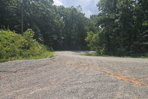
Ivydell Road
This is an easy two lane gravel road to the the trail system at the North Cumberland Wildlife Management Area. There is plenty of room to pass and has a 685 foot elevation gain in a short period. This road is just one of the ways to get to the Elk viewing tower. A North Cumberland Off-Highway Vehicl...
Learn more about Ivydell Road
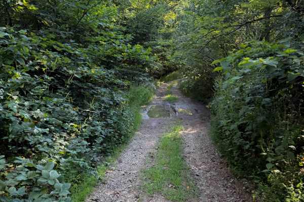
Hunter Access Pond Road
This short hunter’s access road is an unmarked and more primitive Off- Highway Vehicle trail in the Sundquist Unit of the North Cumberland Off- Highway Vehicle Riding Area. The trail starts off from the south end as a single-lane gravel road, lined with locust trees and river birch trees. Watch out ...
Learn more about Hunter Access Pond Road
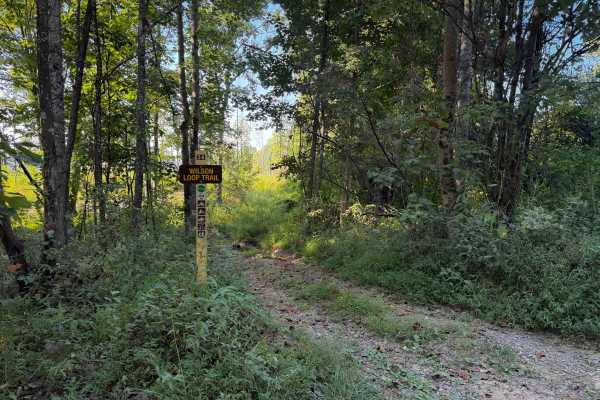
Wilson Loop Trail 38
The Wilson Loop Trail is a .8 mile long Off- Highway Vehicle trail within the North Cumberland Wildlife Management Area, in the Sundquist Unit north of LaFollette, Tennessee, that makes a loop off of McCormick Cemetery Road. There is a mucky mud hole right at the entrance after the sign on the west ...
Learn more about Wilson Loop Trail 38
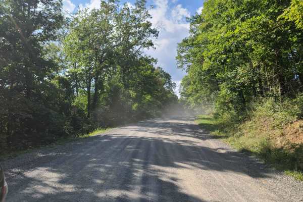
McCormick Cemetery Road - Trail 24
This trail is a maintained gravel road that connects several other popular trails. At one end it connects to Trail 19, and at the other end, it connects to Trail 25. Trail 37 is also accessible from this trail and is a popular waterfall destination. There is also a cemetery called McCormick Cemetery...
Learn more about McCormick Cemetery Road - Trail 24
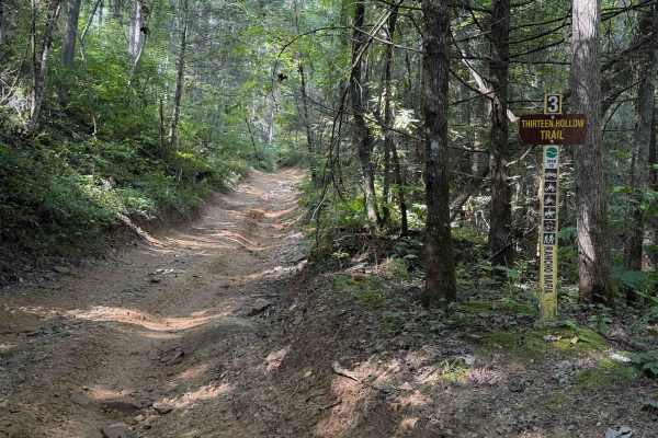
Thirteen Hollow Trail 3
Thirteen Hollow Trail is a short connector trail between Ollie’s Creek Trail 2 and Flatwoods Road Trail 1. The trail is mostly a mix of clay and dirt with loose rocks and shallow ruts that can get very slick when wet, as it rides through a dense forested hollow that holds a lot of moisture in the di...
Learn more about Thirteen Hollow Trail 3
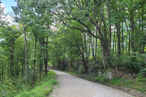
Elk Viewing Tower Road - Trail 25
This is a well-maintained gravel road that goes from Highway 25W to the elk viewing tower at Hatfield Knob. There are several viewing areas and lookouts on the way up as well, so keep an eye out for elk and deer. September is the best time to view elk, as they tend to gather into large herds during ...
Learn more about Elk Viewing Tower Road - Trail 25
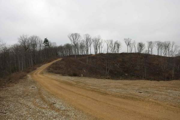
Trail 4 - Short Mountain Road
This is a road along the top of a ridge that has recently been cleared for logging. The road is wide and flat and easily accessible by most stock 4x4s. It gets a little bit rougher as it gets closer to Trail 6 with some humps and dips that may challenge low approach or departure angles. The use of t...
Learn more about Trail 4 - Short Mountain Road
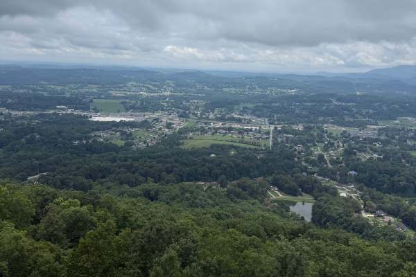
Old Kentucky Road
The route starts on pavement and then transitions to gravel. While generally straightforward, washouts leaving Jacksboro have become more pronounced and can make travel more challenging, especially during or after rain. There are several mud holes near Flatwoods Road. Most are manageable in a stock ...
Learn more about Old Kentucky Road
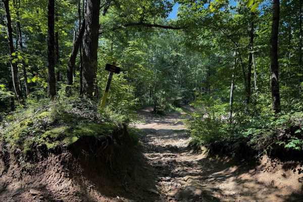
Pond Trail 29
Pond Trail, within the Sundquist Unit of the North Cumberland Off Highway Vehicle Riding Area, near LaFollette, Tennessee, is 2 miles long, meandering up and over small rolling hills on a muddy quad track. The east entrance to the trail is off of Fred’s Way Trail and has a narrow entrance between ta...
Learn more about Pond Trail 29
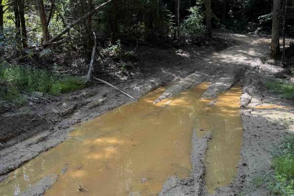
School House Trail 16
The School House Trail within the Sundquist Unit of the North Cumberland Off- Highway Vehicle Riding Area is open to high-clearance 4x4 vehicles and Off- Highway Vehicles. The short trail, at 1.2 miles long, is mostly wide and gradual, with minimal elevation change. It meanders on a hilltop in a lus...
Learn more about School House Trail 16
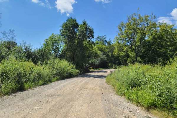
Flatwoods Road - Trail 1
This is a well-maintained gravel road accessible by any stock vehicle. It starts just off of I-75 and is a nice gravel road with a few potholes and puddles. Any stock truck or SUV can do this section at least as far as the shooting range. After that, it is a little rougher with a few steep rocky hil...
Learn more about Flatwoods Road - Trail 1
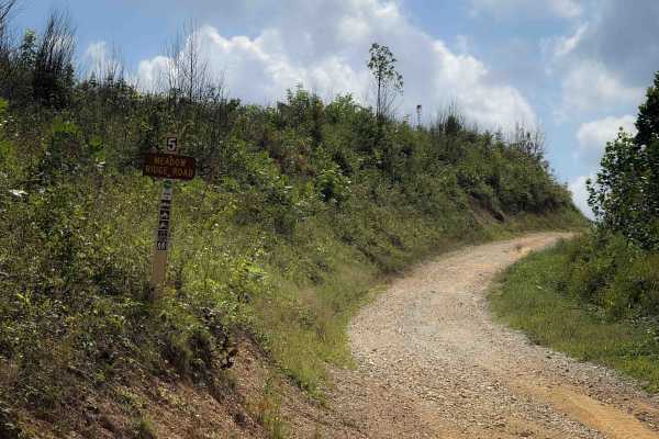
Meadow Ridge Road 5
Meadow Ridge Road is a narrow 4x4 trail within the North Cumberland Off-Highway Vehicle Riding Area, in the Sundquist Unit. It’s an easy and wide gravel trail with frequent ruts running vertically along the side of the trail. The trail is dry and sun-exposed, so it is not as muddy or rutted out as s...
Learn more about Meadow Ridge Road 5
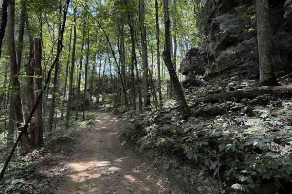
Lost Ridge Trail 14
Lost Ridge Trail within the Sundquist Unit of the North Cumberland OHV Riding Area, is a 1.7 mile long easy OHV trail. It’s mostly a narrow trail on a muddy clay-dirt surface, with a mix of loose rock, and a few bigger flat rocks in the trail that are easy to ride over, but can be slick when wet. Th...
Learn more about Lost Ridge Trail 14
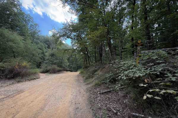
Cell Tower Road - 12
Cell Tower Road is nearly a mile long access road into the Sundquist Unit of the North Cumberland OHV Riding Area. It starts on the Howard Baker Highway at the Shell gas station, on the east side of Interstate 75. The wide shelf road climbs up for .8 miles, gaining about 500 feet elevation, followin...
Learn more about Cell Tower Road - 12
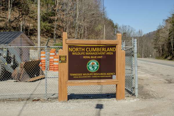
Titus Hollow Road
The trail is a maintained two-way gravel road that follows alongside Titus Creek and parallels active railroad tracks for much of the route. The surface is generally smooth and graded, making it accessible for most vehicles, but drivers should stay alert for occasional blind curves and loose gravel ...
Learn more about Titus Hollow Road
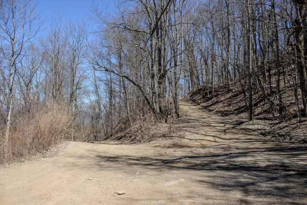
Cross Mountain Road
Cross Mountain Trail is one of the main routes through the Royal Blue Riding Area, stretching across the mountain and serving as a major connector for much of the trail system. Rated a 3/10, it is one of the longer trails in the area and can be completed by smaller 4x4 SUVs with good ground clearanc...
Learn more about Cross Mountain Road
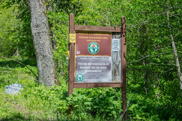
RBS19
RBS19 is a two-way, mostly dirt trail that connects Cross Mountain Road to CR 63. The trail follows the power line for much of the route before branching off toward the main road. This is a narrow trail with limited areas to pass or pull over, so drivers should watch for oncoming traffic and plan be...
Learn more about RBS19
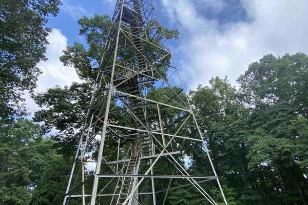
Main Forest Road
Main Forest Road offers an easy, highly scenic 13.2-mile cruise through Chuck Swan State Forest that is perfect for beginners, families, and anyone looking to enjoy a relaxing drive with gorgeous lake views and deep historical significance. This unpaved route serves as the primary artery of the fore...
Learn more about Main Forest Road
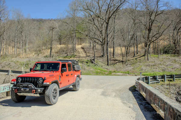
Turley Road
The trail is a two-way route with a mix of dirt, loose rock, and natural terrain features. Drivers can expect steep grades up to 20%, along with sections of loose rock that can make climbs more technical, especially in wet conditions. Water crossings are a key feature, typically reaching up to 12 in...
Learn more about Turley Road
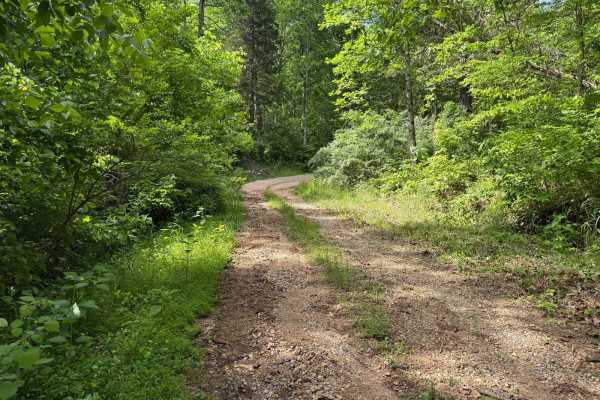
Crumely Loop
Crumely Loop is a mellow 2.6-mile forest road tucked into the heart of Chuck Swan State Forest. Like all the roads here, it's an active logging route, so keep an eye out for trucks and yield when needed. Several old roads branch off along the way, but most are closed to motorized vehicles; just foll...
Learn more about Crumely Loop
Beginner ATV trails near LaFollette, Tennessee
Explore ATV-friendly trails near you. These trails are accessible for vehicles up to 50 inches wide, perfect for ATVs and smaller off-road machines.
Ivydell Road
This is an easy two lane gravel road to the the trail system at the North Cumberland Wildlife Management Area. There is plenty of room to pass and has a 685 foot elevation gain in a short period. This road is just one of the ways to get to the Elk viewing tower. A North Cumberland Off-Highway Vehicl...
Learn more about Ivydell Road
Hunter Access Pond Road
This short hunter’s access road is an unmarked and more primitive Off- Highway Vehicle trail in the Sundquist Unit of the North Cumberland Off- Highway Vehicle Riding Area. The trail starts off from the south end as a single-lane gravel road, lined with locust trees and river birch trees. Watch out ...
Learn more about Hunter Access Pond Road
Wilson Loop Trail 38
The Wilson Loop Trail is a .8 mile long Off- Highway Vehicle trail within the North Cumberland Wildlife Management Area, in the Sundquist Unit north of LaFollette, Tennessee, that makes a loop off of McCormick Cemetery Road. There is a mucky mud hole right at the entrance after the sign on the west ...
Learn more about Wilson Loop Trail 38
McCormick Cemetery Road - Trail 24
This trail is a maintained gravel road that connects several other popular trails. At one end it connects to Trail 19, and at the other end, it connects to Trail 25. Trail 37 is also accessible from this trail and is a popular waterfall destination. There is also a cemetery called McCormick Cemetery...
Learn more about McCormick Cemetery Road - Trail 24
Beginner UTV/side-by-side trails near LaFollette, Tennessee
Find UTV and side-by-side trails near you. These trails accommodate vehicles up to 60 inches wide, ideal for UTVs, side-by-sides, and wider off-road rigs.
Ivydell Road
This is an easy two lane gravel road to the the trail system at the North Cumberland Wildlife Management Area. There is plenty of room to pass and has a 685 foot elevation gain in a short period. This road is just one of the ways to get to the Elk viewing tower. A North Cumberland Off-Highway Vehicl...
Learn more about Ivydell Road
Hunter Access Pond Road
This short hunter’s access road is an unmarked and more primitive Off- Highway Vehicle trail in the Sundquist Unit of the North Cumberland Off- Highway Vehicle Riding Area. The trail starts off from the south end as a single-lane gravel road, lined with locust trees and river birch trees. Watch out ...
Learn more about Hunter Access Pond Road
Wilson Loop Trail 38
The Wilson Loop Trail is a .8 mile long Off- Highway Vehicle trail within the North Cumberland Wildlife Management Area, in the Sundquist Unit north of LaFollette, Tennessee, that makes a loop off of McCormick Cemetery Road. There is a mucky mud hole right at the entrance after the sign on the west ...
Learn more about Wilson Loop Trail 38
McCormick Cemetery Road - Trail 24
This trail is a maintained gravel road that connects several other popular trails. At one end it connects to Trail 19, and at the other end, it connects to Trail 25. Trail 37 is also accessible from this trail and is a popular waterfall destination. There is also a cemetery called McCormick Cemetery...
Learn more about McCormick Cemetery Road - Trail 24
The onX Offroad Difference
onX Offroad combines trail photos, descriptions, difficulty ratings, width restrictions, seasonality, and more in a user-friendly interface. Available on all devices, with offline access and full compatibility with CarPlay and Android Auto. Discover what you're missing today!
Open Trail Map