
Beginner Off-Road Trails
Near Kite, Georgia
Explore All Beginner Trails Near Kite, Georgia
Beginner Off-Road Trails Near Kite, Georgia
Discover the best beginner-friendly off-road trails near you. These easier, lower-rated trails are a great place to start — browse trail maps, check difficulty ratings, and find your next adventure.
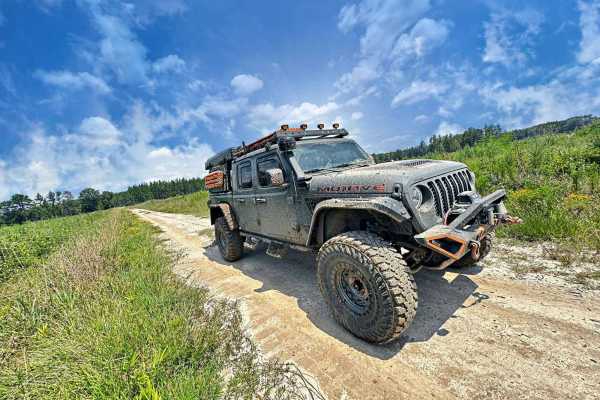
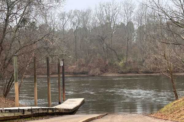
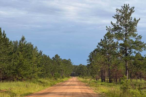
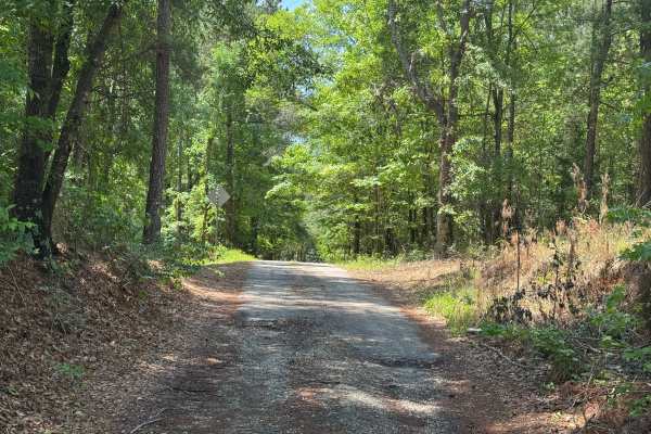
Bullard Altamaha River Loop
Central Georgia woods in country farm land trail that is very scenic with vegetation and animals. This trail follows along the Altamaha River that the World Famous Survivor Man Show couldn't complete. Watch to see Deer, Small Game, Turtles, and Alligators. This trail also crosses the Georgia Overlan...
Learn more about Bullard Altamaha River Loop
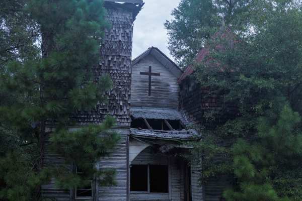
Oak Grove Methodist Church
This route is entirely within the Tuckahoe Wildlife Management Area, a 15,000-acre property bordering the Savannah River. This route spurs from Pine Grove Inn Road and leads to the Old Oak Grove Methodist Church. The church was established in 1876 after the Civil War and was a center of religion for...
Learn more about Oak Grove Methodist Church
Kathwood Trail
This short trail within the Savannah River Water District offers several opportunities to explore the old river basin. While out on the trail, you will pass the Audubon Sanctuary and see the ruins of an old grist mill forgotten to time as you ride on the ancient seashore of the Atlantic Ocean. On on...
Learn more about Kathwood Trail
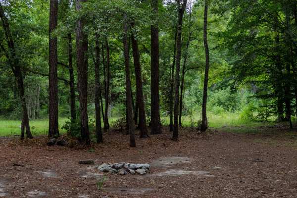
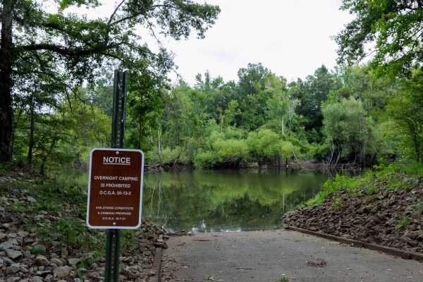
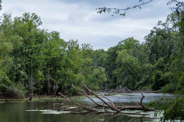
Briarpatch Lake Access
This route is entirely within the Tuckahoe Wildlife Management Area, a 15,000-acre property bordering the Savannah River. A fishing and/or hunting license is required to legally enter the property and can be obtained via georgiawildlife.com/tuckahoe-wma. Camping is only permitted in one of the two d...
Learn more about Briarpatch Lake Access
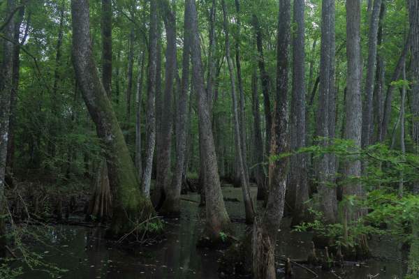
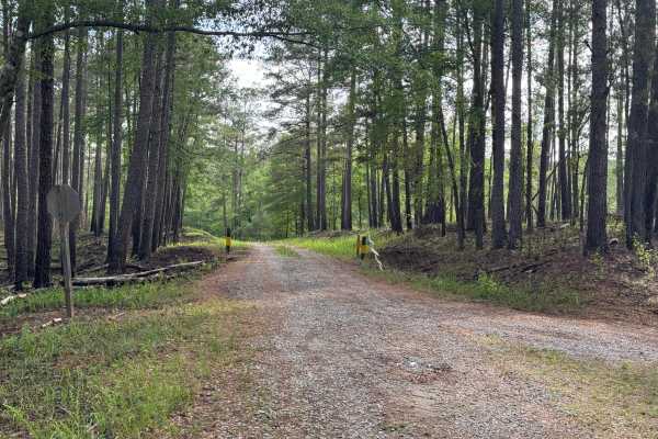
Landing Road
Landing Road takes you back through the flood basin of the Savannah River. This sandy road is a down and back that is well maintained and two lanes wide. You will see the swamps with large cypress trees emerging from the black water. You will encounter farmland as well as crossing over some railroad...
Learn more about Landing Road
Collard Patch Lake Access
This route is entirely within the Tuckahoe Wildlife Management Area, a 15,000-acre property bordering the Savannah River. A fishing and/or hunting license is required to legally enter the property and can be obtained via georgiawildlife.com/tuckahoe-wma. Camping is only permitted in one of the two d...
Learn more about Collard Patch Lake Access
Brier Creek Access
This route is entirely within the Tuckahoe Wildlife Management Area, a 15,000-acre property bordering the Savannah River. A fishing and/or hunting license is required to legally enter the property and can be obtained via georgiawildlife.com/tuckahoe-wma. Camping is only permitted in one of the two d...
Learn more about Brier Creek Access

Clay Hill
This route is entirely within the Tuckahoe Wildlife Management Area, a 15,000-acre property bordering the Savannah River. A fishing and/or hunting license is required to legally enter the property and can be obtained via georgiawildlife.com/tuckahoe-wma. Camping is only permitted in one of the two d...
Learn more about Clay Hill
Miller Lake Access
This route is entirely within the Tuckahoe Wildlife Management Area, a 15,000-acre property bordering the Savannah River. A fishing and/or hunting license is required to legally enter the property and can be obtained via georgiawildlife.com/tuckahoe-wma. Camping is only permitted in one of the two d...
Learn more about Miller Lake Access
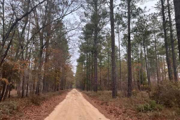
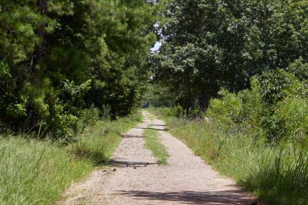
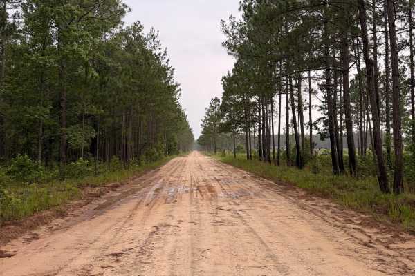
FS 9
FS 9 is a quiet forest road that winds through Fort Stewart’s longleaf pine ecosystem, offering a peaceful drive beneath towering pines and through open forest habitat. The route is primarily composed of sandy roads with gentle curves and occasional puddles after rainfall. Wildlife sightings are com...
Learn more about FS 9
Greenwood Church Road
This route is entirely within the Tuckahoe Wildlife Management Area, a 15,000-acre property bordering the Savannah River. A fishing and/or hunting license is required to legally enter the property and can be obtained via georgiawildlife.com/tuckahoe-wma. Camping is only permitted in one of the two d...
Learn more about Greenwood Church Road
Savannah River Access
This route is entirely within the Tuckahoe Wildlife Management Area, a 15,000-acre property bordering the Savannah River. A fishing and/or hunting license is required to legally enter the property and can be obtained via georgiawildlife.com/tuckahoe-wma. Camping is only permitted in one of the two d...
Learn more about Savannah River Access
River Road
This route is entirely within the Tuckahoe Wildlife Management Area, a 15,000-acre property bordering the Savannah River. A fishing and/or hunting license is required to legally enter the property and can be obtained via georgiawildlife.com/tuckahoe-wma. Camping is only permitted in one of the two d...
Learn more about River Road
Rock House Falls Road - FS 1108
Rock House Falls Road is a short drive in the Cedar Creek Wildlife Management Area of the Oconee National Forest. It leads down to the banks of Murder Creek at Rock House Falls, where there is a small parking area and overlook for the falls. Foot trails lead from the parking area down to Murder Cree...
Learn more about Rock House Falls Road - FS 1108

Peter Williams FR1052
Peter Williams Forest Road 1052 is a winding out-and-back trail that sees little traffic, likely because it begins on private property off the beaten path. The road leading to Peter Williams is paved, but don't worry, as the trail starts where the pavement ends. The road is single-lane wide with a g...
Learn more about Peter Williams FR1052
Williamson Cemetery A - FS 1048A
Williamson Cemetery A (FS 1048A) branches off of FS 1048 about three miles south of County Road 212. Most of the road is single-lane, improved gravel up to the closed gate where it enters private land. Turning left at the private gate to continue, the road loses some of its gravel base and picks up ...
Learn more about Williamson Cemetery A - FS 1048A
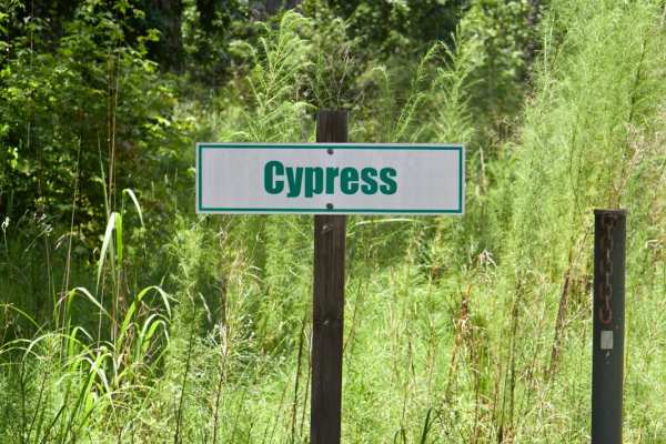
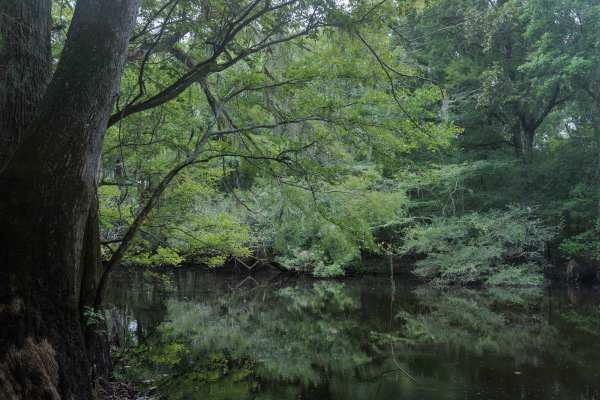
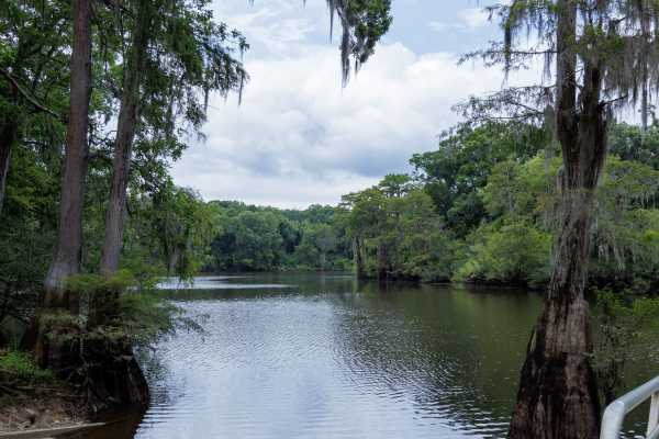
Cypress Swamp Trail
Explore a blackwater oasis along the Savannah River in Hampton County. The major property is the Webb Wildlife Center with the Palachucola and Hamilton Ridge areas on either side. Many of the trails through the property cross between these three areas; it is to be noted that gates can close with no ...
Learn more about Cypress Swamp Trail
Outer Gregory Field Loop
Explore a blackwater oasis along the Savannah River in Hampton County. The major property is the Webb Wildlife Center with the Palachucola and Hamilton Ridge areas on either side. Many of the trails through the property cross between these three areas; it is to be noted that gates can close with no ...
Learn more about Outer Gregory Field Loop
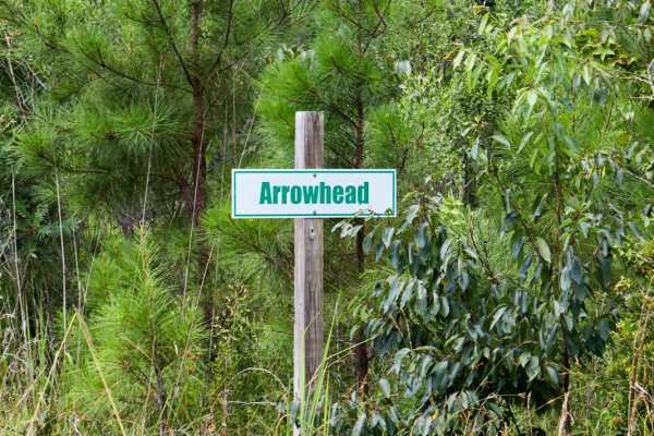
Arrowhead Road
Explore a blackwater oasis along the Savannah River in Hampton County. The major property is the Webb Wildlife Center with the Palachucola and Hamilton Ridge areas on either side. Many of the trails through the property cross between these three areas; it is to be noted that gates can close with no ...
Learn more about Arrowhead Road
FS 4
FS 4 is a scenic forest road that winds through the longleaf pine ecosystem of Fort Stewart. The route features wide sandy roads, gentle curves, and peaceful stretches beneath towering pines, making it ideal for a relaxing drive through one of Georgia’s largest public recreation areas. Along the rou...
Learn more about FS 4
Beginner ATV trails near Kite, Georgia
Explore ATV-friendly trails near you. These trails are accessible for vehicles up to 50 inches wide, perfect for ATVs and smaller off-road machines.
Briarpatch Lake Access
This route is entirely within the Tuckahoe Wildlife Management Area, a 15,000-acre property bordering the Savannah River. A fishing and/or hunting license is required to legally enter the property and can be obtained via georgiawildlife.com/tuckahoe-wma. Camping is only permitted in one of the two d...
Learn more about Briarpatch Lake Access
Collard Patch Lake Access
This route is entirely within the Tuckahoe Wildlife Management Area, a 15,000-acre property bordering the Savannah River. A fishing and/or hunting license is required to legally enter the property and can be obtained via georgiawildlife.com/tuckahoe-wma. Camping is only permitted in one of the two d...
Learn more about Collard Patch Lake Access
Brier Creek Access
This route is entirely within the Tuckahoe Wildlife Management Area, a 15,000-acre property bordering the Savannah River. A fishing and/or hunting license is required to legally enter the property and can be obtained via georgiawildlife.com/tuckahoe-wma. Camping is only permitted in one of the two d...
Learn more about Brier Creek Access
Clay Hill
This route is entirely within the Tuckahoe Wildlife Management Area, a 15,000-acre property bordering the Savannah River. A fishing and/or hunting license is required to legally enter the property and can be obtained via georgiawildlife.com/tuckahoe-wma. Camping is only permitted in one of the two d...
Learn more about Clay Hill
Beginner UTV/side-by-side trails near Kite, Georgia
Find UTV and side-by-side trails near you. These trails accommodate vehicles up to 60 inches wide, ideal for UTVs, side-by-sides, and wider off-road rigs.
Bullard Altamaha River Loop
Central Georgia woods in country farm land trail that is very scenic with vegetation and animals. This trail follows along the Altamaha River that the World Famous Survivor Man Show couldn't complete. Watch to see Deer, Small Game, Turtles, and Alligators. This trail also crosses the Georgia Overlan...
Learn more about Bullard Altamaha River Loop
Briarpatch Lake Access
This route is entirely within the Tuckahoe Wildlife Management Area, a 15,000-acre property bordering the Savannah River. A fishing and/or hunting license is required to legally enter the property and can be obtained via georgiawildlife.com/tuckahoe-wma. Camping is only permitted in one of the two d...
Learn more about Briarpatch Lake Access
Collard Patch Lake Access
This route is entirely within the Tuckahoe Wildlife Management Area, a 15,000-acre property bordering the Savannah River. A fishing and/or hunting license is required to legally enter the property and can be obtained via georgiawildlife.com/tuckahoe-wma. Camping is only permitted in one of the two d...
Learn more about Collard Patch Lake Access
Brier Creek Access
This route is entirely within the Tuckahoe Wildlife Management Area, a 15,000-acre property bordering the Savannah River. A fishing and/or hunting license is required to legally enter the property and can be obtained via georgiawildlife.com/tuckahoe-wma. Camping is only permitted in one of the two d...
Learn more about Brier Creek Access
The onX Offroad Difference
onX Offroad combines trail photos, descriptions, difficulty ratings, width restrictions, seasonality, and more in a user-friendly interface. Available on all devices, with offline access and full compatibility with CarPlay and Android Auto. Discover what you're missing today!
Open Trail Map