
Off-road trails in undefined

Beginner Off-Road TrailsUnited States of AmericaFort Hancock, Texas

Beginner Off-Road Trails
Near Fort Hancock, Texas

Explore All Beginner Trails Near Fort Hancock, Texas

Trail Length
Technical Rating
Best Time of Year
Sort By

Beginner Off-Road Trails Near Fort Hancock, Texas

Discover the best beginner-friendly off-road trails near you. These easier, lower-rated trails are a great place to start — browse trail maps, check difficulty ratings, and find your next adventure.
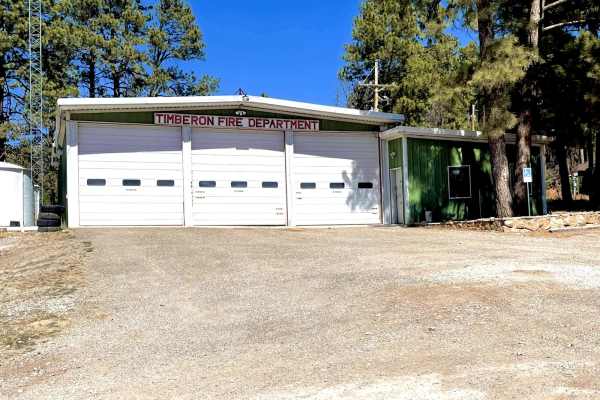
Learn more about Timberon Overland Express
Timberon Overland Express

Timberon Overland Express

The Timberon Overland Express is a great way to get a taste of overlanding without much preparation. The route can be run in either direction, as the entire trip is on county roads which cross state lines between New Mexico and Texas. You will cross through private ranch land, BLM lands, the Lincoln...
Learn more about Timberon Overland Express
Total Miles
79.9
Tech Rating
2Easy
Best Time
Spring, Fall
Learn more about Gateway to Red Sands
Gateway to Red Sands

Gateway to Red Sands

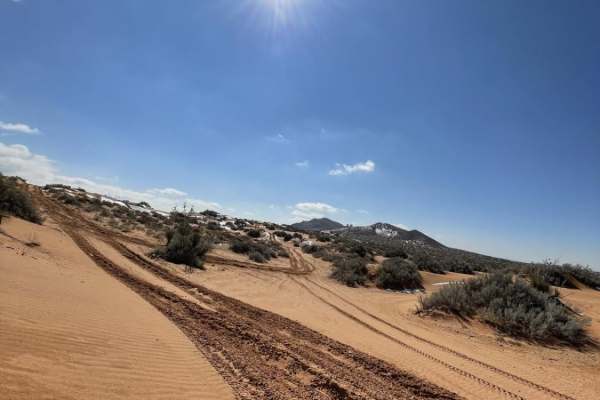
The Gateway to Red Sands is a shallow, washed-out trail that has been used for years. While the majority of the trail is comparable to a dry riverbed and suitable for any 4WD vehicle, there are areas with obstacles suitable for built off-road rigs with ledges up to three feet tall. The trail runs th...
Learn more about Gateway to Red Sands
Total Miles
3.2
Tech Rating
3Easy
Best Time
Fall
Learn more about El Paso Gap Trail
El Paso Gap Trail

El Paso Gap Trail

This trail is a total of 52 miles and connects the town of Dell City to NM Highway 137 which can go to Queens Nm or to the far campsite of Dog Canyon in the Guadalupe National Park. This trail is comprised of gravel roads with occasional unmaintained sections of the road. The last location to get fu...
Learn more about El Paso Gap Trail

Total Miles
51.3
Tech Rating
2Easy
Best Time
Spring
Learn more about Chispa Candelaria Road
Chispa Candelaria Road

Chispa Candelaria Road

Chispa Road is a long, remote backcountry route in the Big Bend region of West Texas, located west of Big Bend National Park and Big Bend Ranch State Park. The route passes through several distinct desert landscapes, beginning in barren rocky terrain near Van Horn before transitioning into tighter t...
Learn more about Chispa Candelaria Road

Total Miles
56.7
Tech Rating
3Easy
Best Time
Spring, Summer, Fall, Winter
Learn more about Cut Out Loop
Cut Out Loop

Cut Out Loop

This trail is about 6 miles long right outside of Oro Grande New Mexico. There are many trails in the area that lead to old prospected mines. Many of the mines are closed off but a few are open and should be explored with precaution. On this trail, you will encounter a variety of terrains. This is a...
Learn more about Cut Out Loop

Total Miles
5.7
Tech Rating
3Easy
Best Time
Spring, Fall
Learn more about Border to Las Cruces
Border to Las Cruces

Border to Las Cruces

This trail starts on Highway 9 in New Mexico. This Highway parallels the border wall for a good while. Once you turn off onto the trail, you have the opportunity to air down. Though the trail is not very technical and is pretty well maintained, there are occasional pockets of silt you must watch for...
Learn more about Border to Las Cruces

Total Miles
14.1
Tech Rating
2Easy
Best Time
Spring, Summer, Fall, Winter
Learn more about Kuykendal
Kuykendal

Kuykendal

Kuykendal is a combination of dirt and rock that will be easily accessible by most 4x4 and AWD vehicles and provides wide open views and numerous areas to disperse camp. While primarily single vehicle wide, there is substantial room to pass if needed. There is some rutting present with a few low-lyi...
Learn more about Kuykendal

Total Miles
5.2
Tech Rating
2Easy
Best Time
Spring, Summer, Fall, Winter
Learn more about Snail
Snail

Snail

Snail is a short out-and-back trail that has multiple dispersed camping areas. The surface is a combination of dirt and rock with some minor rutting and small rock gardens and is primarily single-vehicle wide with room to pass. The trail will be easily traversed by most vehicles with good ground cle...
Learn more about Snail

Total Miles
1.6
Tech Rating
2Easy
Best Time
Spring, Summer, Fall, Winter
Learn more about National Livestock Road
National Livestock Road

National Livestock Road

National Livestock Road begins as a well-maintained dirt and gravel out and back road, and progressively becomes more difficult and rocky. Starting out wide enough for two vehicles, the road changes to a single-vehicle-wide two-track trail where it intersects with FS-277A and FS-277C. Shortly after ...
Learn more about National Livestock Road

Total Miles
9.6
Tech Rating
2Easy
Best Time
Spring, Summer, Fall, Winter
Learn more about Scenic Drive
Scenic Drive

Scenic Drive

Scenic Drive runs south from CR137/Queens HWY to the southern most portion of the Guadalupe range and begins as a very well maintained gravel road. There is a paved bridge over a low-lying wash early on with the rest of the route being gravel and later changing to a dirt and rock single track trail....
Learn more about Scenic Drive

Total Miles
13.1
Tech Rating
2Easy
Best Time
Spring, Summer, Fall, Winter
Learn more about Mary
Mary

Mary

Mary is an out and back style trail with a surface combination of rock and dirt that gradually descends into a canyon. The beginning of the trail features wide open views on a rocky surface with multiple dispersed camping areas and views gradually become limited descending into the canyon. Take note...
Learn more about Mary

Total Miles
4.6
Tech Rating
3Easy
Best Time
Spring, Summer, Fall, Winter
Learn more about Rawhide
Rawhide

Rawhide

Rawhide is a looped trail that connects to the Guadalupe Rim Road and is a combination of rock and dirt. Rock gardens are scattered throughout along with some loose rocks and gravel, with no obstacles larger than 10". In dirt areas there is minor rutting and some low-lying areas do have the potentia...
Learn more about Rawhide

Total Miles
9.6
Tech Rating
2Easy
Best Time
Spring, Summer, Fall, Winter
Learn more about Horse Pasture
Horse Pasture

Horse Pasture

Horse Pasture begins on a small section of private land right off CR137/Queens Highway in the town of Queen, NM. This out-and-back trail will be easily completed by 4x4 vehicles and most AWD vehicles with good clearance. The surface is a combination of rock and some areas of softer dirt with minor ...
Learn more about Horse Pasture

Total Miles
5.6
Tech Rating
2Easy
Best Time
Spring, Summer, Fall, Winter
Learn more about Rocky
Rocky

Rocky

Rocky is primarily a dirt trail to begin and later becomes more rock than dirt. There is some minor rutting present with spots showing signs of erosion, expect this to become worse with heavy rains. There are several areas to disperse camp along the route with wide open views for the majority of the...
Learn more about Rocky

Total Miles
10.8
Tech Rating
2Easy
Best Time
Spring, Summer, Fall, Winter
Learn more about Wildhorse
Wildhorse

Wildhorse

Wildhorse is found directly off the Guadalupe Rim Road and runs east. There are a few motorized and hiking spurs off the main trail that are not labeled. The trail has a limited number of areas that would be ideal for dispersed camping due to the heavy brush and makeup of the terrain. The route is p...
Learn more about Wildhorse

Total Miles
4.8
Tech Rating
3Easy
Best Time
Spring, Summer, Fall, Winter
Learn more about Segrest Draw
Segrest Draw

Segrest Draw

Segrest Draw can be accessed from Guadalupe Rim Road and is primarily a dirt surface with small areas being primarily rock. There are no obstacles larger than 10" along the route, but there are a few areas with substantial rutting and erosion. While it appears the trail is well maintained, rutting a...
Learn more about Segrest Draw

Total Miles
5.3
Tech Rating
2Easy
Best Time
Spring, Summer, Fall, Winter
Learn more about Storage
Storage

Storage

Storage begins as a dirt road and then frequently changes to a rocky surface before eventually becoming primarily rock. This out and back trail is a spur off Rocky/FS521 and will be easily completed by most 4x4s. Rutting is present in a few of the areas that are primarily dirt some of which is mildl...
Learn more about Storage

Total Miles
7.3
Tech Rating
2Easy
Best Time
Spring, Summer, Fall, Winter
Learn more about Powers Ridge
Powers Ridge

Powers Ridge

Powers Ridge is located in the central portion of the Guadalupe Mountain Range in Lincoln National Forest. The trail is a combination of rocks and dirt, with some obstacles in excess of 12". The trail is primarily single vehicle wide, with room to pass in a few areas and is an out and back. Trail do...
Learn more about Powers Ridge

Total Miles
7.1
Tech Rating
3Easy
Best Time
Spring, Summer, Fall, Winter
Learn more about Crooked Canyon
Crooked Canyon

Crooked Canyon

Crooked Canyon is a trail that can be approached from the north or south and overall is an easily completed trail by 4x4 and some AWD with appropriate ground clearance. Being primarily a single vehicle wide dirt trail, there are sections through low-lying washes that are primarily made up of rock ga...
Learn more about Crooked Canyon

Total Miles
4.5
Tech Rating
2Easy
Best Time
Spring, Summer, Fall, Winter
Learn more about Acrey Allot
Acrey Allot

Acrey Allot

Acrey Allot is a spur off Storage/FS313 and is very similar in terrain and features. The trail begins with a primarily dirt surface, later becoming more rocky. There are multiple dispersed camping areas at the lower elevation of the trail where the foliage and brush is less dense. This is an out and...
Learn more about Acrey Allot

Total Miles
5.9
Tech Rating
2Easy
Best Time
Spring, Summer, Fall, Winter

Beginner ATV trails near Fort Hancock, Texas

Explore ATV-friendly trails near you. These trails are accessible for vehicles up to 50 inches wide, perfect for ATVs and smaller off-road machines.

Learn more about Timberon Overland Express
Timberon Overland Express

Timberon Overland Express

The Timberon Overland Express is a great way to get a taste of overlanding without much preparation. The route can be run in either direction, as the entire trip is on county roads which cross state lines between New Mexico and Texas. You will cross through private ranch land, BLM lands, the Lincoln...
Learn more about Timberon Overland Express

Total Miles
79.9
Tech Rating
2Easy
Best Time
Spring, Fall
Learn more about Gateway to Red Sands
Gateway to Red Sands

Gateway to Red Sands

The Gateway to Red Sands is a shallow, washed-out trail that has been used for years. While the majority of the trail is comparable to a dry riverbed and suitable for any 4WD vehicle, there are areas with obstacles suitable for built off-road rigs with ledges up to three feet tall. The trail runs th...
Learn more about Gateway to Red Sands

Total Miles
3.2
Tech Rating
3Easy
Best Time
Fall
Learn more about El Paso Gap Trail
El Paso Gap Trail

El Paso Gap Trail

This trail is a total of 52 miles and connects the town of Dell City to NM Highway 137 which can go to Queens Nm or to the far campsite of Dog Canyon in the Guadalupe National Park. This trail is comprised of gravel roads with occasional unmaintained sections of the road. The last location to get fu...
Learn more about El Paso Gap Trail

Total Miles
51.3
Tech Rating
2Easy
Best Time
Spring
Learn more about Cut Out Loop
Cut Out Loop

Cut Out Loop

This trail is about 6 miles long right outside of Oro Grande New Mexico. There are many trails in the area that lead to old prospected mines. Many of the mines are closed off but a few are open and should be explored with precaution. On this trail, you will encounter a variety of terrains. This is a...
Learn more about Cut Out Loop

Total Miles
5.7
Tech Rating
3Easy
Best Time
Spring, Fall

Beginner UTV/side-by-side trails near Fort Hancock, Texas

Find UTV and side-by-side trails near you. These trails accommodate vehicles up to 60 inches wide, ideal for UTVs, side-by-sides, and wider off-road rigs.

Learn more about El Paso Gap Trail
El Paso Gap Trail

El Paso Gap Trail

This trail is a total of 52 miles and connects the town of Dell City to NM Highway 137 which can go to Queens Nm or to the far campsite of Dog Canyon in the Guadalupe National Park. This trail is comprised of gravel roads with occasional unmaintained sections of the road. The last location to get fu...
Learn more about El Paso Gap Trail

Total Miles
51.3
Tech Rating
2Easy
Best Time
Spring
Learn more about Cut Out Loop
Cut Out Loop

Cut Out Loop

This trail is about 6 miles long right outside of Oro Grande New Mexico. There are many trails in the area that lead to old prospected mines. Many of the mines are closed off but a few are open and should be explored with precaution. On this trail, you will encounter a variety of terrains. This is a...
Learn more about Cut Out Loop

Total Miles
5.7
Tech Rating
3Easy
Best Time
Spring, Fall
Learn more about Border to Las Cruces
Border to Las Cruces

Border to Las Cruces

This trail starts on Highway 9 in New Mexico. This Highway parallels the border wall for a good while. Once you turn off onto the trail, you have the opportunity to air down. Though the trail is not very technical and is pretty well maintained, there are occasional pockets of silt you must watch for...
Learn more about Border to Las Cruces

Total Miles
14.1
Tech Rating
2Easy
Best Time
Spring, Summer, Fall, Winter
Learn more about Kuykendal
Kuykendal

Kuykendal

Kuykendal is a combination of dirt and rock that will be easily accessible by most 4x4 and AWD vehicles and provides wide open views and numerous areas to disperse camp. While primarily single vehicle wide, there is substantial room to pass if needed. There is some rutting present with a few low-lyi...
Learn more about Kuykendal

Total Miles
5.2
Tech Rating
2Easy
Best Time
Spring, Summer, Fall, Winter

The onX Offroad Difference

onX Offroad combines trail photos, descriptions, difficulty ratings, width restrictions, seasonality, and more in a user-friendly interface. Available on all devices, with offline access and full compatibility with CarPlay and Android Auto. Discover what you're missing today!

Open Trail Map