
Beginner Off-Road Trails
Near Copperhill, Tennessee
Explore All Beginner Trails Near Copperhill, Tennessee
Beginner Off-Road Trails Near Copperhill, Tennessee
Discover the best beginner-friendly off-road trails near you. These easier, lower-rated trails are a great place to start — browse trail maps, check difficulty ratings, and find your next adventure.
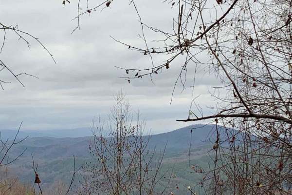
Peavine Sheeds - CR 221
This is a nice easy-to-navigate trail in the Big Frog Mountain Wilderness, part of the Cherokee National Forest. The trail is fairly well-maintained so it should be accessible to almost any vehicle. Several areas along the trail have great views of the surrounding mountains and valleys. There are ma...
Learn more about Peavine Sheeds - CR 221
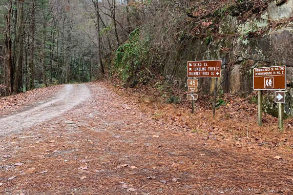
Little Gassaway - Trail NF45
Little Gassaway (Forest Road 45) is an easy, scenic dirt road perfect for beginners and scenic drivers looking to explore the beautiful Cherokee National Forest near the Ocoee River. Stretching approximately 2.7 miles, this route serves as a main access point for those looking to reach the hiking tr...
Learn more about Little Gassaway - Trail NF45
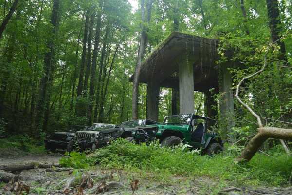
McFarland Rd
McFarland Road is an easy, scenic 21-mile point-to-point route in the Cherokee National Forest that is perfect for beginners, overland families, and scenic tourers looking for a history-rich drive. Winding through dense forests and rising to a maximum elevation of 1,977 feet, this wide, double-lane ...
Learn more about McFarland Rd
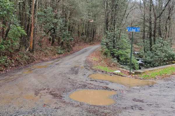
Hickorynut Gap - FSR 797
Hickorynut Gap, FSR 797, is an in-and-out forest service road in the Chattahoochee-Oconee National Forest just on the edge of the Cohutta Wilderness. Being an in-and-out road, the travel time reflects this with the return trip. It is a longer than usual forest service road for the area. Hickorynut G...
Learn more about Hickorynut Gap - FSR 797
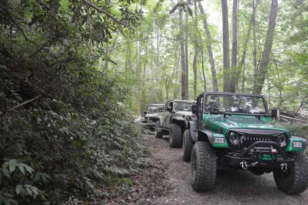
Smith Mountain
About 100 yards into the trail, there is a decent hill climb with some decent-size rocks. High clearance is nice to have. However, stock rigs with the right tire placement will be just fine. Most of the trail is a nice trail with some overlooks in the winter. Once the leaves are on the trees, it bec...
Learn more about Smith Mountain
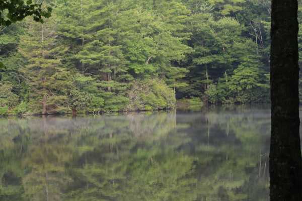
Georgia Traverse
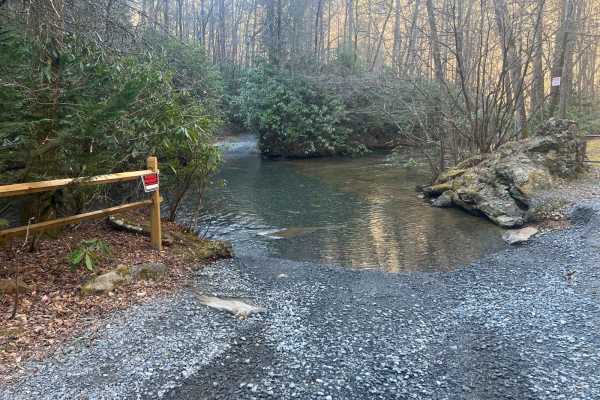
Cashes Valley Road
Cashes Valley Road is a hidden gem, perfect for an out-and-back adventure in the Chattahoochee National Forest, spanning Fannin and Gilmer Counties in Georgia. This picturesque trail features several water crossings, approximately a foot deep under dry conditions. However, be prepared for these cros...
Learn more about Cashes Valley Road
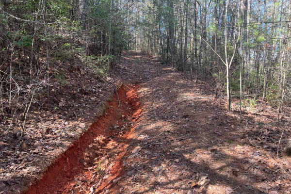
Postelle
The Postelle Trail is an out-and-back route in the Chattahoochee National Forest within Fannin County, Georgia. This trail is defined by its single-lane path, which is rarely traversed and has become overgrown, rendering it unsuitable for full-sized vehicles. The narrow trail accommodates only one v...
Learn more about Postelle
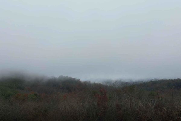
Falls Branch Road - FS 374
This forest service road is gravel and easy to navigate, there are a few rough places along the trail but nothing difficult. It is located in the Big Frog mountain wilderness which is part of the Cherokee National Forest. There are a lot of great views along this trail. When we went, the trail was c...
Learn more about Falls Branch Road - FS 374
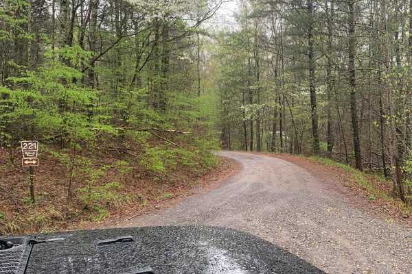
FS 221 - Big Frog
This is a well-groomed, gravel, fire service road. You do not need a 4x4 to do this trail. We did not have cell service (Verizon) on this trail. In the fall there should be some good views. There are some dispersed camping spots along this trail. When we visited they were doing some prescribed burns...
Learn more about FS 221 - Big Frog
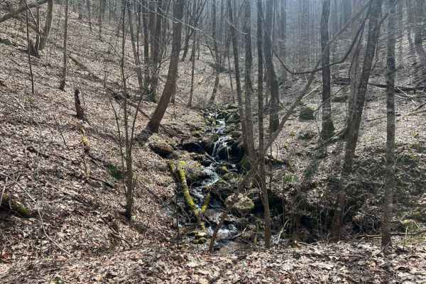
Williamson Cove
Williamson Cove is an out-and-back branch trail from Hickorynut Gap in the Chattahoochee National Forest in Fannin County, Georgia. These trails are exclusively for full-sized, high-clearance vehicles, with clear signage prohibiting access for SxS and ATVs. The trail is mainly a one-lane trail that ...
Learn more about Williamson Cove
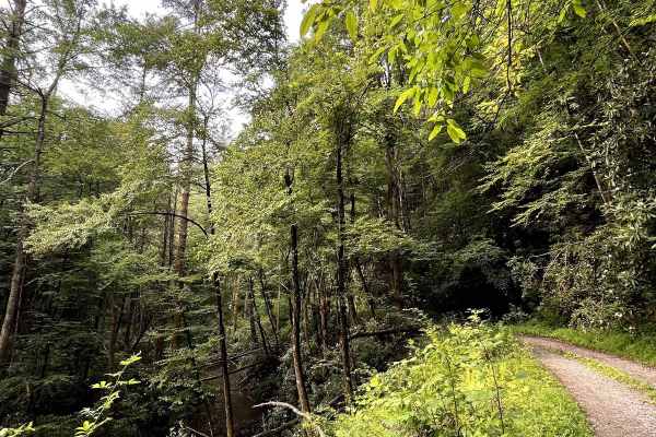
Foster Branch Road
Forrest Service Road 126, locally known as Foster Branch Road, is an out-and-back road. At the entry of the Cohutta Wildlife MGMT Area, you will find the road. A short ride down this road you are met with the West Fork of the Jacks River winding alongside the mountain. This road is gravel suitable f...
Learn more about Foster Branch Road
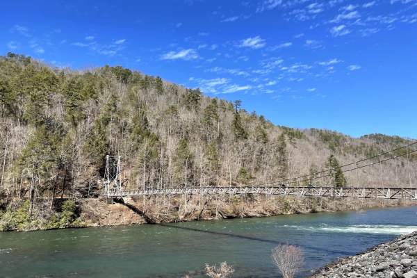
Powerhouse Road
Forest Service Road 236 Smith Creek Road down to the powerhouse. The highlight of this trail is the powerhouse at the end of the trail. The Appalachia powerhouse supplies the Hiawassee River. During the summer months, this is a favorite spot for rafters. Fly fishing is a big activity in the area as ...
Learn more about Powerhouse Road
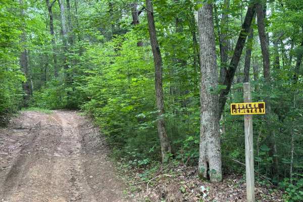
Butler Ridge - FS 1061
Butler Ridge (FS 1061) is a short, narrow, somewhat rutted and muddy trail that leads to the historic Butler Ridge Cemetery. Butler Ridge is a branch off of McFarland Road, and there is a small brown and yellow sign at the intersection. There are several low spots in the short length that will tend ...
Learn more about Butler Ridge - FS 1061
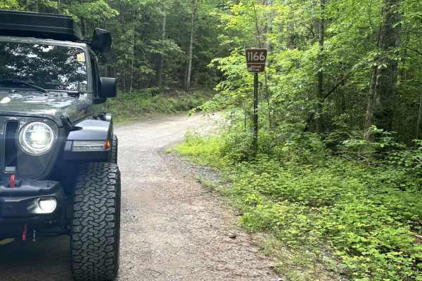
Apalachia Tunnel - FS 1166
Apalachia Tunnel Road - FS 1166 changes to Turtletown Creek Road - FS 11651 and ends at the trailhead of Turtletown Creek Falls. The road is an improved two-lane gravel road that can be driven by almost any vehicle these days. There is one creek crossing that has now had a concrete bed installed. Th...
Learn more about Apalachia Tunnel - FS 1166
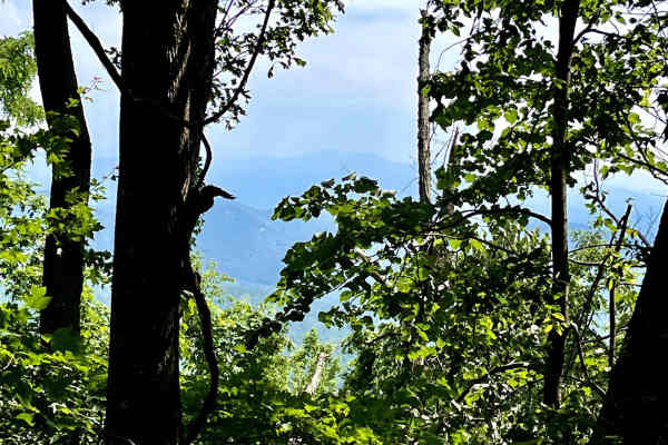
Flat Top Mountain
Forrest Service Road 64A is a rollercoaster of a road. On this road, you will feel like you are on a rollercoaster with how you climb this hill climb. long accents before dropping shortly to another hill climb. After the beautiful hill climb with amazing overlooks and some awesome rock faces along t...
Learn more about Flat Top Mountain
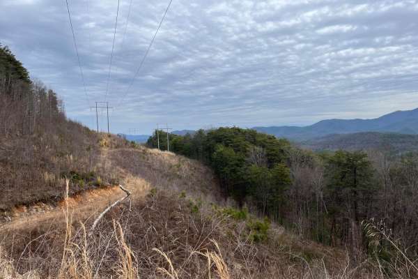
Kimsey MTN (Old 68 HWY)
Kimsey Mountain Trail on Old Highway 68 is one of the most underestimated trails around. Travel this in the winter and early spring and you will find out what I mean. Every turn greets you with a new view of Mountain landscapes as far as the eye can see. You will want to stop and just gaze out into ...
Learn more about Kimsey MTN (Old 68 HWY)
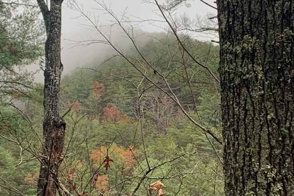
Big Frog - FS 62
Big Frog - FS 62 is an excellent forest road route for intermediate offroaders looking to explore the scenic, lesser-maintained mountain terrain bordering Georgia and Tennessee. Spanning approximately 11.4 miles, this trail is a key segment of the famous Georgia Traverse, offering a rugged trek thro...
Learn more about Big Frog - FS 62
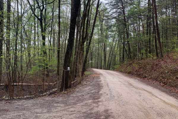
Baker Creek - Big Frog
The trail is a fairly well-maintained fire service road surfaced with gravel, which does not require a 4x4 vehicle to navigate. However, cell phone reception (Verizon) is not available while on the trail. There are several spots for dispersed camping located along the trail. During our visit, there ...
Learn more about Baker Creek - Big Frog
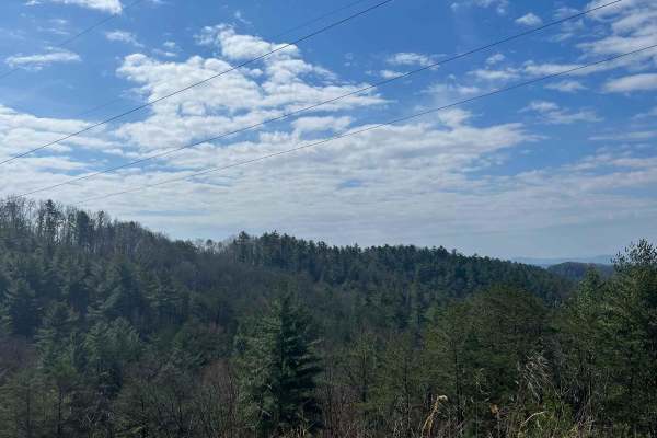
Shuler Creek
This trail has easy access gravel road off Highway 68 in Farner. The road is 2 vehicles wide and has mostly gentle elevations. It starts out running parallel to the Hiwassee River and then a branch of Shuler Creek. Along the way, there are pullovers and an occasional campsite. The creek is wide and ...
Learn more about Shuler Creek
Beginner ATV trails near Copperhill, Tennessee
Explore ATV-friendly trails near you. These trails are accessible for vehicles up to 50 inches wide, perfect for ATVs and smaller off-road machines.
Peavine Sheeds - CR 221
This is a nice easy-to-navigate trail in the Big Frog Mountain Wilderness, part of the Cherokee National Forest. The trail is fairly well-maintained so it should be accessible to almost any vehicle. Several areas along the trail have great views of the surrounding mountains and valleys. There are ma...
Learn more about Peavine Sheeds - CR 221
Little Gassaway - Trail NF45
Little Gassaway (Forest Road 45) is an easy, scenic dirt road perfect for beginners and scenic drivers looking to explore the beautiful Cherokee National Forest near the Ocoee River. Stretching approximately 2.7 miles, this route serves as a main access point for those looking to reach the hiking tr...
Learn more about Little Gassaway - Trail NF45
Postelle
The Postelle Trail is an out-and-back route in the Chattahoochee National Forest within Fannin County, Georgia. This trail is defined by its single-lane path, which is rarely traversed and has become overgrown, rendering it unsuitable for full-sized vehicles. The narrow trail accommodates only one v...
Learn more about Postelle
Falls Branch Road - FS 374
This forest service road is gravel and easy to navigate, there are a few rough places along the trail but nothing difficult. It is located in the Big Frog mountain wilderness which is part of the Cherokee National Forest. There are a lot of great views along this trail. When we went, the trail was c...
Learn more about Falls Branch Road - FS 374
Beginner UTV/side-by-side trails near Copperhill, Tennessee
Find UTV and side-by-side trails near you. These trails accommodate vehicles up to 60 inches wide, ideal for UTVs, side-by-sides, and wider off-road rigs.
Peavine Sheeds - CR 221
This is a nice easy-to-navigate trail in the Big Frog Mountain Wilderness, part of the Cherokee National Forest. The trail is fairly well-maintained so it should be accessible to almost any vehicle. Several areas along the trail have great views of the surrounding mountains and valleys. There are ma...
Learn more about Peavine Sheeds - CR 221
Little Gassaway - Trail NF45
Little Gassaway (Forest Road 45) is an easy, scenic dirt road perfect for beginners and scenic drivers looking to explore the beautiful Cherokee National Forest near the Ocoee River. Stretching approximately 2.7 miles, this route serves as a main access point for those looking to reach the hiking tr...
Learn more about Little Gassaway - Trail NF45
Postelle
The Postelle Trail is an out-and-back route in the Chattahoochee National Forest within Fannin County, Georgia. This trail is defined by its single-lane path, which is rarely traversed and has become overgrown, rendering it unsuitable for full-sized vehicles. The narrow trail accommodates only one v...
Learn more about Postelle
Falls Branch Road - FS 374
This forest service road is gravel and easy to navigate, there are a few rough places along the trail but nothing difficult. It is located in the Big Frog mountain wilderness which is part of the Cherokee National Forest. There are a lot of great views along this trail. When we went, the trail was c...
Learn more about Falls Branch Road - FS 374
The onX Offroad Difference
onX Offroad combines trail photos, descriptions, difficulty ratings, width restrictions, seasonality, and more in a user-friendly interface. Available on all devices, with offline access and full compatibility with CarPlay and Android Auto. Discover what you're missing today!
Open Trail Map