North Carolina Leaf-Off Imagery
Take a Look Under the Canopy
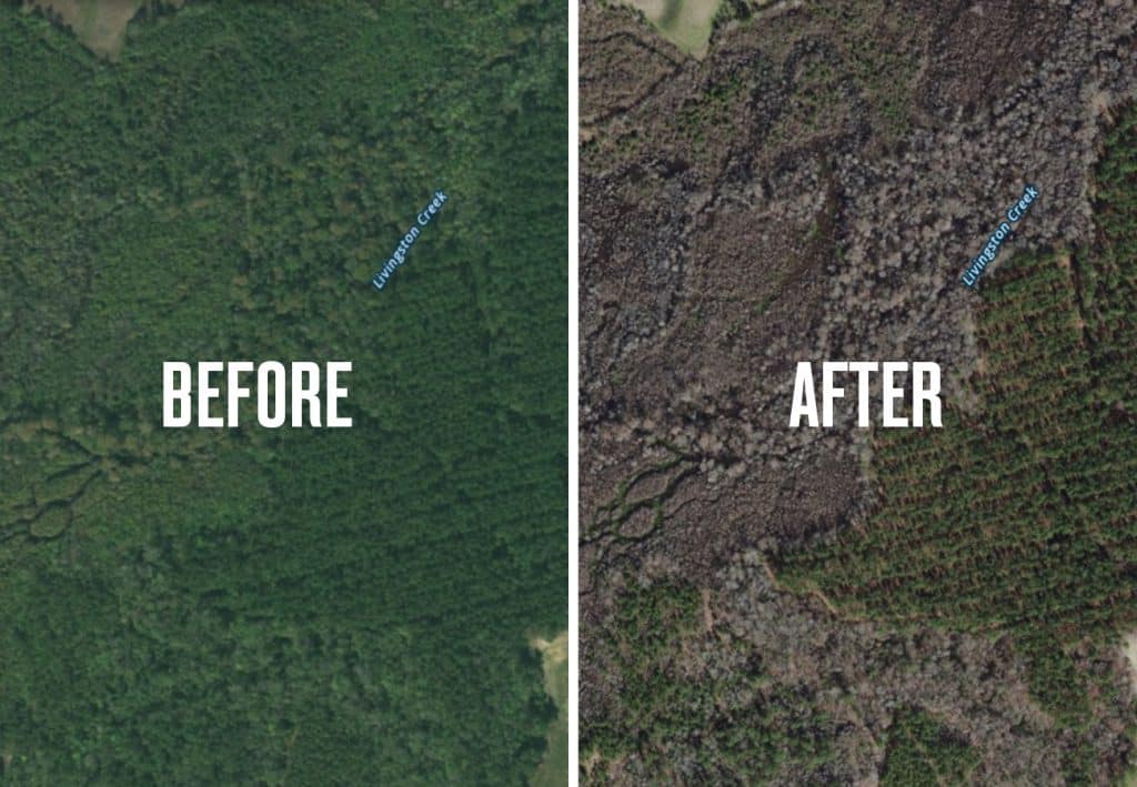
One challenge often faced by hunters in the hardwood forests of the East is deciphering the lay of the land through a dense canopy of leaves when viewing satellite imagery. This thick, green carpet obscures the finer details of the terrain and gets in the way of planning and scouting. Thanks to comments we’ve received from our customers, we realized that this is a particular problem for hunters in North Carolina.
To solve this problem, onX Hunt now features leaf-off satellite imagery in North Carolina. With the ability to see through to the forest floor, hunters can now better identify edges, water and vegetation, pinch points, and more. Additionally, this imagery is sharper at the closest zoom levels, revealing even more details on the landscape.
Thanks to your feedback, close partnership with the state of North Carolina, and our desire to respond to the needs of onX Hunt users, our commitment to continually improving the Hunt App remains unrivaled.