The Power of the Blue Dot
I have always been lost. Not in the “what am I doing with my life” sense (skiing, duh), but in the literal way: I can’t find my way home from the grocery store. I have missed my daughter’s soccer games by mistaking east for west, hitchhiked with some sketchy dude after a wrong turn on my mountain bike, and canceled my own birthday dinner because I couldn’t find my car (again) at the airport. (Dear Denver airport security, thank you for the rides—and for all the tissues.)
And when it comes to backcountry skiing? Well, let’s just say I know how to ski, dig a pit, use a snow saw, perform column tests…everything except actually get to someplace worth skiing. I rely on my partners far more than I should—always following, never leading, and with no valuable opinion when we’ve lost the track. My most shameful admission? The only thing I’ve used my compass for is to scrape snow off my skis or pop the cap off a tailgate beer.
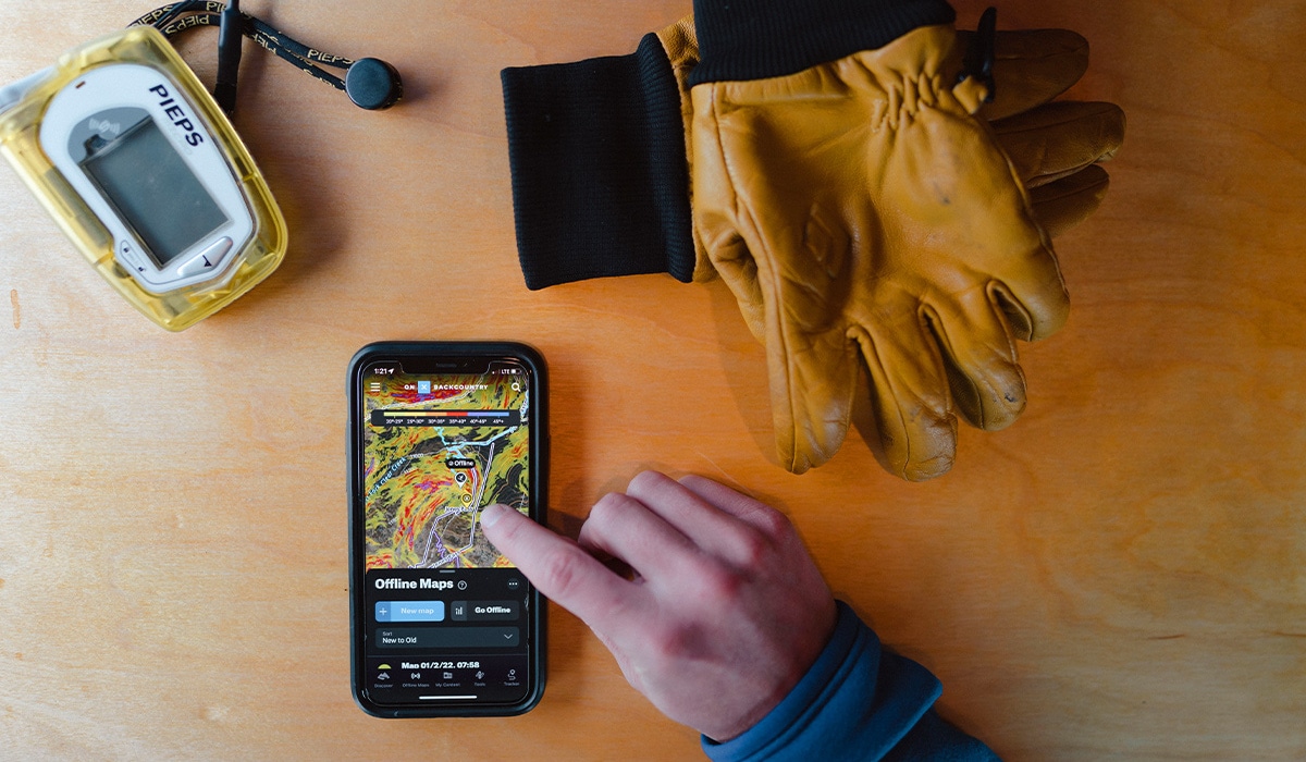
Yet, this past season, onX Backcountry changed my life. I know I am prone to hyperbole and embellishment, but I stand by the statement. Prompted by my profound humiliation, I have tried many other mapping apps over the years, not to mention a fancy $500 GPS watch that I couldn’t get to even tell the time. When I enlisted my 13-year-old daughter to help, the only thing she figured out was that I had 10 years of DMs in my Instagram account that I had never figured out how to access. (Dear friends, I’m sorry.)
But the onX mapping system is so easy and intuitive—just plot it on your desktop and download it to your phone—that after playing with it for an hour or so, I felt a foreign surge of confidence. “Hey, boys,” I texted my partners, “tomorrow, I’m in charge.”
My first objective was Radio Beacon Peak, which I’ve skied twice before, but the memory of how to get there was as fresh as the bag of goo formerly known as cilantro I had just cleaned from the bottom of my crisper. There were several turn-offs and a couple of lakes to circumnavigate, more than enough to test my newfound self-reliance. There would also surely be a “shortcut,” predictably instigated by my friend Steven.
“Let’s just cut up through these trees and bear left,” he said about a half hour in. It’s a familiar refrain, delivered with only slight directional alterations.
Traditionally, I would roll my eyes and, not having a better idea, blindly consent, and then silently curse him while bushwhacking through the willows or looking for a snow bridge or backtracking to our point of departure. This time, however, I consulted my onX Backcountry app. And despite the obvious wisdom I should have gained from years of skiing with Steven, which is that a shortcut is never actually a shortcut, I thought this one actually looked viable. I zoomed in so I could see the dense thicket of green around us, but there, just up the ridge and to the left, was the main trail. “Looks a little tight in there, but ok!” I replied.
Forty-five minutes later, with sticks and moss stuck in my hair and a sore shoulder from falling over after my pole post-holed all the way to the ground near a fallen log, I stopped to check our progress. Our Track looked like one a drunk person might make while staggering home from the bar, or a fly bumping up against every inch of a window except the one that is open.
“Guys, cut hard left,” I said, assertively. “We need to get up and over that ridge.” Arguing ensued. Our other friend Diego was busy trying to zoom out of the tiny map on his $500 watch that showed only that we were lost in the middle of a dense forest, information that any luddite could have discerned by just looking around. At this point, I brandished my phone like some kind of weapon, with our little blue dot and a bright red trail broadcasting the shiny truth. They looked up. Silence. Then came the words I had never imagined I would hear, made even sweeter by years of their shit-talking: “Beekman, you’re right.”
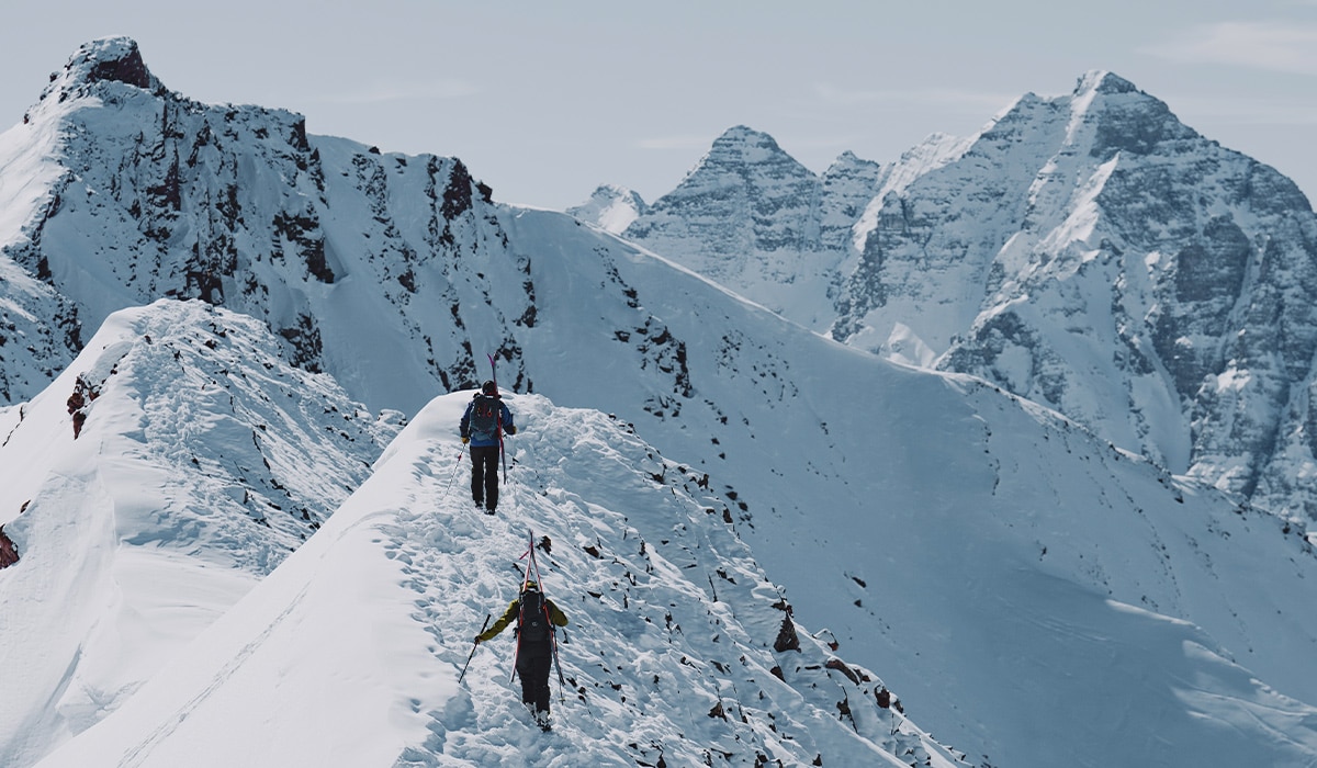
Hours later when we finally summited, the view seemed somehow more dramatic than any I’d experienced, even though it’s all equally dramatic at that elevation. White peaks and couloirs begged to be skied in every direction, funneling down into treed valleys that eventually poured into roads and then towns. The wind whipped stinging snow in our faces as we high-fived and ripped skins. I was elated. It didn’t even matter that I had neglected to readjust one of my bindings from trying a larger pair of boots the week before and that Steven had left my binding tool on the front seat of his Subaru.
No, I would ski down with one heel as free as I felt at that moment—because I got us here. I could do this on my own. I could go anywhere, anytime, and I will always know where I am. It is perhaps the most powerful I have ever felt.
I have led a few more tours since then—Woods, Parnasus, Dead Dog Couloir (twice)— all seamlessly, if I do say so myself. I even navigated us through another of Steven’s shortcuts, and it was so successful I feared that we may no longer have a reason to make him always bring the beer.
Ah well. A couple of IPAs are a small price to pay for freedom. Thanks, onX Backcountry. Now all I have to do is remember where I left my phone…