The Uber Tour, Rogers Pass, BC
In year four of Cody Townsend’s “The Fifty Project,” we’re showcasing his lines and route descriptions in onX Backcountry. Go deeper on The Fifty Project and get the beta from Cody on how he plans, executes, and conquers these 50 descents.
Watch The Fifty: The Uber Tour
A mysterious line that was attempted in one massive single-day push with two uber steep runs is the name of the game in this episode of The Fifty.
View Cody’s Line in onX Backcountry
Below is an interactive map of Cody’s line for The Uber Tour. Use Control + Drag to rotate in 3D on desktop or two fingers to pinch, zoom and rotate on mobile. Login or create an account to gain full functionality.
The Fifty Project Guidebook: The Uber Tour
onX Backcountry has partnered with Cody Townsend to bring you guidebook quality descriptions of routes in The Fifty Project from Cody himself. Read his beta on The Uber Tour. Start your free trial of onX Backcountry today to view these lines and descriptions in the App.
Overview
The first challenge is figuring out what the Uber Tour actually is. “Fifty Classic Ski Descents of North America” lists the Uber Tour as a classic, yet its origin and route are almost universally unknowns. The best interpretation of the book’s description is a long challenging day of linking up the north face of Mt. Rogers and the northeast face of Swiss Peaks by approaching from the southeast side of Mt. Rogers. The link up of the two peaks represents about 8,000 feet of ascent and 9,000 feet of descent. Both faces are steep and exposed, but when it’s in—it’s in. Both faces are serious with high consequences if something were to go wrong. Snow stability is paramount to a safe ascent and descent. This is a line reserved for highly experienced, fit, and expert backcountry skiers only.
Photo: @BjarneSalen
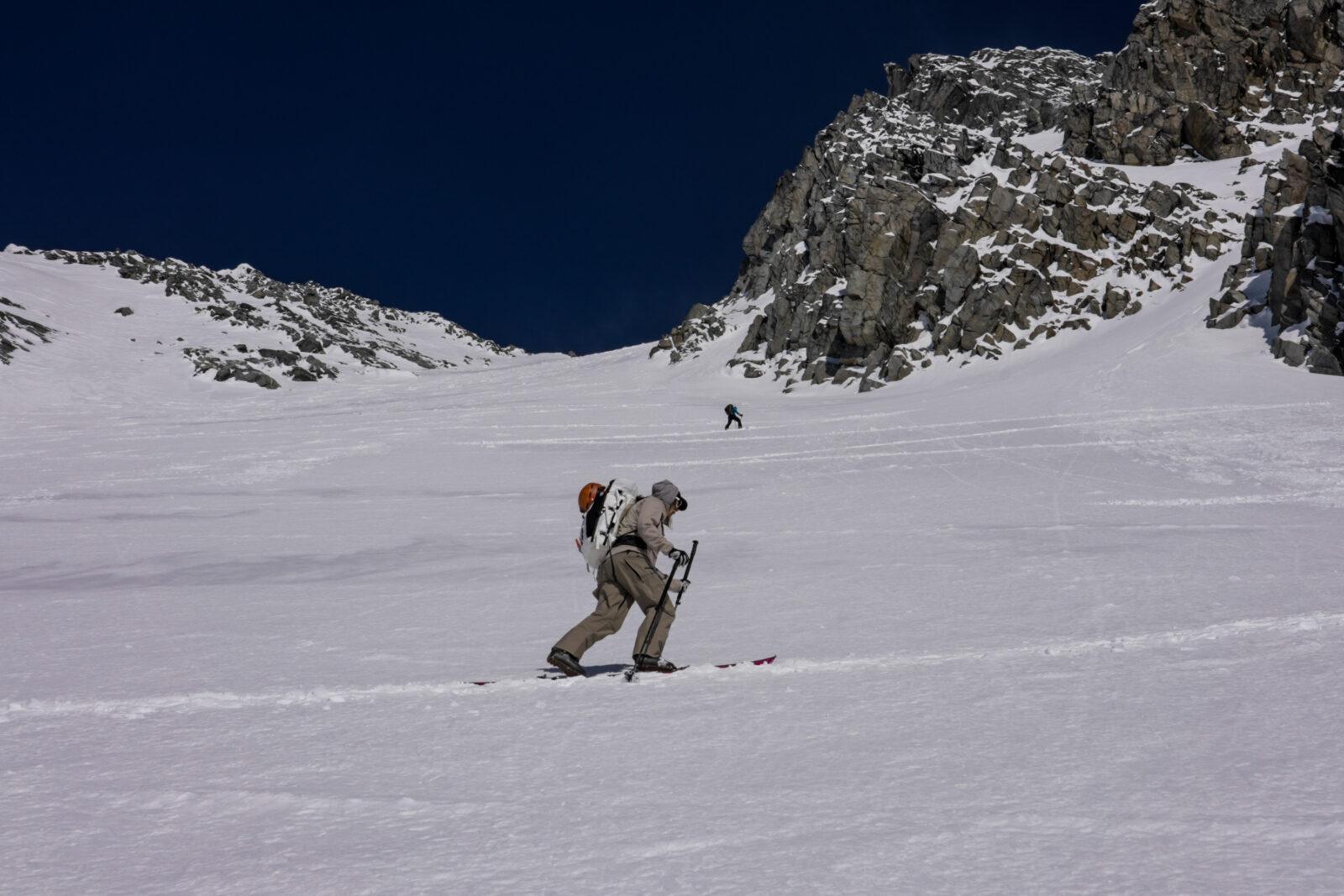
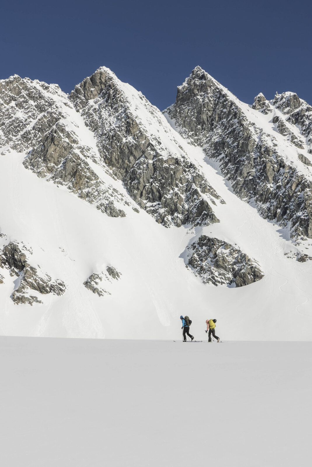
Ascent Description
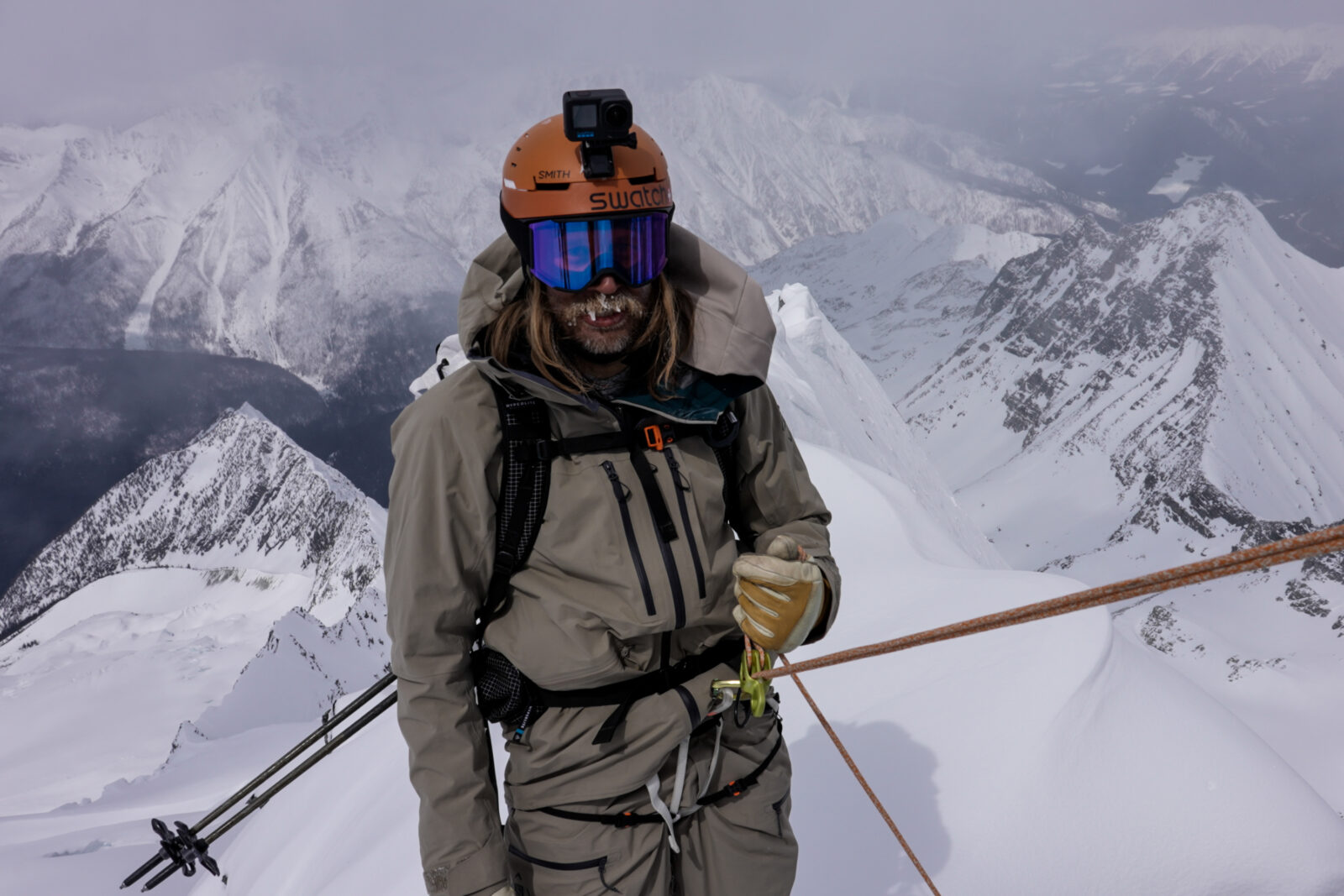
Starting at the Hermit Trailhead, the ascent winds through the steep trees for a couple thousand vertical feet before emerging in the sub-alpine. As the trees thin, multiple routes exist to continue upward. Stability and climbing conditions will dictate which route can be safely and efficiently taken to approach the alpine basin. The most dangerous part of the climb to Mt. Rogers exists here as the south face rapidly warms and the slope above can release rocks and avalanches on those below. A very early start, strong uphill speed, and a cold morning are all required to safely navigate up the wide couloir to the col (the lowest point between two mountains) between Mt. Rogers and Swiss Peaks. An ascent of the exposed and steep ridgeline to the summit of Mt. Rogers is just to the west after reaching the col. The second ascent up the west slopes of Swiss Peaks requires bootpacking up the steep, slippery, and exposed rock scramble to reach either the summit or the lower, northern entrance. A rappel is required if using the northern lower entrance.
Photo: @the.fifty.project
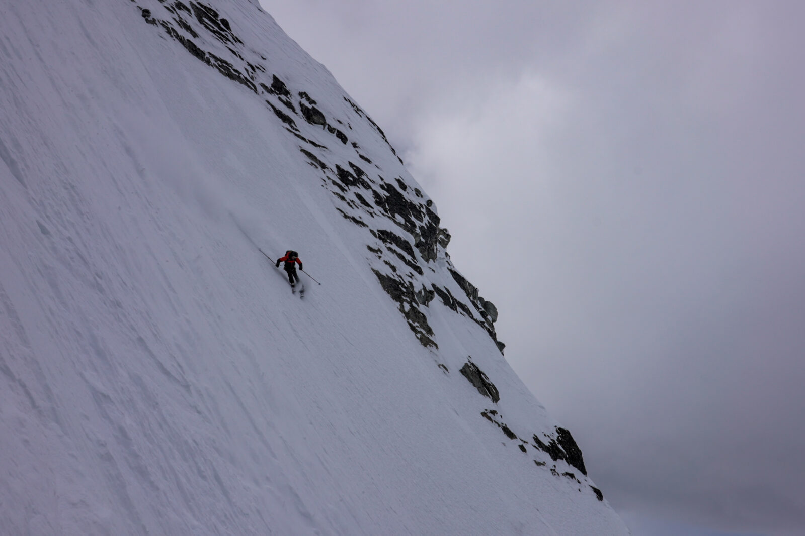
The Descent
The descent of the north face of Mt. Rogers is very steep and exposed. There are two potential options—a steeper, more glaciated face to the east of the summit and a longer, but slightly less steep ramp to the west of the summit. The exit from the western descent leaves you far more exposed to unpredictable serac falls and a challenging exit back up towards the western face of Swiss Peaks. The northeast face of Swiss Peaks descent is over 3,000 feet in sustained length, has unrelenting exposure, and ranges from 45 to 50 degrees in pitch. It’s a big, burly, and breathtaking face that rivals some of the best ski lines in the world. Due to the size, pitch, and exposure of both ski lines, avalanche stability is of prime importance to a safe descent. If powder conditions align, it may just be the best ski descent of your life.
Photo: @the.fifty.project
Hazards
Avalanches, exposure, glacier navigation, serac fall, rock climbing, and technical rope work. Any fall or avalanche on either descent would most likely be fatal.
Photo: @the.fifty.project
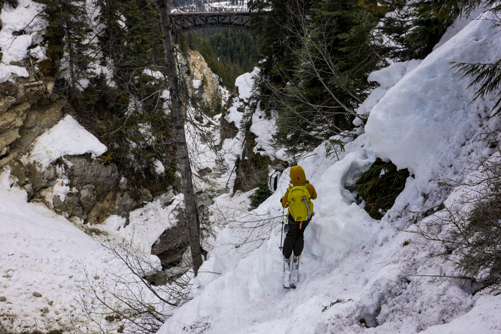
Exit Description
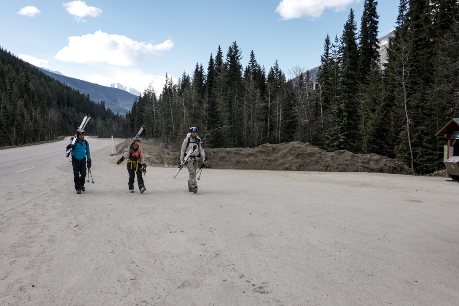
he exit of the northeast face of Swiss Peaks is anything but straightforward. The exit goes out the Stoney Creek drainage and a car shuttle at the Beaver Valley trailhead can be helpful to make return to Hermit trailhead easy. Multiple options exist after Swiss Peaks descent and there are benefits and hardships to each path. Find your own way according to weather, snowpack, time of year, and conditions. It is illegal to walk across or on the train tracks and ignoring the law threatens permanent closures of the area for everyone. Do your best to find your own way out.
Photo: @the.fifty.project
Access
Hermit Trailhead, Roger’s Pass, Glacier National Park, Canada. Parking Permits and Winter Permits required to ski on Roger’s Pass. Overnight Permits required if overnighting in the backcountry. Do not ski Roger’s Pass without them.
Photo: @the.fifty.project
Try onX Backcountry for free for 7 days.