Soft Rock 100
The Hardrock Hundred Mile Endurance Run is an elite race in the San Juan mountains of Colorado. It covers over 30,000 feet of elevation change while staying mostly above 10,000 feet. The race’s high point is at the top of Handies Peak at 14,048 feet. The average time to finish the race is over 41 hours, which is longer than the cut-offs for most other 100 milers. The race starts and ends in Silverton, passes through the towns of Ouray and Telluride, and crosses 13 12,000 foot passes. The race is hard to finish, but perhaps even harder to get into. The field is limited to 140 runners, selected through a lottery, with prerequisites including substantial mountaineering ability and previous finishes of other notable 100-mile races.
If all that sounds pretty crazy to you, it does to me too. Despite that, I signed up for the 200-mile Trans Alpine Run this year. I’ll leave running 100 continuous miles on the Hardrock course to the lucky lottery winners. Yet, I had the idea that breaking up that run into four manageable chunks, sounded like a pretty perfect training weekend for my alps run. Navigating steep, rugged, technical, and primitive trails in the remote backcountry, while managing changing weather, and soaking in the success at Ouray’s hot springs at the end of the day, sounded like a perfect vacation to me. Maybe I’m not so different from those crazy lottery winners after all.
After completing the course, I’ve come to realize it’s one of the most magical experiences I’ve had in a long time. Each day was a new adventure. We started relatively fresh and took in views during the daylight that Hardrock racers miss while running through the night. We admired every alpine lake, bighorn sheep, wildflower, and bear we saw along the way. If that sounds like something you’d like to do too, read on for more details about our trip.
Experience, Gear, and Preparation
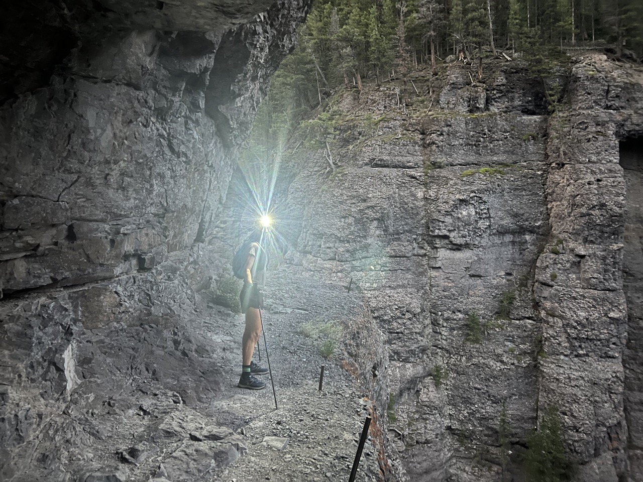
We certainly weren’t the first people to think of dividing the course into multiple days; the adventure even has a name—The Softrock 100. Breaking up the course into multiple days does make the journey less challenging, but not to be confused with easy. One should ensure they embark on the adventure with proper experience and training. When running the course self-supported, options to bail are extremely limited. Drives between towns are long and complicated, and hitchhiking isn’t exactly feasible. While most of the course is on pre-existing trails, some sections shortcut on very primitive tracks making it hard to identify. Overgrown vegetation further complicated this during the monsoon season. We relied heavily on our onX Backcountry Offline Maps with loaded GPX files to find our way.
Depending on your starting point and number of stops, days are between 25 to 30 miles long. The pace is rather slow due to the high altitude, rugged trails, steep climbs, and technical descents. The ability to spend a long time on your feet, acclimating to altitude, and a good recovery plan in between runs will behoove you. Sleep and food are perhaps the two most effective recovery techniques. Altitude acclimation prior to starting the course is highly advised. Note that your nutrition and hydration needs change at elevation as well, so be prepared to carry more fuel, water, and electrolytes. Water filtration can be your friend as the sources are plentiful and can be identified by using onX Backcountry. Some of the higher passes are more barren so planning ahead is important to make sure your flasks and bladders don’t run dry.
We planned on moving fast and light so we used 15-liter Dynafit Ultra running vests. It was big enough to fit waterproof pants and shell, lightweight down jacket, beanie, gloves, emergency blanket, satellite tracker, toiletries, sunscreen, anti-chafe stick, chargers, spare shirt, underwear, and a spare pair of socks. We planned on washing everything else each day, banking on the dry Colorado air to dry our clothes overnight. We each carried a water filter and one liter of water in soft flasks or a bladder.
Route Planning
The first thing to determine is whether you’ll be doing the route self-sufficient or with the help of a crew. Having support changes the adventure and makes your start and stop locations more flexible. Restocking your fuel supplies becomes easier and options to bail less complicated. Most of the course is out of cell phone coverage so communicating with your support crew must be done via satellite phone or tracker. The downside of having a crew is that driving between towns is not completely straightforward—meaning ‘you can’t get there from here.’
While Ouray and Silverton are connected by the Million Dollar Highway, you likely won’t be going straight from one to the other, but stopping in either Telluride or Lake City. That makes the drives for your crew long—roughly three or four hours each day. If you’re confident in your ability to complete the route, I would suggest doing it self-supported. Well developed towns make it relatively easy to restock and I found the simplicity of walking into and out of each town enchanting. Since the only experience I have is self-supported, the rest of this story will focus on the adventure specific to ours. However, don’t be limited by what we did, use it as a starting point to craft your own adventure.
We booked hotels in Silverton, Telluride, and Ouray, but made sure our reservations were refundable in case of a bad weather forecast that would make all those high mountain passes risky to cross.
Choosing Direction and Starting Point
We chose to do the course over four days, which included one night of camping between Ouray and Silverton—the longest, 50-plus-mile leg. We didn’t want to run with our camping gear, so we used Cataract Gulch as our starting point. We arrived in the evening, camped by the trailhead, put the tent back in the car in the morning, and returned four days later. We approached the loop in a clockwise direction. This worked great for a few different reasons—it was the shortest drive from the Front Range, divided the days into three longer pushes with an easier day three, and it put the 14er summit, the highest point of the course, on the final day. Talk about ending on a high note.
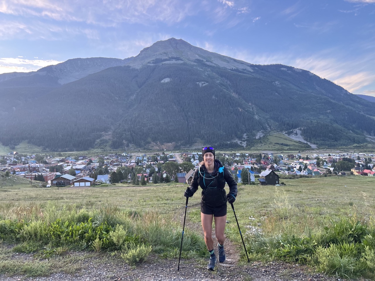
Day One: Cataract Gulch to Silverton
Equipped with Offline Maps, GPX files for the route, and an updated forecast, all available in onX Backcountry, we waited for first light to start our adventure. Hilariously, we brought one broken JetBoil and one stove with a broken ignitor, so we enjoyed our cold oatmeal with crunchy coffee. The rough start quickly turned around as we climbed the trail towards Cataract Lake with the alpenglow treating us to hues of pink and red.
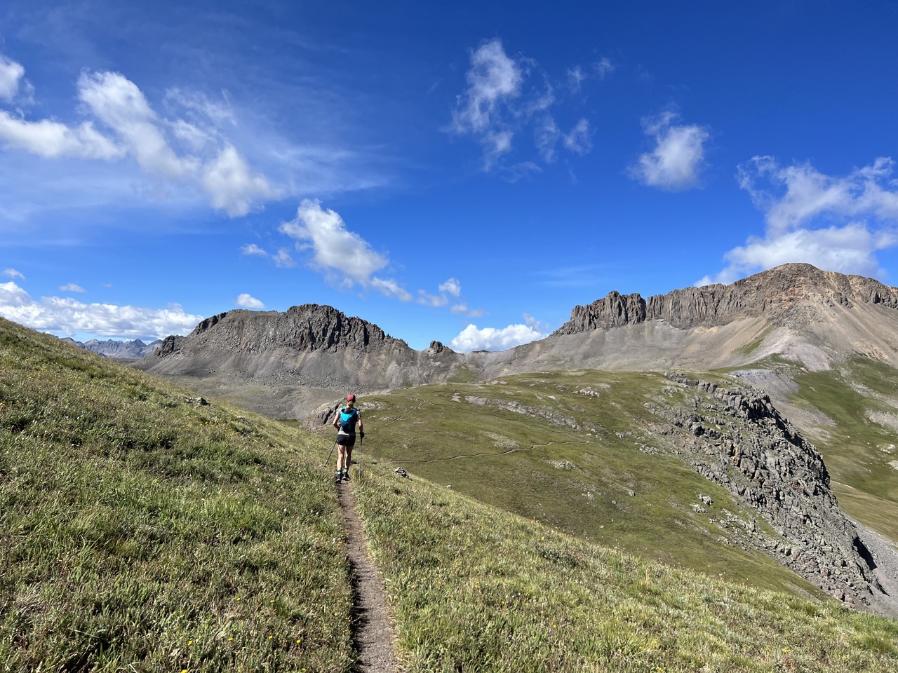
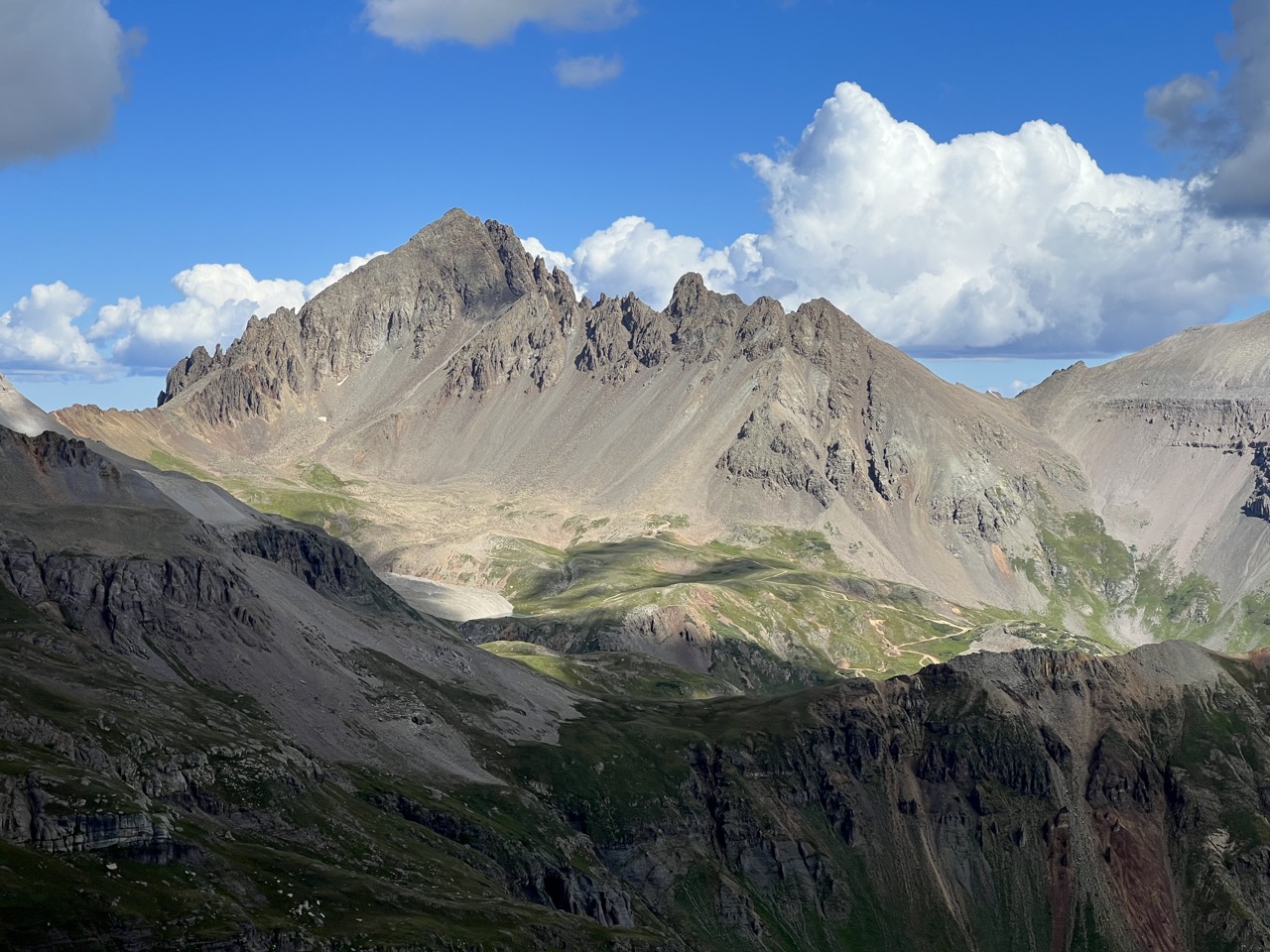
The first 16 miles weren’t steep and would be runnable at an altitude a few thousand feet lower than where we were. Up high, it was more of a shuffle jog. We saw a few people camping out by the lake but other than them, it was just a few cows, some sheep, and what looked like a wild horse to keep us company. We spent a few miles on the Colorado Trail, climbed a short time on a jeep road to Stony Pass, skirted a few 13ers, then descended steeply down to CR4 out of Howardsville. This was the first time that day we saw people, and the area had several beautiful campgrounds serving as a gateway to the many alpine lakes nearby. Descending into that valley you can see the last pass that still awaits. It’s looming high above—steep and intimidating standing sentinel over the floor below. You can’t discern the trail that climbs to the top, and it’s hard to imagine one carved into what looks like a sheer cliff. One has the option to skip the last climb and take dirt roads to Silverton, however staying on course requires a final climb of 2,500 feet in under two miles to the saddle of Little Giant Peak and King Solomon Mountain. We noticed a peculiar trend—every day there was a 3,000 foot, steep climb awaiting us around mile 18.
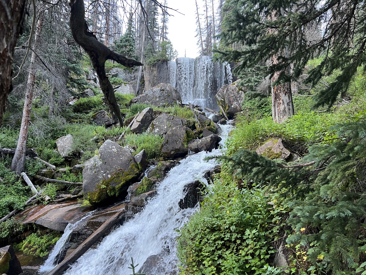
From the top of the pass we descended briefly on singletrack, but mostly on mining roads down to the valley of Silverton. Our legs lost some of their spring and navigating a rough rocky road wasn’t as fast as we expected. The last couple of miles were a treat as we stepped off the road into the forest, bouncing on soft forested singletrack right to town. It took us just under eight hours to get there, and we walked straight into Avalanche Brewing for some pizza and a Coke.
We stayed in Canyon View Motel and stocked up on running fuel for day two in Silverton Grocery. While the options were limited, we were able to gather enough calories for our second leg of the journey to Telluride.
Day Two: Silverton to Telluride
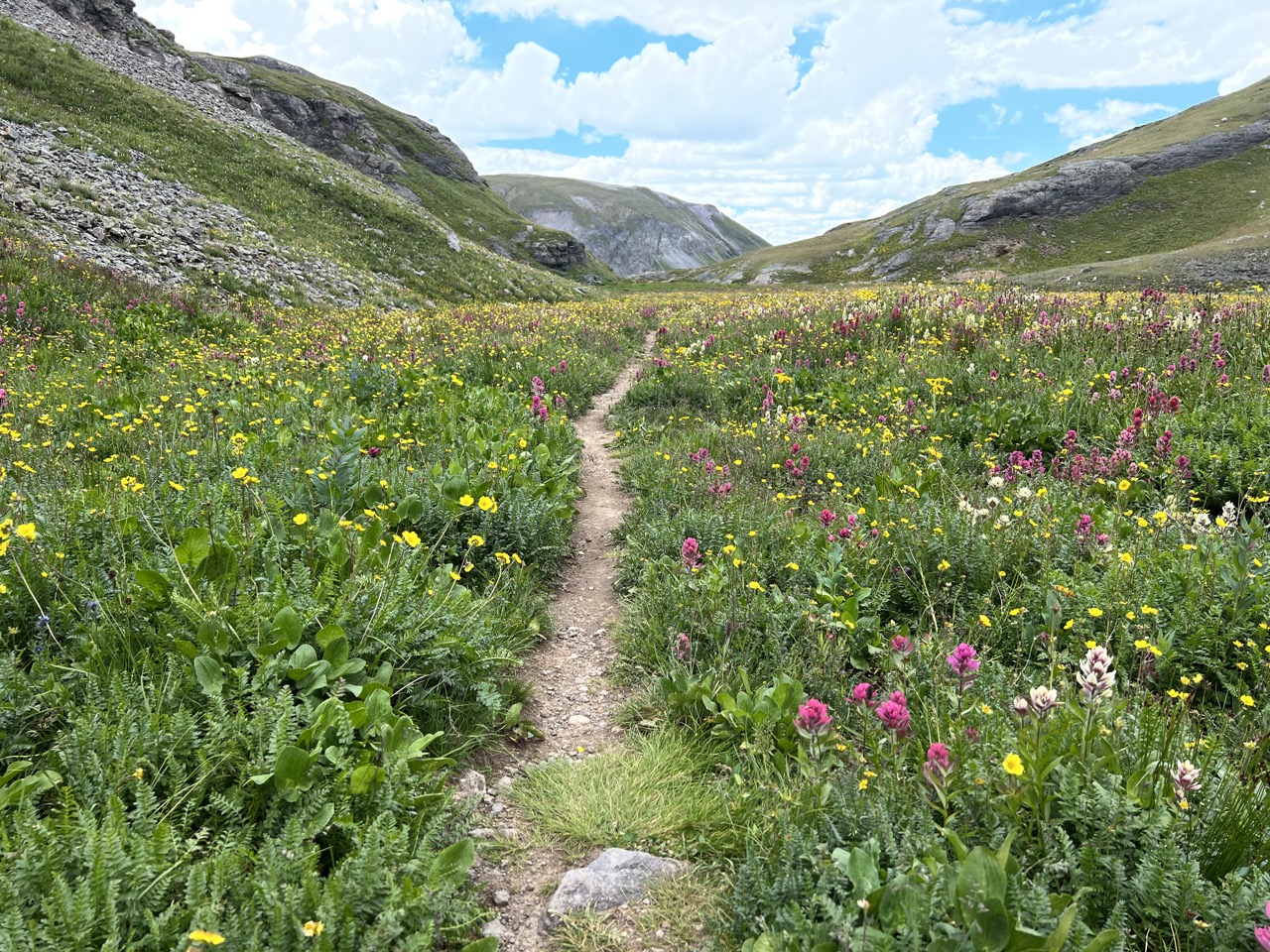
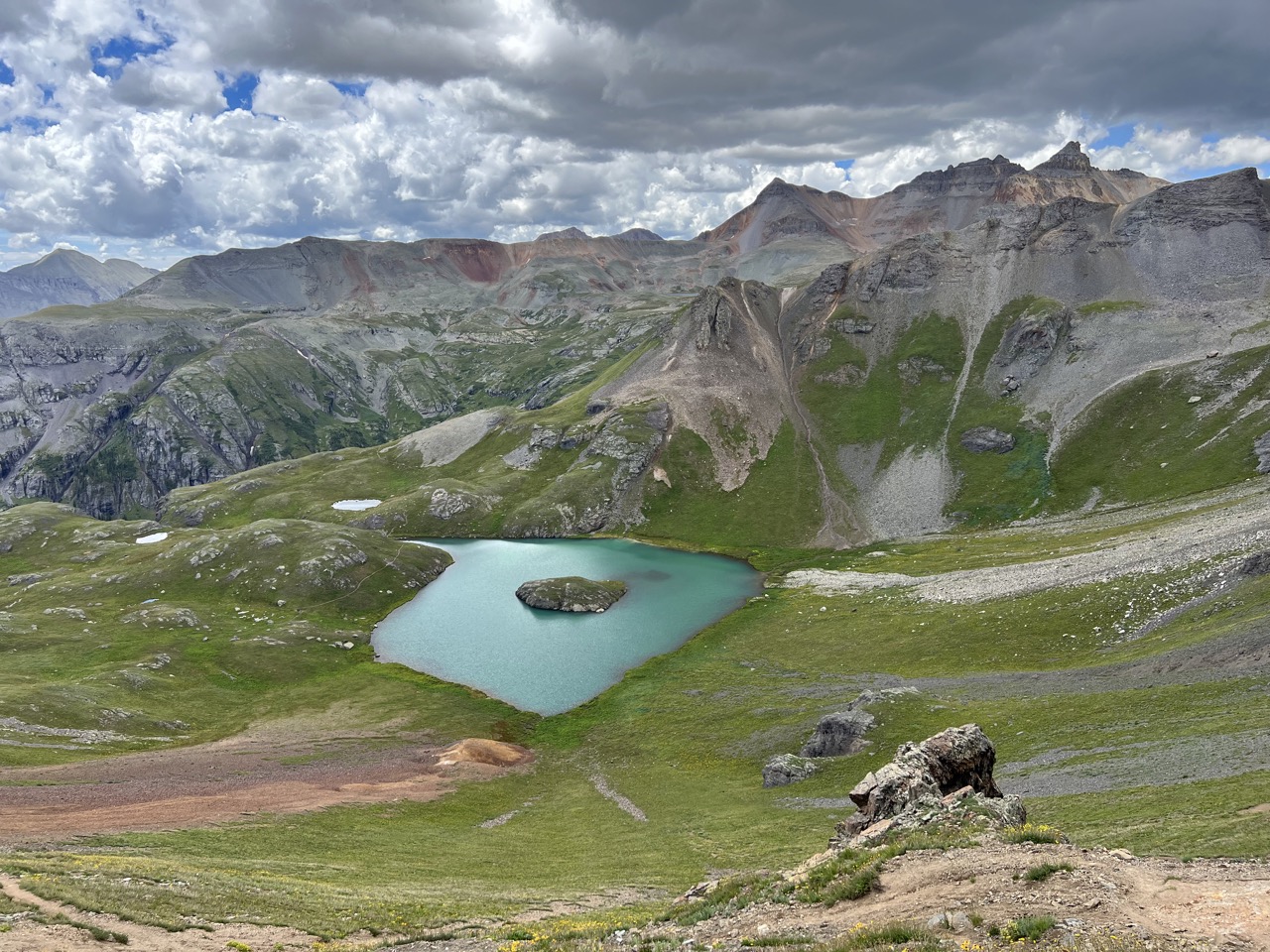
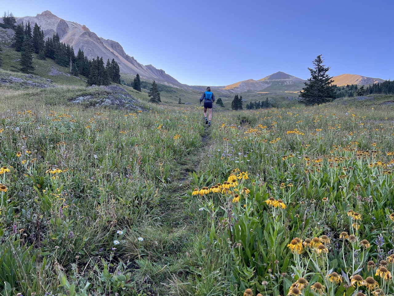
Day two was my all time favorite—stunning views, peaceful wilderness, swimming in an alpine lake, and legs that felt much better after the day one warm-up. I started with fresh socks hoping my feet would stay dry, but it wasn’t even two miles in that we reached our first river crossing. We saw no one for the entire first climb and descent, which was almost three hours of complete solitude. The mountains can be so silent, the only audible sounds are the rhythmic steps of our feet moving across the terrain and breathing the thin alpine air. Day two had us passing by Ice Lakes, which aren’t on the race course but are a worthy detour.
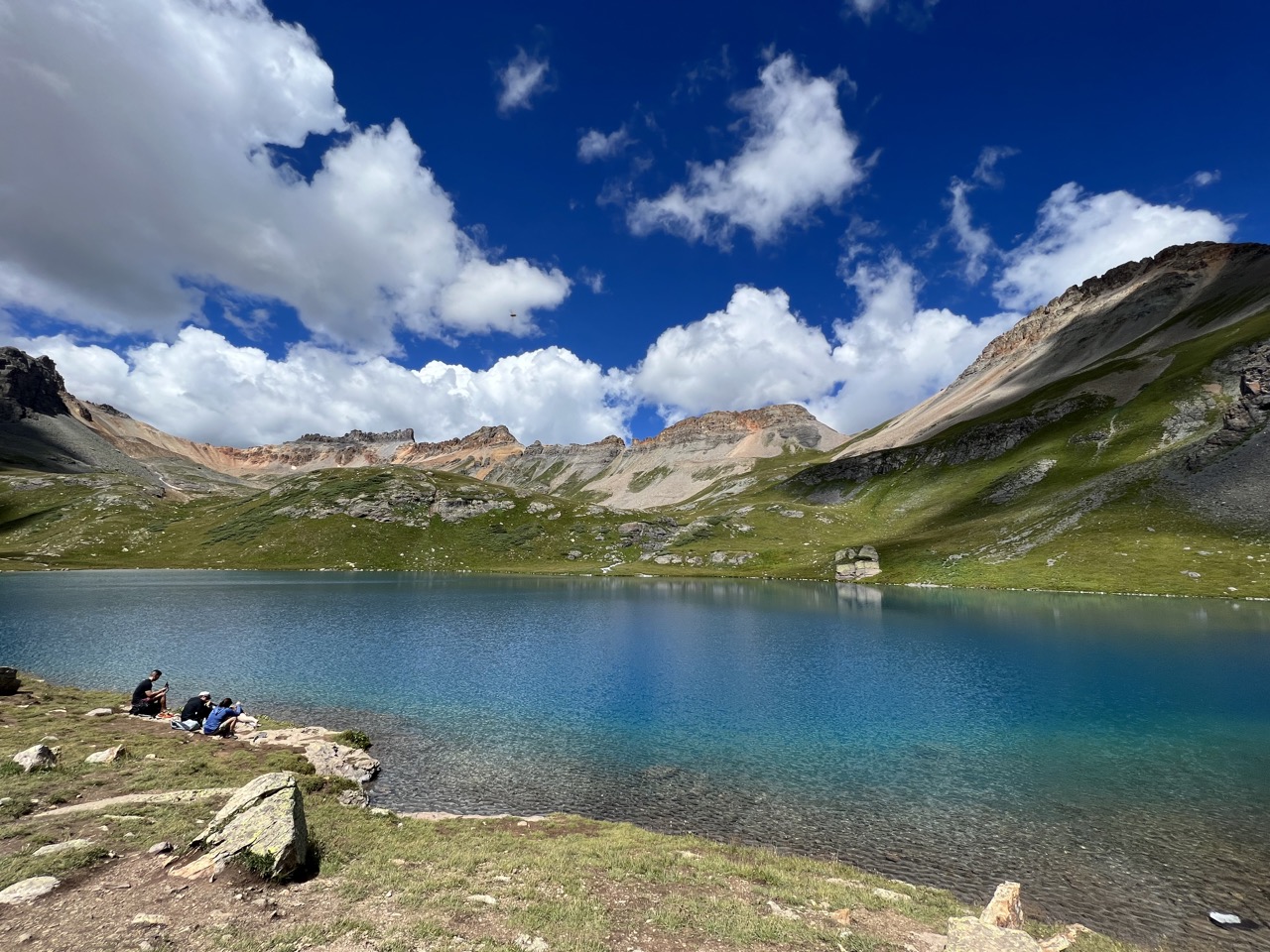
Despite passing through on a weekend, the trail wasn’t as crowded as we expected. Only a handful of groups were enjoying the views at Ice Lake. It’s one of the prettiest alpine lakes I’ve seen, with deep blue hues only rivaled perhaps by Blue Lake sitting below Sneffels Mountain, only a short distance away. It was a warm day and I couldn’t resist a jump into the lake—a welcome refreshment on a hot day. Adding the Ice Lakes detour meant more distance, but no extra elevation. The top of the pass above the lake was where the fun started. The descent towards Ophir took place on a scree field—the kind you can surf.
In the valley, before the last climb over Ophir Pass into Telluride, the black clouds congregated above, and we heard thunder in the distance behind us. We didn’t want to get caught in a storm above treeline, and we had very few bail options given that our accommodations were on the other side. We climbed up to the edge of the treeline, tracked the cloud movements, listened and counted the gaps between lightning and thunder. Lucky for us, by the time we made the 2,000 foot climb, the thunderstorm dispersed and the clouds cleared. We had a free pass to Telluride.
We stayed in the Mountain Lodge in Telluride which required a gondola ride to get there from town. We needed groceries again for day three and the lodge provided a free shuttle on demand—a convenience I never expected to appreciate.
Day Three: Telluride to Ouray
Day three was an easy day which gave us a chance to catch up on sleep in the morning and recover later in the day.
Telluride to Ouray was the least eventful day. There’s only a single pass to climb over and you spend most of the time on a forested doubletrack trail. The descent into town is mostly rugged jeep trails followed by smooth and fast dirt roads. With countless vehicles passing by, peace and solitude were hard to come by, yet the easy miles coasting downhill allowed us to open up our strides and move with speed.
Ouray was the perfect place to arrive early because we had more of the day to enjoy town and rest our legs. We stayed in Twin Peaks Lodge and Hot Springs, which, as the name suggests, included a luxurious hot spring. They even had a cold pool, a tired runner’s dream.
Day Four: Ouray to Cataract Gulch
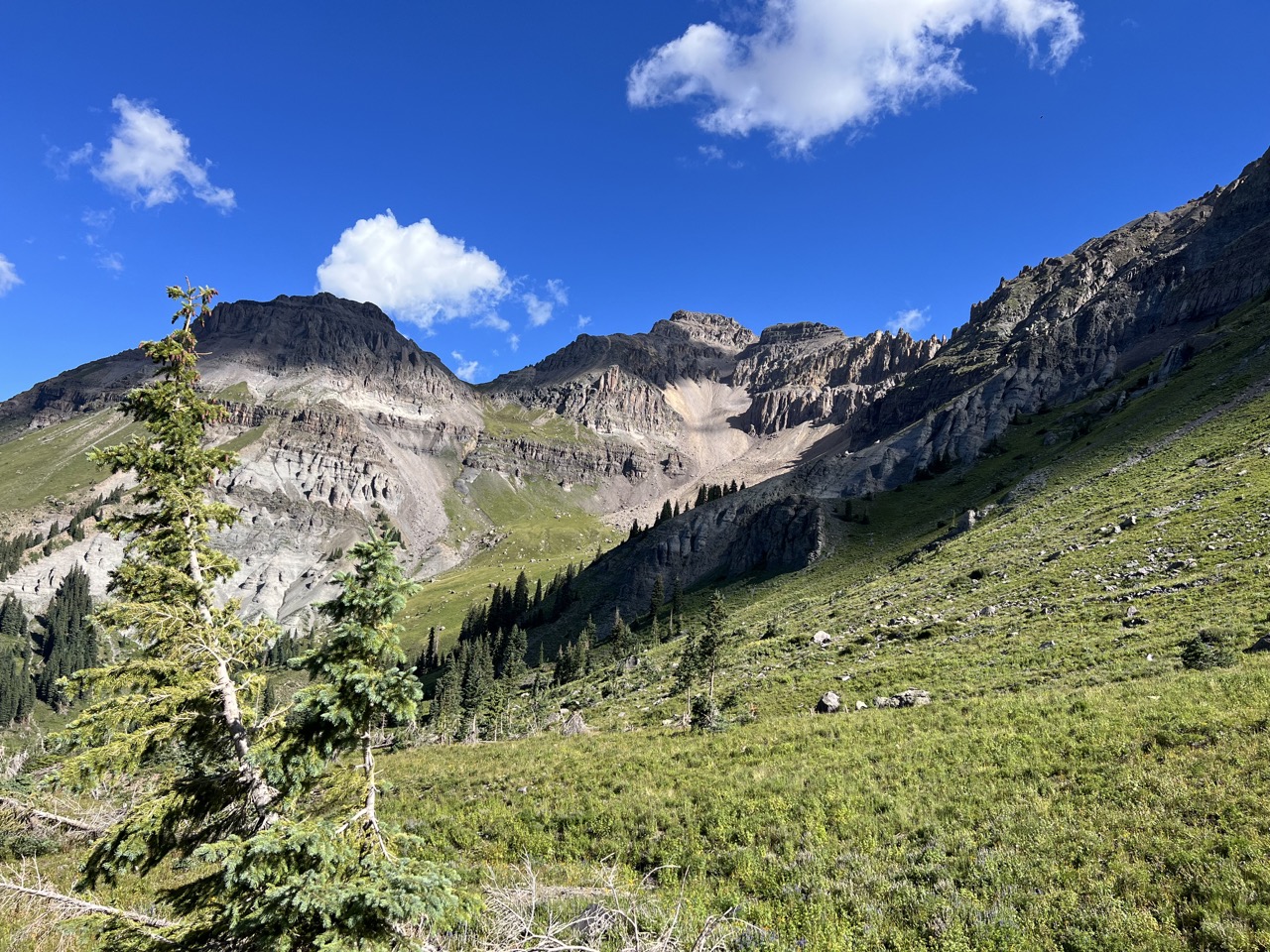
Knowing we had to climb a 14er at mile 20 on the last day, cumulative mile 93 of the trip, we started the day long before dawn. The lights from Ouray town center glowed below us as we climbed into the mountains, and the sunrise was one of the best I’ve ever seen. Bear Creek Trail was unique in ways we hadn’t seen before on this trip, and we grew to appreciate all the different ecosystems we experienced in the four-day adventure. The climb was long—10 miles to the top of the Engineer Pass.
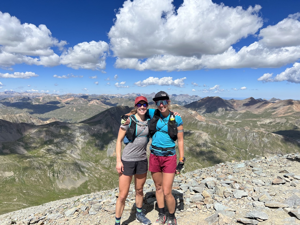
Once we crested the top, we descended a jeep trail, but the early start meant we slipped through before any motor traffic began for the day. It was nice to complete some miles faster towards our finish line. Before we knew it, we were climbing up what would be our final summit—Handies Peak.
As we descended Handies, I stopped, turned to my friend, and said, “I’m so happy right now, but I can’t really put my feelings into words.” She responded, “I know, and I feel it too.”
One hundred miles later, we arrived back to where we started, and everything looked just as we left it. Yet, so much inside us has changed. When I question why I sign myself up for these long, not always pleasant adventures, the answer lies on the trails surrounding those last 14ers. In our busy life we rarely allow ourselves to be solely focused on the moment, and I find the mountains to be both the challenge and meditation that I can find nowhere else. There’s magic to these endeavors, but you have to be willing to go the distance to find it. When you do, it changes a little part of you forever.