Bright Angel Trail Day Hike
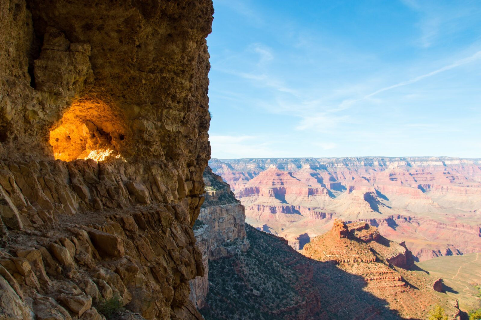
Often lauded as one of the crown jewels of Grand Canyon National Park, the Bright Angel Trail is an iconic 8.1-mile point-to-point descent that covers over 4,400 feet of elevation loss, dropping from the South Rim to the Colorado River. Dramatic towers, enormous stone walls, and fertile havens of green amidst a harsh desert landscape make the Bright Angel Trail a land of extremes.
That said, with dry and hot desert conditions, rugged topography, and a huge vertical relief, the Bright Angel Trail is not to be underestimated, especially if you’re planning on doing all 16.2 out-and-back miles in a single day.
Take your hiking GPS offline
Download your trail maps so that when you are at Bright Angel you can feel confident in your plan.
The upper stage of the hike—about four miles—comprises the lion’s share of the vertical descent and can offer many trekkers more than enough scenery for any trip. This section of trail roughly follows the path of Garden Creek, dropping rapidly down a tributary canyon in a series of seemingly never-ending switchbacks. Nestled inside this canyon, the trail receives a great deal of shade and is a popular habitat for wildlife.
Amidst the sharp descent, resthouses with compost toilets, emergency phones, and drinking water are situated at mile markers 1.5 and 3.0. As the Bright Angel Trail can be hot and unforgiving, hikers are encouraged to take advantage of the stopping points to refuel and hydrate before continuing the descent or climb.
At mile marker 4.8, hikers reach Havasupai Gardens Campground (formerly known as Indian Garden Campground). This area’s topography is flatter than the previous miles and offers a reprieve with drinking water, compost toilets, an emergency phone, a wilderness ranger station, plus campsites for those with a permit reservation ($10). For those camping at Havasupai Gardens, the short (and sun-exposed) jaunt to Plateau Point makes for a popular side excursion. However, if you’re trying to do the entire out-and-back 16.2 miles as a day hike, adding this extra three miles might be a bit much. Regardless of whether this is your stopping point, be sure to take a rest and relax under the area’s prominent Cottonwood trees.
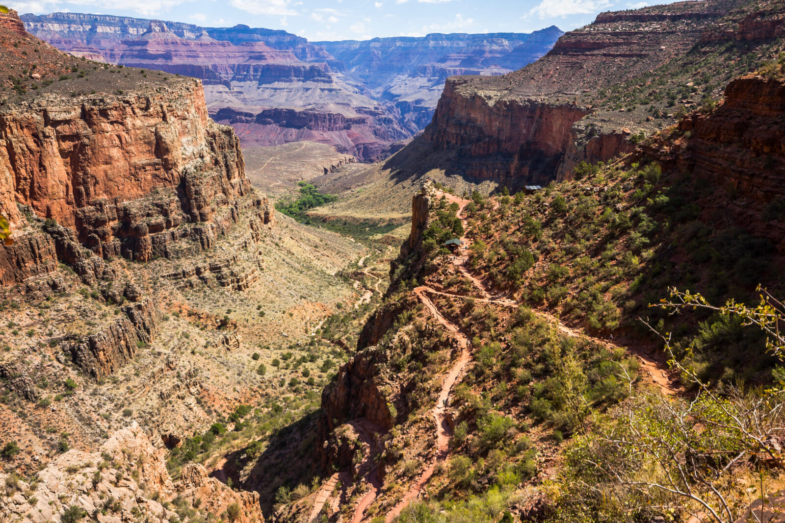
Continuing on from Havasupai Gardens, the Bright Angel Trail traverses the shale-composed Tonto Platform—the relatively flat mid-layer of the Grand Canyon. Cutting northeast, the trail follows the Tonto’s contours until dropping into the inner sanctum of the Grand Canyon, yet again traversing a labyrinthine series of switchbacks ever deeper as the canyon’s walls grow behind you.
At mile marker 8.0, hikers arrive at the River Resthouse, which has both toilet facilities and an emergency phone. This is the traditional end of the Bright Angel Trail, so if you’re planning to tackle the 8.1-mile climb back to the South Rim, this is a good turnaround.
Beyond the River Resthouse, the trail traverses a series of sun-exposed sand dunes before arriving at the Silver Bridge spanning the width of the Colorado River. Bright Angel Campground is at mile marker 9.5, with Phantom Ranch just 0.4 miles further. Both the campground and Phantom Ranch offer drinking water, toilets and emergency phones. Additionally, there is a ranger station at Phantom Ranch that can facilitate an emergency medical response and a helicopter evacuation, if necessary.
Bright Angel Overview
- Distance: 16.2 miles roundtrip (to River Resthouse) / 4,460 elevation loss/gain
- Hike Time: Depending on speed and hiker fitness, the descent takes roughly 4-5 hours. However, the climb back to the South Rim can easily take double that. For strong, athletic hikers, the entire trip can take around 10 hours. For the average day tripper, the roundtrip can take upwards of 12-15 hours. Either way, plan to spend a full day on this route and pack accordingly.
- Difficulty: Difficult and strenuous—not to be underestimated!
- Best Time to Hike: October to May, early morning/cooler hours of the day
- Trail Map
What to know about hiking Bright Angel Trail
Covering 4,500’ of vertical relief in a little over eight miles, the Bright Angel Trail is a long and steep day hike that catches many by surprise with its arduous climbs, steep descents, and harsh desert conditions.
That said, the trail is graded for mule packing, so it’s well built, flat from side to side, and offers hikers plenty of berth for sure footing. Some sections—especially the upper portion—offer a fair amount of shade for hikers to rest and recover. Additionally, there are numerous water outlets, both creeks and human-built drinking taps, that enable hikers to cool off and rehydrate during the descent and climb.
Even so, this is a difficult and strenuous hike, full stop. Hikers are encouraged to bring food, sustain energy levels and actively rehydrate during the entirety of the hike. Historically, many have underestimated the climb out and have struggled to make it back to the South Rim due to poor planning. More than a handful have required rescue due to dehydration and a lack of preparedness—in fact, over 250 hikers are rescued EVERY YEAR from the canyon, so be prepared and have a plan.
It’s best to avoid the Bright Angel Trail in the warmer, summer months due to heat and sun exposure. Due to the extreme elevation loss, the bottom of the canyon is on average 20ºF hotter than the rim, meaning if it’s 90ºF at the South Rim, it’ll be pushing 110ºF at the River Resthouse, 4,400’ lower. This temperature differential, combined with hikers often starting their ascent in the afternoon, conspire to create truly heinous hiking conditions for the trek out. Again, drink plenty of fluids (plus electrolytes), eat salty snacks, wear a wide-brimmed hat, and time your hike to avoid the sun’s afternoon zenith.
If hiking in peak winter months, be sure to check with a Grand Canyon Ranger as to whether (and where) the Bright Angel Trail is holding ice. If this is the case, bringing along snow spikes is highly recommended for negotiating these icy sections of the trail.
Camping is by permit only at Havasupai Gardens Campground and Bright Angel Campground. For more information and to apply for a camping permit ($10), head to the Grand Canyon backcountry website.
FAQs
Bright Angel Trail in Grand Canyon National Park is very difficult, with high mileage, steep climbs, harsh sun and unforgiving terrain. Having the right equipment and a group of mentally prepared trail mates is highly recommended.
At 16.2 miles round trip, the Bright Angel Trail can be done in a day. However, it’s likely to be one of the longer, tougher day hikes you’ll encounter.
With high mileage and burly desert conditions, it’s unrealistic to expect children to tackle the Bright Angel Trail. There are exceptions, but as an alternative, consider narrowing your family’s goal to reaching one of the early rest houses at mile markers 1.5 or 3.0, and turning back from there.
The National Park Service has announced planned upgrades to the Bright Angel Trail during the fall of 2023. These projects will unfortunately cause intermittent trail closures during this time and it’s highly recommended to check with the Park Service before committing to a trip.
To check trail conditions and closures, head to the Grand Canyon operations website.
See more bucket list day hikes, like the adventurous Angels Landing.
The Ultimate Offline GPS Hiking Maps
See why onX Backcountry is the ultimate GPS navigation app for your outdoor pursuits. Try Today for Free.