
Off-Road Trails
Near Hartsel, Colorado
Off-Road Trails Near Hartsel, Colorado
Discover the best offroad trails near you. Browse trail maps, check difficulty ratings, and find your next adventure — whether you're looking for a quick ride or an all-day expedition.
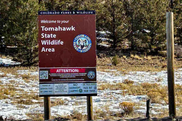
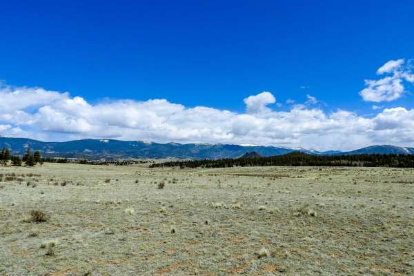
Tomahawk State Wildlife Area East
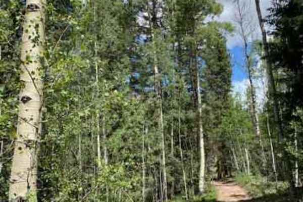
The trail is easy when dry and can be muddy in places when wet; it travels along the middle fork of the South Platte River, which is open to the public for fishing. Even though the road looks like it continues to Hartsell, it is closed at the 4.4-mile point where it is Private Ranch Land at that poi...
Learn more about Tomahawk State Wildlife Area East

Tomahawk State Wildlife Area West
The road is easy, it travels up to a ridge that follows through the trees. Towards the end, the road drops down to the parking area at the end. In the wintertime, when it is snowy, four-wheel drive may be required to get back out. There is access to the Middle fork of the South Platte River for fish...
Learn more about Tomahawk State Wildlife Area West

Salt Creek Road
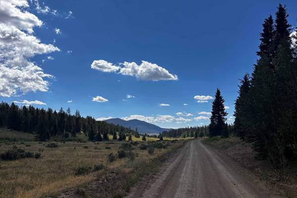
Salt Creek Road is directly accessed from Highway 285. It is a 2-way gravel road that partially follows Salt Creek, until the Y where it turns toward the wilderness area and becomes a single-lane, very rutted dirt road. In rainy conditions, a 4WD vehicle will be necessary. Dispersed camping sites ar...
Learn more about Salt Creek Road
Turner Gulch Road
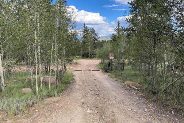
Turn Gulch Road (FS 238 1a or Park County 23) serves as an unpaved alternative to Park County 77 connecting US24 to the Tarryall Reservoir. This is a mild dirt/sand road suitable for larger trailers and offers numerous dispersed camping options as well as a number of side trails to explore. There ar...
Learn more about Turner Gulch Road

Buffalo Peaks Road - 431
This is an easy road for all vehicles, from open meadows to aspen groves to burn scar areas. Use caution in burn areas during high winds as trees can blow down. In the wintertime, you'll have a chance of seeing elk and deer as this is a wintering area for them. There is a seasonal closure for wildli...
Learn more about Buffalo Peaks Road - 431
Criterion Road - 430
This road is rougher than Buffalo Peaks Road. High clearance vehicle is recommended. The route takes you through pine forests, aspen groves, and open meadows. There are a few remote camping areas, one by Tumble Creek at the north end of the road. Seasonal closure for wildlife habitat from January 1 ...
Learn more about Criterion Road - 430

Buffalo Peaks Road #2 - 431
This is an easy road for all types of vehicles, mostly through open meadows. It can get muddy after a rain storm which can be an issue for passenger cars. This is the main road to a trailhead into Buffalo Peaks Wilderness. The road gets rougher at the intersection of Buffalo Peaks Road FR 431 and B...
Learn more about Buffalo Peaks Road #2 - 431
La Salle Pass
La Salle Pass is a rugged off-road trail with distinct variations between the east and west sections. The eastern portion is rougher, featuring two particularly tricky spots that act as minor “obstacles.” Drivers will encounter rocky terrain, dips, humps, and rolling hills that demand careful line s...
Learn more about La Salle Pass
Paige Road
This road is easy. If doing Eagle Rock Road, you can use this road as a different route instead of Turner Gulch Road. The views are worth taking this alternate way--you just need to reach the top of the south end of Turner Gulch Road and turn back towards Eagle Rock Road to the north.
Learn more about Paige Road
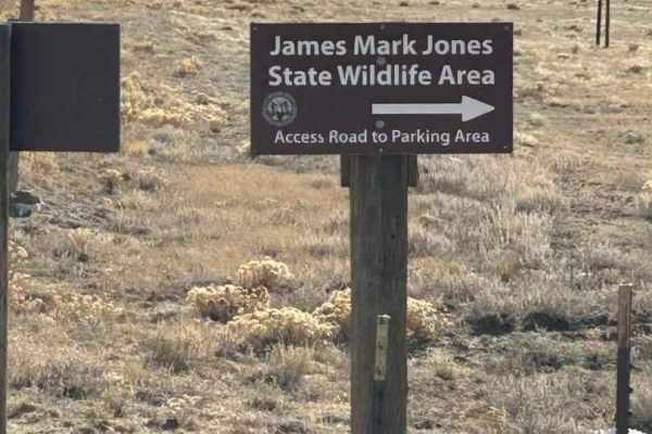
Meadow Drive/ James Mark Jones Wildlife Area
This is an easy road when dry. The road travels through open meadows with good views of the surrounding mountains. This road gives you access to hunting, camping at two campgrounds, fishing along the middle fork of the South Platte River, and wildlife viewing. The wildlife area is closed from Januar...
Learn more about Meadow Drive/ James Mark Jones Wildlife Area

Pony Park Road - 433
This trail takes you through mostly aspen groves, open areas, and some of the burn scars of a wildfire in 2018. The trail can be tricky in wintertime due to some semi-steep sections, and drifting snow in open areas. There are no water crossings. In the summer time road is easy. The trail follows Sal...
Learn more about Pony Park Road - 433
Weston Pass
Weston Pass is a scenic and historic mountain route connecting Fairplay and Leadville, with an easygoing nature that makes it a great choice for most high-clearance vehicles. The trail is generally wide, with only a few narrow stretches and a small shelf section that has minimal exposure and no majo...
Learn more about Weston Pass
FS 309A
The trail now begins at the north end of Chubb Park along Forest Service Road 309, as the former access from FS 309 and FS 311 via FS 309A has been closed. There is one designated camping area within the first quarter mile that is accessible for trailers. Beyond this point, the trail is an out-and-b...
Learn more about FS 309A
Browns & Breakneck
Most people start on the southern leg, about 5 miles south of Fairplay. Doing the loop, plus Lamb Mountain is 20 miles.The main loop of Browns and Breakneck Passes is mostly in the trees. There are groves of aspen on each end of the loop. The southern leg is extremely narrow, and there are long s...
Learn more about Browns & Breakneck
Bear Gulch Road - 158
This trail is mostly through Pine Forest with some Aspen Groves. There are some good vistas for pictures. There are a few dispersed camping areas there is a nice one at the north end just before Tumble Creek. The trail has some steeper sections that can be tricky in the wintertime as the road is mos...
Learn more about Bear Gulch Road - 158
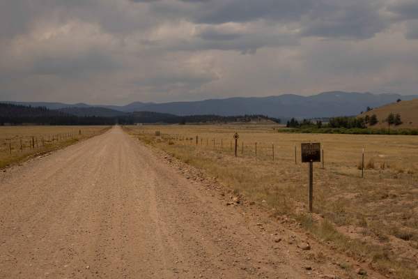
Windy
Windy is the largest and most expansive trail in the Tarryall Reservoir trail network and allows for easy access to any side route to explore. Windy is also the most acceptable trail for dispersed trailer camping. Lots of open and wooded areas make it easy for trailers to access with enough room for...
Learn more about Windy
39 Mile Mountain Road
Trail pretty easy, rocky in places, good scenery. Drove most of the trail in 2 wheel drive, however high clearance was needed as well as 4 wheel drive in few places. The road changes names thru out the route, follow main road which will take you to the main road at the end.
Learn more about 39 Mile Mountain Road
Skinny
Fun trail to ride while exploring the middle of the Tarryall Reservoir trail network. Skinny is in excellent connection between Packer Gulch, West Packer, Schoolmarm, Windy, and Paige. Skinny offers open fields, thick pines, and tall aspens to ride through. Limited dispersed camping on Skinny but if...
Learn more about Skinny
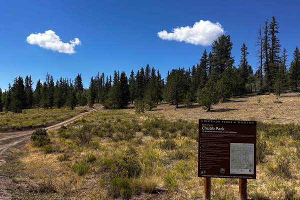
Chubb Park Trail - FS 309
This trail connects Chubb Park Ranch State Wildlife Area to the Fourmile recreation area. The trail is mostly dirt with small rocks, making it completely passable by any vehicle and RV. Towards Highway 285, the trail is mostly open fields with lots of easy pull-offs. When passing Forest Service Road...
Learn more about Chubb Park Trail - FS 309
Observatory Rock Road FS 148
The trail is located within the Pike National Forest and goes through sections of aspen and pine trees, but is mostly in open meadows. Some areas of the trail are rutted and shallow puddles with mud. The trail is accessible by 4WD and high-clearance 2WD vehicles. In wet conditions, 4WD may be requir...
Learn more about Observatory Rock Road FS 148
ATV trails near Hartsel, Colorado
Explore ATV-friendly trails near you. These trails are accessible for vehicles up to 50 inches wide, perfect for ATVs and smaller off-road machines.
Salt Creek Road
Salt Creek Road is directly accessed from Highway 285. It is a 2-way gravel road that partially follows Salt Creek, until the Y where it turns toward the wilderness area and becomes a single-lane, very rutted dirt road. In rainy conditions, a 4WD vehicle will be necessary. Dispersed camping sites ar...
Learn more about Salt Creek Road
Turner Gulch Road
Turn Gulch Road (FS 238 1a or Park County 23) serves as an unpaved alternative to Park County 77 connecting US24 to the Tarryall Reservoir. This is a mild dirt/sand road suitable for larger trailers and offers numerous dispersed camping options as well as a number of side trails to explore. There ar...
Learn more about Turner Gulch Road
Buffalo Peaks Road - 431
This is an easy road for all vehicles, from open meadows to aspen groves to burn scar areas. Use caution in burn areas during high winds as trees can blow down. In the wintertime, you'll have a chance of seeing elk and deer as this is a wintering area for them. There is a seasonal closure for wildli...
Learn more about Buffalo Peaks Road - 431
Criterion Road - 430
This road is rougher than Buffalo Peaks Road. High clearance vehicle is recommended. The route takes you through pine forests, aspen groves, and open meadows. There are a few remote camping areas, one by Tumble Creek at the north end of the road. Seasonal closure for wildlife habitat from January 1 ...
Learn more about Criterion Road - 430
UTV/side-by-side trails near Hartsel, Colorado
Find UTV and side-by-side trails near you. These trails accommodate vehicles up to 60 inches wide, ideal for UTVs, side-by-sides, and wider off-road rigs.
Salt Creek Road
Salt Creek Road is directly accessed from Highway 285. It is a 2-way gravel road that partially follows Salt Creek, until the Y where it turns toward the wilderness area and becomes a single-lane, very rutted dirt road. In rainy conditions, a 4WD vehicle will be necessary. Dispersed camping sites ar...
Learn more about Salt Creek Road
Turner Gulch Road
Turn Gulch Road (FS 238 1a or Park County 23) serves as an unpaved alternative to Park County 77 connecting US24 to the Tarryall Reservoir. This is a mild dirt/sand road suitable for larger trailers and offers numerous dispersed camping options as well as a number of side trails to explore. There ar...
Learn more about Turner Gulch Road
Buffalo Peaks Road - 431
This is an easy road for all vehicles, from open meadows to aspen groves to burn scar areas. Use caution in burn areas during high winds as trees can blow down. In the wintertime, you'll have a chance of seeing elk and deer as this is a wintering area for them. There is a seasonal closure for wildli...
Learn more about Buffalo Peaks Road - 431
Criterion Road - 430
This road is rougher than Buffalo Peaks Road. High clearance vehicle is recommended. The route takes you through pine forests, aspen groves, and open meadows. There are a few remote camping areas, one by Tumble Creek at the north end of the road. Seasonal closure for wildlife habitat from January 1 ...
Learn more about Criterion Road - 430
The onX Offroad Difference
onX Offroad combines trail photos, descriptions, difficulty ratings, width restrictions, seasonality, and more in a user-friendly interface. Available on all devices, with offline access and full compatibility with CarPlay and Android Auto. Discover what you're missing today!
Open Trail Map