
Off-Road Trails
Near Coalmont, Tennessee
Off-Road Trails Near Coalmont, Tennessee
Discover the best offroad trails near you. Browse trail maps, check difficulty ratings, and find your next adventure — whether you're looking for a quick ride or an all-day expedition.
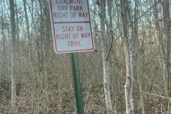
Coalmont OHV Company Farm Road
Right-of-way trail to get to and from Coalmont OHV from Company Farm Road. This. makes a great cut-through if you want a faster way to town to get more supplies. You will need an off-highway tag if you plan on going to town on your machine.
Learn more about Coalmont OHV Company Farm Road
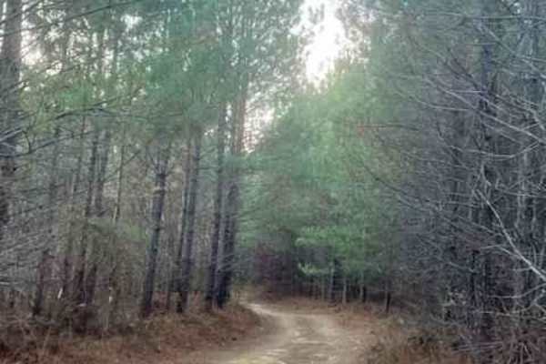
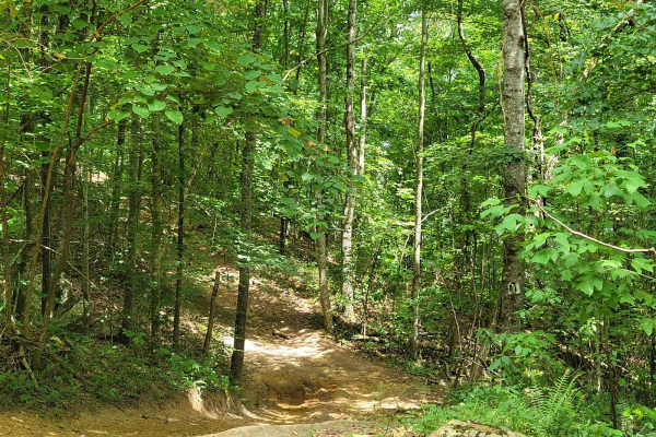
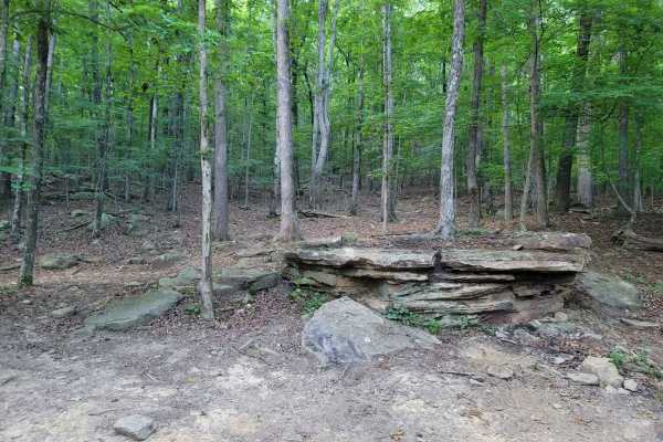
Coalmont Trail 11 Green
Trail 11 Green traverses from Trail 2 Green to Trail 13. The trail has gentle slopes and a few rocky spots along the way. There is an overlook spot through the trees that you can hike to. The pipeline is crossed along the trail and comes to Trail 13 on the pipeline.
Learn more about Coalmont Trail 11 Green
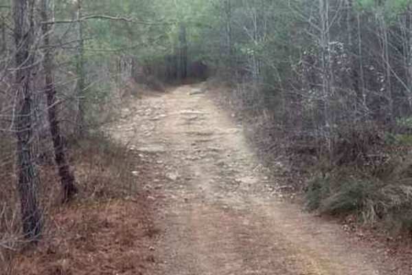
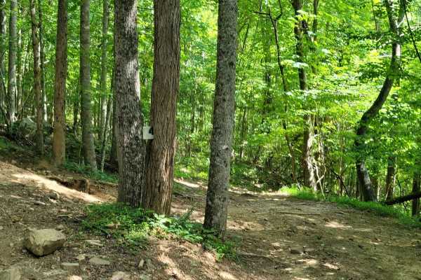
Coalmont OHV Trail 2 Green
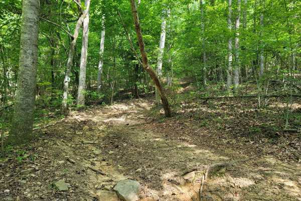
Trail 2 Green goes from Trail 3 to Trail 2 Blue and Trail 11. The trail is easy to travel and has smooth dirt most of the way with very few rocks. There is a small spring crossing along the trail and one overlook along the trail. There are quite of few other trails that branch off of this trail.
Learn more about Coalmont OHV Trail 2 Green
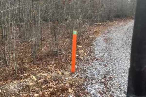
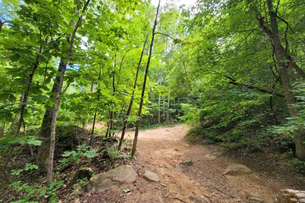
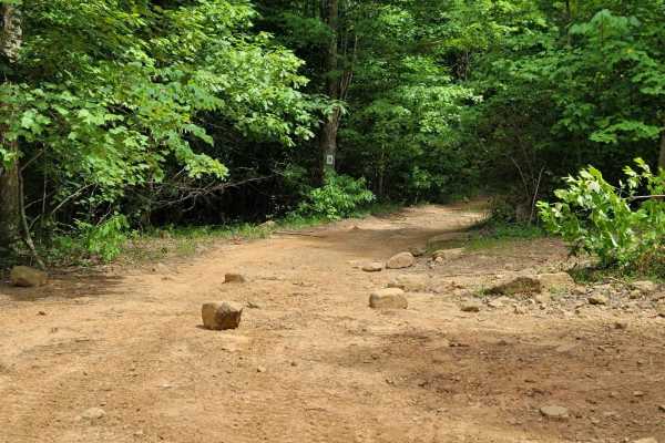
Coalmont Trail 15
Trail 15 leaves the parking and camping area and loops back to the overlook road. Along the way, trails 16 and 17 intersect and branch off. The trail has a few mud holes but nothing too difficult. Makes a good tail to warm up your equipment and start your adventure at Coalmont OHV.
Learn more about Coalmont Trail 15
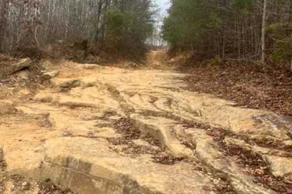
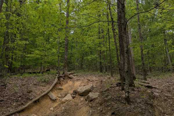
Coalmont Trail 2 Blue
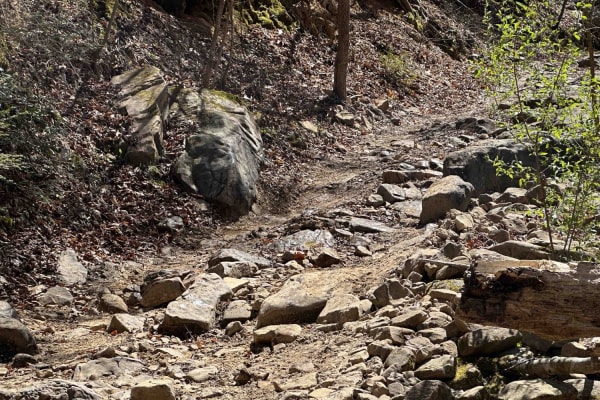
Trail 2 Blue has 8 creek crossings and lots of rock climbs, up to 24 inches high. The trail can be accessed from Trail 13, Trail 1, and Trail 2 Green. There is a long hill that has quite a few tight switchbacks, and elevation changes over 400 feet.
Learn more about Coalmont Trail 2 Blue
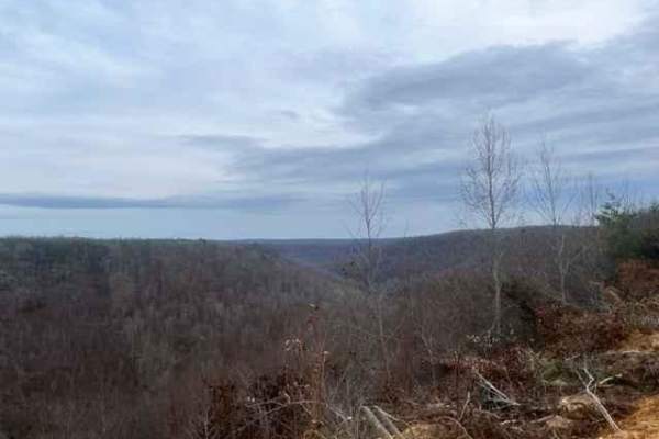
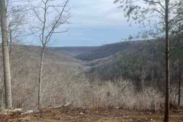
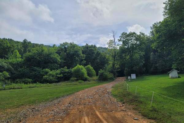
Coalmont OHV Main Road
Located in the Heart of Grundy County, come see what Coalmont OHV is about! This trail connects the camping and parking area to the beautiful overlook and the beginning of Trail 1. The overlook on this trail is the best view at Coalmont OHV. It is easily accessed in almost any vehicle.
Learn more about Coalmont OHV Main Road
Coalmont OHV Trail 1 Blue
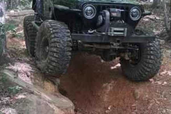
Drops off the mountain from the main overlook and goes to the southeastern end of Coalmont OHV. Along the way, there are 4 creek crossings, but the first creek crossing is usually dry. The train is really rocky and some rocks are as high as 24 inches. This is the longest single Trail at Coalmont OHV...
Learn more about Coalmont OHV Trail 1 Blue
Coalmont OHV Trail 17 Blue
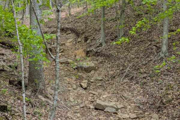
Trail 17 goes from Trail 15 to Trail 1. Along the way, you will encounter steep hill climbs and descents. There are rocks up to 18 inches tall to climb over. The trail goes out to the bluff and drops off the hill, where it circles around the bottom and then climbs up to a beautiful overlook. At the ...
Learn more about Coalmont OHV Trail 17 Blue
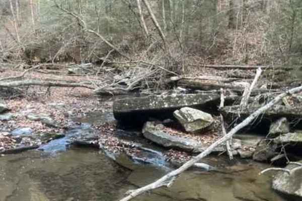
Coppinger Cove to Cave
Coppinger Cove is a wonderful trail with a mix of everything, dirt, rocks, mud, and water. The kick-off of this trail is a water crossing, one small obstacle that leads to a longer water crossing. From there you will continue to go up the trail going north running parallel to Little Sequatchie River...
Learn more about Coppinger Cove to Cave
Trail 5
AOP Trail 5 - Lifeform is a peaceful uphill climbing connector trail. Trail 5 features small rocks, exposed roots, and curving bends that bring you out to Trail 3. During the spring and summer, you will have a dense overhead canopy that shades you from the blistering Tennessee heat which makes for ...
Learn more about Trail 5
Trail 6
AOP trail 6 - Descension is a mild downhill trail that starts off as a dirt flat, and ends with a deeply rutted and eroded section. The bottom half rut also has an exposed tree root. You have 3 options: Straddle the rut, stay on the high side of the rut if you have a narrow enough wheelbase, or get...
Learn more about Trail 6
JW1
JW1 is a short, steep trail that connects Trails 4 and 17. Its main obstacle is a deep rut in a turn at the top of the hill. The trail is named after Jeeps and Wrenches, a club based in Nashville that originally cleared this trail. The park rating for this trail is Blue (Moderate). A Park Day-Use Tr...
Learn more about JW1
Trail 11
AOP trail 11 - Ground Control is like a child's roller coaster- slightly uphill then back down over and over. Trail 11 - Ground Control has concentrated clusters of rock, however none are difficult to traverse. One section does show some larger rocks that could scuff up the oil pans on a low-clearan...
Learn more about Trail 11
Trail 4
AOP Trail 4 - Mars is a short and simple connector trail that features a hard-packed route with lots of smaller rocks with little to no mud. While Trail 4 - Mars does not have any difficult features, it is a great trail to tie into others to make a good cruising route.
Learn more about Trail 4
Trail 90
Trail 90 is a steep, winding trail at the top of the park with a lot of rock obstacles approaching 2 to 3 feet tall. The park rating for this trail is Blue (Moderate). A Park Day-Use Trail Pass is required to access this system of trails. Cell service is spotty in places, and trail conditions can ch...
Learn more about Trail 90
Trail 7
AOP 7 - Ascension can be quite a slippery slope when wet. When the trail is dry it is a fun hill climb for all vehicle types. Trail 7 - Ascension features two uphill climbs with two distinct turns. The first climb and turn is well packed with softball to volleyball-sized rock for increased traction....
Learn more about Trail 7
Trail 3
3 - Major Tom is an excellent trail on the more casual side that can be underestimated. At the same time, Major Tom is a more accessible trail that can sometimes lead to complacency for a starter vehicle or one with less ground clearance. You may, for example, find yourself hung up on your different...
Learn more about Trail 3

Trail 2
AOP's trail 2 - Convergence is an easy route that peels off of trail 1 - Launch Pad and curves around towards the buggy side of the park. Trail 2 is a convergence point for water that runs off the mountain and feeds into the nearby Battle Creek. Convergence features a hard-packed dirt, with little t...
Learn more about Trail 2
Trail 9
AOP trail 9 - Little Dipper is a full loop trail that connects back to itself, but also connects to a few other more difficult trails. Trail 9 - Little Dipper is mostly flat throughout with little to no obstacles. The loose dirt and light gravel is compact from one end to the other.
Learn more about Trail 9
Trail 1
AOP 1 - Launchpad begins with a fine dirt-filled trail with a slight uphill climb. Once you make it to Area 51, there is lots of loose rock that makes you feel like you're driving on a cobblestone road. From this point on, the trail features hard-packed dirt, with scattered shallow mud holes. At the...
Learn more about Trail 1
ATV trails near Coalmont, Tennessee
Explore ATV-friendly trails near you. These trails are accessible for vehicles up to 50 inches wide, perfect for ATVs and smaller off-road machines.
Coalmont OHV Company Farm Road
Right-of-way trail to get to and from Coalmont OHV from Company Farm Road. This. makes a great cut-through if you want a faster way to town to get more supplies. You will need an off-highway tag if you plan on going to town on your machine.
Learn more about Coalmont OHV Company Farm Road
Coalmont Trail 11 Green
Trail 11 Green traverses from Trail 2 Green to Trail 13. The trail has gentle slopes and a few rocky spots along the way. There is an overlook spot through the trees that you can hike to. The pipeline is crossed along the trail and comes to Trail 13 on the pipeline.
Learn more about Coalmont Trail 11 Green
Coalmont OHV Trail 2 Green
Trail 2 Green goes from Trail 3 to Trail 2 Blue and Trail 11. The trail is easy to travel and has smooth dirt most of the way with very few rocks. There is a small spring crossing along the trail and one overlook along the trail. There are quite of few other trails that branch off of this trail.
Learn more about Coalmont OHV Trail 2 Green
Coalmont Trail 15
Trail 15 leaves the parking and camping area and loops back to the overlook road. Along the way, trails 16 and 17 intersect and branch off. The trail has a few mud holes but nothing too difficult. Makes a good tail to warm up your equipment and start your adventure at Coalmont OHV.
Learn more about Coalmont Trail 15
UTV/side-by-side trails near Coalmont, Tennessee
Find UTV and side-by-side trails near you. These trails accommodate vehicles up to 60 inches wide, ideal for UTVs, side-by-sides, and wider off-road rigs.
Coalmont OHV Company Farm Road
Right-of-way trail to get to and from Coalmont OHV from Company Farm Road. This. makes a great cut-through if you want a faster way to town to get more supplies. You will need an off-highway tag if you plan on going to town on your machine.
Learn more about Coalmont OHV Company Farm Road
Coalmont Trail 11 Green
Trail 11 Green traverses from Trail 2 Green to Trail 13. The trail has gentle slopes and a few rocky spots along the way. There is an overlook spot through the trees that you can hike to. The pipeline is crossed along the trail and comes to Trail 13 on the pipeline.
Learn more about Coalmont Trail 11 Green
Coalmont OHV Trail 2 Green
Trail 2 Green goes from Trail 3 to Trail 2 Blue and Trail 11. The trail is easy to travel and has smooth dirt most of the way with very few rocks. There is a small spring crossing along the trail and one overlook along the trail. There are quite of few other trails that branch off of this trail.
Learn more about Coalmont OHV Trail 2 Green
Coalmont Trail 15
Trail 15 leaves the parking and camping area and loops back to the overlook road. Along the way, trails 16 and 17 intersect and branch off. The trail has a few mud holes but nothing too difficult. Makes a good tail to warm up your equipment and start your adventure at Coalmont OHV.
Learn more about Coalmont Trail 15
The onX Offroad Difference
onX Offroad combines trail photos, descriptions, difficulty ratings, width restrictions, seasonality, and more in a user-friendly interface. Available on all devices, with offline access and full compatibility with CarPlay and Android Auto. Discover what you're missing today!
Open Trail Map