
Dirt Bike Trails
Near Taylorsville, Utah
Explore All Dirt Bike Trails Near Taylorsville, Utah
Dirt Bike Trails Near Taylorsville, Utah
Discover the best dirt bike trails near you. Browse trail maps, check difficulty ratings, and find your next adventure — whether you're looking for a quick ride or an all-day expedition.
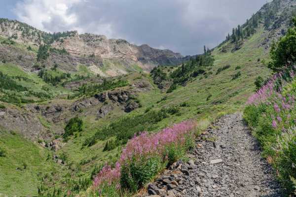
Mineral Fork
Mineral Fork gets the designation as the only off-road route open in the Cottonwoods above Salt Lake County. This trail is popular with dirt bikes, ATVs and hikers. Be sure to respect anyone that is using the trail. Your vehicle has to be under 50" to complete the trail. Please be courteous and obey...
Learn more about Mineral Fork
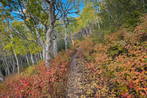
North Park
North Park near Bountiful, Utah, is a great beginner-friendly trail for dirt bikers. Starting from the parking lot, you follow a 4x4 road up to the North Park single-track trailhead. The trail is relatively easy to handle, with gradual climbs and smooth sections, making it perfect for new or experie...
Learn more about North Park
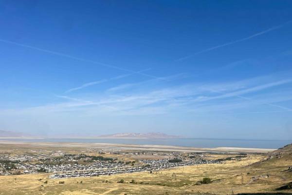
Radio Tower - Tramway Slide Trail
This route starts at the Radio Towers on Droubay Road and rides along the Rail Road tracks heading north, and about 3 miles up, you veer off to the east up the mountain toward the landslide on the hill. Once you are next to the fence line, you will go through a bit of a rock garden and then see a sm...
Learn more about Radio Tower - Tramway Slide Trail
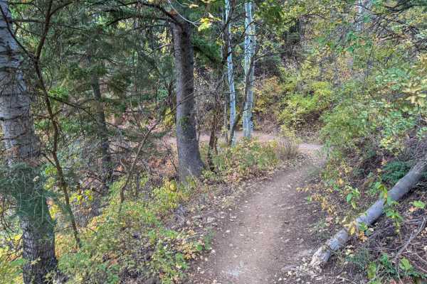
Mueller Park
The Mueller Park Trail in Bountiful, Utah, offers an enjoyable ride for all skill levels. Starting at the trailhead, the path winds through scenic forest areas with moderate climbs and a few technical sections, but nothing too crazy. The trail is well-maintained, and there are occasional spots with ...
Learn more about Mueller Park
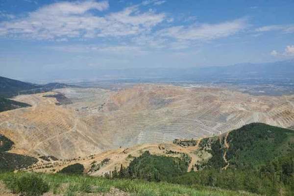
Kennecott Copper Mine Overlook
This trail is a quick 5-mile total out-and-back. It is well-maintained dirt leading to a large parking area that overlooks the main pit of the mine. One can also see the Salt Lake Valley to the east and Tooele Valley to the west and the views of the mountains, valleys, and mine are incredible. The r...
Learn more about Kennecott Copper Mine Overlook
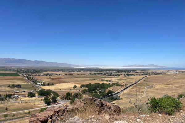
The Bunker Trail
There are a few gates on this trail, make sure you leave the gates the way you found them. This trail rides along the ridgeline and has lots of loose rocks (baby heads mostly with some sharp rocks). This can be challenging on a bigger motorcycle due to the grades and loose material. 4x4s might find ...
Learn more about The Bunker Trail
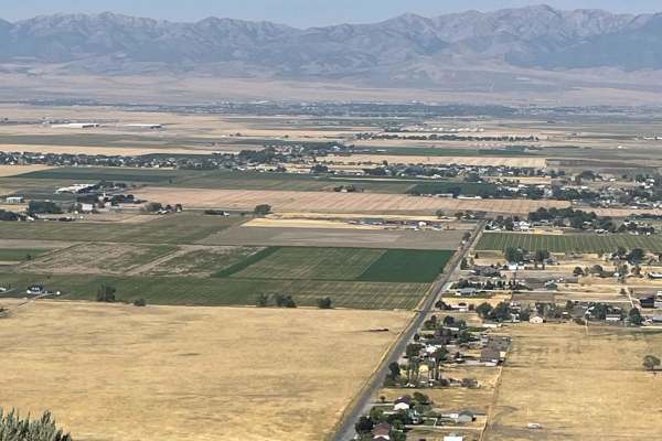
Bates Canyon Trail Access To Erda Lookout
This trail is a short 2-track hill. It starts off with a hardpack OHV trail and about a 1/3 of a mile in, you will get to a steep sand hill. This feature alone makes this a 4 or 5/10. You will need some speed and skill to make it up the deep sand slope. Other than this section, the trail is a 2 or 3...
Learn more about Bates Canyon Trail Access To Erda Lookout
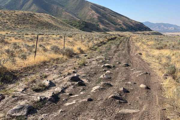
Springs Road Fence Line Trail
This trail starts off the dirt road called Foothill Drive. It starts heading east up the hill on the section line road and then connects to TC03617 back to the southeast all the way to the fence line. There is a gate that has been broken down in the past. There is NO Motorized access past this gate,...
Learn more about Springs Road Fence Line Trail
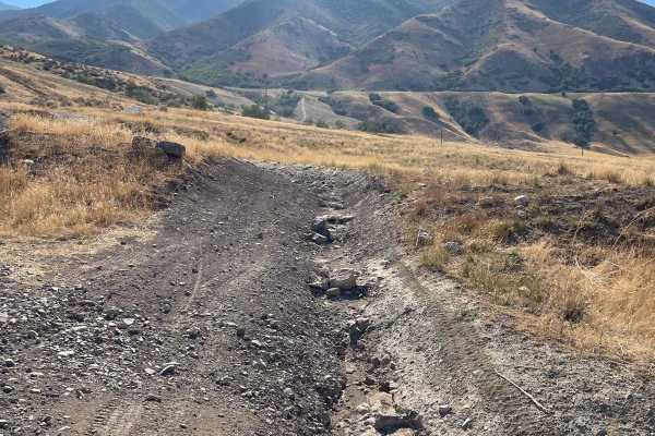
Bates Canyon Trail
This is a well-traveled two-track with all types of 4x4 and off-road machines. This trail is a great way to overlook the Tooele Valley above Stansbury Park and Erda. You will encounter some large rocks and rutted roads along the way to the top. There is a gate at the end where motorized travel is pr...
Learn more about Bates Canyon Trail
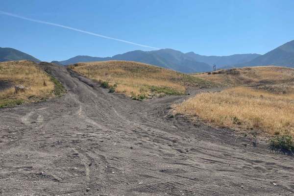
Pole Canyon Trail
This is one of the easiest ways to the top of the plateau. There are some large boulders and sand that could present a challenge depending on your vehicle type. There are mostly rocks on the lower half of the trail and then once climbing on the upper section, you will find a good hard pack and some ...
Learn more about Pole Canyon Trail
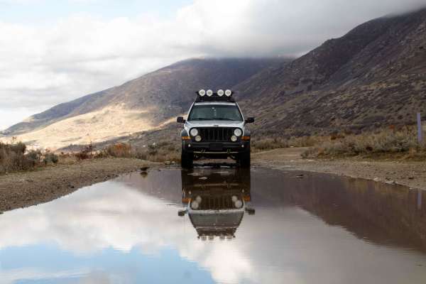
Centerville Firebreak Road
Centerville Firebreak Road runs from Bountiful to Farmington, following the benches above the neighborhoods. It is an easy, scenic drive that makes for a great short trip between Ward and Farmington Canyons. The road runs along the benches, staying high enough to overlook the valley and Antelope Isl...
Learn more about Centerville Firebreak Road
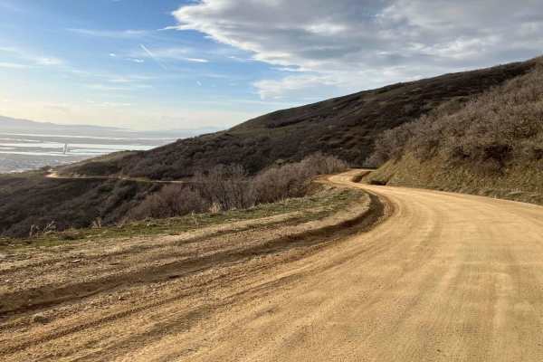
Ward Canyon Road
Ward Canyon Road is an easy, scenic dirt and gravel route ideal for beginners, families, and those seeking quick access to sweeping views of the Great Salt Lake and Antelope Island. Spanning approximately 4.7 miles with a steady climb of about 1,679 feet, the trail begins near the landmark white Bou...
Learn more about Ward Canyon Road
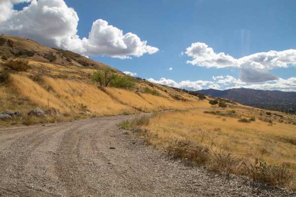
Centerville Offroad Bowl Return
This trail takes you from the South end of the Offroad Bowl and loops around the outside back to South Duel Creek Trail. This trail is relatively tame as it follows the hillside with only a couple of spots that may cause difficulty, those being the exit/entrance from the bowl being tight, and a spot...
Learn more about Centerville Offroad Bowl Return
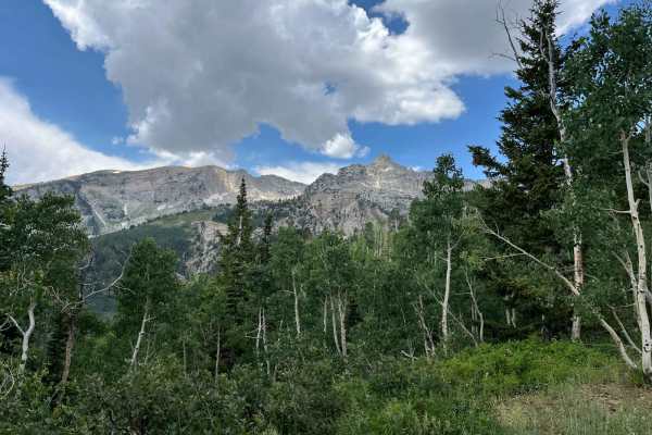
Major Evans
This is a narrow track through pleasant trees. The track switches up the mountainside and provides good views of the surrounding peaks. Since it ends at a locked gate, it needs an hour up, and an hour down. Passing can be difficult due to the track width. There are some pleasant meadows at the turno...
Learn more about Major Evans
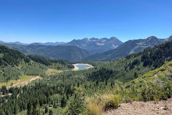
Milk Maid
This trail has larger rocks and ledges at the start. Higher clearance is needed. The rocks give way to seasonal streams and meadows. There are switchbacks and shelf roads that ultimately end at an overlook of Silver Lake Flats. This is a single-width trail with limited turnaround options. The reward...
Learn more about Milk Maid
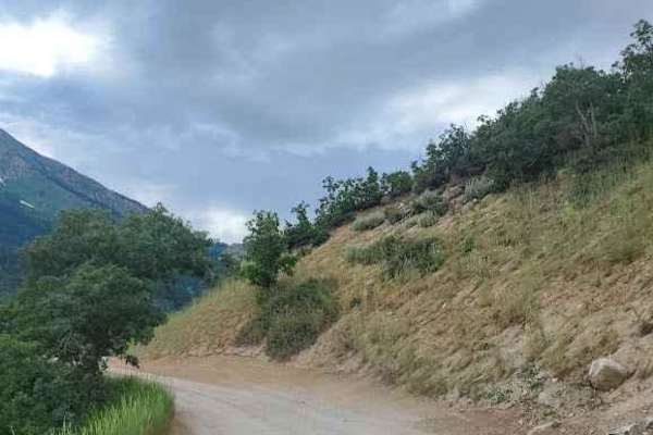
Silver Lake Road
This 9-mile out-and-back dirt road from Tibble Fork Reservoir to Silver Lake is beautiful and boasts mountain views. Make sure to bring your paddleboards and/or kayaks to use at either lake. The road is well maintained and driven by cars and vans but is narrow in a few places-not quite wide enough f...
Learn more about Silver Lake Road
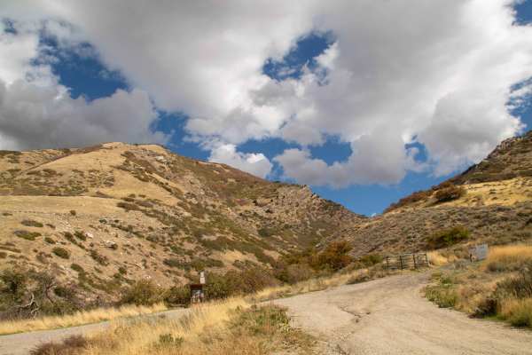
South Duel Creek Trail
This trail is a short spur off of Centerville Firebreak Road that leads you to the Offroad Bowl Trails as well as the trailhead for South Duel Creek hiking trail. This trail is easy with the surface consisting of gravel for the entire length. There is an optional obstacle at the final turn before yo...
Learn more about South Duel Creek Trail
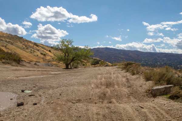
Centerville Offroad Bowl Upper Trail
This trail follows the west rim of the Centerville Offroad Bowl. The upper trail is tight in some spots and has a couple of spots that are off-camber. This upper section is a good bypass for the sections of the lower bowl that are filled with mud too deep to traverse, but the surface is covered in w...
Learn more about Centerville Offroad Bowl Upper Trail
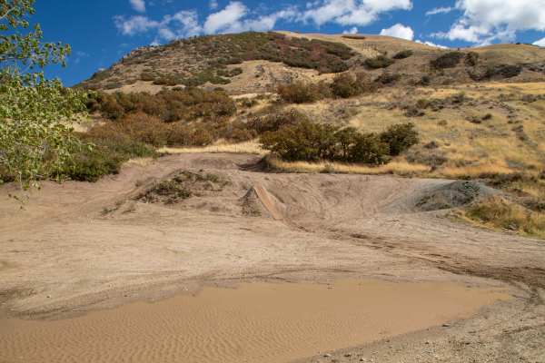
Centerville Offroad Bowl Lower Trail
This trail is a part of the Centerville Offroad system and traverses a bowl area comprised of 2 main routes going through the bowl. This route is the lower route, which, due to this being a bowl, tends to be muddy and wet as water pools in the bottom. The deepest of these mudholes is around 2 Feet d...
Learn more about Centerville Offroad Bowl Lower Trail
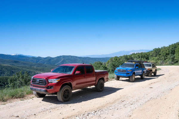
Upper Ward Canyon Road
This is a continuation of the lower Ward Canyon Road. It continues winding up the mountainside with amazing views off of the side of the road. The trail has a few ruts and small rock gardens but there shouldn't be any issues getting any car up here. At the top, you get a view out to the west and the...
Learn more about Upper Ward Canyon Road
ATV trails near Taylorsville, Utah
Explore ATV-friendly trails near you. These trails are accessible for vehicles up to 50 inches wide, perfect for ATVs and smaller off-road machines.
Mineral Fork
Mineral Fork gets the designation as the only off-road route open in the Cottonwoods above Salt Lake County. This trail is popular with dirt bikes, ATVs and hikers. Be sure to respect anyone that is using the trail. Your vehicle has to be under 50" to complete the trail. Please be courteous and obey...
Learn more about Mineral Fork
Radio Tower - Tramway Slide Trail
This route starts at the Radio Towers on Droubay Road and rides along the Rail Road tracks heading north, and about 3 miles up, you veer off to the east up the mountain toward the landslide on the hill. Once you are next to the fence line, you will go through a bit of a rock garden and then see a sm...
Learn more about Radio Tower - Tramway Slide Trail
Kennecott Copper Mine Overlook
This trail is a quick 5-mile total out-and-back. It is well-maintained dirt leading to a large parking area that overlooks the main pit of the mine. One can also see the Salt Lake Valley to the east and Tooele Valley to the west and the views of the mountains, valleys, and mine are incredible. The r...
Learn more about Kennecott Copper Mine Overlook
The Bunker Trail
There are a few gates on this trail, make sure you leave the gates the way you found them. This trail rides along the ridgeline and has lots of loose rocks (baby heads mostly with some sharp rocks). This can be challenging on a bigger motorcycle due to the grades and loose material. 4x4s might find ...
Learn more about The Bunker Trail
UTV/side-by-side trails near Taylorsville, Utah
Find UTV and side-by-side trails near you. These trails accommodate vehicles up to 60 inches wide, ideal for UTVs, side-by-sides, and wider off-road rigs.
Kennecott Copper Mine Overlook
This trail is a quick 5-mile total out-and-back. It is well-maintained dirt leading to a large parking area that overlooks the main pit of the mine. One can also see the Salt Lake Valley to the east and Tooele Valley to the west and the views of the mountains, valleys, and mine are incredible. The r...
Learn more about Kennecott Copper Mine Overlook
The Bunker Trail
There are a few gates on this trail, make sure you leave the gates the way you found them. This trail rides along the ridgeline and has lots of loose rocks (baby heads mostly with some sharp rocks). This can be challenging on a bigger motorcycle due to the grades and loose material. 4x4s might find ...
Learn more about The Bunker Trail
Bates Canyon Trail Access To Erda Lookout
This trail is a short 2-track hill. It starts off with a hardpack OHV trail and about a 1/3 of a mile in, you will get to a steep sand hill. This feature alone makes this a 4 or 5/10. You will need some speed and skill to make it up the deep sand slope. Other than this section, the trail is a 2 or 3...
Learn more about Bates Canyon Trail Access To Erda Lookout
Springs Road Fence Line Trail
This trail starts off the dirt road called Foothill Drive. It starts heading east up the hill on the section line road and then connects to TC03617 back to the southeast all the way to the fence line. There is a gate that has been broken down in the past. There is NO Motorized access past this gate,...
Learn more about Springs Road Fence Line Trail
The onX Offroad Difference
onX Offroad combines trail photos, descriptions, difficulty ratings, width restrictions, seasonality, and more in a user-friendly interface. Available on all devices, with offline access and full compatibility with CarPlay and Android Auto. Discover what you're missing today!
Open Trail Map