
Dirt Bike Trails
Near Summit, Oregon
Explore All Dirt Bike Trails Near Summit, Oregon
Dirt Bike Trails Near Summit, Oregon
Discover the best dirt bike trails near you. Browse trail maps, check difficulty ratings, and find your next adventure — whether you're looking for a quick ride or an all-day expedition.
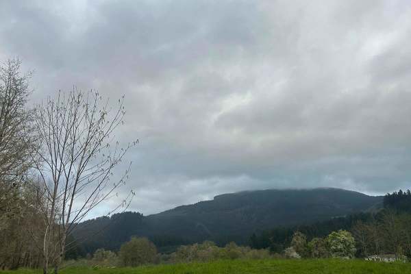
Mary's Peak to Harlan
The first mile to mile and a half is full of potholes, then it smooths out. There are dispersed camping spots along the way along with a couple of streams and views when it opens up. Throughout the trail, there are offshoots for further exploration. Winter travel is not recommended due to high pileu...
Learn more about Mary's Peak to Harlan
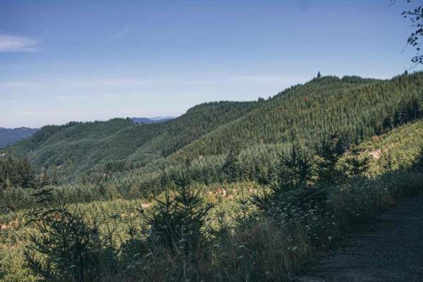
Sugar Loaf
Sugar Loaf is an approachable yet scenic gravel route through the Siuslaw National Forest and private timberlands, making it a perfect drive for beginners, high-clearance four-wheel-drive vehicles, and SxSs seeking sweeping forest views. Spanning approximately 3.7 miles, this easy-rated trail climbs...
Learn more about Sugar Loaf
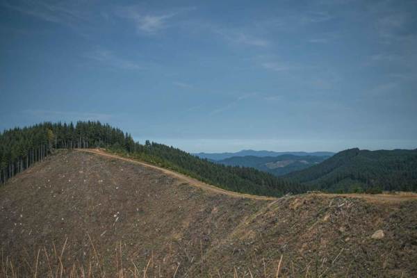
Bull Run
Bull Run is a loose gravel road that runs through the Siuslaw National Forest, most of the road is surrounded by thick trees. At the very top, the road becomes steep where logging is done. The trees have been cleared up there, offering a large open view and on a clear day, there is a beautiful viewi...
Learn more about Bull Run

Gopher Creek
Gopher Creek Road runs through Siuslaw National Forest and is a mix of gravel and natural surface single-lane road, with a small creek access and access to a hiking and biking trail called the C2C aka (The Corvallis to the Sea) Hiking Trail. This 60-mile-long trail connects the Heart of the Willamet...
Learn more about Gopher Creek
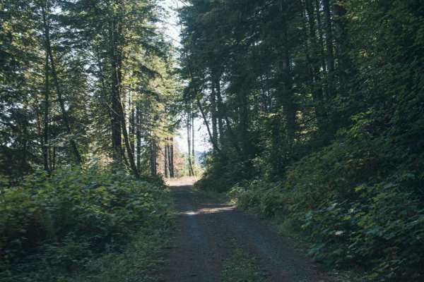
1000 Line
1000 Line Road runs through a mix of Siuslaw National Forst, Weyerhaeuser, and private property and the road does connect with other roads. This is an easy gravel road that is typically unmaintained, it tends to have overgrown vegetation and fallen tree limbs after a big storm or winter. There was o...
Learn more about 1000 Line
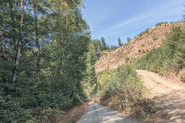
Blind Corners
Blind Corners is a gravel road that is typically unmaintained. There are many blind corners with hard visibility, so taking a slow speed would be recommended, hence the name. A few times on the drive the trees will clear out, or the road will be high enough that the views of the valley and the Yaqui...
Learn more about Blind Corners
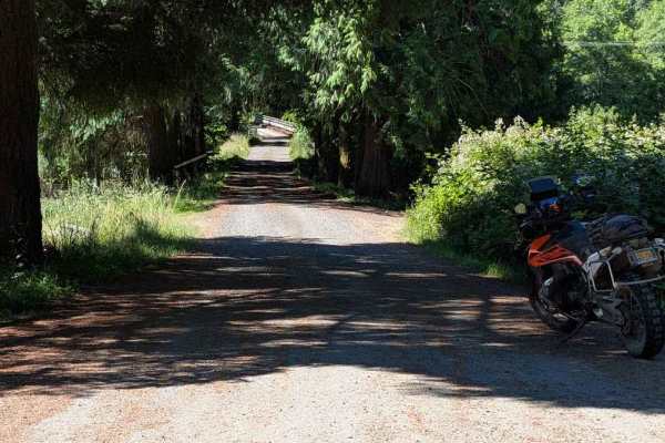
FS 3415
This road is accessed directly from Highway 34, but there are no signs marking its beginning. The road is easy, but it becomes overgrown fairly quickly, with encroaching vegetation and some low-hanging branches. From the Motor Vehicle Use Map, it is open to all classes of vehicles, but paint scratch...
Learn more about FS 3415
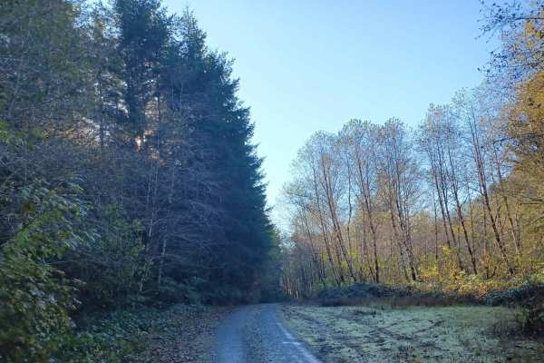
Missouri Tie
Missouri Tie is an easy yet very overgrown tight gravel and natural surface mixed road, if you don't want to get pinstripes I would stay away from this route. There are a couple of small pull-offs where you could camp for the night, but no firepits, and it's right off the side of the road. The road ...
Learn more about Missouri Tie
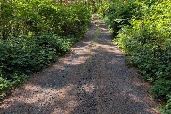
Grass Creek Rd - FS 3430
This is an easy gravel road that is overgrown in places. The track begins where the pavement ends on Grass Creek Road. It is a two-track for much of its length, starting wider and then narrowing and becoming more overgrown. The road is open to all vehicle classes, but even a motorcycle will be pushi...
Learn more about Grass Creek Rd - FS 3430
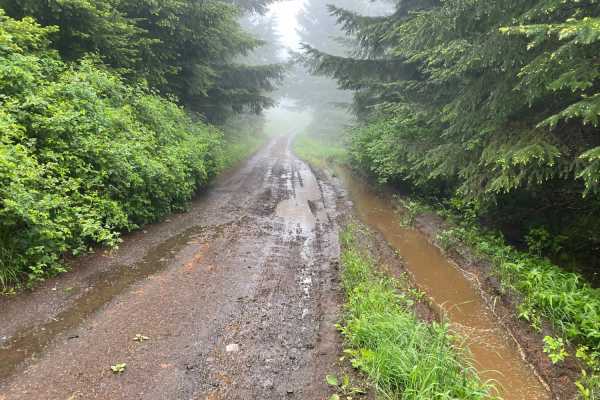
Prairie Peak
Prairie Peak is located on BLM land outside of Triangle Lake, Oregon. The area is a system of trails and dirt roads that wind their way up to a broadcast tower at the peak that can make for some easy riding and great scenic views. The trail leading up to the peak is a somewhat maintained dirt road w...
Learn more about Prairie Peak
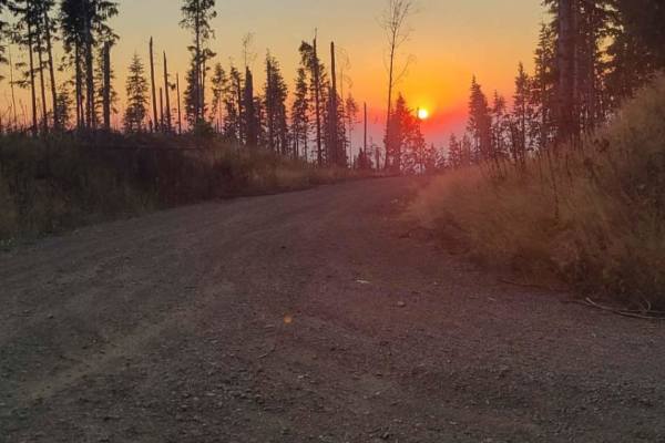
Osterman Cabin Trail
The Osterman Cabin Trail runs East to West through Siuslaw National Forest in Oregon. This trail is very easy besides a few washed-out areas at the top. There are several campsites along the way, while the campsite at the east end of the trail has a nice view of the ocean. Spotty cell service can be...
Learn more about Osterman Cabin Trail
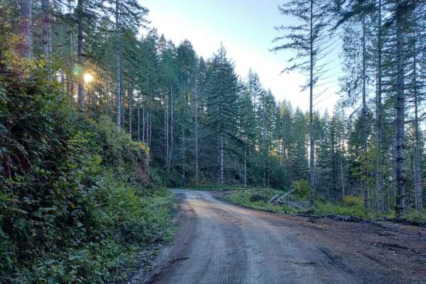
Boundary
Boundary Road is an easy gravel road that runs through the Siuslaw National Forest. It is a busy road for logging, so be careful around corners. You will find a few small spots off the side of the road where you could park and camp, but none that have fire pits, most spots are only big enough for on...
Learn more about Boundary
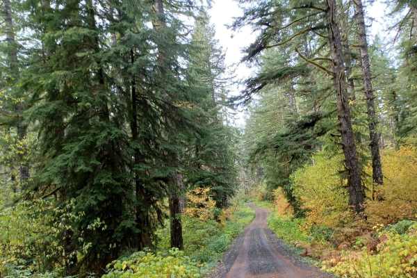
Little Hebo
Little Hebo is an easy gravel road that runs through the Siuslaw National Forest. There are a couple of camp spots on this trail some small ones, and a larger one as well. No cellphone service and the road is not winter-maintained. There are a lot of roads around this area to explore and enjoy.
Learn more about Little Hebo
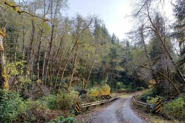
Sourgrass Ridge
Sourgrass Ridge is an easy road that any vehicle could do, but it is not winter-maintained. The road is very busy, so be mindful of that when going around corners. Some cars go very fast on this road because of how smooth the gravel is. There is one spot on this road right off the side that you coul...
Learn more about Sourgrass Ridge
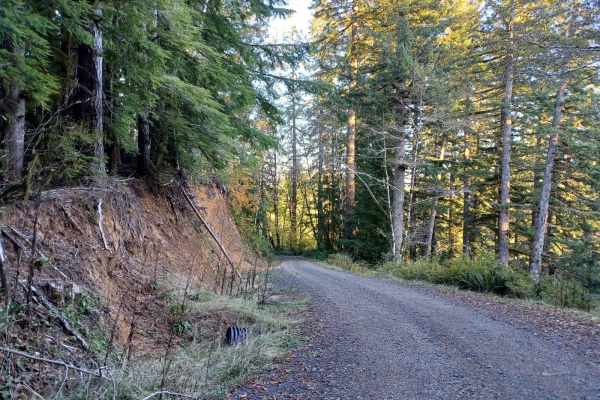
5800
Forest Road 5800 offers an easy, scenic drive through the lush canopy of the Oregon Coast Range in the Siuslaw National Forest, making it perfect for beginners and drivers looking for a relaxing route. Stretching approximately 4.9 miles, this gravel road features gentle elevation changes as it winds...
Learn more about 5800
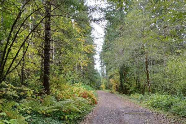
Little Hebo Access
Little Hebo Access road is an easy short gravel, it is a quick road to access a bunch of other roads. This road however is beautiful with thick beautiful trees and vegetation. The road runs through Siuslaw National Forest, and it is easily done by any vehicle, during winter months it is not winter m...
Learn more about Little Hebo Access
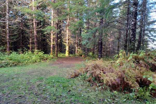
Lewis Creek
Lewis Creek road is an easy gravel road that runs through the Siuslaw National Forest. It is a one-lane road with pullouts, that can get curvy in some spots, a beautiful road filled with thick mossy trees. There is one good camp spot and a couple of other smaller pull-offs that you could camp in.
Learn more about Lewis Creek
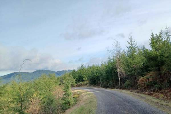
Hiack
Hiack is an easy gravel road that runs through the Siuslaw National Forest. Be mindful this is a very easy road, and some cars go very fast around corners due to the road being very easy, other than a few small potholes. There are some camp spots, one of them is a decent size right off the side of t...
Learn more about Hiack
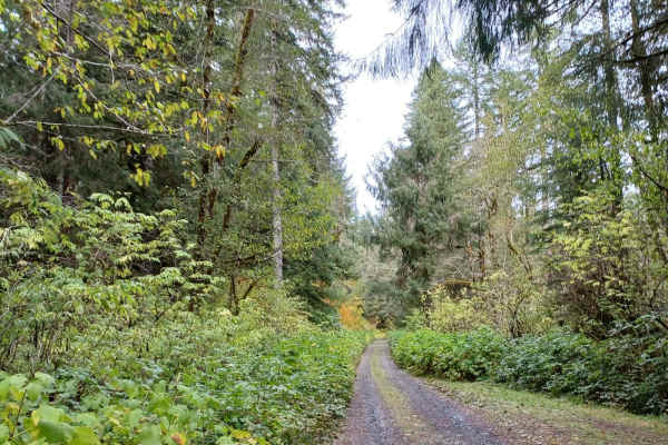
Gauldy
Gauldy is an easy gravel road that runs through the Siuslaw National Forest. There are a couple of large camp spots that could fit at least up to 5 rigs along this route, and a few other small camp spots as well. A section of this road on a clear day you will be able to see the ocean in the distance...
Learn more about Gauldy
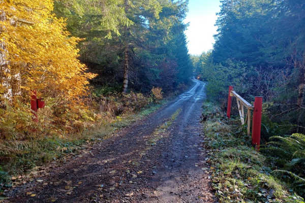
Crazy Lakes
Crazy Lakes is a scenic, point-to-point trail in the Siuslaw National Forest that is perfect for beginners and drivers with high-clearance four-wheel-drive vehicles seeking a peaceful, immersive forest drive. Stretching approximately 5.37 miles, this route climbs from an elevation of about 1,366 fee...
Learn more about Crazy Lakes
ATV trails near Summit, Oregon
Explore ATV-friendly trails near you. These trails are accessible for vehicles up to 50 inches wide, perfect for ATVs and smaller off-road machines.
Mary's Peak to Harlan
The first mile to mile and a half is full of potholes, then it smooths out. There are dispersed camping spots along the way along with a couple of streams and views when it opens up. Throughout the trail, there are offshoots for further exploration. Winter travel is not recommended due to high pileu...
Learn more about Mary's Peak to Harlan
Sugar Loaf
Sugar Loaf is an approachable yet scenic gravel route through the Siuslaw National Forest and private timberlands, making it a perfect drive for beginners, high-clearance four-wheel-drive vehicles, and SxSs seeking sweeping forest views. Spanning approximately 3.7 miles, this easy-rated trail climbs...
Learn more about Sugar Loaf
Bull Run
Bull Run is a loose gravel road that runs through the Siuslaw National Forest, most of the road is surrounded by thick trees. At the very top, the road becomes steep where logging is done. The trees have been cleared up there, offering a large open view and on a clear day, there is a beautiful viewi...
Learn more about Bull Run
Gopher Creek
Gopher Creek Road runs through Siuslaw National Forest and is a mix of gravel and natural surface single-lane road, with a small creek access and access to a hiking and biking trail called the C2C aka (The Corvallis to the Sea) Hiking Trail. This 60-mile-long trail connects the Heart of the Willamet...
Learn more about Gopher Creek
UTV/side-by-side trails near Summit, Oregon
Find UTV and side-by-side trails near you. These trails accommodate vehicles up to 60 inches wide, ideal for UTVs, side-by-sides, and wider off-road rigs.
Mary's Peak to Harlan
The first mile to mile and a half is full of potholes, then it smooths out. There are dispersed camping spots along the way along with a couple of streams and views when it opens up. Throughout the trail, there are offshoots for further exploration. Winter travel is not recommended due to high pileu...
Learn more about Mary's Peak to Harlan
Sugar Loaf
Sugar Loaf is an approachable yet scenic gravel route through the Siuslaw National Forest and private timberlands, making it a perfect drive for beginners, high-clearance four-wheel-drive vehicles, and SxSs seeking sweeping forest views. Spanning approximately 3.7 miles, this easy-rated trail climbs...
Learn more about Sugar Loaf
Bull Run
Bull Run is a loose gravel road that runs through the Siuslaw National Forest, most of the road is surrounded by thick trees. At the very top, the road becomes steep where logging is done. The trees have been cleared up there, offering a large open view and on a clear day, there is a beautiful viewi...
Learn more about Bull Run
Gopher Creek
Gopher Creek Road runs through Siuslaw National Forest and is a mix of gravel and natural surface single-lane road, with a small creek access and access to a hiking and biking trail called the C2C aka (The Corvallis to the Sea) Hiking Trail. This 60-mile-long trail connects the Heart of the Willamet...
Learn more about Gopher Creek
The onX Offroad Difference
onX Offroad combines trail photos, descriptions, difficulty ratings, width restrictions, seasonality, and more in a user-friendly interface. Available on all devices, with offline access and full compatibility with CarPlay and Android Auto. Discover what you're missing today!
Open Trail Map