
Dirt Bike Trails
Near Ronald, Washington
Explore All Dirt Bike Trails Near Ronald, Washington
Dirt Bike Trails Near Ronald, Washington
Discover the best dirt bike trails near you. Browse trail maps, check difficulty ratings, and find your next adventure — whether you're looking for a quick ride or an all-day expedition.
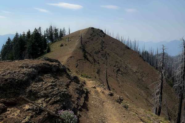
Sasse Mountain (Lower) 1340
The Lower Sasse Mountain Trail is an intermediate route with a fun mix of tech and flowy that is not overly difficult. The trail starts from the Sasse Mountain Trailhead, a small parking area at the end of FS Road 1340. It climbs for the 2.2 mile route from south to north, gaining about 1,400 feet e...
Learn more about Sasse Mountain (Lower) 1340
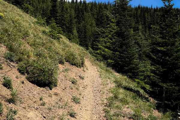
North Ridge 1321
North Ridge is a long route, spanning 8.1 miles, through the Wenatchee National Forest. It has constant intermediate obstacles, steep, exposed terrain, and fantastic views. Throughout the route, you’ll experience narrow, exposed side-hilling sections, especially in the first few miles on the norther...
Learn more about North Ridge 1321
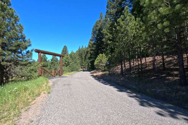
Middle Fork Teanaway - FS 4305113
Middle Fork Teanaway is a 1.5-mile out-and-back route that follows a single-lane gravel road into the Teanaway Community Forest. A Discover Pass is required for access. The route provides access to Indian Camp Campground and follows the Middle Fork Teanaway River through a scenic forested corridor. ...
Learn more about Middle Fork Teanaway - FS 4305113
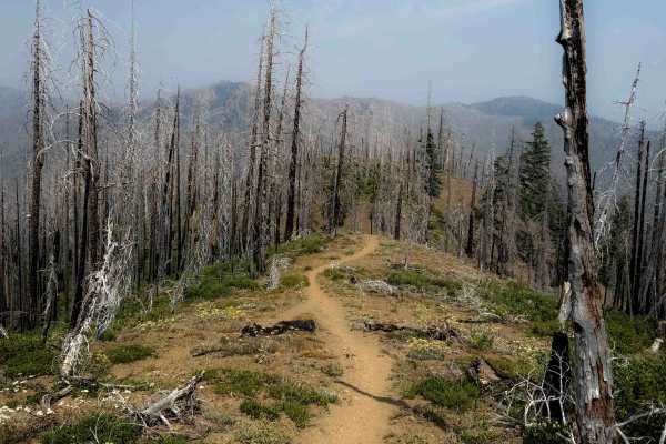
Corral Creek Trail 1340.1
Corral Creek Trail descends from north to south through a burn area, making a loop with the Sasse Mountain Trail. The north end of the trail is narrow, weaving through burned trees and overgrown bushes on a wide open hilltop, and it starts descending down through the hillsides with lots of small loo...
Learn more about Corral Creek Trail 1340.1
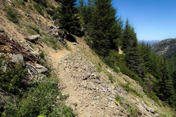
Little Creek Basin Trail 1334
Little Creek Basin is a 4.6 mile long intermediate route through the Wenatchee National Forest that connects Cle Elum Ridge Trail to North Ridge Trail. The east half of the trail is mostly narrow side-hilling through a tight tree corridor, following the curvature of the mountain. It crosses several ...
Learn more about Little Creek Basin Trail 1334
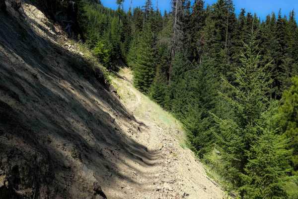
Lightning Point Trail 1377.1
This trail is 2.7 miles long, and it connects North Fork Taneum Trail to the Cle Elum Ridge Trail. The east entrance starts off with a very steep and long climb up a silty troughed out hill, going straight up a loose hillside in a burn area. It crosses a couple logging roads, and then after 1.2 mile...
Learn more about Lightning Point Trail 1377.1
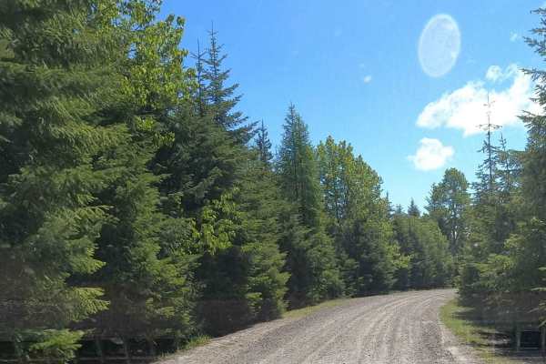
Lankin Loop - NF3350-119
Lankin Loop - NF3350-119 is an easy, scenic 2-mile gravel connector ideal for beginner overlanders and families looking to explore the scenic ridges of the Wenatchee National Forest. This maintained Forest Service road links the high elevations of South Cle Elum Ridge down to Miners Point Road and t...
Learn more about Lankin Loop - NF3350-119
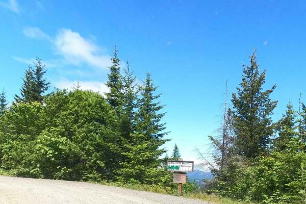
South Cle Elum Ridge - NF3350
South Cle Elum Ridge - NF3350 offers scenic and accessible driving for overlanders, beginners, and families seeking a scenic gateway into the Okanogan-Wenatchee National Forest. This 6.5-mile maintained gravel route serves as a crucial segment of a massive 60-mile north-south overland passage connec...
Learn more about South Cle Elum Ridge - NF3350
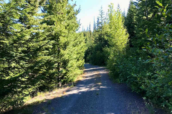
Taneum - NF 3300
The trail consists of hard-packed dirt and gravel, and you'll find it mostly clear of obstacles. You might come across a tree that's fallen onto the trail, so having a handsaw or chainsaw handy can be really helpful for clearing any deadfall. The trail winds around a beautiful ridge, surrounded by a...
Learn more about Taneum - NF 3300
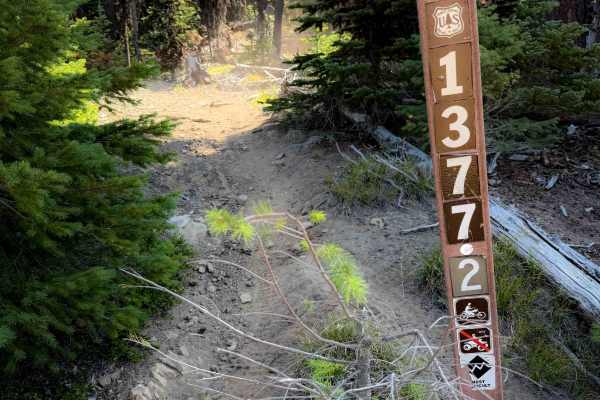
Lightening Point Trail 1377.2
This is a short segment of intermediate single track that connects a logging road with the Cle Elum Ridge Trail. It is a narrow single track through lodgepole pines, riding on a hilltop. The trail is a steep climb from east to west for the first .6 miles, gaining about 350 feet in elevation with sev...
Learn more about Lightening Point Trail 1377.2
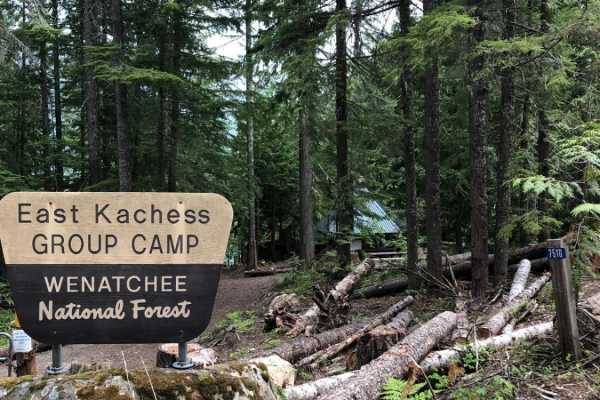
East Kachess Road 4818
This is a beautiful trail around the east side of Lake Kachess. Wrapped in tree cover, this road provides access to a number of additional trails and campsites, as well as views of the lake. The road is usually in good condition but sometimes has deep potholes. The East Kachess Group Campsite is ava...
Learn more about East Kachess Road 4818
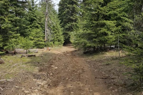
3350-114
The trail leads you into high alpine terrain, offering stunning views of the valleys and meadows of the Wenatchee National Forest. Wildlife is abundant along the route, and you may have a good chance of spotting deer or elk while traversing the trail. In early summer, wildflowers bloom beautifully. ...
Learn more about 3350-114
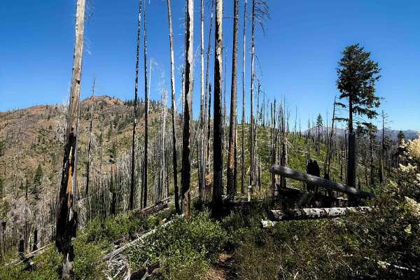
Way Creek Trail - FS 1235
Way Creek is a rugged and difficult single-track through the Wenatchee National Forest north of Cle Elum, Washington. The west end starts at an intersection with the Middle Fork Teanaway Trail, and it ascends steeply for 2 miles to the Way Creek Trailhead, which is a small parking area at the end of...
Learn more about Way Creek Trail - FS 1235
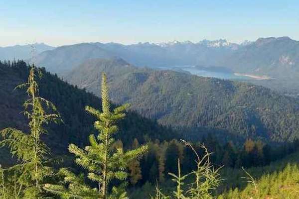
Tucker Creek Road
Tucker Creek Road offers a classic Pacific Northwest off-road experience with a mix of gravel, dirt, and rocky stretches that keep things interesting. The road is generally passable for high-clearance vehicles, but expect rough sections with ruts and deep puddles during the wet season. As you climb,...
Learn more about Tucker Creek Road
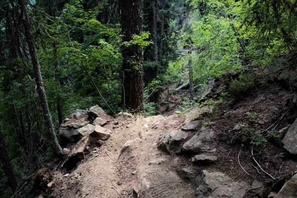
South Fork Taneum 1367
South Fork Taneum is a narrow and shelfy trail for the majority of the 8 mile route, with significant exposure as the trail side-hills along the mountains above the South Fork Taneum Creek. Riders should use caution in the many exposed spots of the trail, and keep their eyes up for oncoming traffic,...
Learn more about South Fork Taneum 1367
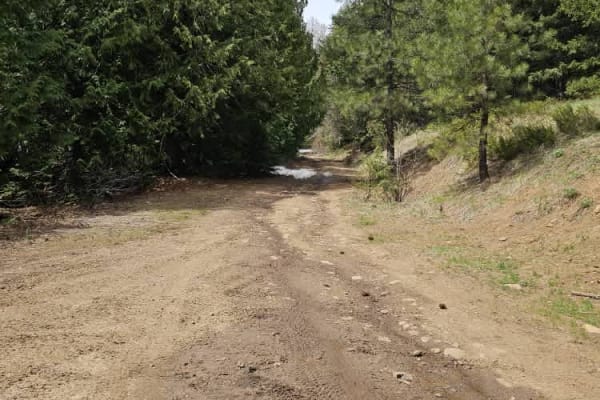
Lower South Cle Elum Ridge
The trail is rated as level 1 and winds through a thick forest with no major obstacles, aside from occasional squirrels. The view at Taneum Point is breathtaking on a clear day. Be sure to check out the US Geological Survey marker for Taneum Point. The trail can be dusty, so wearing a bandana is rec...
Learn more about Lower South Cle Elum Ridge
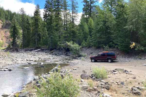
Cabin Creek Trail
Following Cabin Creek Road, this trail is mostly easy and one of the ways to get across Stampede Pass. At about 2 miles in, the road and bridge that crossed Cabin Creek are washed out, and there is a detour that brings you to a shallow (in the fall) water crossing at Cabin Creek. From there, the tra...
Learn more about Cabin Creek Trail
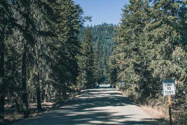
French Cabin Creek
French Cabin Creek runs through the Wenatchee National Forest. It is a gravel road with washboard sections and steep gradual inclines. There is an abundant amount of camping. Right after the bridge, you will find a large dispersed campground in French Cabin Creek Recreation Area. It is on either sid...
Learn more about French Cabin Creek
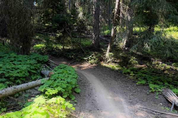
Fishhook Flat - FS 1378
Fishhook Flat is an easy connector trail between the North Fork Taneum and South Fork Taneum trails in the Wenatchee National Forest. The trail is 4.3 miles long and is full of easy technical features such as short but steep climbs and descents, easy switchbacks, loose rocks, mild exposure, and smal...
Learn more about Fishhook Flat - FS 1378
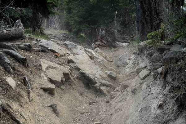
Frost Mountain - FS 1366
The Frost Mountain Trail is a fun and scenic 5.2-mile-long section of single-track through the Wenatchee National Forest that connects the Shoestring Trail to the South Fork Taneum Trail. The southern half of the trail is easier and more gradual, while the northern half gets a bit more technical and...
Learn more about Frost Mountain - FS 1366
ATV trails near Ronald, Washington
Explore ATV-friendly trails near you. These trails are accessible for vehicles up to 50 inches wide, perfect for ATVs and smaller off-road machines.
Middle Fork Teanaway - FS 4305113
Middle Fork Teanaway is a 1.5-mile out-and-back route that follows a single-lane gravel road into the Teanaway Community Forest. A Discover Pass is required for access. The route provides access to Indian Camp Campground and follows the Middle Fork Teanaway River through a scenic forested corridor. ...
Learn more about Middle Fork Teanaway - FS 4305113
Lankin Loop - NF3350-119
Lankin Loop - NF3350-119 is an easy, scenic 2-mile gravel connector ideal for beginner overlanders and families looking to explore the scenic ridges of the Wenatchee National Forest. This maintained Forest Service road links the high elevations of South Cle Elum Ridge down to Miners Point Road and t...
Learn more about Lankin Loop - NF3350-119
South Cle Elum Ridge - NF3350
South Cle Elum Ridge - NF3350 offers scenic and accessible driving for overlanders, beginners, and families seeking a scenic gateway into the Okanogan-Wenatchee National Forest. This 6.5-mile maintained gravel route serves as a crucial segment of a massive 60-mile north-south overland passage connec...
Learn more about South Cle Elum Ridge - NF3350
Taneum - NF 3300
The trail consists of hard-packed dirt and gravel, and you'll find it mostly clear of obstacles. You might come across a tree that's fallen onto the trail, so having a handsaw or chainsaw handy can be really helpful for clearing any deadfall. The trail winds around a beautiful ridge, surrounded by a...
Learn more about Taneum - NF 3300
UTV/side-by-side trails near Ronald, Washington
Find UTV and side-by-side trails near you. These trails accommodate vehicles up to 60 inches wide, ideal for UTVs, side-by-sides, and wider off-road rigs.
Middle Fork Teanaway - FS 4305113
Middle Fork Teanaway is a 1.5-mile out-and-back route that follows a single-lane gravel road into the Teanaway Community Forest. A Discover Pass is required for access. The route provides access to Indian Camp Campground and follows the Middle Fork Teanaway River through a scenic forested corridor. ...
Learn more about Middle Fork Teanaway - FS 4305113
Lankin Loop - NF3350-119
Lankin Loop - NF3350-119 is an easy, scenic 2-mile gravel connector ideal for beginner overlanders and families looking to explore the scenic ridges of the Wenatchee National Forest. This maintained Forest Service road links the high elevations of South Cle Elum Ridge down to Miners Point Road and t...
Learn more about Lankin Loop - NF3350-119
South Cle Elum Ridge - NF3350
South Cle Elum Ridge - NF3350 offers scenic and accessible driving for overlanders, beginners, and families seeking a scenic gateway into the Okanogan-Wenatchee National Forest. This 6.5-mile maintained gravel route serves as a crucial segment of a massive 60-mile north-south overland passage connec...
Learn more about South Cle Elum Ridge - NF3350
Taneum - NF 3300
The trail consists of hard-packed dirt and gravel, and you'll find it mostly clear of obstacles. You might come across a tree that's fallen onto the trail, so having a handsaw or chainsaw handy can be really helpful for clearing any deadfall. The trail winds around a beautiful ridge, surrounded by a...
Learn more about Taneum - NF 3300
The onX Offroad Difference
onX Offroad combines trail photos, descriptions, difficulty ratings, width restrictions, seasonality, and more in a user-friendly interface. Available on all devices, with offline access and full compatibility with CarPlay and Android Auto. Discover what you're missing today!
Open Trail Map