
Dirt Bike Trails
Near Gardiner, Oregon
Explore All Dirt Bike Trails Near Gardiner, Oregon
Dirt Bike Trails Near Gardiner, Oregon
Discover the best dirt bike trails near you. Browse trail maps, check difficulty ratings, and find your next adventure — whether you're looking for a quick ride or an all-day expedition.
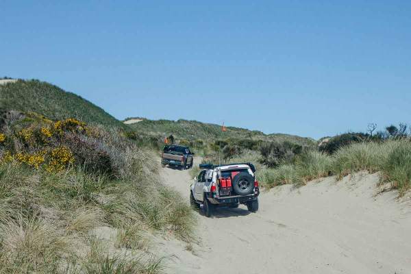
Coast Guard OHV Trail
This trail parallels the coastline, connecting Siltcoos Day Use to South Jetty Access, with multiple links to the open-ride beach. It winds through coastal grasses and shrubs, with frequent bald eagle and wildflower sightings. The trail is narrow, though passable for oncoming traffic. Expect continu...
Learn more about Coast Guard OHV Trail
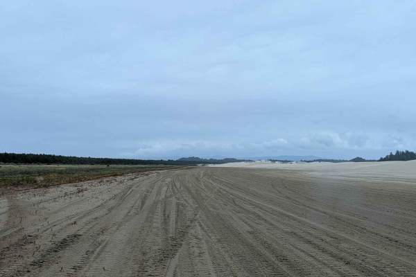
Open West
This track is along the west side of the open riding area. It is commonly used to travel from one part of the area to another, and is generally the easiest way to do so. Along the way, there are several side trails to the west leading to the beach. The entire track is on sand, with some of it being ...
Learn more about Open West
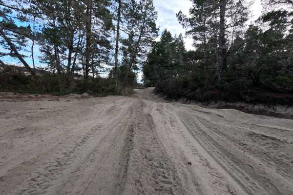
10 Mile OHV Trail
Despite its numeric moniker, which refers to the adjacent Tenmile Creek rather than its distance, this 1.6-mile sandy corridor acts as a vital gateway into the vast Oregon Dunes National Recreation Area. Launching from the popular Spinreel Staging Area and Campground, the route plunges travelers imm...
Learn more about 10 Mile OHV Trail
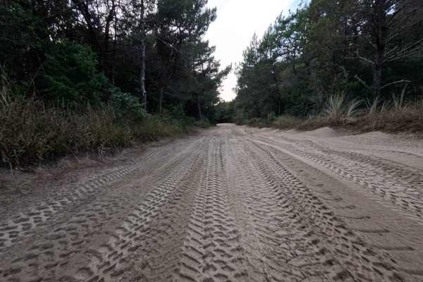
Coast Guard OHV South Trail - 1343
This 8.8-mile sandy corridor is a quintessential dune experience, serving as a primary North-South artery running parallel to the crashing Pacific Ocean. The route connects the northern 10 Mile OHV Trail to the southern hub of Horsefall Beach Campground, offering a continuous flow through the shifti...
Learn more about Coast Guard OHV South Trail - 1343
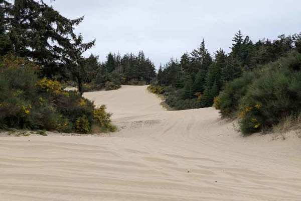
South Jetty Trail A - FS 1344A
This sandy route connects the South Jetty Sand Road to open dunes further south, and also to the South Jetty Trail B that continues further south. This trail runs along the eastern boundary of the area open to motorized vehicles in places, and the boundary is marked in several places. There are some...
Learn more about South Jetty Trail A - FS 1344A
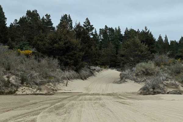
Upper Clearwox Trail - FS 344B
This sandy track runs along the east side of the open riding area, starting near the southern end of the FS 1344A track. This one gets a bit more challenging in places and will change as the wind moves the dunes. The southern end of the track was in a dune bowl when mapped. This track gets softer th...
Learn more about Upper Clearwox Trail - FS 344B
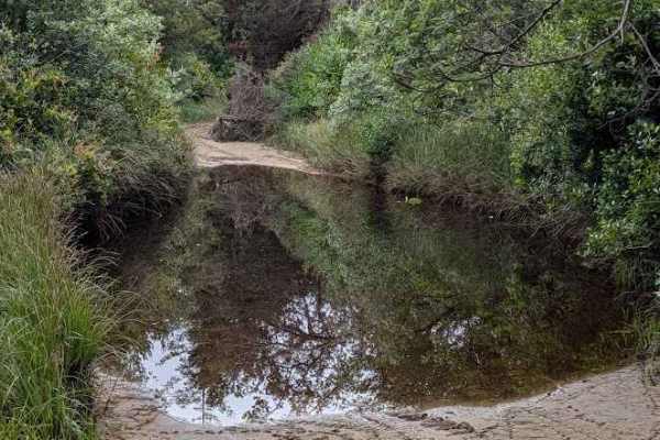
Hunters Trail - 1349
Hunters Trail #1349 is an intermediate dune route for riders and drivers comfortable with open sand navigation, linking South Jetty OHV Trail #1344 to Driftwood II OHV Trail #1380 over roughly 5.3 miles. The trail runs inland across open dunes, wind-shaped ridges, and scattered vegetated corridors w...
Learn more about Hunters Trail - 1349
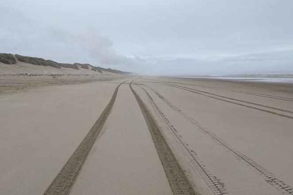
South Jetty Open Beach
This track marks the area of the beach open to driving and riding. Signs posted at the north and south ends mark areas that are closed to motor vehicles. This track is mostly packed sand, but access to it will be over a loose sandy dune. There are multiple access paths, marked with numbered signs vi...
Learn more about South Jetty Open Beach
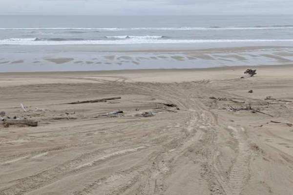
South Jetty Sand Road
This sand track starts at the South Jetty Staging Area and ends at the beach. It often has some whoops, but is usually not terribly soft. The track also passes through (or around with a detour) the Goose Pasture Staging Area. Both of these staging areas have bathrooms. Most of it is easy, with the e...
Learn more about South Jetty Sand Road
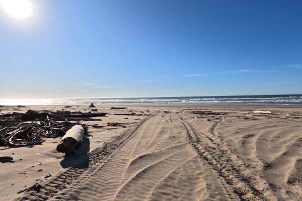
Hauser OHV Trail - 1341
The Hauser OHV Trail is a 2.4-mile sandy corridor that acts as a premier gateway from the sheltered coastal forest directly to the crashing surf of the Pacific Ocean. Beginning near the staging area kiosks, this wide, deeply rutted sand route winds westward from the Hauser Hill Campground through th...
Learn more about Hauser OHV Trail - 1341
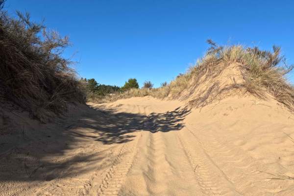
Bark OHV Trail - 1342
This 4-mile undulating sand track offers a dynamic North-South traverse through the inland section of the Oregon Dunes National Recreation Area. Running parallel to the coast but sheltered by the foredunes, the route connects the Horsefall and Old Bark OHV Staging Areas in the south to the Hauser Sa...
Learn more about Bark OHV Trail - 1342
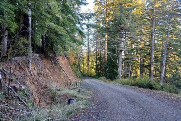
5800
Forest Road 5800 offers an easy, scenic drive through the lush canopy of the Oregon Coast Range in the Siuslaw National Forest, making it perfect for beginners and drivers looking for a relaxing route. Stretching approximately 4.9 miles, this gravel road features gentle elevation changes as it winds...
Learn more about 5800
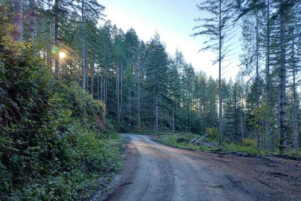
Boundary
Boundary Road is an easy gravel road that runs through the Siuslaw National Forest. It is a busy road for logging, so be careful around corners. You will find a few small spots off the side of the road where you could park and camp, but none that have fire pits, most spots are only big enough for on...
Learn more about Boundary
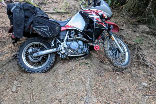
Dead Horse Revenge
This trail is a fun out-and-back route that offers great views and some fun terrain. Originally the trail connects back to Coos Bay Wagon road, however, aside from the trail becoming very difficult at the end of this route, it appears that RFP posted signs closing the trail to motor vehicles. Althou...
Learn more about Dead Horse Revenge
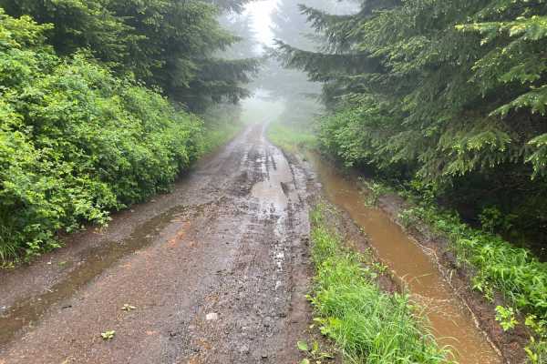
Prairie Peak
Prairie Peak is located on BLM land outside of Triangle Lake, Oregon. The area is a system of trails and dirt roads that wind their way up to a broadcast tower at the peak that can make for some easy riding and great scenic views. The trail leading up to the peak is a somewhat maintained dirt road w...
Learn more about Prairie Peak
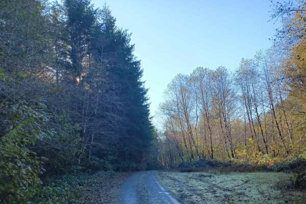
Missouri Tie
Missouri Tie is a 5-mile unpaved route winding through the Siuslaw National Forest along the Lincoln and Benton County border. The narrow corridor is heavily overgrown with dense coastal foliage, making vehicle pinstriping highly likely.
The trail has a low technical difficulty rating of 2, requiri...
Learn more about Missouri Tie
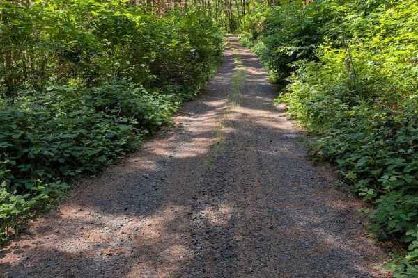
Grass Creek Rd - FS 3430
This is an easy gravel road that is overgrown in places. The track begins where the pavement ends on Grass Creek Road. It is a two-track for much of its length, starting wider and then narrowing and becoming more overgrown. The road is open to all vehicle classes, but even a motorcycle will be pushi...
Learn more about Grass Creek Rd - FS 3430
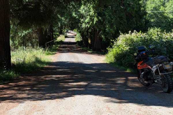
FS 3415
This road is accessed directly from Highway 34, but there are no signs marking its beginning. The road is easy, but it becomes overgrown fairly quickly, with encroaching vegetation and some low-hanging branches. From the Motor Vehicle Use Map, it is open to all classes of vehicles, but paint scratch...
Learn more about FS 3415
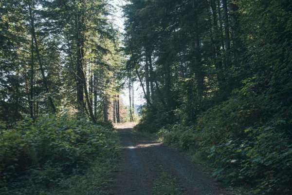
1000 Line
1000 Line Road runs through a mix of Siuslaw National Forst, Weyerhaeuser, and private property and the road does connect with other roads. This is an easy gravel road that is typically unmaintained, it tends to have overgrown vegetation and fallen tree limbs after a big storm or winter. There was o...
Learn more about 1000 Line
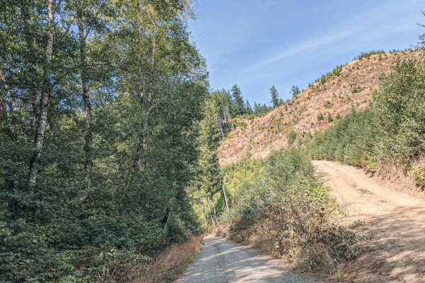
Blind Corners
Blind Corners is a gravel road that is typically unmaintained. There are many blind corners with hard visibility, so taking a slow speed would be recommended, hence the name. A few times on the drive the trees will clear out, or the road will be high enough that the views of the valley and the Yaqui...
Learn more about Blind Corners
ATV trails near Gardiner, Oregon
Explore ATV-friendly trails near you. These trails are accessible for vehicles up to 50 inches wide, perfect for ATVs and smaller off-road machines.
Coast Guard OHV Trail
This trail parallels the coastline, connecting Siltcoos Day Use to South Jetty Access, with multiple links to the open-ride beach. It winds through coastal grasses and shrubs, with frequent bald eagle and wildflower sightings. The trail is narrow, though passable for oncoming traffic. Expect continu...
Learn more about Coast Guard OHV Trail
Open West
This track is along the west side of the open riding area. It is commonly used to travel from one part of the area to another, and is generally the easiest way to do so. Along the way, there are several side trails to the west leading to the beach. The entire track is on sand, with some of it being ...
Learn more about Open West
10 Mile OHV Trail
Despite its numeric moniker, which refers to the adjacent Tenmile Creek rather than its distance, this 1.6-mile sandy corridor acts as a vital gateway into the vast Oregon Dunes National Recreation Area. Launching from the popular Spinreel Staging Area and Campground, the route plunges travelers imm...
Learn more about 10 Mile OHV Trail
Coast Guard OHV South Trail - 1343
This 8.8-mile sandy corridor is a quintessential dune experience, serving as a primary North-South artery running parallel to the crashing Pacific Ocean. The route connects the northern 10 Mile OHV Trail to the southern hub of Horsefall Beach Campground, offering a continuous flow through the shifti...
Learn more about Coast Guard OHV South Trail - 1343
UTV/side-by-side trails near Gardiner, Oregon
Find UTV and side-by-side trails near you. These trails accommodate vehicles up to 60 inches wide, ideal for UTVs, side-by-sides, and wider off-road rigs.
Coast Guard OHV Trail
This trail parallels the coastline, connecting Siltcoos Day Use to South Jetty Access, with multiple links to the open-ride beach. It winds through coastal grasses and shrubs, with frequent bald eagle and wildflower sightings. The trail is narrow, though passable for oncoming traffic. Expect continu...
Learn more about Coast Guard OHV Trail
Open West
This track is along the west side of the open riding area. It is commonly used to travel from one part of the area to another, and is generally the easiest way to do so. Along the way, there are several side trails to the west leading to the beach. The entire track is on sand, with some of it being ...
Learn more about Open West
10 Mile OHV Trail
Despite its numeric moniker, which refers to the adjacent Tenmile Creek rather than its distance, this 1.6-mile sandy corridor acts as a vital gateway into the vast Oregon Dunes National Recreation Area. Launching from the popular Spinreel Staging Area and Campground, the route plunges travelers imm...
Learn more about 10 Mile OHV Trail
Coast Guard OHV South Trail - 1343
This 8.8-mile sandy corridor is a quintessential dune experience, serving as a primary North-South artery running parallel to the crashing Pacific Ocean. The route connects the northern 10 Mile OHV Trail to the southern hub of Horsefall Beach Campground, offering a continuous flow through the shifti...
Learn more about Coast Guard OHV South Trail - 1343
The onX Offroad Difference
onX Offroad combines trail photos, descriptions, difficulty ratings, width restrictions, seasonality, and more in a user-friendly interface. Available on all devices, with offline access and full compatibility with CarPlay and Android Auto. Discover what you're missing today!
Open Trail Map