
Dirt Bike Trails
Near Cobleskill, New York
Explore All Dirt Bike Trails Near Cobleskill, New York
Dirt Bike Trails Near Cobleskill, New York
Discover the best dirt bike trails near you. Browse trail maps, check difficulty ratings, and find your next adventure — whether you're looking for a quick ride or an all-day expedition.
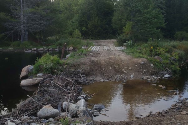
Tannery Rd
Tannery road is a nice connecting off-road trail between Rt 125 and Rt 30. From north to south it starts off with a rocky uphill that transitions to some nice wooded trail. There is a beaver dam/ stream crossing with a small bridge in one spot and water crossing in another. The trail is mostly d...
Learn more about Tannery Rd
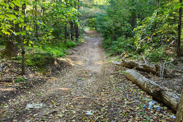
Military Road
Sandy dirt road connecting from Cold Brook to Norway. It is a seasonal road only open during the summer months. They have recently resurfaced part of the road, making it easier for non-lifted vehicles. The sand can make it slow going epically for motorcycles. There are a few side trails with sand pi...
Learn more about Military Road
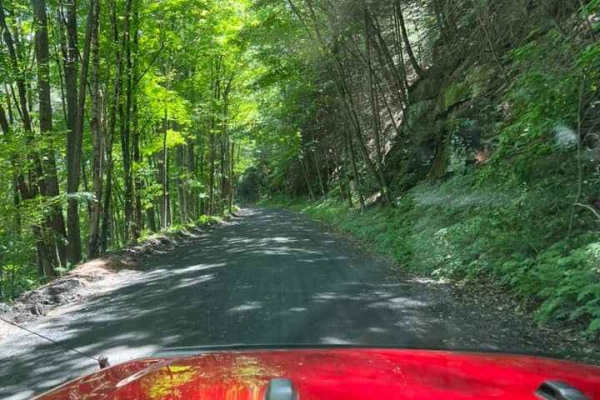
T-743/T-727
The trail starts off in Poyntelle as Township-727 and in Winterdale as T-743. This section of the O and W Trail is a recognized Township route open to street-licensed 4x4s. The trail follows the former route of the Ohio and Western Railroad. Multiple former stations can be observed along the route. ...
Learn more about T-743/T-727
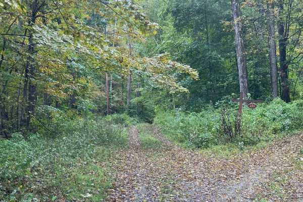
Benedict Trail
This trail starts as a regular dirt road, transforming into a narrow two-track with large ruts and holes. The surface of the trail breaks up on the steeper grades, and there is a potential for deep water crossings. In the image, the water is just over a foot deep. Most high-clearance 4x4 vehicles wi...
Learn more about Benedict Trail
Old Military Road/TH-35
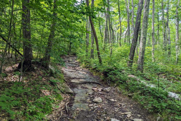
If entering from the south, the hard part is first. The northern end of the trail is an easy dirt track. Coming up the hill from the south are many differential dingers and under carriage crunchers. The trail gets a bit narrow at times but is easily passed with a good spotter. The rougher parts skir...
Learn more about Old Military Road/TH-35
Mount Wilcox Road
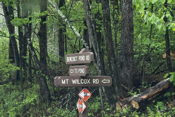
Mount Wilcox Road is the main loop that meanders through Beartown State Forest. The loop is 4.3 miles and climbs from 1,600 feet to 2,100 feet. The trail begins and ends off Benedict Pond Road. Halfway through the route from either direction is a short spur that breaks off and provides access to the...
Learn more about Mount Wilcox Road
Linklaen State Forest
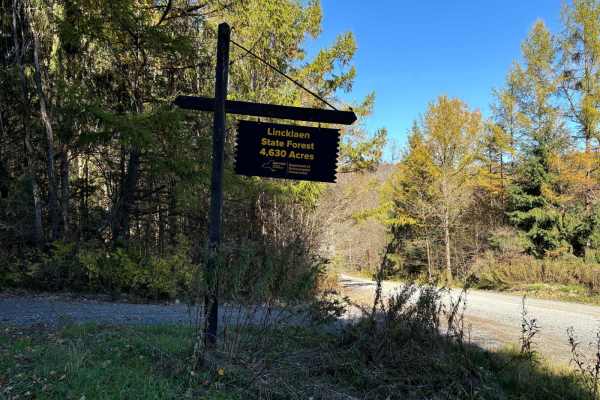
This route consists of seasonal gravel roads that are generally well-maintained in the summer. During the winter the roads are used for snowmobile trails. The roads lead to several side routes that are two-tracks, most are out-and-back routes and will add adventure to the ride. The main road is easi...
Learn more about Linklaen State Forest
Big Valley Road
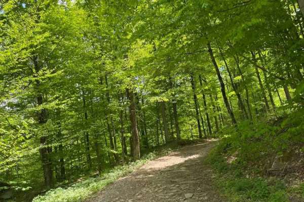
Big Valley Road offers a scenic and highly accessible offroad driving experience for novice drivers and seasoned explorers alike, serving as a tranquil passage through Pennsylvania's dense State Game Lands. Stretching approximately 2.2 miles, this winding forest road climbs from an elevation of 1,29...
Learn more about Big Valley Road
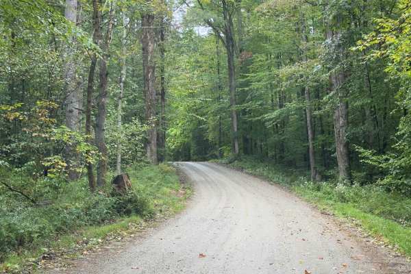
Klondike Road
Serving as a perfect connection point to other trails, this trail is an easy dirt road with limited obstacles. Overall, it's a well-graded forest road winding through mixed hardwoods. The trail is wide enough for comfortable passing, and grades are mild. There's potential for shallow standing water ...
Learn more about Klondike Road
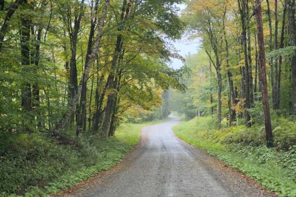
County Road Connection
Serving as a connection trail to County Road or the Klondike Trail, this trail is a simple, wide dirt road. Winding through the Vermont forest, you will be surrounded by a mix of hardwoods. It's a comfortable trail, with room to pass. If there's rain or wet ground, prepare to be muddy.
Learn more about County Road Connection
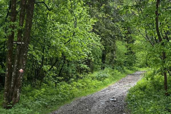
Sky Peak Road
Sky Peak Road is a short connector between Beartown Mountain Road and Wilcox Mountain Road. The trail begins from Beartown and climbs from 1760 to 1900 feet in the short 0.7 miles of the trail over loose rock. The trail is well-graded in most sections, with some showing exposed rock. The trail ends...
Learn more about Sky Peak Road
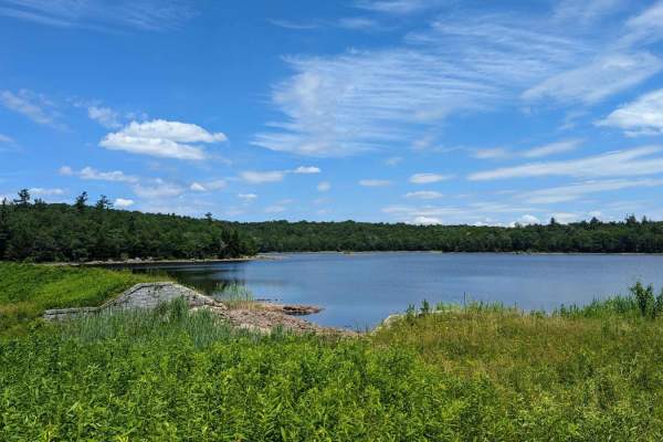
Ashley Lake Road
Ashley Lake Road is an old, unmaintained road through October Mountain State Forest. It rolls through hardwood forests past multiple lakes/reservoirs, including Ashley Lake, Sandwash Reservoir (this has a unique "aerator" which is a large fountain in the middle of the woods), Clapp Pond, and Mud Pon...
Learn more about Ashley Lake Road
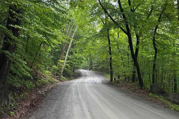
Shelving Rock Road
Shelving Rock Road starts at the Sly Pond Road and takes you to several primitive campsites, trailheads that lead to breathtaking waterfalls, and Lake George in the Lake George Wild Forest in the eastern part of Adirondack Park. It is a gravel forestry road with some soft sand spots that can turn in...
Learn more about Shelving Rock Road
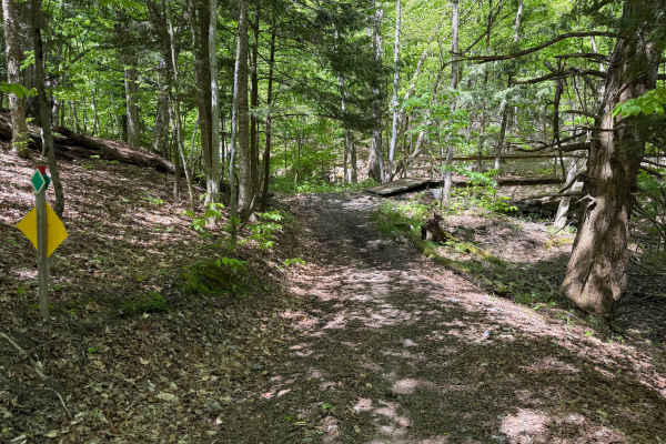
Grower Green Trail East - 3
While traversing through this route, riders will encounter a moderate wooded trail through rolling terrain featuring a mix of hard-packed dirt, loose rock, shallow ruts, and scattered root sections. Several narrow trail corridors wind through the forest with tight turns, small hill climbs and descen...
Learn more about Grower Green Trail East - 3
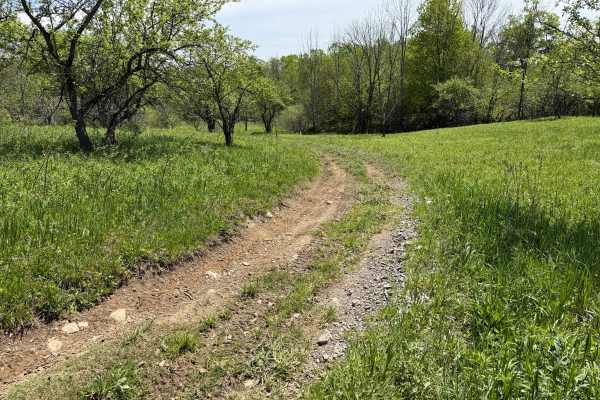
Grower Green Trail East - 2
As you traverse this trail, expect a moderately easy route winding through a mix of wooded terrain and open meadow sections. Riders can expect primarily hard-packed dirt with occasional shallow ruts, loose rock, exposed roots, soft grassy sections, slight off-camber descents, and scattered mud holes...
Learn more about Grower Green Trail East - 2
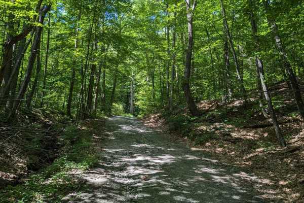
Southeast Corners Road
Vermont Class 4 Road: This is an easy drive through a notch between Little Equinox and Pendock Hill. The trail is sometimes steep, especially on the eastern slope, but includes nothing too technical. The road parallels Skyline Drive, the longest paved toll road in the US for some of the eastern clim...
Learn more about Southeast Corners Road
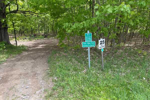
Grower Green Trail East - 1
A moderately easy wooded trail route traveling through classic Lewis County terrain featuring hard-packed dirt, shallow ruts, loose rock, exposed roots, and gradual elevation changes throughout. Riders will travel through dense hardwood forest sections with narrow trail corridors, rolling hills, and...
Learn more about Grower Green Trail East - 1
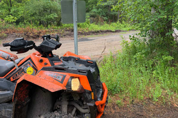
Wildcat Road Green Trail Loop
When traveling along this marked Lewis County ATV trail, riders will pass through a mix of pine and hardwood forest featuring a maintained two-track trail surface. The route primarily consists of hard-packed dirt, natural soil, pine needles, and occasional loose stone with light rutting throughout. ...
Learn more about Wildcat Road Green Trail Loop
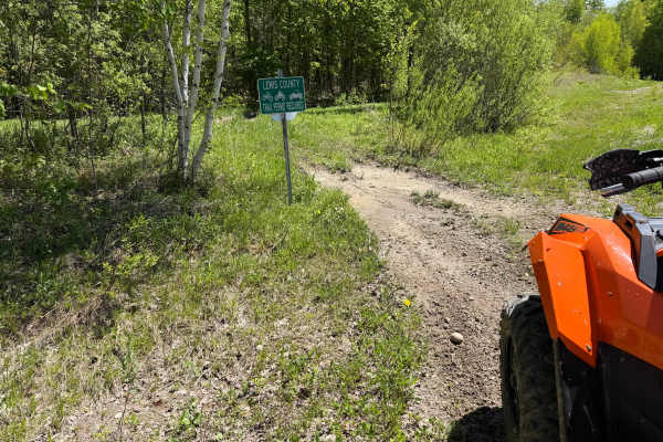
Bauer Wooded Spur Trail
When traveling along this marked connector trail, riders will pass through a mix of wooded terrain and open grass corridor sections featuring a primarily narrow two-track trail surface. Riders can expect mostly hard-packed dirt with shallow ruts, loose soil, scattered roots, and occasional muddy are...
Learn more about Bauer Wooded Spur Trail
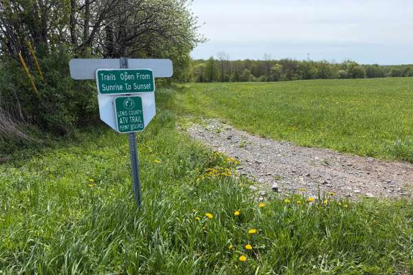
Grower Green Trail West
A scenic and moderately challenging Lewis County ATV trail route traveling through open farm fields, wooded corridors, and remote backcountry terrain. Riders will encounter a mix of hard-packed dirt, loose rock, shallow mud holes, rutted sections, and soft, low-lying areas depending on recent weathe...
Learn more about Grower Green Trail West
ATV trails near Cobleskill, New York
Explore ATV-friendly trails near you. These trails are accessible for vehicles up to 50 inches wide, perfect for ATVs and smaller off-road machines.
Tannery Rd
Tannery road is a nice connecting off-road trail between Rt 125 and Rt 30. From north to south it starts off with a rocky uphill that transitions to some nice wooded trail. There is a beaver dam/ stream crossing with a small bridge in one spot and water crossing in another. The trail is mostly d...
Learn more about Tannery Rd
Military Road
Sandy dirt road connecting from Cold Brook to Norway. It is a seasonal road only open during the summer months. They have recently resurfaced part of the road, making it easier for non-lifted vehicles. The sand can make it slow going epically for motorcycles. There are a few side trails with sand pi...
Learn more about Military Road
T-743/T-727
The trail starts off in Poyntelle as Township-727 and in Winterdale as T-743. This section of the O and W Trail is a recognized Township route open to street-licensed 4x4s. The trail follows the former route of the Ohio and Western Railroad. Multiple former stations can be observed along the route. ...
Learn more about T-743/T-727
Benedict Trail
This trail starts as a regular dirt road, transforming into a narrow two-track with large ruts and holes. The surface of the trail breaks up on the steeper grades, and there is a potential for deep water crossings. In the image, the water is just over a foot deep. Most high-clearance 4x4 vehicles wi...
Learn more about Benedict Trail
UTV/side-by-side trails near Cobleskill, New York
Find UTV and side-by-side trails near you. These trails accommodate vehicles up to 60 inches wide, ideal for UTVs, side-by-sides, and wider off-road rigs.
Tannery Rd
Tannery road is a nice connecting off-road trail between Rt 125 and Rt 30. From north to south it starts off with a rocky uphill that transitions to some nice wooded trail. There is a beaver dam/ stream crossing with a small bridge in one spot and water crossing in another. The trail is mostly d...
Learn more about Tannery Rd
Military Road
Sandy dirt road connecting from Cold Brook to Norway. It is a seasonal road only open during the summer months. They have recently resurfaced part of the road, making it easier for non-lifted vehicles. The sand can make it slow going epically for motorcycles. There are a few side trails with sand pi...
Learn more about Military Road
T-743/T-727
The trail starts off in Poyntelle as Township-727 and in Winterdale as T-743. This section of the O and W Trail is a recognized Township route open to street-licensed 4x4s. The trail follows the former route of the Ohio and Western Railroad. Multiple former stations can be observed along the route. ...
Learn more about T-743/T-727
Benedict Trail
This trail starts as a regular dirt road, transforming into a narrow two-track with large ruts and holes. The surface of the trail breaks up on the steeper grades, and there is a potential for deep water crossings. In the image, the water is just over a foot deep. Most high-clearance 4x4 vehicles wi...
Learn more about Benedict Trail
The onX Offroad Difference
onX Offroad combines trail photos, descriptions, difficulty ratings, width restrictions, seasonality, and more in a user-friendly interface. Available on all devices, with offline access and full compatibility with CarPlay and Android Auto. Discover what you're missing today!
Open Trail Map