
Beginner Off-Road Trails
Near Wadsworth, Nevada
Explore All Beginner Trails Near Wadsworth, Nevada
Beginner Off-Road Trails Near Wadsworth, Nevada
Discover the best beginner-friendly off-road trails near you. These easier, lower-rated trails are a great place to start — browse trail maps, check difficulty ratings, and find your next adventure.
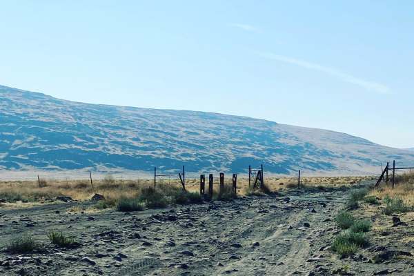
Dry Lakes Loop
The trail starts at a cattle guard after you leave the staging area. The first few miles are soft sand with little to no obstruction. The area to the north side of the trail is a public access shooting area. Once past the shooting area, the trail narrows and drops down a dry creek valley before comi...
Learn more about Dry Lakes Loop

Six Mile Beach Trail
This route takes you from the trailhead located off Hwy 50, East of Silver Springs, Nevada to Six Mile Beach and loops back to the bridge over the Carson River below the Lahontan Reservoir Dam. Six Mile Beach is located on the east shore of Lahontan. The trail begins on a very wide, graded dirt road...
Learn more about Six Mile Beach Trail
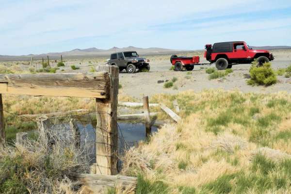
Hot Springs Mountains
The trail takes you by some of the sites in the Hot Springs Mountains. These sites include Eagle Rock, Eagle Salt Works site, an abandoned telecommunications building, Airway Beacon site, and a few mine sites. Spend some time exploring along the way, as well as enjoying the views of the 40-mile dese...
Learn more about Hot Springs Mountains
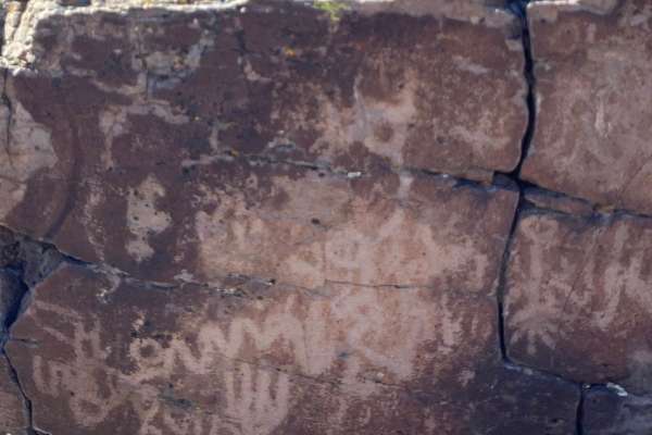
Spanish Springs Petroglyphs
Griffith Canyon is an approximately 2 mile out-and-back hike north of Reno that leads to several galleries of petroglyphs. While several trails in the area lead to petroglyphs, the Griffith Canyon trail is the easiest route to see the displays of native art. The trail is unmarked but is known and mo...
Learn more about Spanish Springs Petroglyphs
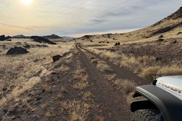
The Narrows
The Narrows is a pole line road that runs between Fernley Nevada, and Winnemucca Lake. Winnemucca Lake is a dry lake bed in northwest Nevada that features the oldest known petroglyphs in North America. It is quite remote once you get out of Fernley, cell service is spotty, and you may not see anyone...
Learn more about The Narrows
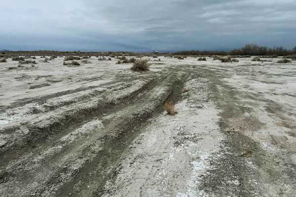
Lunchtime Rip
Lunchtime Rip is a short fun trail consisting of a sandy salt flat and packed dirt with many ruts and routes along with a short hill climb meeting up with Powerline Road. This a fun local spot commonly ran over lunchtime as a fun break from school or work.
Learn more about Lunchtime Rip
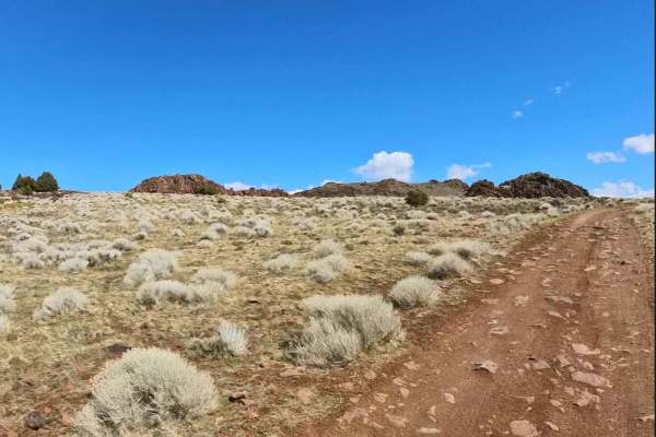
Rocky Glyph
Enjoy this South Reno access road into the foothills, then follow it all the way to the Glyphs via the Lockwood Trail. The route is rocky throughout, so plan on slow going. Keep an eye out—wild horses are commonly seen along this corridor (give them space). From the top, soak in the abundant, sweepi...
Learn more about Rocky Glyph
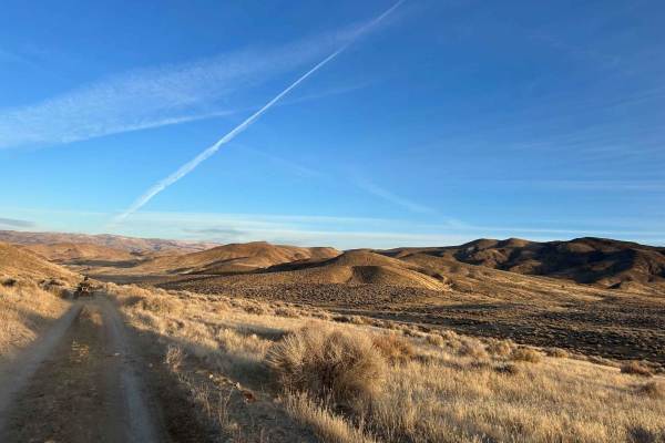
Wildhorse Track
Travel through Red Rock Canyon, running along the border of California and cutting back over to Antelope Valley using a popular off-road connector. Blaze across Antelope Valley and visit the Moon Rocks area, or continue up and over Warm Springs Mountain, down into Hungry Valley, and back to Winnemuc...
Learn more about Wildhorse Track
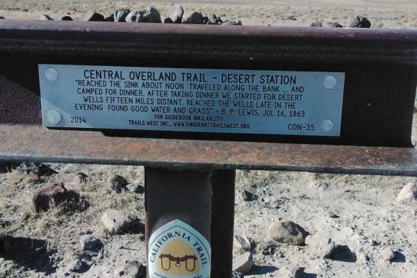
Historical and Petroglyph trail
An historical trail with Petroglyphs at the end
Learn more about Historical and Petroglyph trail
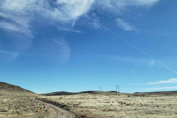
Clifton Flat Trail
Clifton Flat is a valley known for herds of wild horses and herds of Pronghorn Antelope. The trailhead starts at the unlocked barbed wire wild horse protection gate. Make sure to properly close and latch the gate. The trail begins on a graded dirt road. As you descend, the road narrows to a double-t...
Learn more about Clifton Flat Trail
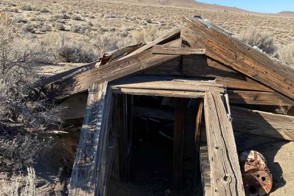
Nightingale Mine
These are old mining roads that weave their way through what was once the Nightingale Mine. Active in the 40s, the mine was extracting tungsten ore for the war effort. The are still a few structures on the site that can be explored. The road is a mix of sand and gravel. It's not maintained but it's ...
Learn more about Nightingale Mine
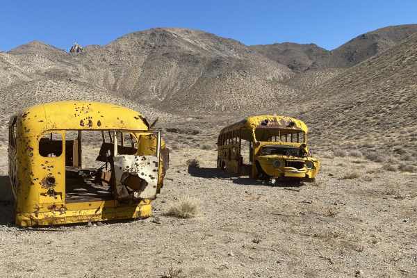
Winnemucca Lake School Buses
The route takes you along the east side of the dry lake bed and up into the Nightingale Range. Up in the hills are two, 1950s school buses that were used to transport workers to the mines in the area. You will also find the foundation of an ore processing mill. Not much is left of the mill. The road...
Learn more about Winnemucca Lake School Buses
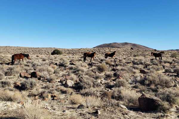
Wild Horse Trail
This route takes you from the outskirts of Dayton, Nevada to Clifton Flats. The trail head starts at the unlocked wild horse protection gate. Make sure to properly close and latch the gate. The trail begins on a graded dirt road. As you ascend, the road narrows to a double track trail. The surface v...
Learn more about Wild Horse Trail
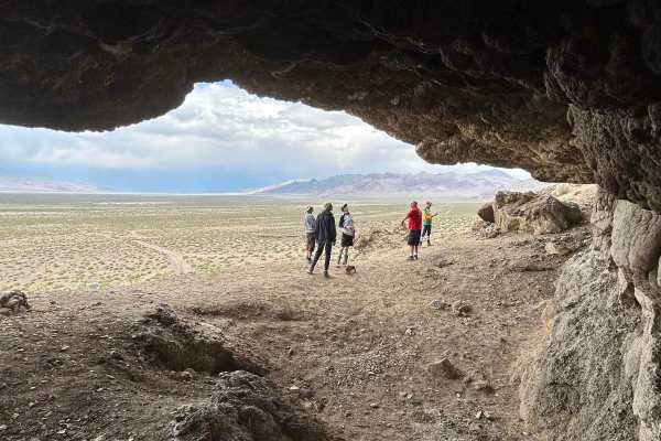
Winnemucca Lake Caves South Shore
This is a well-traveled gravel road. On the south end of the route, the road curves around a sand dune that can cover up the trail at times. Many of the caves on this end are overhanging. The major site is a tufa dome that is named Nicolarsen which is located near Highway 447.
Learn more about Winnemucca Lake Caves South Shore
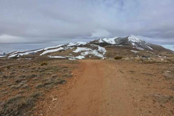
Hoge Road
This is an easy, high-speed trail for most of the distance but includes a few moderate hill climbs along the way. Hard-packed roads with some larger, avoidable rocks here and there. Expect heavy foot and mountain bike traffic, so ride with caution and be mindful of other trail users. The trail offer...
Learn more about Hoge Road
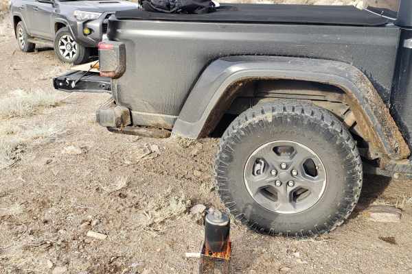
Old Como Road
This road begins at Dayton, Nevada, and gradually rises in elevation from 4367'' to 7128' into the Pine Nut Mountains and is located on mostly BLM lands. The trail starts off over a flat alluvial plain and then climbs out of the wash into the mountains. Sage, Juniper, and Pine trees are abundant as ...
Learn more about Old Como Road
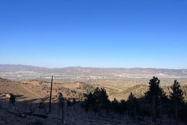
Blue Truck Fork
Tucked in the South-West corner of Reno, Blue Truck Fork is a great way to get out of the city and escape to some nearby nature. This trail offers some great sights of the surrounding mountains and a view of Reno higher up the trail. This is especially so once the sun sets and the city lights up. Mo...
Learn more about Blue Truck Fork
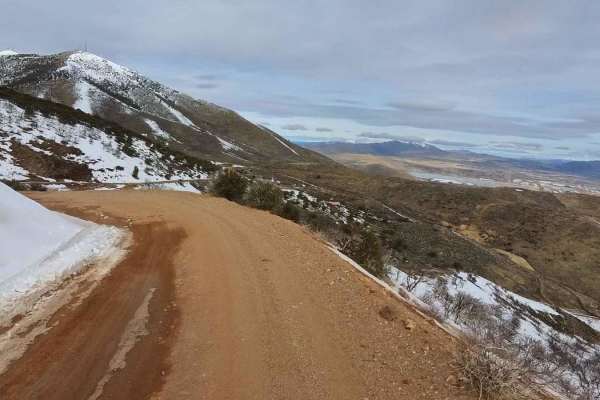
Golden Fleece Mine Road
Access Golden Fleece Mine Road from Headliner Trail at the top of Peavine, the main Peavine Access Road, Horizon Hills Staging Area, or Raleigh Heights Staging Area. No matter which route you take, this trail offers a rewarding ride. Travel through the Horizon Hills Mountain area, past the Kiowa Pon...
Learn more about Golden Fleece Mine Road
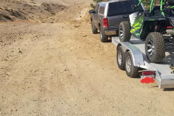
Peavine Prospector Run
Spectacular views of Reno abound from high above on this trail that traverses historic Peavine Mountain. In stark contrast to the urban hustle and bustle of Reno, Peavine showcases the desolate beauty of the harsh high desert that defines much of Nevada. Standing as the City of Reno's northwest boun...
Learn more about Peavine Prospector Run
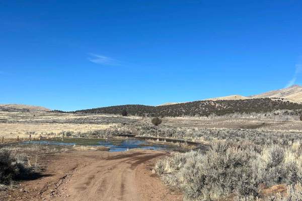
Jumbo Ranch Run
From Reno, take Pyramid Highway north for about 17 miles and turn left onto Winnemucca Ranch Road. Follow Winnemucca Ranch Road to a large parking/staging area to your left (Moon Rocks Recreation Area). This parking area has plenty of room for even the largest of trailers. You will find the start of...
Learn more about Jumbo Ranch Run
Beginner ATV trails near Wadsworth, Nevada
Explore ATV-friendly trails near you. These trails are accessible for vehicles up to 50 inches wide, perfect for ATVs and smaller off-road machines.
Dry Lakes Loop
The trail starts at a cattle guard after you leave the staging area. The first few miles are soft sand with little to no obstruction. The area to the north side of the trail is a public access shooting area. Once past the shooting area, the trail narrows and drops down a dry creek valley before comi...
Learn more about Dry Lakes Loop
Hot Springs Mountains
The trail takes you by some of the sites in the Hot Springs Mountains. These sites include Eagle Rock, Eagle Salt Works site, an abandoned telecommunications building, Airway Beacon site, and a few mine sites. Spend some time exploring along the way, as well as enjoying the views of the 40-mile dese...
Learn more about Hot Springs Mountains
Spanish Springs Petroglyphs
Griffith Canyon is an approximately 2 mile out-and-back hike north of Reno that leads to several galleries of petroglyphs. While several trails in the area lead to petroglyphs, the Griffith Canyon trail is the easiest route to see the displays of native art. The trail is unmarked but is known and mo...
Learn more about Spanish Springs Petroglyphs
The Narrows
The Narrows is a pole line road that runs between Fernley Nevada, and Winnemucca Lake. Winnemucca Lake is a dry lake bed in northwest Nevada that features the oldest known petroglyphs in North America. It is quite remote once you get out of Fernley, cell service is spotty, and you may not see anyone...
Learn more about The Narrows
Beginner UTV/side-by-side trails near Wadsworth, Nevada
Find UTV and side-by-side trails near you. These trails accommodate vehicles up to 60 inches wide, ideal for UTVs, side-by-sides, and wider off-road rigs.
Hot Springs Mountains
The trail takes you by some of the sites in the Hot Springs Mountains. These sites include Eagle Rock, Eagle Salt Works site, an abandoned telecommunications building, Airway Beacon site, and a few mine sites. Spend some time exploring along the way, as well as enjoying the views of the 40-mile dese...
Learn more about Hot Springs Mountains
Spanish Springs Petroglyphs
Griffith Canyon is an approximately 2 mile out-and-back hike north of Reno that leads to several galleries of petroglyphs. While several trails in the area lead to petroglyphs, the Griffith Canyon trail is the easiest route to see the displays of native art. The trail is unmarked but is known and mo...
Learn more about Spanish Springs Petroglyphs
The Narrows
The Narrows is a pole line road that runs between Fernley Nevada, and Winnemucca Lake. Winnemucca Lake is a dry lake bed in northwest Nevada that features the oldest known petroglyphs in North America. It is quite remote once you get out of Fernley, cell service is spotty, and you may not see anyone...
Learn more about The Narrows
Lunchtime Rip
Lunchtime Rip is a short fun trail consisting of a sandy salt flat and packed dirt with many ruts and routes along with a short hill climb meeting up with Powerline Road. This a fun local spot commonly ran over lunchtime as a fun break from school or work.
Learn more about Lunchtime Rip
The onX Offroad Difference
onX Offroad combines trail photos, descriptions, difficulty ratings, width restrictions, seasonality, and more in a user-friendly interface. Available on all devices, with offline access and full compatibility with CarPlay and Android Auto. Discover what you're missing today!
Open Trail Map