
Beginner Off-Road Trails
Near Stansbury Park, Utah
Explore All Beginner Trails Near Stansbury Park, Utah
Beginner Off-Road Trails Near Stansbury Park, Utah
Discover the best beginner-friendly off-road trails near you. These easier, lower-rated trails are a great place to start — browse trail maps, check difficulty ratings, and find your next adventure.
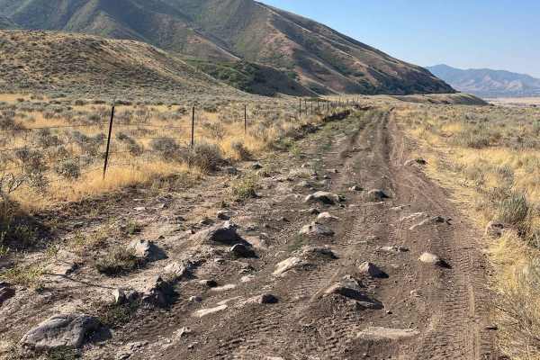
Springs Road Fence Line Trail
This trail starts off the dirt road called Foothill Drive. It starts heading east up the hill on the section line road and then connects to TC03617 back to the southeast all the way to the fence line. There is a gate that has been broken down in the past. There is NO Motorized access past this gate,...
Learn more about Springs Road Fence Line Trail
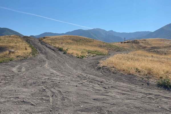
Pole Canyon Trail
This is one of the easiest ways to the top of the plateau. There are some large boulders and sand that could present a challenge depending on your vehicle type. There are mostly rocks on the lower half of the trail and then once climbing on the upper section, you will find a good hard pack and some ...
Learn more about Pole Canyon Trail
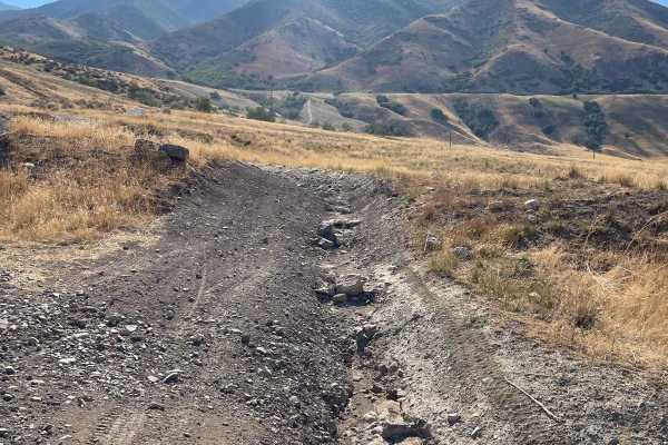
Bates Canyon Trail
This is a well-traveled two-track with all types of 4x4 and off-road machines. This trail is a great way to overlook the Tooele Valley above Stansbury Park and Erda. You will encounter some large rocks and rutted roads along the way to the top. There is a gate at the end where motorized travel is pr...
Learn more about Bates Canyon Trail
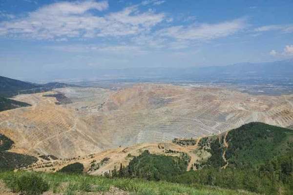
Kennecott Copper Mine Overlook
This trail is a quick 5-mile total out-and-back. It is well-maintained dirt leading to a large parking area that overlooks the main pit of the mine. One can also see the Salt Lake Valley to the east and Tooele Valley to the west and the views of the mountains, valleys, and mine are incredible. The r...
Learn more about Kennecott Copper Mine Overlook
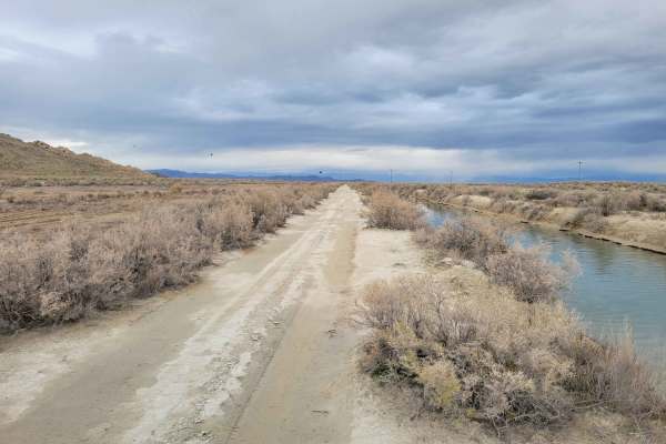
Canal Road
This straight-away trail leads to the furthest, Eastern part of the island's BLM land. It parallels one of the Great Salt Lake water canals and is in much better condition than many of the other trails in the area. A couple of ruts and mud holes are possible. There is no barrier to protect against f...
Learn more about Canal Road
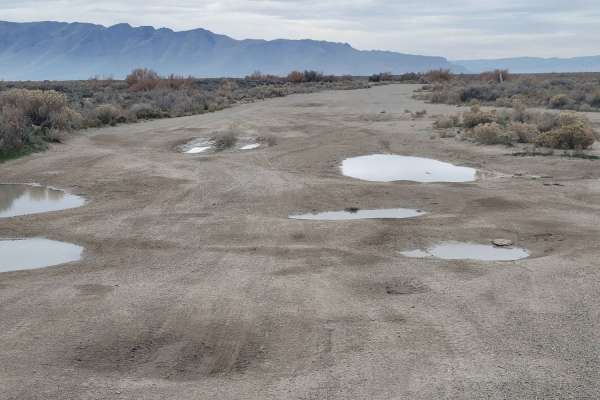
Direct Shot
This connecting route leads to several other trails in the area, as well as a handful of shooting ranges against the mountainside. The trail is hard-packed dirt with quite a few massive "potholes". Water or mud may be present in them. Always remember to "pack it in, pack it out" with the shooting ra...
Learn more about Direct Shot
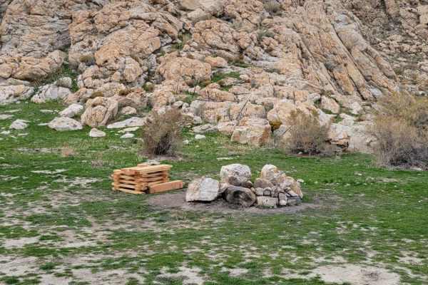
Dismal Finale
Dismal Finale is a short, rugged 0.6-mile trail on Stansbury Island tailored for four-wheel-drive vehicles, SxSs, and dirt bikes looking to reach the eastern boundary of public BLM land near the Great Salt Lake. This flat route, sitting at an elevation of roughly 4,220 feet, is highly susceptible to...
Learn more about Dismal Finale
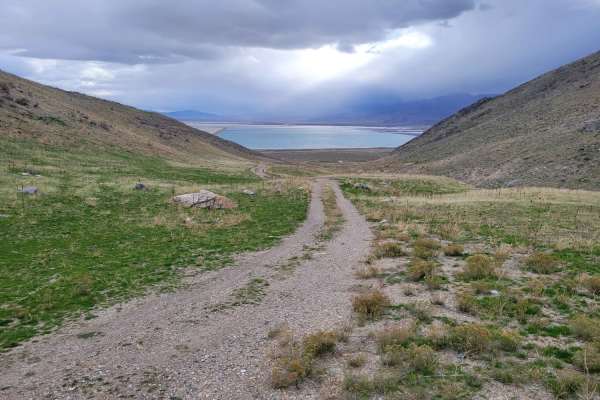
Dead End Pass
Dead End Pass is an easy, scenic route on Stansbury Island perfect for beginners, stock high-clearance four-wheel-drive vehicles, and SxSs looking for a quick climb with expansive views of the Great Salt Lake. Spanning approximately 0.86 miles with a steady elevation gain of about 384 feet, this sho...
Learn more about Dead End Pass
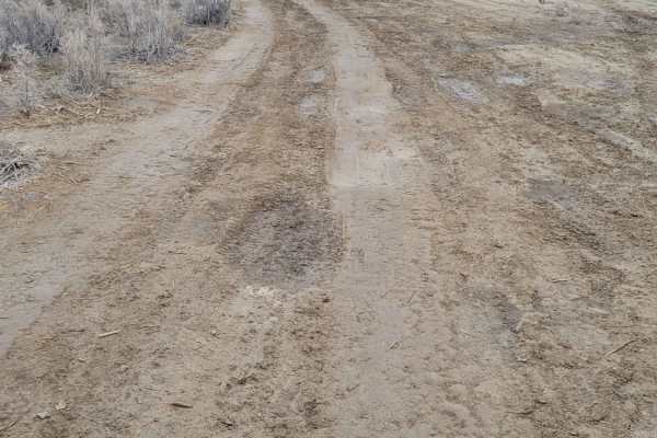
Southside
This connecting trail is less damaged than others in the area, although there are still a couple of ruts and mud holes to navigate. It leads from the main road up to one of the many shooting areas and connects to several other trails.
Learn more about Southside
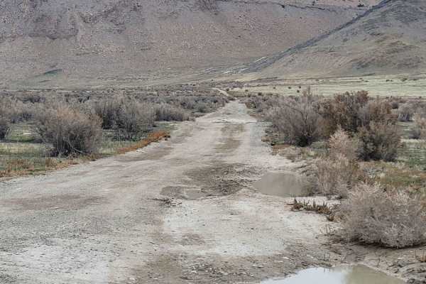
Straight Shooter
This short, straight trail takes you past a small shooting area on the South end and up to Tabby's Canyon area on the North end. There are various connecting trails off of this route. Tons of mud holes and trail damage (ruts) are present, but often there are secondary ways around some of the worst s...
Learn more about Straight Shooter
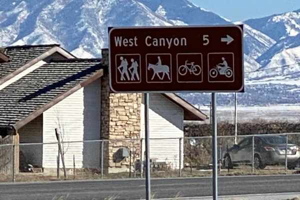
West Canyon Trailhead Road
West Canyon Trailhead Road is a scenic, beginner-friendly route perfect for stock four-wheel-drive vehicles, SxSs, and dirt bikes looking for easy access to the Stansbury Mountains and spectacular views of the Tooele Valley. Spanning approximately 4.8 miles, this unpaved road climbs gently from High...
Learn more about West Canyon Trailhead Road
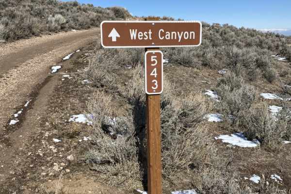
Magpie Road to West Canyon Trailhead
This scenic 4.1-mile point-to-point trail is ideal for drivers of stock four-wheel-drive vehicles, SxSs, and ATVs looking for a slower, quieter alternative route to the West Canyon Trailhead with sweeping views of the Tooele Valley. Descending from a maximum elevation of 6,063 feet down to 4,735 fee...
Learn more about Magpie Road to West Canyon Trailhead
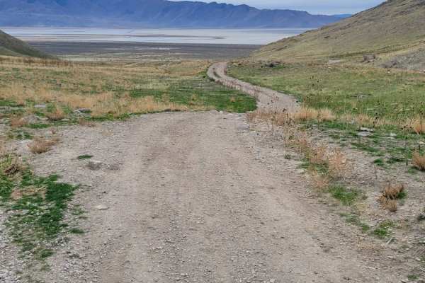
Round The Bend
This easy trail around the hillside connects Stansbury Gulch and Tabby's Canyon. There is nothing of major difficulty to note except where the trail dips down and up a ravine on the beginning of the Eastside. The west end of the trail is at a quarry/shooting area. Great views overlooking the Salt La...
Learn more about Round The Bend
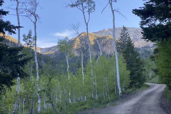
South Willow Canyon
This is a scenic drive that follows South Willow Creek, leaving the high desert of Tooele Valley and entering the aspen groves. There are 4 campgrounds along this road. The majority of the campgrounds are along the stream or within the scenic forest. This area is particularly gorgeous during the fal...
Learn more about South Willow Canyon
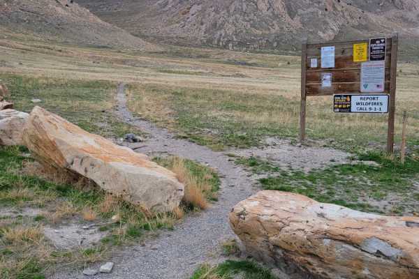
Stansbury Hike Trailhead
This trail leads from the main road to the Stansbury hiking trailhead with parking. Water/Mud holes may be present at the very beginning, but there is an alternative path around them if so. Fairly easy dirt road with one small rocky section right before the parking loop. Be advised that shooting ran...
Learn more about Stansbury Hike Trailhead
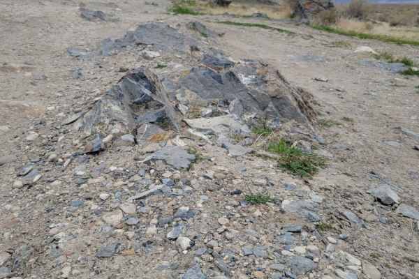
Shotgun Alley
A short route that leads past several shooting areas along the hillside. Lots of trash/shells were noted along the route, so if you decide to shoot here, please be sure to pack out any garbage that you bring. Predominantly easy dirt trail with some water pockets or mud holes possible. One or two sma...
Learn more about Shotgun Alley
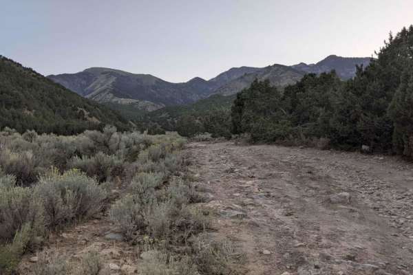
Box Elder Canyon South
This is a scenic drive that follows along a canyon in the high desert of Tooele Valley. Warning: The trail has a lot of tight areas through the brush. It is not recommended to take a full-size vehicle. Scratches are likely. It was tight in a Grand Cherokee. The trail as of this recording is washed o...
Learn more about Box Elder Canyon South
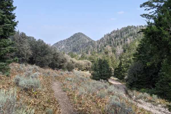
Mining Fork 4x4
This is a scenic drive that follows along a ridgeline in the high desert of Tooele Valley and drops down into a canyon entering the aspen groves. Warning: The trail has a lot of tight areas along cliff sides and through the brush. It is not recommended to take a full-size vehicle. Scratches are like...
Learn more about Mining Fork 4x4
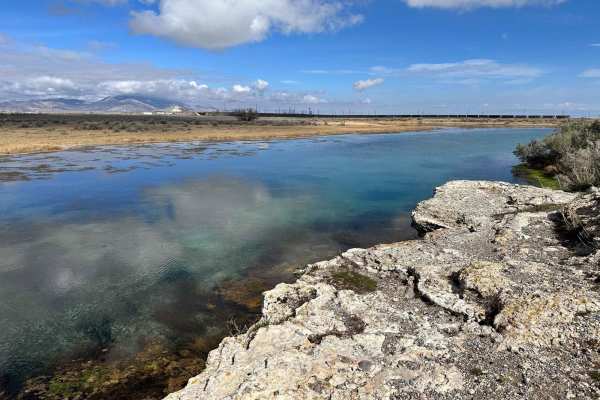
Big Spring Scenic Route
This trail leads to a beautiful natural spring in the Skull Valley Desert called the "Big Spring." You can start this trail at the Spring or off State Highway 196 further south. This is an easy dirt road trail on BLM land, with plenty of open room for recreation shooting. If you decide to shoot, ple...
Learn more about Big Spring Scenic Route
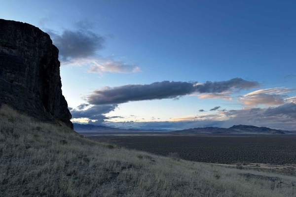
Lone Rock Loop
This loop goes around Lone Rock, which is a natural formation in the middle of the desert. The road is straightforward and can be accessed by most vehicles. The trail can sometimes be muddy but mostly dry, which is okay for all cars. There is quite a bit of glass and gun shells on the ground, so wat...
Learn more about Lone Rock Loop
Beginner ATV trails near Stansbury Park, Utah
Explore ATV-friendly trails near you. These trails are accessible for vehicles up to 50 inches wide, perfect for ATVs and smaller off-road machines.
Springs Road Fence Line Trail
This trail starts off the dirt road called Foothill Drive. It starts heading east up the hill on the section line road and then connects to TC03617 back to the southeast all the way to the fence line. There is a gate that has been broken down in the past. There is NO Motorized access past this gate,...
Learn more about Springs Road Fence Line Trail
Pole Canyon Trail
This is one of the easiest ways to the top of the plateau. There are some large boulders and sand that could present a challenge depending on your vehicle type. There are mostly rocks on the lower half of the trail and then once climbing on the upper section, you will find a good hard pack and some ...
Learn more about Pole Canyon Trail
Bates Canyon Trail
This is a well-traveled two-track with all types of 4x4 and off-road machines. This trail is a great way to overlook the Tooele Valley above Stansbury Park and Erda. You will encounter some large rocks and rutted roads along the way to the top. There is a gate at the end where motorized travel is pr...
Learn more about Bates Canyon Trail
Kennecott Copper Mine Overlook
This trail is a quick 5-mile total out-and-back. It is well-maintained dirt leading to a large parking area that overlooks the main pit of the mine. One can also see the Salt Lake Valley to the east and Tooele Valley to the west and the views of the mountains, valleys, and mine are incredible. The r...
Learn more about Kennecott Copper Mine Overlook
Beginner UTV/side-by-side trails near Stansbury Park, Utah
Find UTV and side-by-side trails near you. These trails accommodate vehicles up to 60 inches wide, ideal for UTVs, side-by-sides, and wider off-road rigs.
Springs Road Fence Line Trail
This trail starts off the dirt road called Foothill Drive. It starts heading east up the hill on the section line road and then connects to TC03617 back to the southeast all the way to the fence line. There is a gate that has been broken down in the past. There is NO Motorized access past this gate,...
Learn more about Springs Road Fence Line Trail
Pole Canyon Trail
This is one of the easiest ways to the top of the plateau. There are some large boulders and sand that could present a challenge depending on your vehicle type. There are mostly rocks on the lower half of the trail and then once climbing on the upper section, you will find a good hard pack and some ...
Learn more about Pole Canyon Trail
Bates Canyon Trail
This is a well-traveled two-track with all types of 4x4 and off-road machines. This trail is a great way to overlook the Tooele Valley above Stansbury Park and Erda. You will encounter some large rocks and rutted roads along the way to the top. There is a gate at the end where motorized travel is pr...
Learn more about Bates Canyon Trail
Kennecott Copper Mine Overlook
This trail is a quick 5-mile total out-and-back. It is well-maintained dirt leading to a large parking area that overlooks the main pit of the mine. One can also see the Salt Lake Valley to the east and Tooele Valley to the west and the views of the mountains, valleys, and mine are incredible. The r...
Learn more about Kennecott Copper Mine Overlook
The onX Offroad Difference
onX Offroad combines trail photos, descriptions, difficulty ratings, width restrictions, seasonality, and more in a user-friendly interface. Available on all devices, with offline access and full compatibility with CarPlay and Android Auto. Discover what you're missing today!
Open Trail Map